
After what has been one of the warmest and least snowy winters in recorded history, which dates back to the 1800s, cold and snowy conditions are finally inbound across the Upper Midwest. A juiced clipper system coming down from Alberta will move across the Northern Plains and into the Great Lakes Thursday into Friday, dropping moderate snowfall amounts in areas north of the low pressure center.
Parts of Southern Minnesota have received less snow this winter than Washington D.C., this is coming off a few snowless winters and still only recorded around 9″. However, we have no doubt that Southern Minnesota will finish their winter with double that number, as we approach an active and potentially snowy pattern for the Upper Midwest.
Snowstorm Timing
Light to moderate snow will fall across much of Montana and the Dakotas on Thursday before pushing east into the Twin Cities by Thursday night. By Friday morning, heavy snow is forecast to be accumulating on all surfaces across the Twin Cities, with temperatures well below freezing. Snow will continue east into Wisconsin Friday and into parts of Michigan Friday evening.
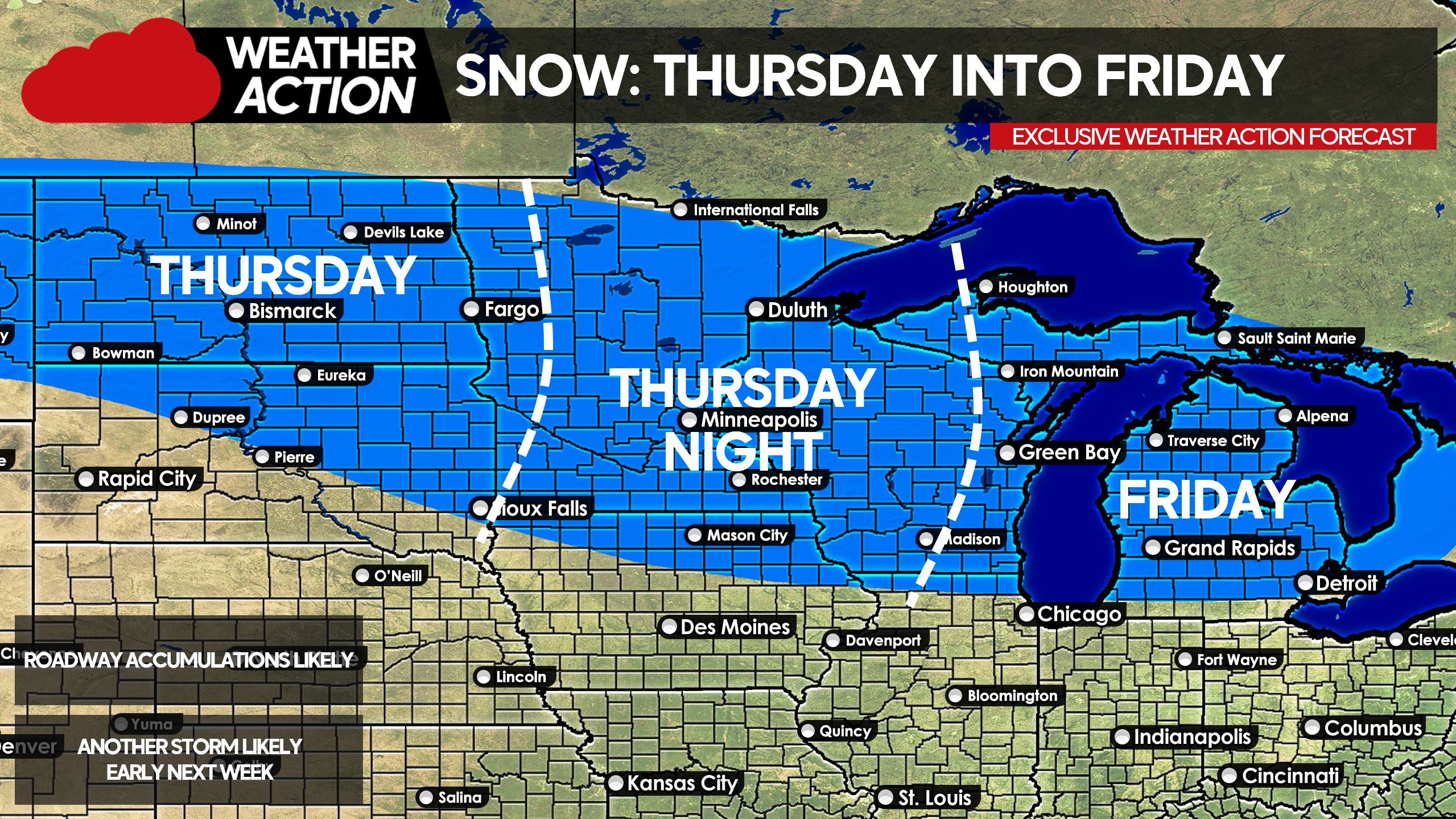
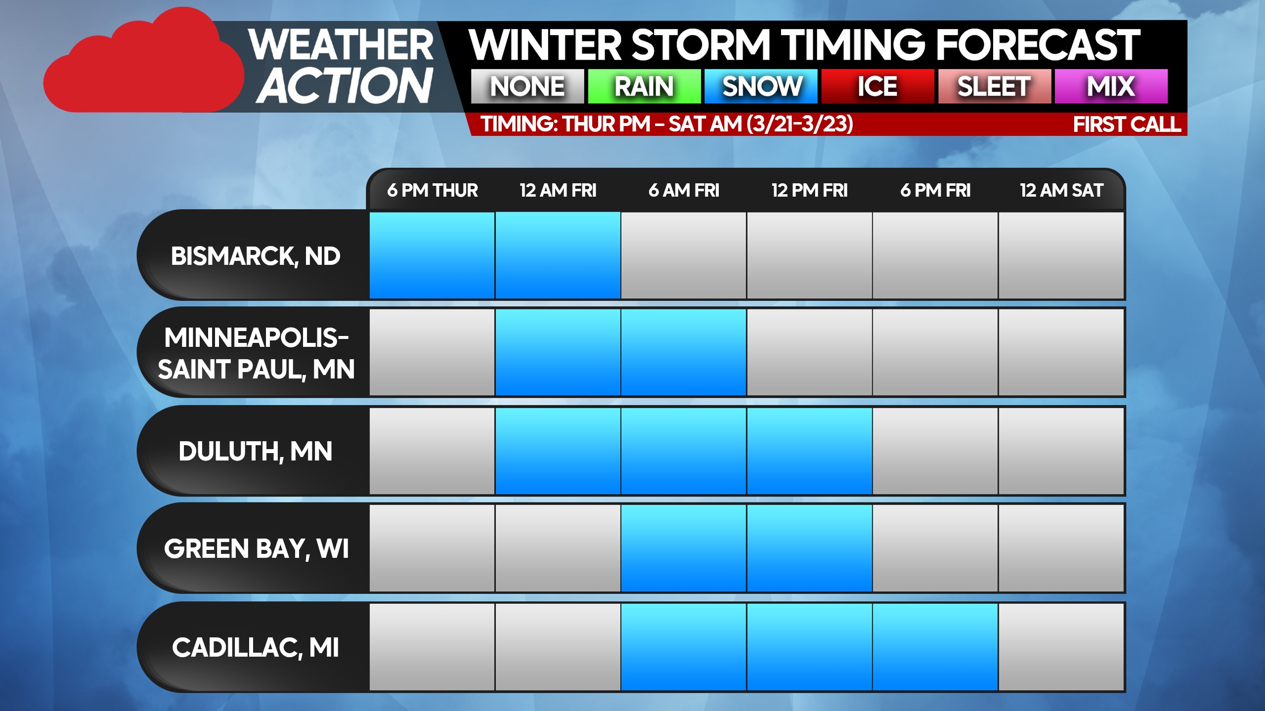
Below is a look at timing for the big cities that are expecting snowfall across the Upper Midwest late this workweek.
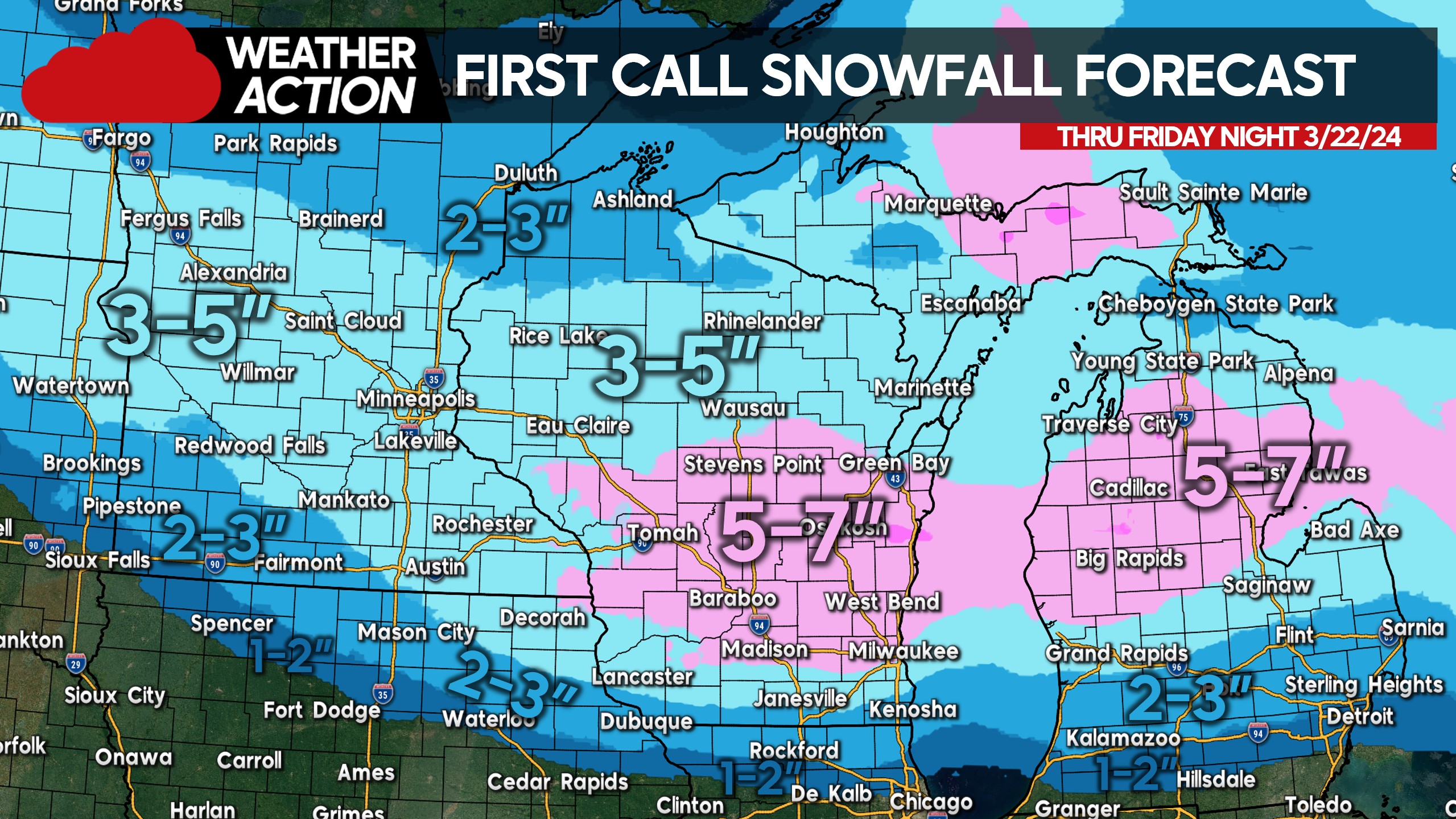
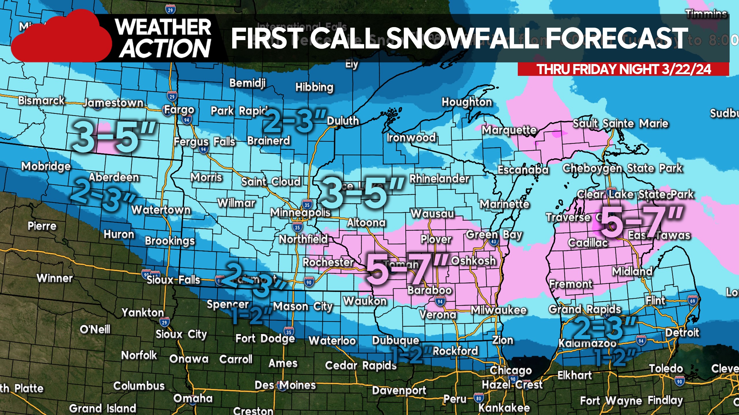
First Call Snowfall Forecast for Thursday – Friday
Snow-covered roads are likely in much of Minnesota Friday morning, and into Green Bay by Friday afternoon. Snowfall accumulations of 4 – 7″ will be common across Southern ND, Central MN, much of WI, and Northern MI. Minor accumulations of 1-3″ are likely up towards Fargo and Duluth.
Stay tuned for the latest updates on the Weather Action Facebook Page! You can follow us here: https://www.facebook.com/usweatheraction
Don’t forget to share this article with family and friends in the area!


You must be logged in to post a comment.