
Sunday featured a shallow flow of cool dense off the Atlantic which banked up against the southeastern slopes of the Poconos. Those areas spent the entire day in the fog with temperatures creeping through the 40s. That chill breeze failed to push northwest of the Poconos so our northern and western counties enjoyed sunshine and temperatures well into the 60s and even some 70s!
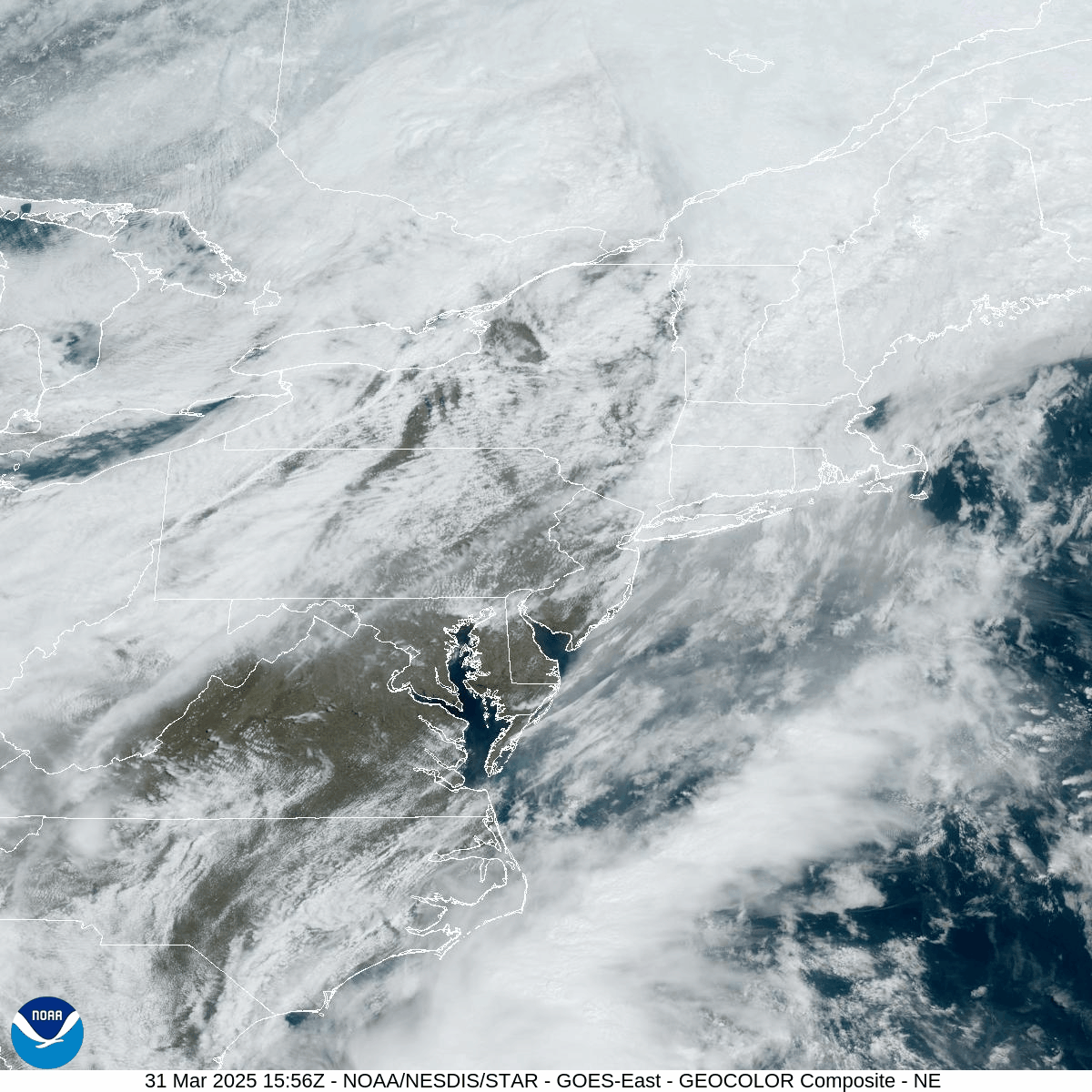
Tropical air (for Spring) infiltrated our area today on gusty southwest wind ahead of a strong cold front approaching from the west. Showers and thunderstorms will develop this afternoon and evening. A line of strong thunderstorms with heavy rain and gusty wind will form along the front move across New Jersey this evening, which could impact parts of our area, especially our southeastern counties. There even could be isolated severe thunderstorms! Behind that line of storms, gusty wind from the northwest will drive temperatures through the 30s overnight.
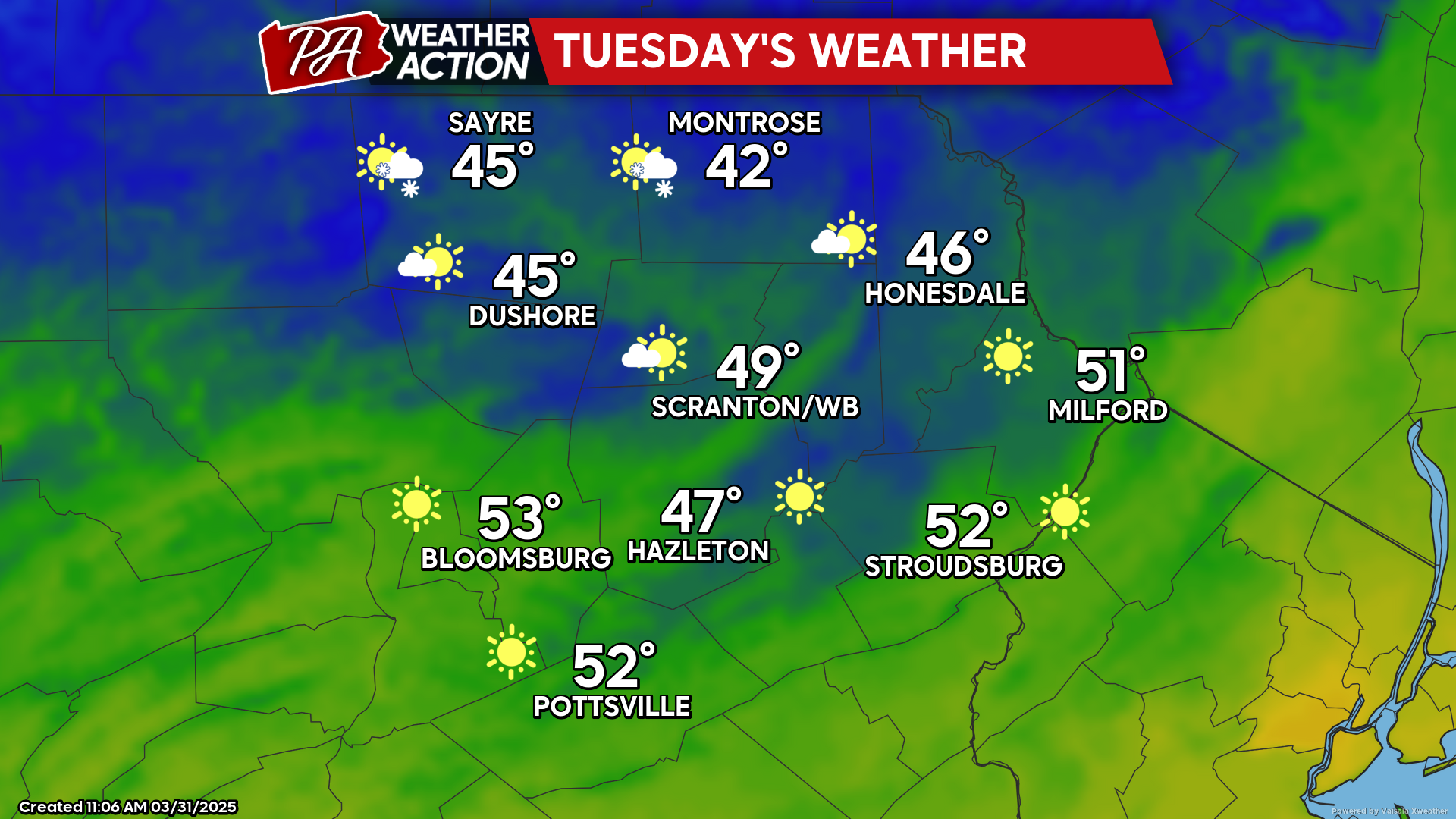
TUESDAY
Tuesday will feature wind from the northwest gusting over 30 mph, courtesy of a surface high dropping southeastward from Canada into New England. There will be some clouds across our northern counties, with temperatures in the low-mid 40s. Our southern counties will enjoy more sunshine and temperatures in the low 50s. Temperatures will fall into the 20s and low 30s overnight into Wednesday morning.
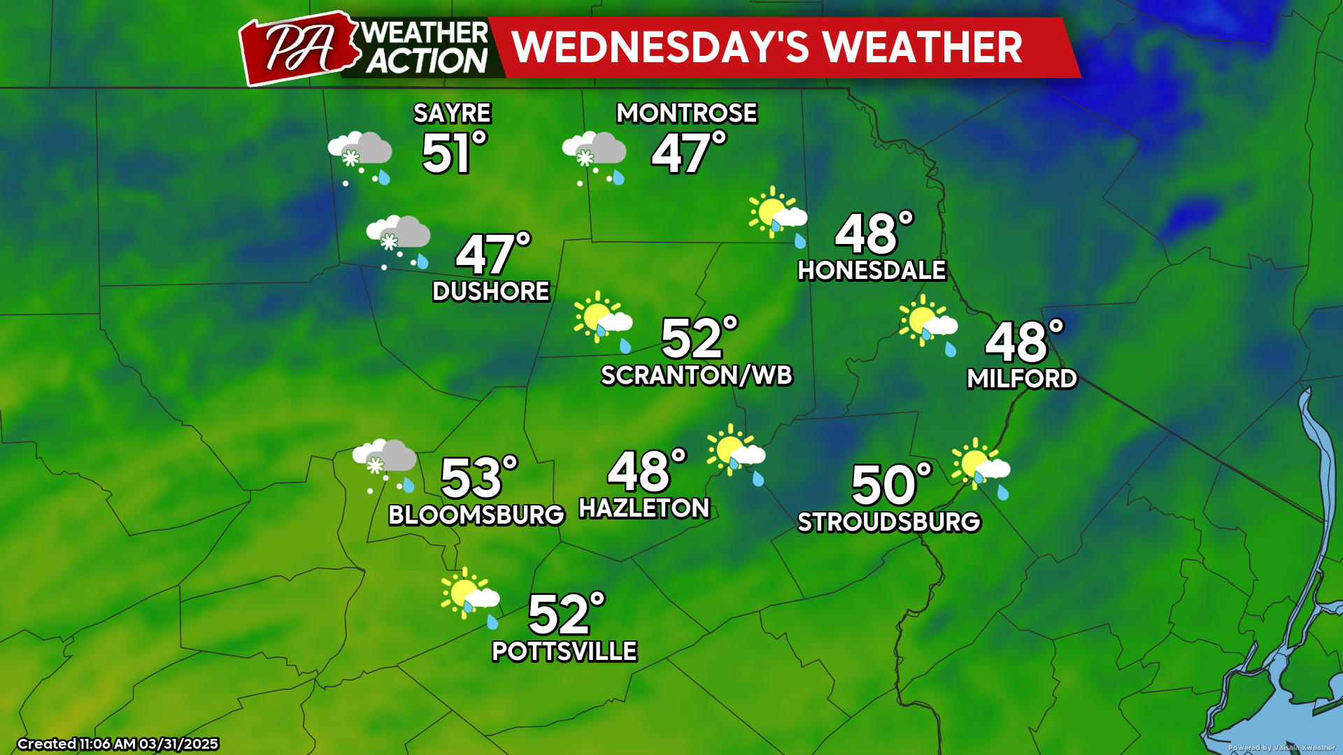
WEDNESDAY
The morning will dawn below freezing, with widespread 20s and low 30s. The surface high over New England will move offshore, inducing a wind from the southeast across our area. A warm front will cross the region and could produce some light rain or snow showers in the northern counties, but not much precipitation is expected. There will be a more-widespread opportunity for showers late Wednesday night. Unlike Tuesday night, Wednesday night will be quite mild as temperatures will be steady or even slowly rise.
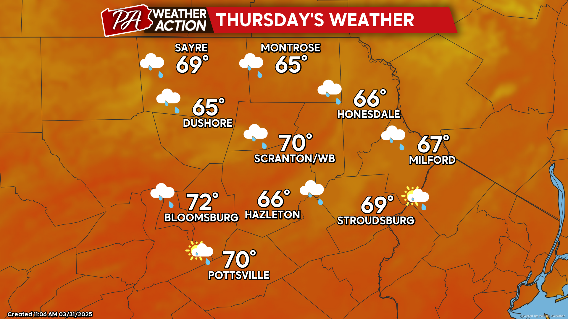
THURSDAY
Warm and humid air will envelop the region along with periods of showers. Amounts will likely be under a quarter inch.


You must be logged in to post a comment.