
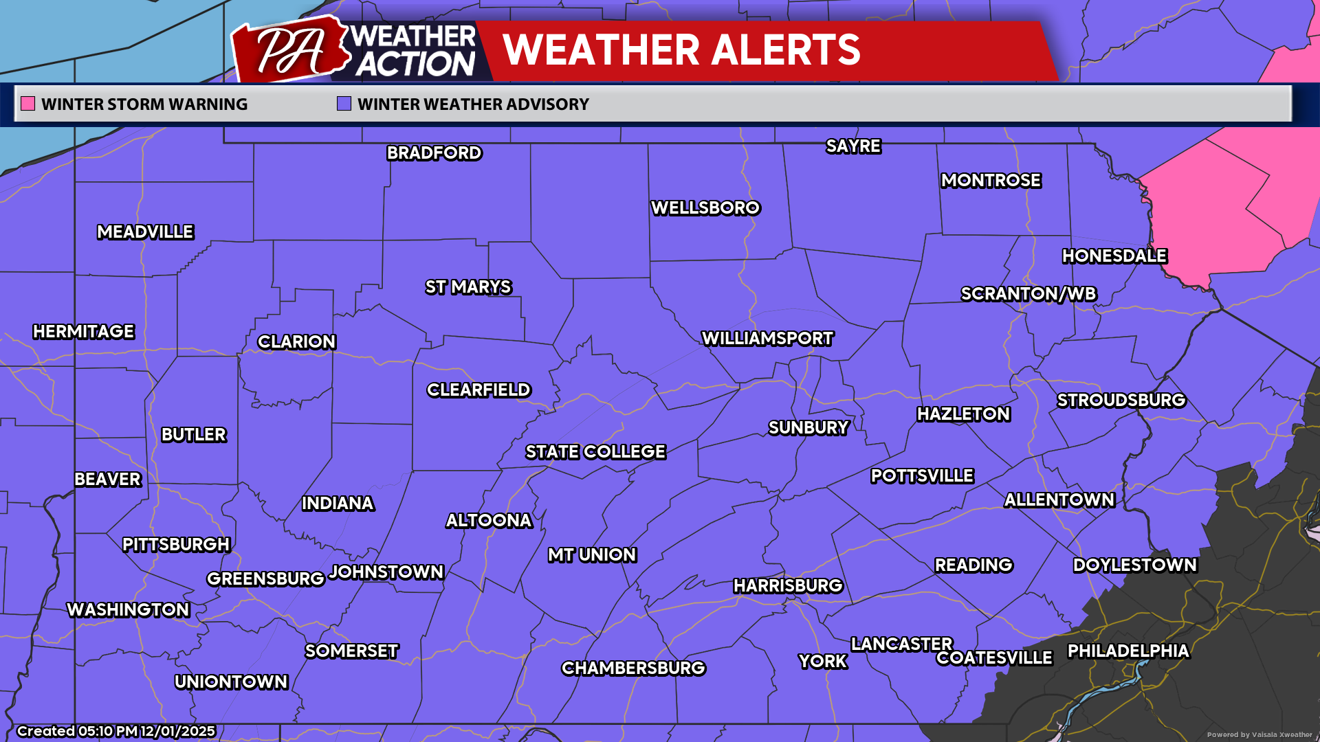
The first widespread winter storm of the season is inbound, with much of Pennsylvania falling on the wintry side of the system. Areas near Philadelphia will be left out, with the rest of the state facing treacherous travel Tuesday morning. The NWS has issued Winter Weather Advisories everywhere except the Philly Metro Area.
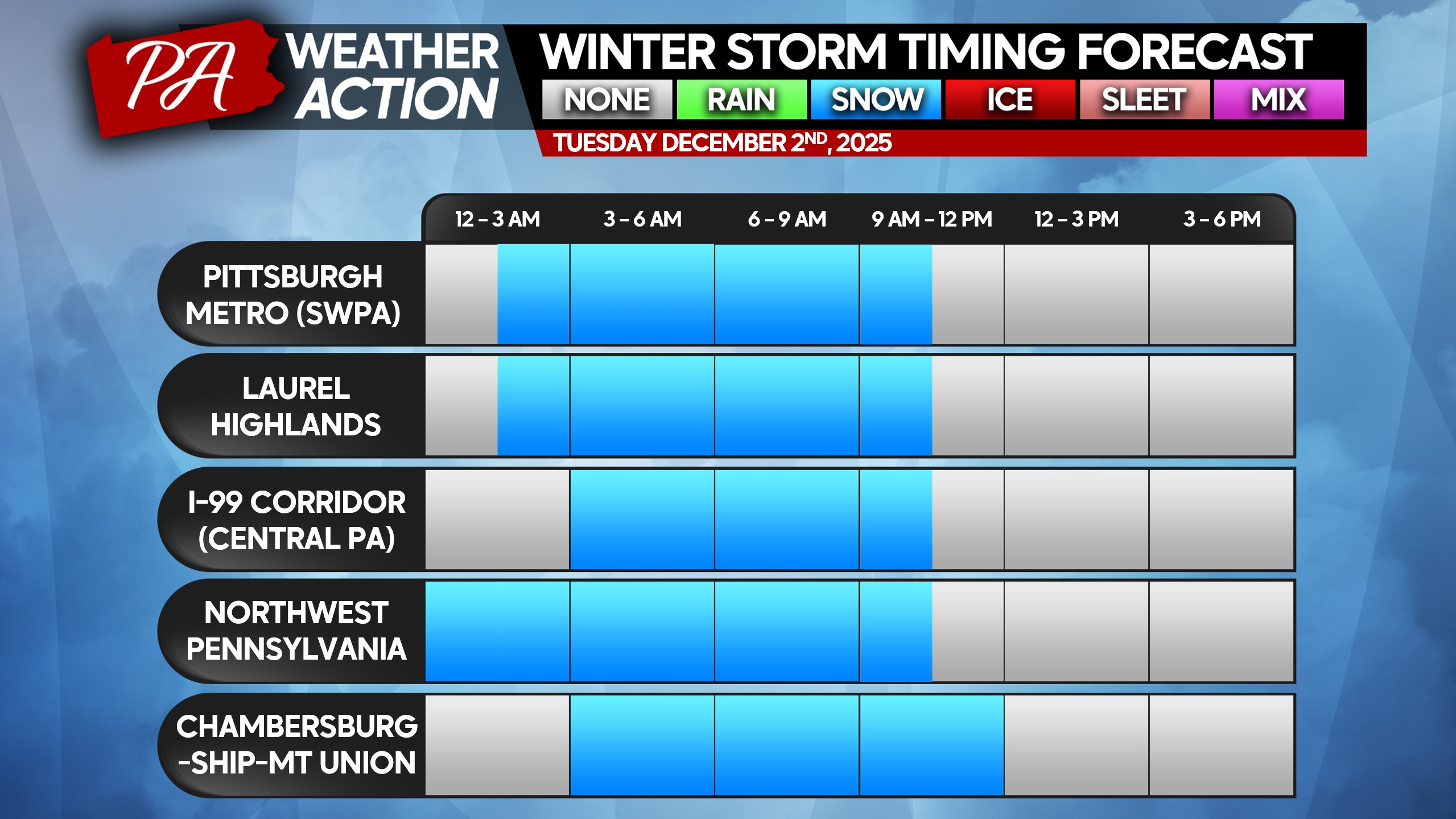
Snow will begin falling first in Northwest PA just after midnight, with the rest of Western PA seeing snow by around 3 AM Tuesday. Snow will push east into Central PA by 3-6 AM, reaching Eastern PA by around sunrise.
Snow will then shut off from west to east in the late morning and early afternoon hours of Tuesday. As the morning progresses, the rain/snow line is expected to push north of the Mason Dixon, as far north as I-78 in Eastern PA by lunchtime.
There is a chance that the morning and evening commute will be less affected near and south of I-78, as snow will only just be reaching the area during the morning commute and will be plowed/somewhat melted by the late afternoon. Some schools in places like Lancaster, Reading, and the Lehigh Valley may not have to cancel.
However, that zone from York to Easton where the rain/snow line will setup has the greatest boom/bust potential. There could be just an inch if the warm air changes things over sooner, but there may also be 3-4″ if the cold air hangs on. It’s a tough call for school districts in that area.
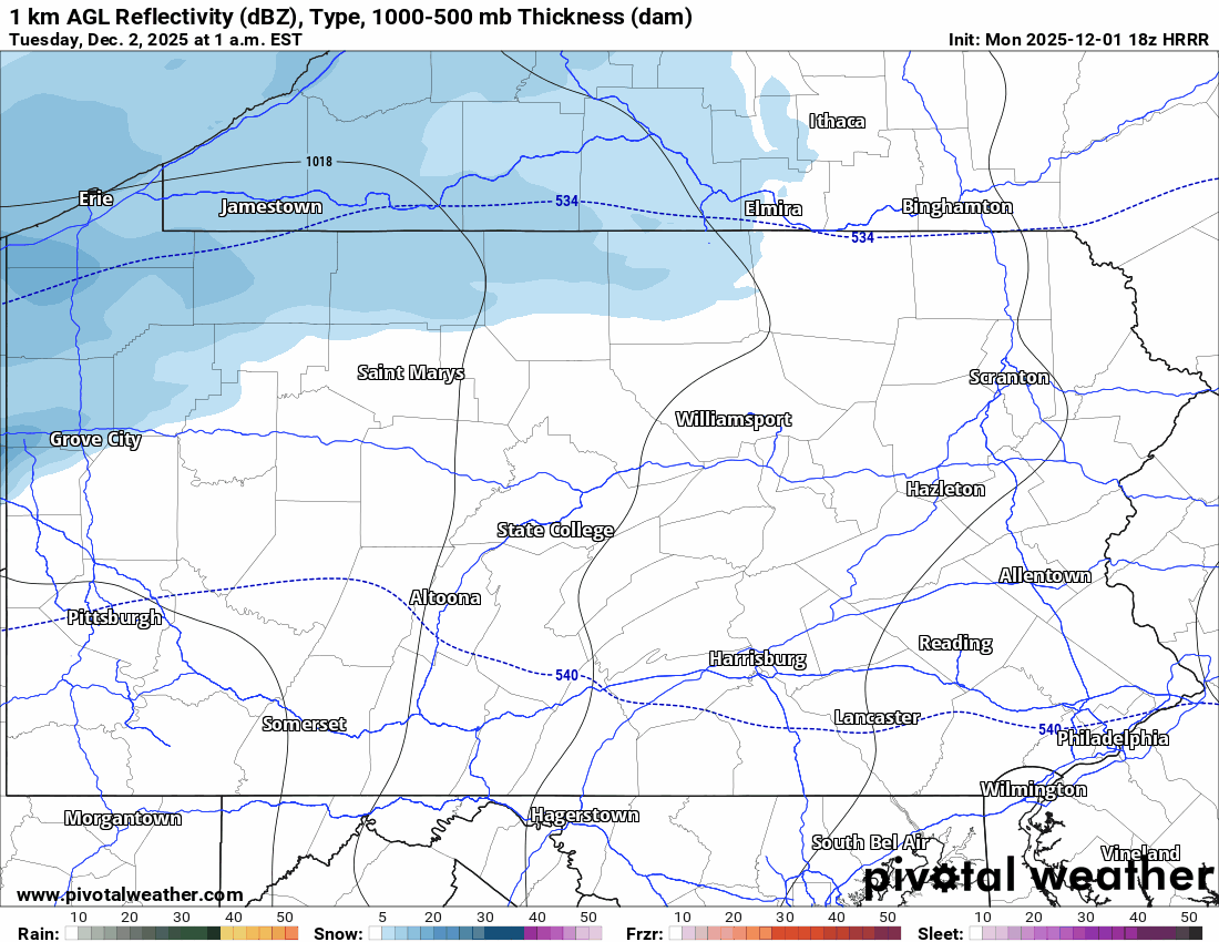
Below is the High Resolution Rapid Refresh model for Tuesday morning and early afternoon.
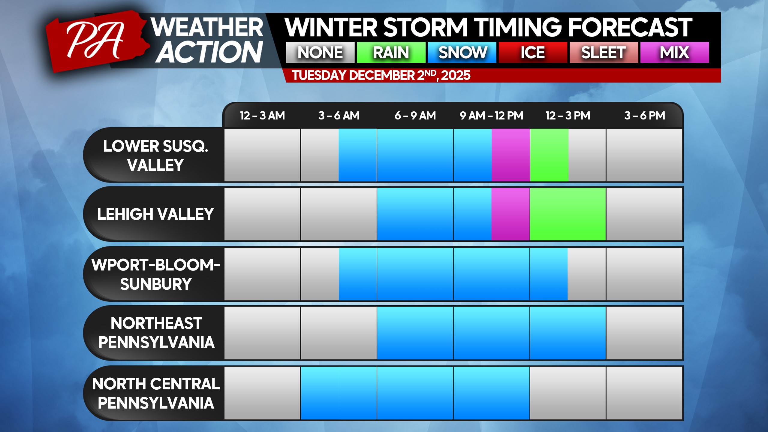
Latest timing charts for this event remain relatively unchanged from our previous update, with slightly earlier mixing in those fringe areas from the Lower Susquehanna Valley to the Lehigh Valley.
Heaviest snow will begin roughly 1-2 hours after start time in any given region, ending about an hour before end time. Snowfall rates of 0.5 – 1.2″ per hour are expected. This will make it very difficult for road crews to keep up, with snow-covered roads likely. The moral of the story is: if you don’t have to travel during this quick storm, don’t.
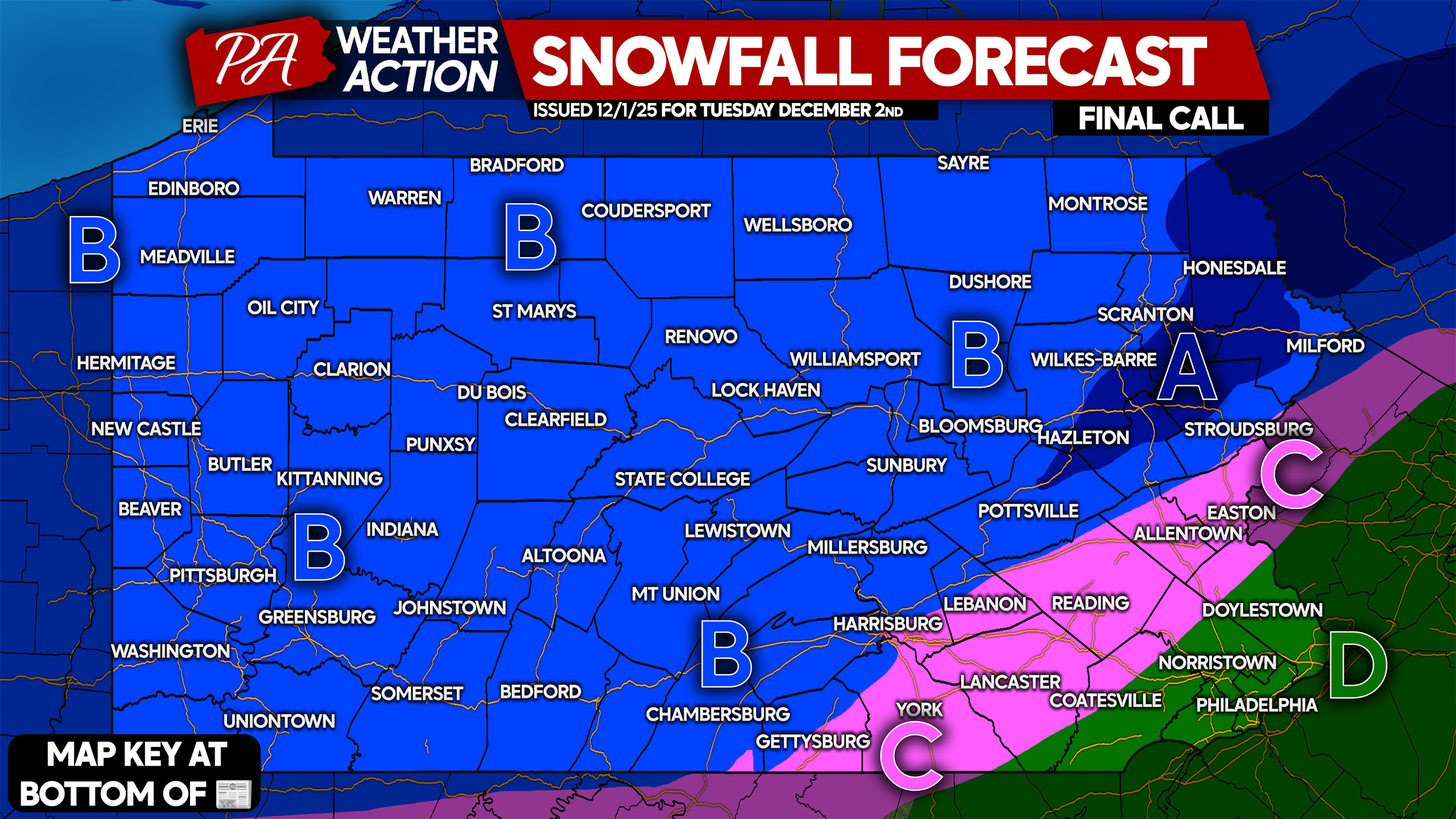
FINAL CALL SNOWFALL FORECAST FOR TUESDAY’S QUICK STORM
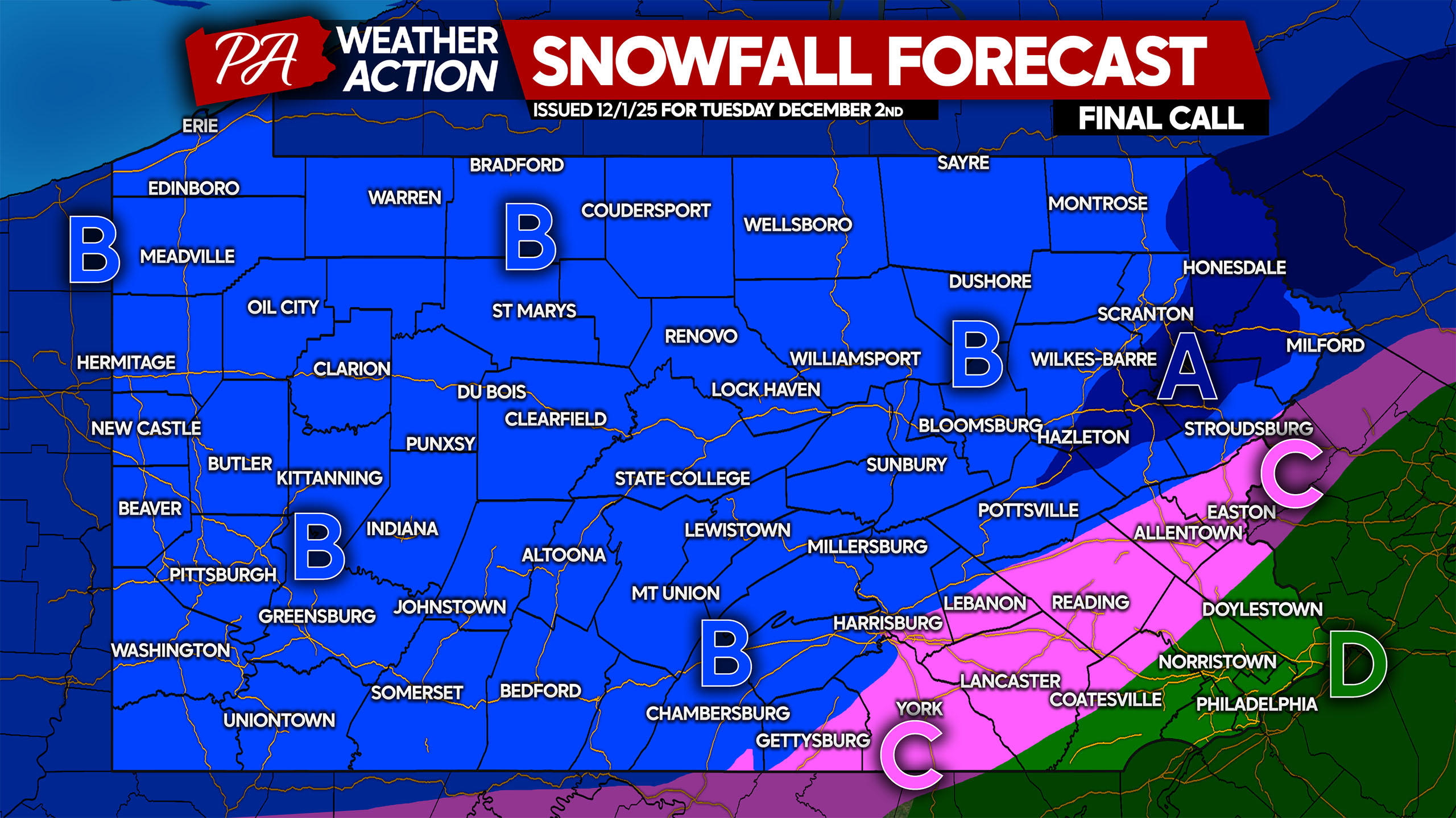
Area A: Snowfall accumulation of 5 – 7″ expected. Roads will rapidly become snow-covered and hazardous with moderate to heavy snowfall rates.
Area B: All snow is expected, with snow accumulation of 3 – 5″ expected. Roads will quickly become snow and slush-covered. If you must drive, take it slow.
Area C: Starting as snow before a changeover to rain. Snow accumulation of 1 – 3″ expected, with slippery travel a likelihood before the changeover.
Area D: Plain rain expected.
Be sure to share this final forecast with friends and family!
You must be logged in to post a comment.