

For some areas, the biggest winter storm of the season is under 12 hours away. We are tracking significant snow, sleet, and freezing rain that will change over to a plain rain for several locations. We anticipate major travel disruptions during your morning commute tomorrow as the bulk of the wintry precipitation will fall during the morning hours.
Nearly everyone will begin as a period of snow tomorrow morning. Snow will overspread the area from southwest to northeast beginning after 3:00 AM. Below is look at the future radar valid for 5:00 AM: 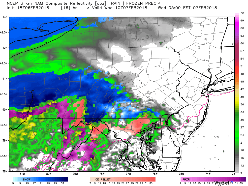
While many locations will only experience a few hours of snow before changing over to sleet and freezing rain, the snow that does fall, will fall and accumulate rapidly. It is likely snow will fall at 1-2″/hr before the change over. As we move forward to 8:00 AM, the precipitation has overspread much of the coverage area: 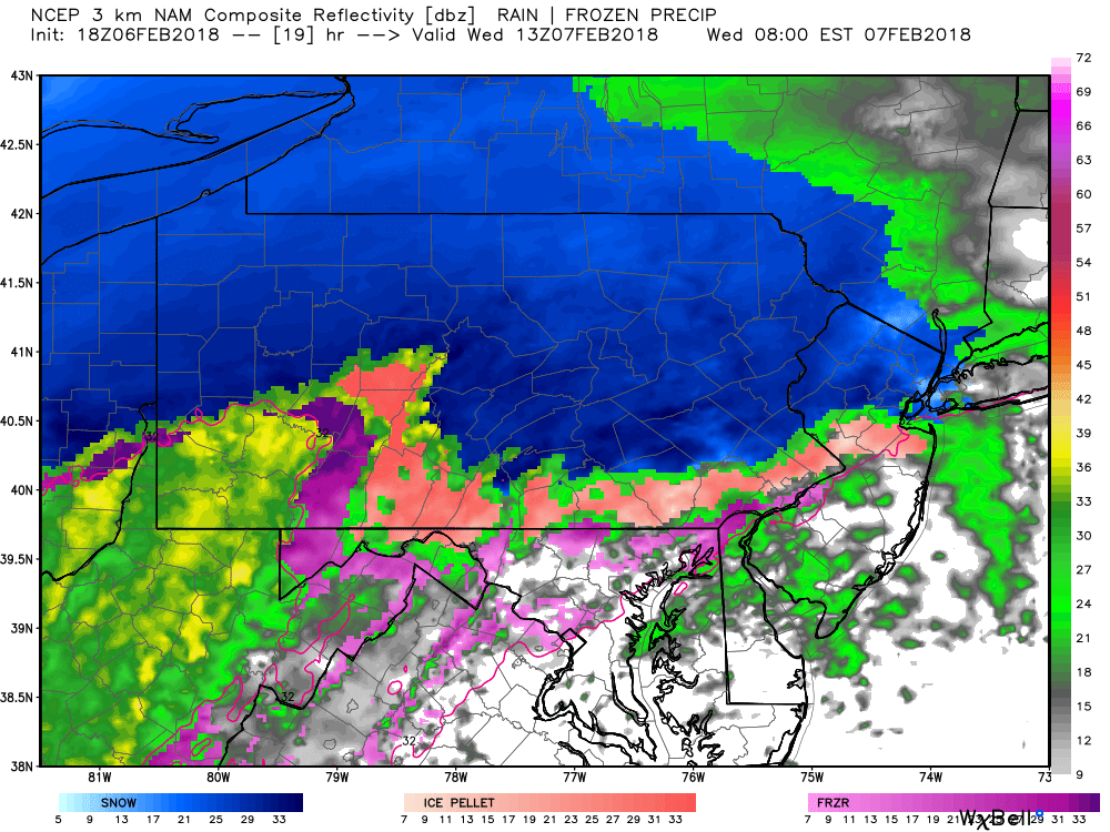
Notice the change over to sleet and freezing rain has begun already across Southern Pennsylvania and plain rain across Southwest Pennsylvania. This is why the heavier snow accumulations will be focused across Northern Pennsylvania where they will experience a longer duration snowfall.
The snow tomorrow might not be the biggest story. We are anticipating many area to experience a possible several hour period of sleet and freezing rain. This could lead downed tree limbs, possible power outages, and horrendous travel conditions. The future radar for 11:00 AM focus the sleet and freezing rain over South-Central Pennsylvania in the pink shade: 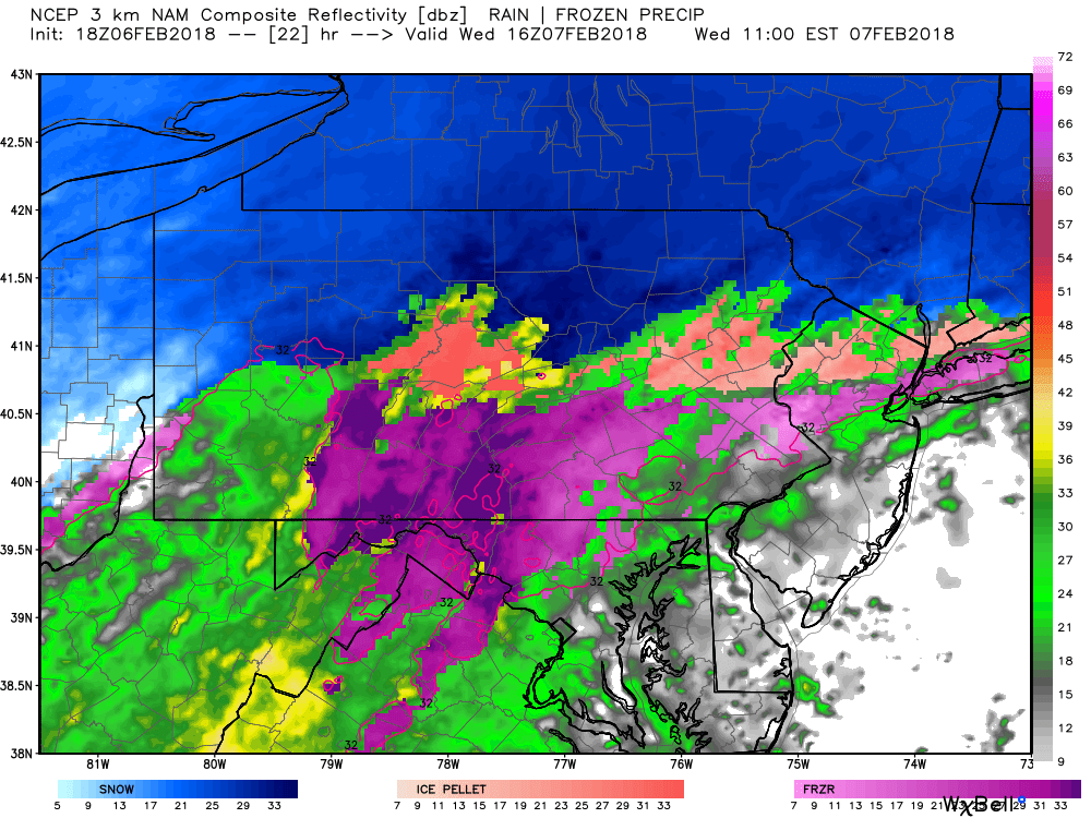
The precipitation will begin to taper off from West to East after 2:00 PM Wednesday afternoon. Below is a look at 3:00 PM showing some lingering precipitation in Central and Eastern Pennsylvania: 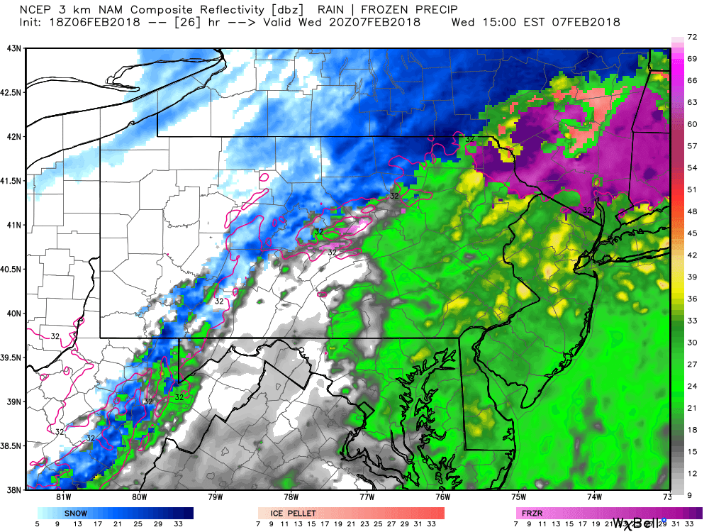
FINAL CALL SNOWFALL FORECAST MAP
Area A: 6-10″ of snow is expected. Snow covered roads will make for dangerous travel all day Wednesday.
Area B: 4-6″ of snow is expected. This area will start as snow and end as sleet or freezing rain. Snow and ice covered roads will cause hazardous travel conditions all day Wednesday.
Area C: 2-4″ of snow is expected. This area will start with a heavy burst of snow for several hours, followed by sleet or freezing rain, the ending as rain. The worst travel conditions will be during Wednesday Morning into the early afternoon.
Area D: 1-2″ of snow is expected. A burst of snow will last a few hours before changing over to sleet, then rain in most areas. Travel will be most difficult Wednesday Morning, until about noon except in areas that receive the most ice.
Area E: <1″ of snow is expected. Snow will quickly transition to rain Wednesday Morning. Untreated roads may be slick as the snow falls.
FINAL CALL ICE FORECAST
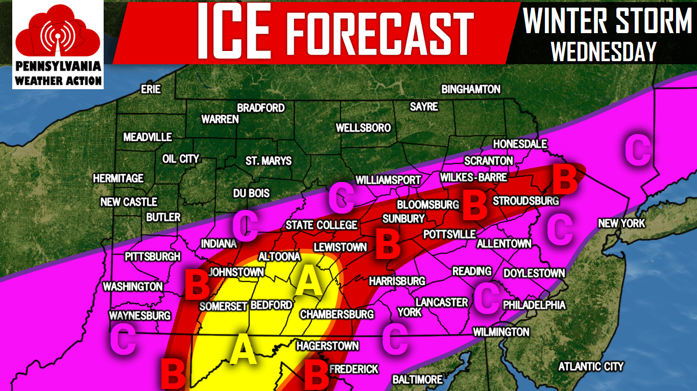
Area A: Ice accumulation of a quarter to a half-inch is expected. Scattered power outages possible as well as downed tree brances and power lines. Be prepared to lose power especially in rural areas.
Area B: Ice accumulation of a tenth to a quarter-inch is expected. Isolated power outages possible as well as downed tree branches and power lines.
Area C: Ice accumulation of .01 to a tenth-inch is expected.
For updates during the storm, like us on Facebook by clicking here>>>Pennsylvania Weather Action’s Facebook Page You can also download our free app for interactive radar, your latest forecast, alerts, and more by tapping here >>> PA Weather App
Share this final call forecast with your family and friends using the button below!
You must be logged in to post a comment.