
A long duration major Springtime winter storm will impact our area beginning tomorrow morning and will last through Wednesday evening. In our first call yesterday, we mentioned the potential for this scenario to play out if the secondary low pressure that develops off the Carolina coast takes a track closer to the coast. Model data and current observations suggests this to be the case. There will be two rounds of wintry weather with a potential break in between the two in some areas.
The first round begins tomorrow morning and will last through tomorrow afternoon. Tuesday night there could be a lull in the action, or lighter precipitation. Then early Wednesday morning through all of Wednesday the secondary coastal low takes over and throws heavy amounts of precipitation over our area.
Wave 1 will benefit southern areas the most. Precipitation will begin southwest to northeast after 6:00 AM. There is potential for snow to mix in with sleet at times. Below is a look at 10:00 AM tomorrow morning: 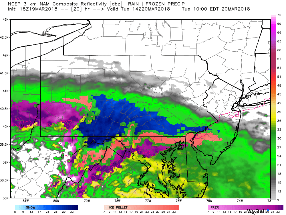
The precipitation will begin to fall down heavier as the day progresses. By 2:00 PM Tuesday afternoon, many areas are snowing heavily, while some mixing issues is taking place across Southeast Pennsylvania. 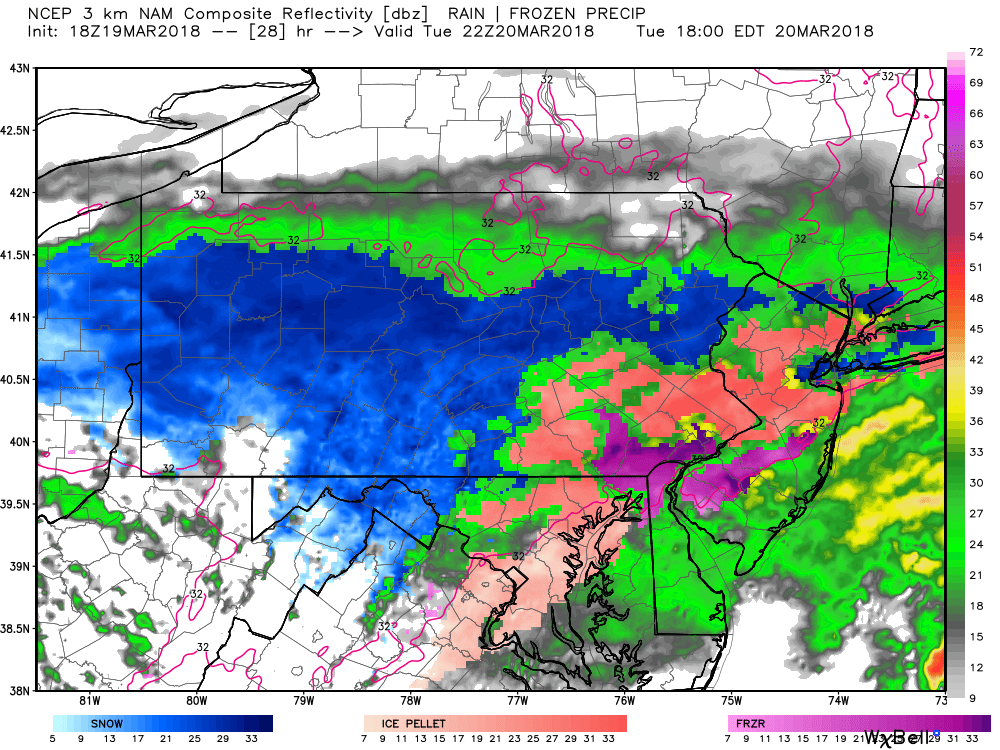
A break in the action is possible especially across Eastern Pennsylvania late Tuesday night into early Wednesday morning: Using the future radar, it begins to hint at this by 8:00 PM Tuesday night: 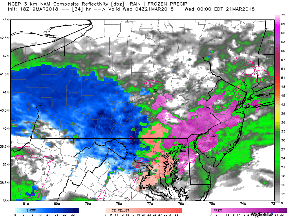
Up until this point, this is all from our first storm. The secondary low pressure will begin to take over early Wednesday morning and will redevelop heavy snow and maybe sleet for some areas by 7:00 AM Wednesday morning: 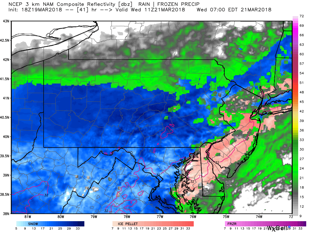
The snow will continue to fall heavily throughout the day for much of the area. Below is a look at 12:00 PM Wednesday afternoon: 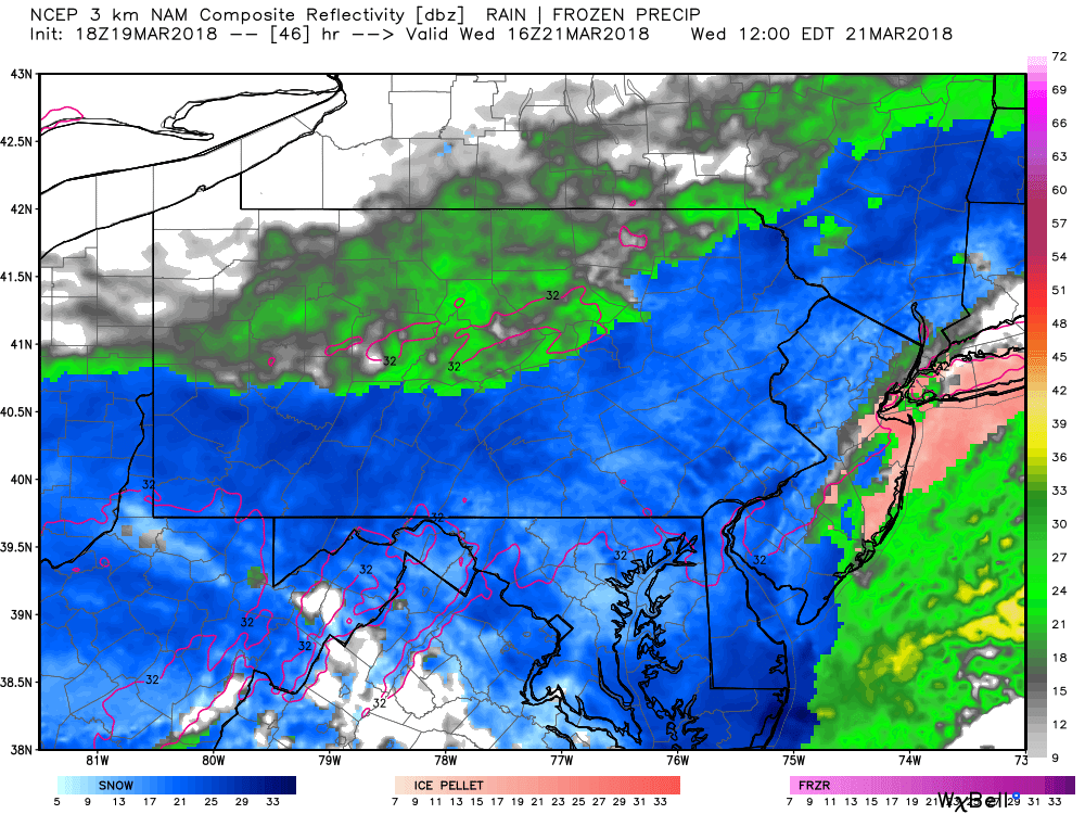
The heaviest of the snowfall accumulations will be across Southern and Eastern Pennsylvania where the snow will last the longest. The snow will not begin to taper off until after 6:00 PM Wednesday evening. Doing the math there, that is about a 36 hour duration winter storm. 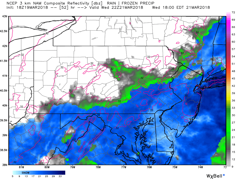
Even though we are in late March, we still expect roads to be snow covered for many areas that receive the heaviest of snows. Our main concern is the weight of the snow on trees. Widespread power outages are certainly possible both Tuesday and Wednesday. It does not take much snowfall accumulation to bring down trees or power lines, especially when the snow is heavy and wet.
FINAL CALL SNOWFALL FORECAST THROUGH WEDNESDAY
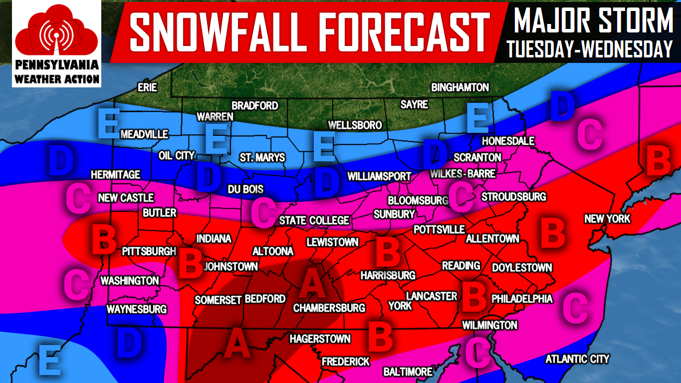
Area A: Snow accumulations of 8-14″ are expected within this area.
Area B: Snow accumulations of 6-10″ are expected within this area.
Area C: Snow accumulations of 4-6″ are expected within this area.
Area D: Snow accumulations of 2-4” are expected within this area.
Area E: Snow accumulations of 1-2” are expected within this area.
Be sure to follow us on our Facebook page for live updates and latest model data >>>PA Weather Action on Facebook
Share this important forecast with your friends and family using the share button below. Stay safe!


You must be logged in to post a comment.