
Severe thunderstorms remain likely across Western and Central PA Tuesday. A low pressure system cutting through the Great Lakes will have both a warm front and cold front associated with it that will impact our weather Tuesday. Showers are possible with the initial warm front early in the day Tuesday, but it is the trailing cold front that will pass through during the late evening hours that will contain the strong to severe storms.
The longer the cloudiness takes to wear off, the less of a threat there will be. However, we expect a two to four hour period of clearing skies between the morning’s rain and the evening’s storms. This will likely trigger just enough instability for these storms to intensify in Western PA. Embedded supercells are possible with the trailing cold front, which may result in a tornado or two. The main threat will be damaging winds in excess of 60 MPH and large hail.
For those interested in the Little League World Series this time of year, unfortunately it is more than likely the Tuesday’s games may have to deal with a little rain during the day. The 7:30 PM game may escape the severe weather as the strong storms are not expected to reach the Williamsport area until after 9:00 PM, but it is a close call.
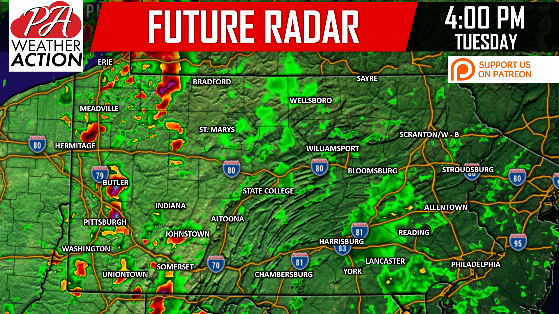
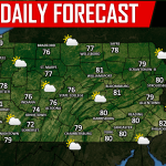
Storms will pop-up and quickly intensify in the mid-late afternoon cross Western PA. They will be moving east at about 40 MPH. Here is the Hi-Res NAM for 4:00 PM Tuesday:
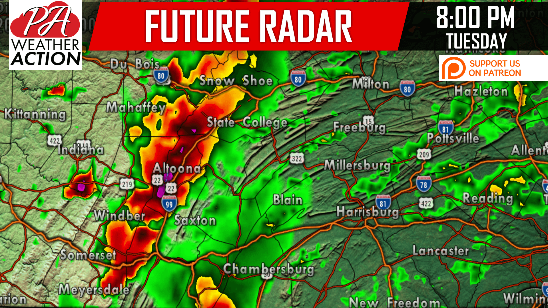
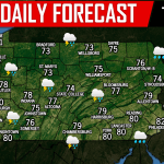
As the storms move east, we expect a line to form in the Laurel Highlands and Northwest PA mountains. Below is the Hi-Res NAM for 8:00 PM Tuesday:
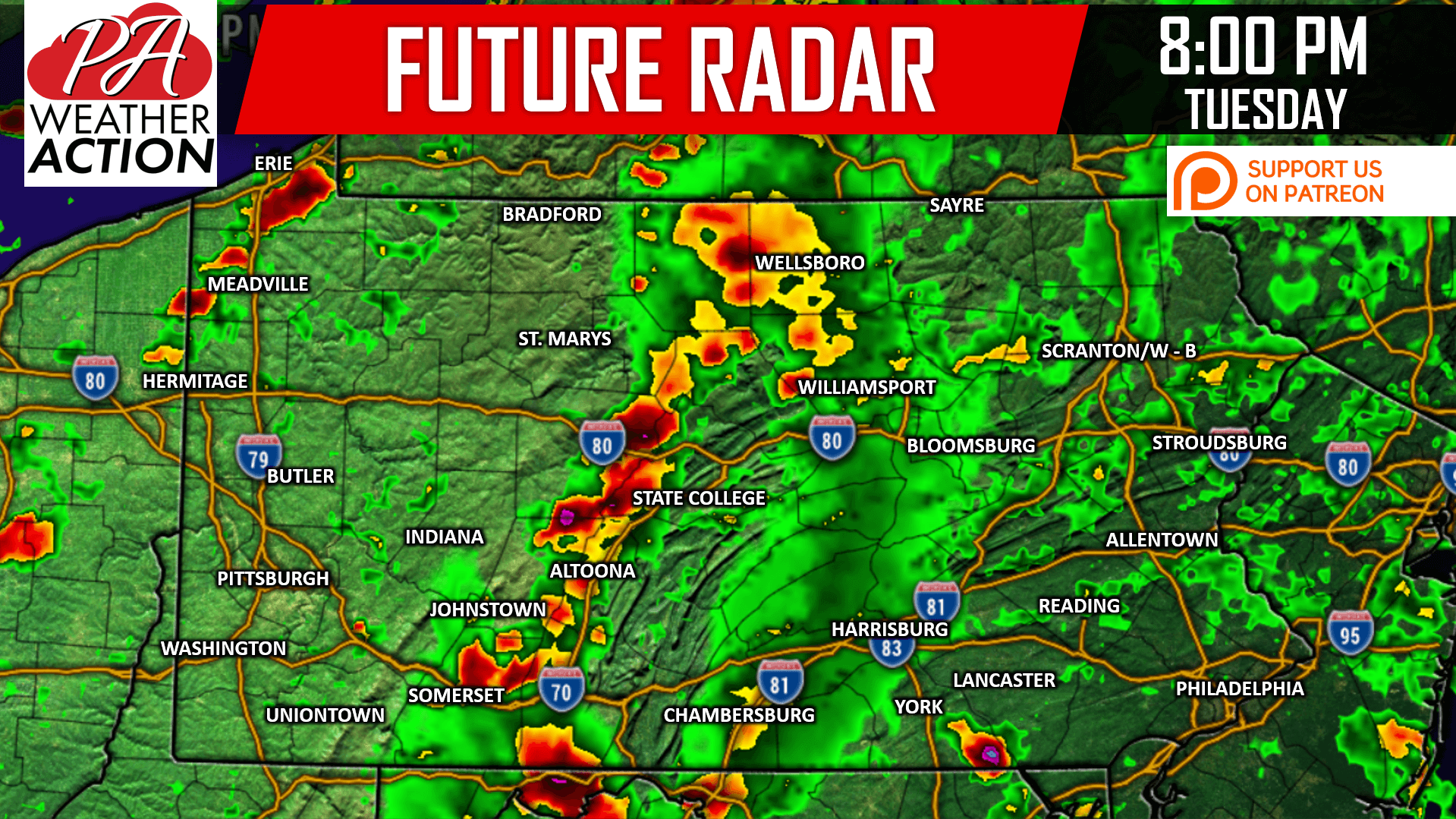
The line will be slowly weakening as it pushes east in Central PA. Cells may pop-up ahead of the line in the Susquehanna Valley. View the full future radar:
SPC RISK MAP
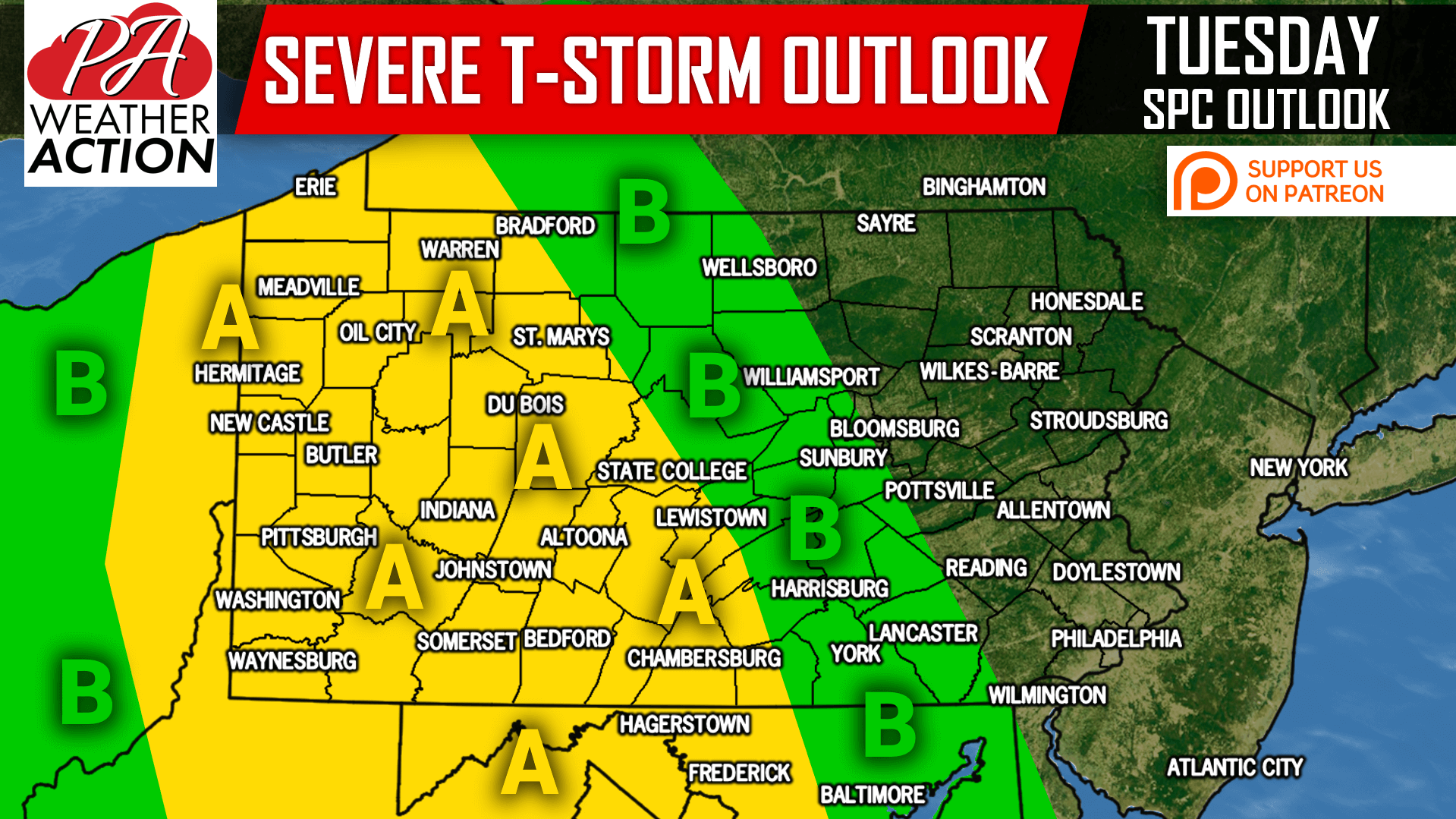
Area A: Severe storms containing damaging winds, hail, and a tornado or two are likely in Western PA late afternoon and early evening Tuesday. An organized line of strong to severe storms will likely form in the Laurel Highlands and Northwest PA Mountains by the evening. The line will dissipate around State College to Chambersburg as it heads east (Slight Risk).
Area B: This region will see the leftovers of the line late Tuesday Evening. Storms will be hit-or-miss, with isolated damaging winds being the main threat (Marginal Risk).
Flash flooding is still possible in areas that receive 2-3″ of rainfall in a short period.
If you appreciate our work, please consider supporting us on Patreon to receive some great rewards, click here>>>Support PA Weather Action on Patreon!
Monitor these storms and receive push notifications when severe weather alerts are issued for your county >>> Download Our App Here!
Share this important new update with your family and friends using the button below!
You must be logged in to post a comment.