

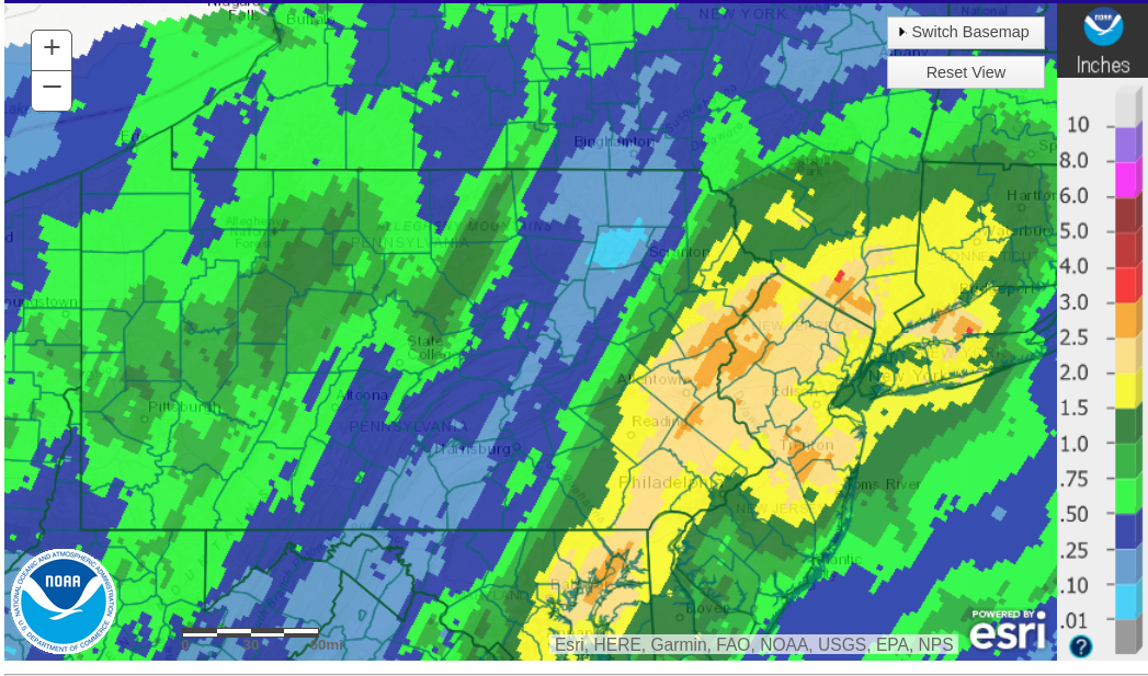
As the astronomical winter for the northern hemisphere commenced, December’s warm wet pattern continued as yet another tropically-logged system inundated parts of our area with 2-3″ rain, along with days of dismal clouds and dreary conditions. This event swelled monthly precipitation totals over 10″ in the southern and eastern areas!
Please enjoy a radar-estimated map of rainfall amounts for this event:
This system will reluctantly relinquish control of our area and permit some sunlight onto area this weekend, but most of the remainder of this year will feature cloudy conditions. Thankfully, little precipitation is expected through next week.
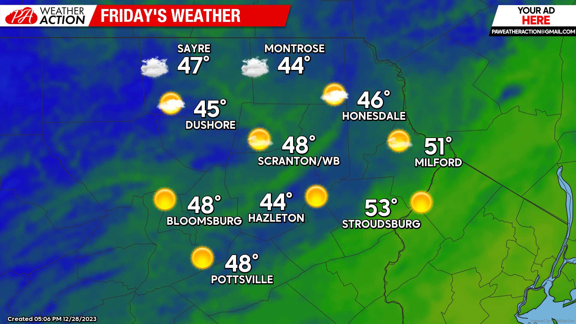
FRIDAY
Isolated sprinkles could annoy the area from the morning into the afternoon. Thankfully there will be patches of sunlight. Temperatures will remain warmer than normal.
SATURDAY
There could be some snow showers throughout the day for the northern areas and higher elevations. Some of those snow showers could coat the ground to perhaps an inch in the higher elevations, but the low elevations will sadly miss out.

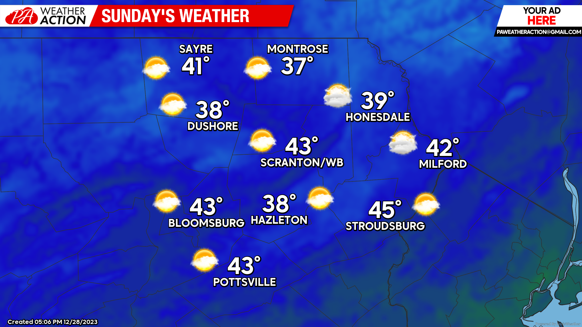
SUNDAY
There could be much-welcomed breaks in the clouds along with warmer-than-normal conditions. Enjoy! A weak disturbance will deliver snow showers to the northern parts of the area and the highest elevations Sunday night into Monday, where small accumulations could occur. Alas, the lower elevations will likely miss out on this potential.
NEXT WEEK
Arctic air will continue to be elusive through next week, but at this moment at least most of the week looks dry. There could be snow showers that whitened the ground over the northern areas over the course of the week, but most of the area will remain dry and snowless along with warmer-than-normal temperatures.

You must be logged in to post a comment.