

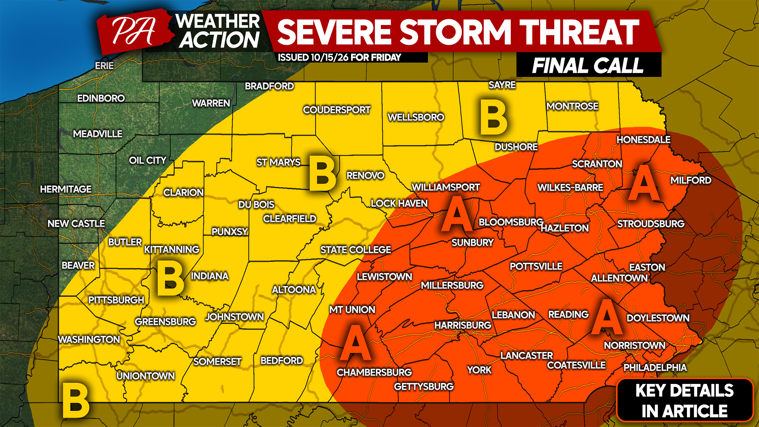
Severe thunderstorms will bring a damaging wind threat Friday ahead of a strong cold front that will bring the coldest air yet of fall behind it. Snow squalls are possible Saturday in parts of Pennsylvania Saturday, followed by the first frost and freeze of the season in nearly the entire state Sunday morning.
A storm system pushing through the Eastern Great Lakes will bring Quebec its first snowstorm of the season, north on Montreal. Here in Pennsylvania, we’ll have to wait another month at least for any widespread snow. We will be on the warm side of the low pressure, with a line of thunderstorms likely to push west to east across the state Friday afternoon.
Wind gusts of 30 – 40mph will occur nearly everywhere as the line moves through. We’re focused on the eastern half of the state for gusts up to 60mph that could cause damage and temporary power outages.
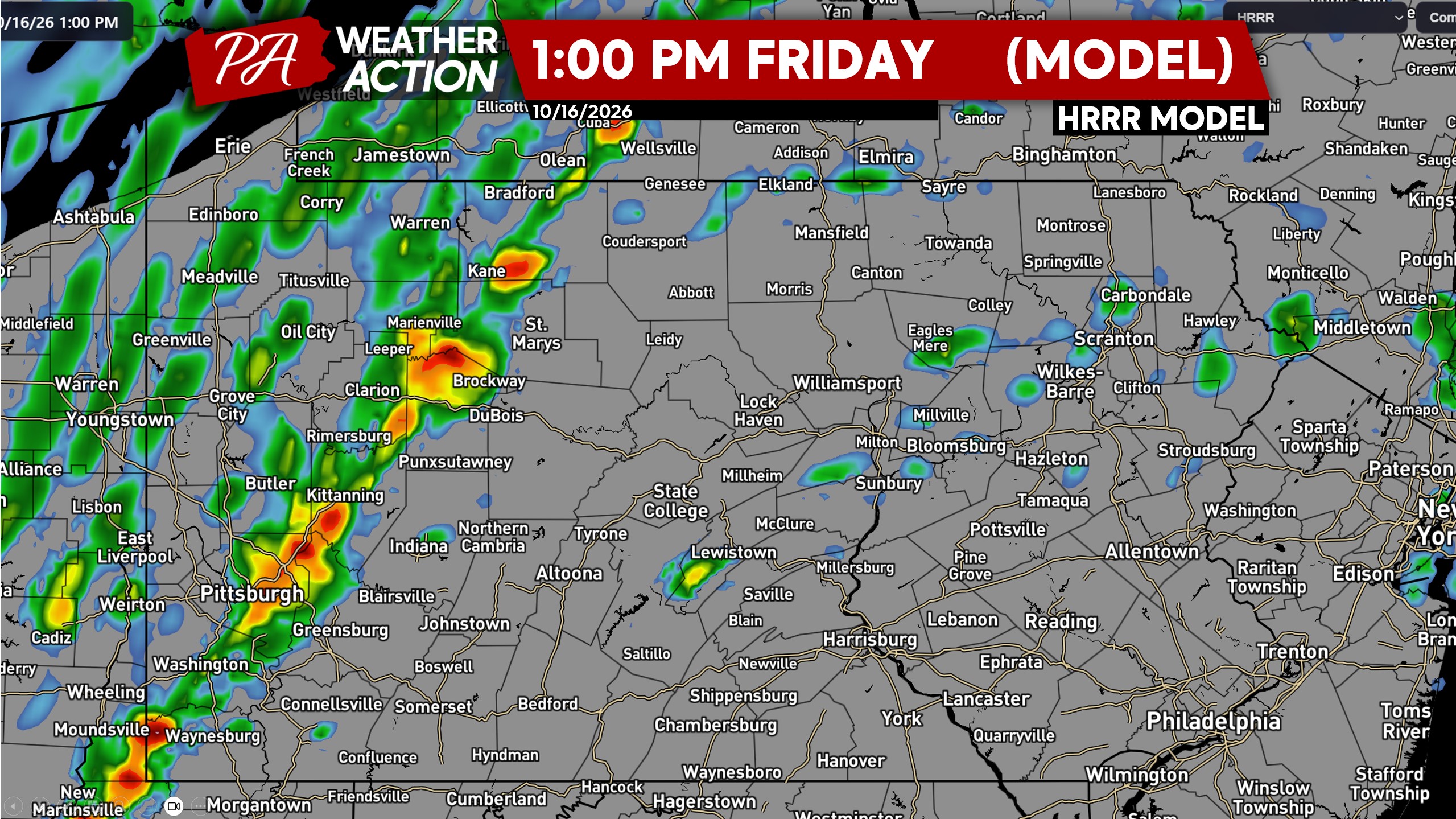
Starting around lunchtime Friday, we expect to see a broken line of strong showers and some storms develop in Western PA.
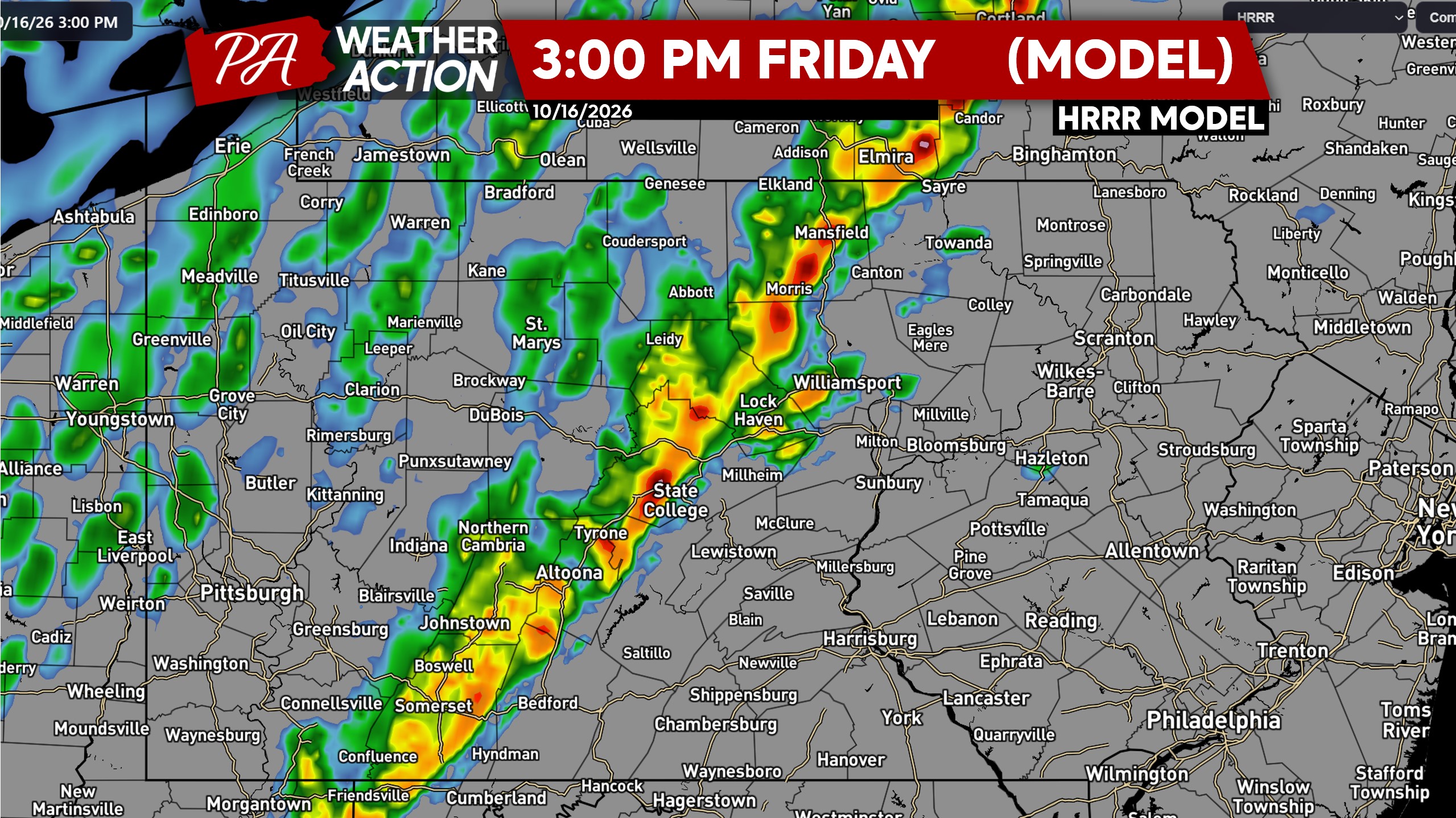
As the line pushes through the Appalachians, we expect it to strengthen somewhat in a more favorable environment. Below is a look at 3pm Friday future radar.
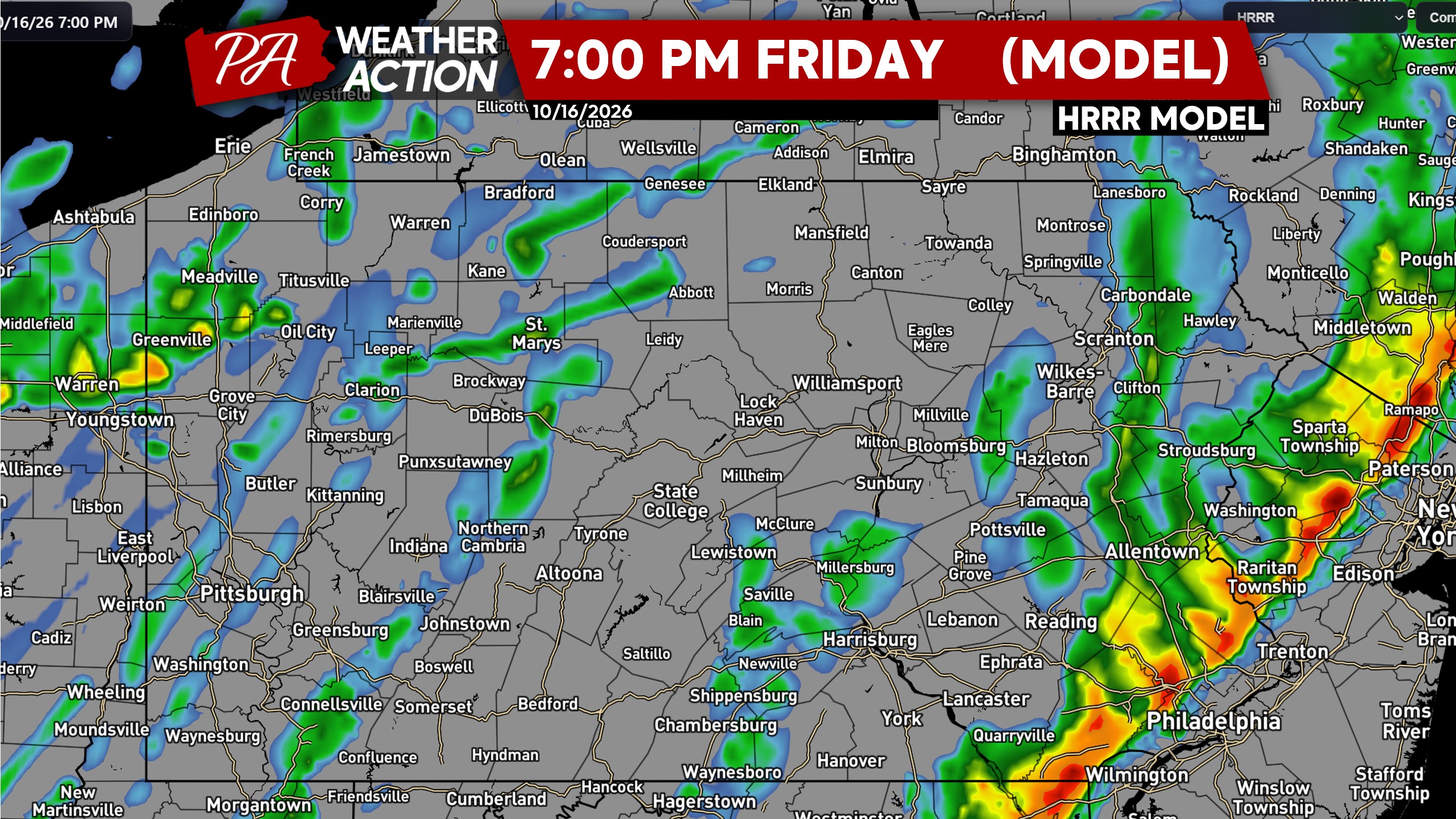
Peak intensity for this line is expected to come as it’s near the I-81 corridor in Eastern and Central PA, with wind gusts of 40 – 60mph probable in the stronger segments of the line. Here’s a look at 5pm Friday future radar.
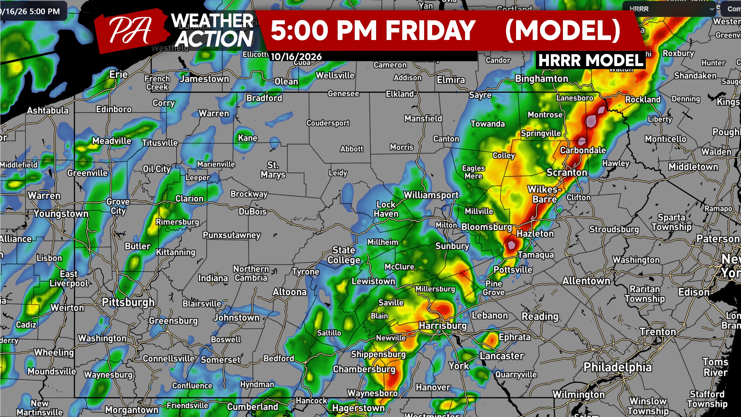
The front will be moving through exceptionally fast, with the line already through most of Eastern PA and in the Philadelphia Metro by dinnertime Friday.
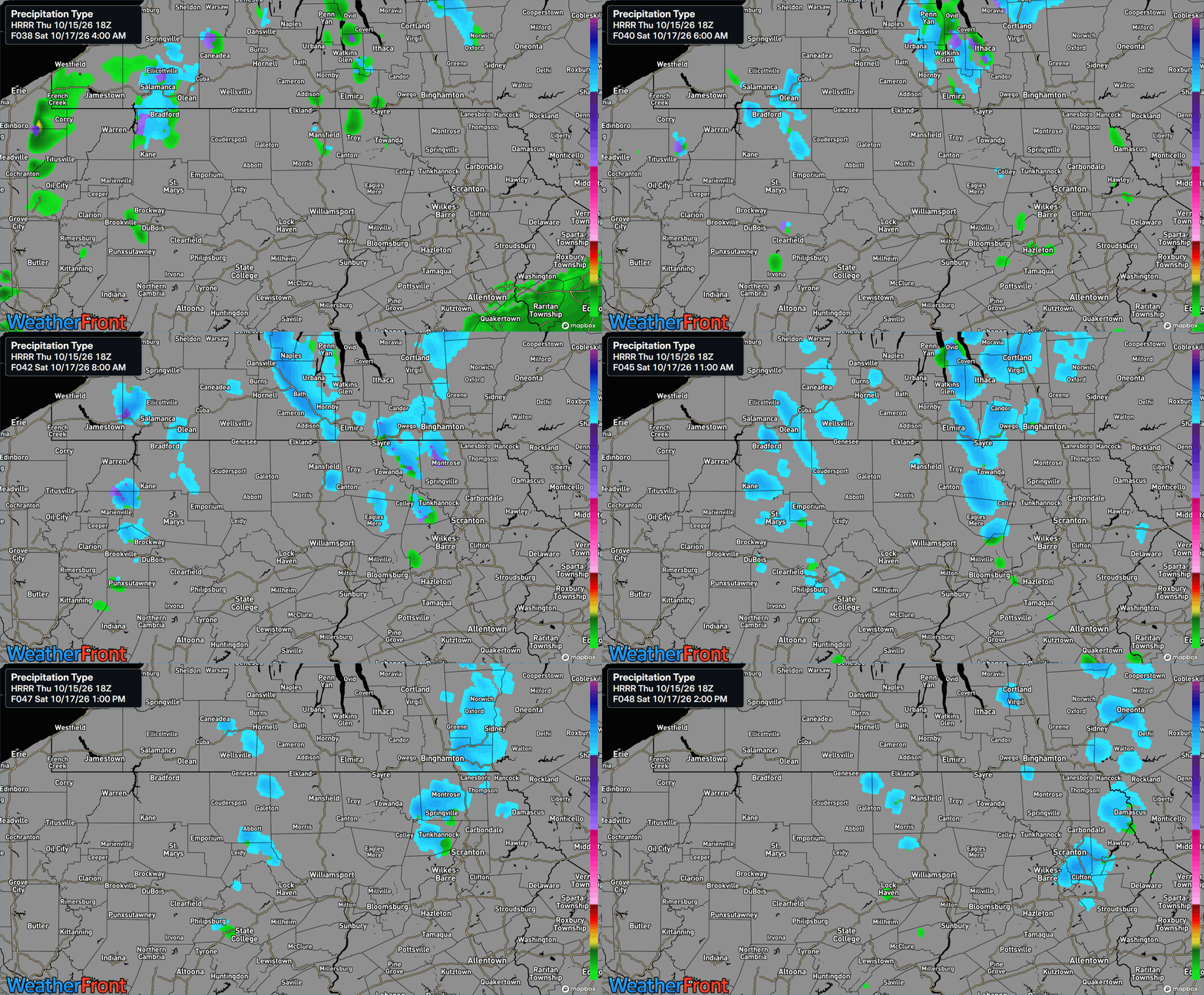
Behind the cold front, temperatures will crash Friday night and we may actually see some snow squalls in the Northern PA mountains on Saturday morning, as shown below.
FINAL CALL SEVERE THUNDERSTORM THREAT MAP FOR FRIDAY 10/16
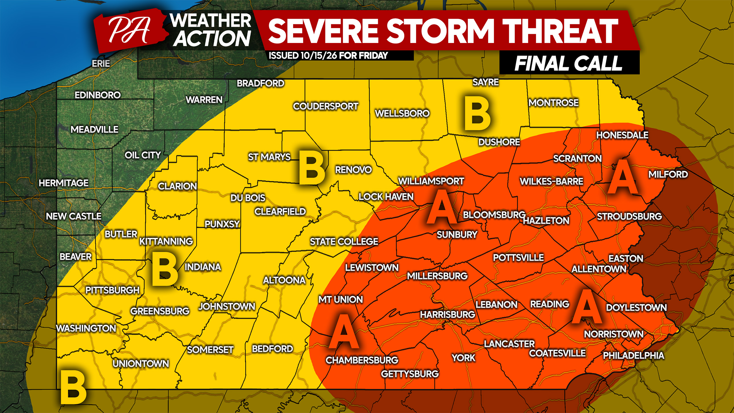
Area A: Scattered damaging wind gusts of 50-65mph possible with the line of storms, leading to localized temporary power outages. Watch for fallen debris on roadways Friday evening.
Area B: Isolated damaging wind gusts of 50-60mph possible, with localized temporary power outages a concern. Watch for fallen debris, as well as slippery roads from fallen leaves.
Many people have outdoor plans Friday, so don’t forget to share this forecast with family and friends!

You must be logged in to post a comment.