
Wednesday was a very active day for severe weather in much of the state, with well over 100k customers without power at one point. Most of the damage was in Southwest PA, the middle Susquehanna Valley, and the Lehigh Valley. We now turn our attention to another potential severe weather day on Saturday.
A low pressure system moving through Ontario will provide wind shear, which is change in wind speed & direction with height above the surface. This combined with sufficient CAPE, which is energy needed for thunderstorm development, along with a few other dynamics will create the potential for specifically a few tornadoes Saturday.
Our main area of concern is Southwest PA, as that area has been red hot for tornadoes so far this season as well. South Central PA is the secondary area of concern, as we will get to later.
SATURDAY THUNDERSTORM TIMING
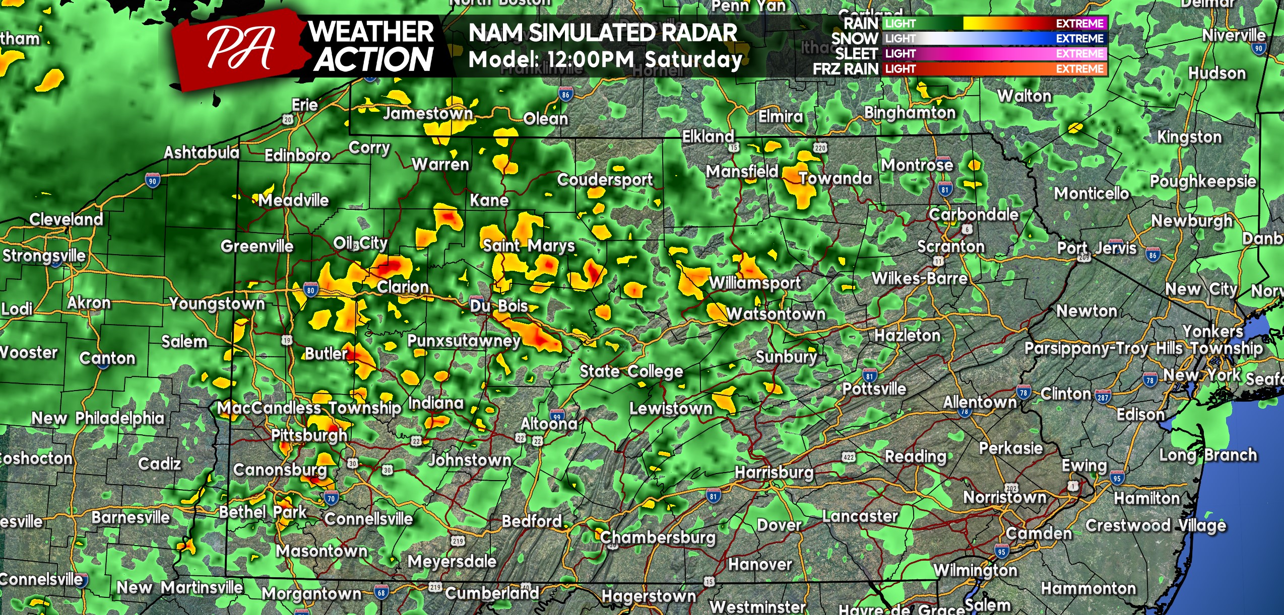
Widespread showers and thunderstorms will move through western and northern Pennsylvania Saturday morning and early afternoon before the area clears out. While this activity is unlikely to bring severe impacts, it won’t be an ideal morning in those areas. Below is Hi-Res NAM Future Radar for 12:00 PM Saturday.
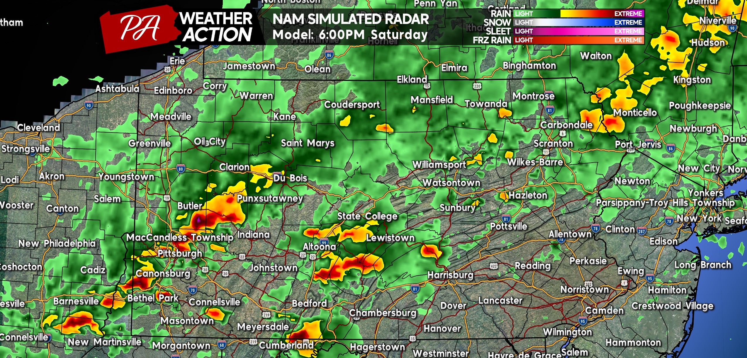
Storms are expected to push into Southwest PA from Ohio in the late afternoon hours of Saturday. These storms may already be severe, so watch out around dinnertime across Southwest PA. A few of these storms may be rotating, meaning tornadoes are possible. Here is future radar for 6:00 PM Saturday.
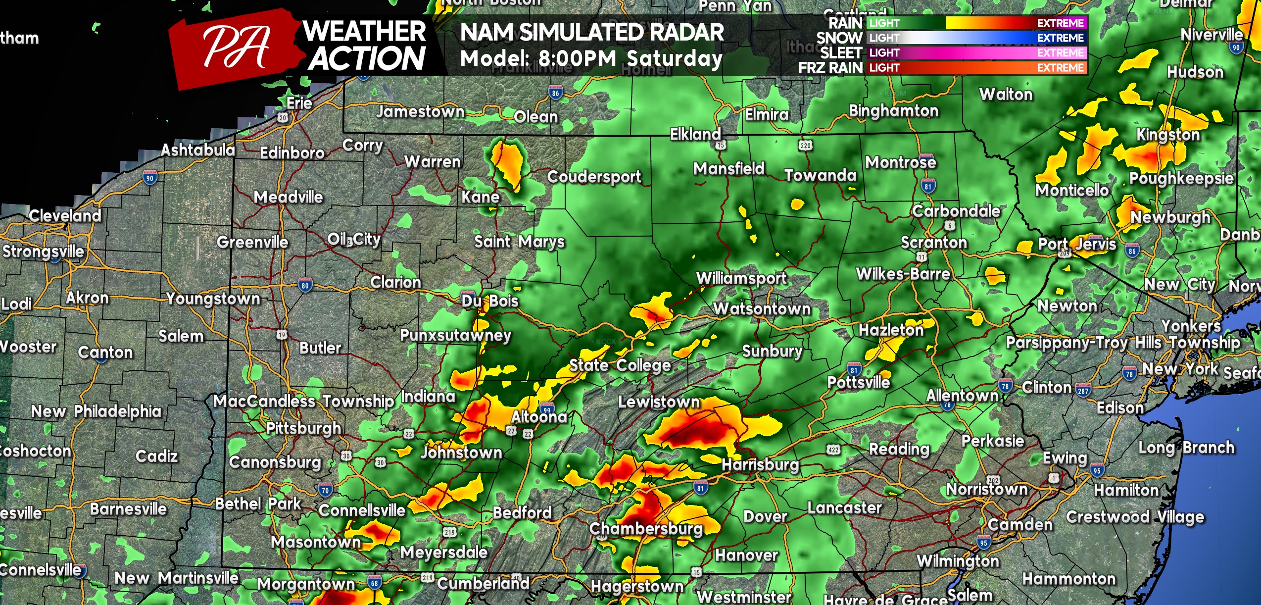
Strong to severe thunderstorms will then push east into the Laurel Highlands and South Central PA Saturday evening. These storms are expected to maintain strength as they move into an equally favorable environment until about the State College to Chambersburg longitude. East of there, less favorable dynamics will be at play. Here is future radar for 8:00 PM Saturday.
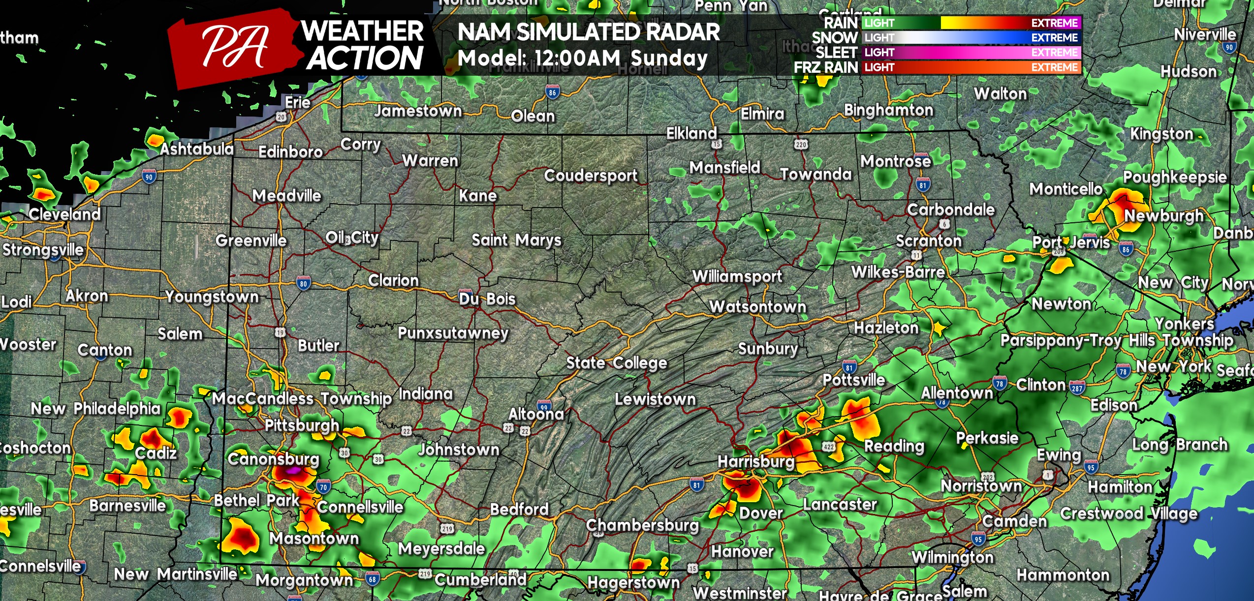
Storms will begin to weaken after sunset, especially near the Susquehanna River. They may still be strong as they push into the Susquehanna Valley, but shouldn’t be damaging. Below is future radar for 12:00 AM Sunday. There be also be a few strong storms in Southwest PA once again.
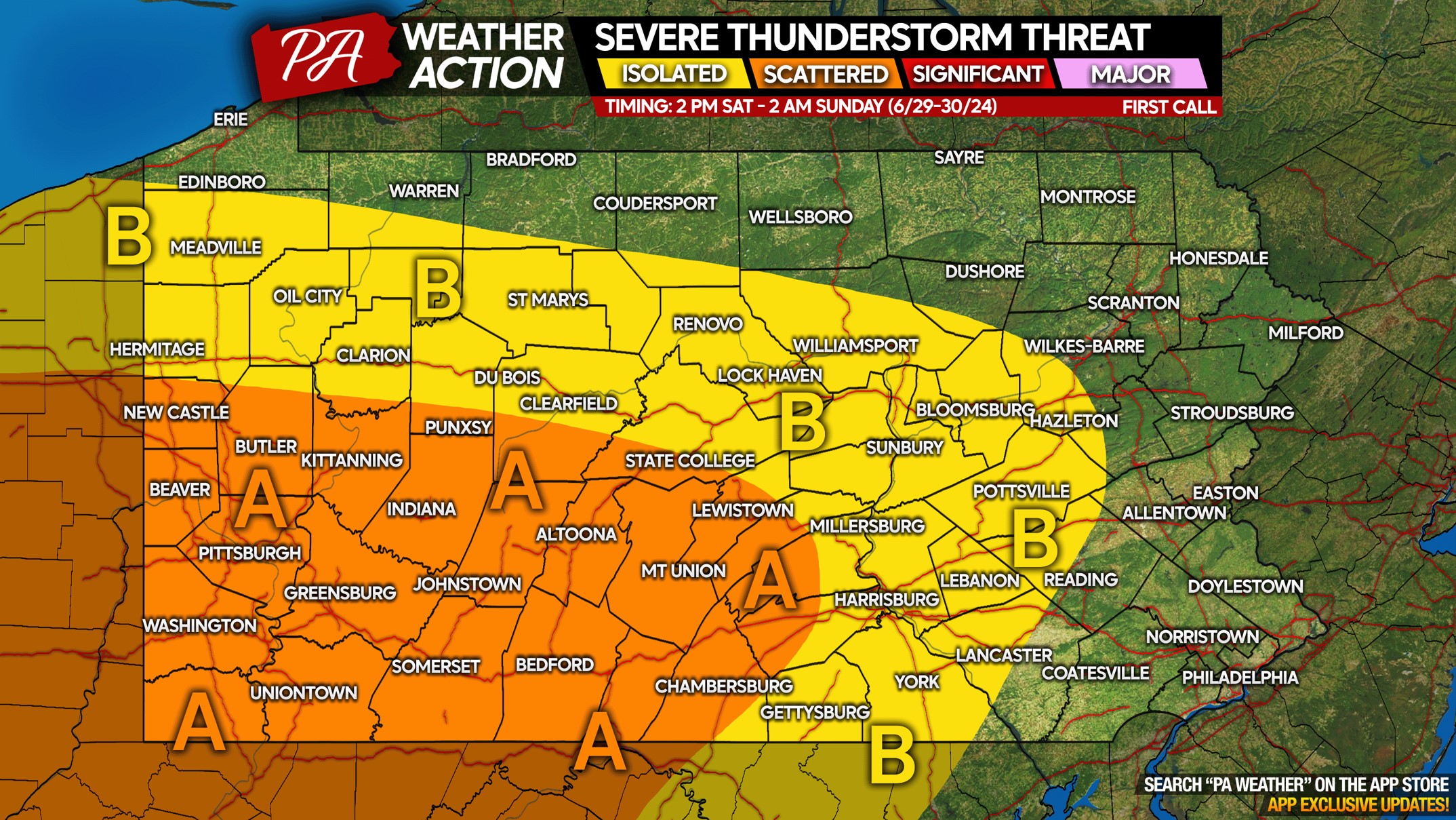
SATURDAY 6/29 SEVERE THUNDERSTORM RISK MAP
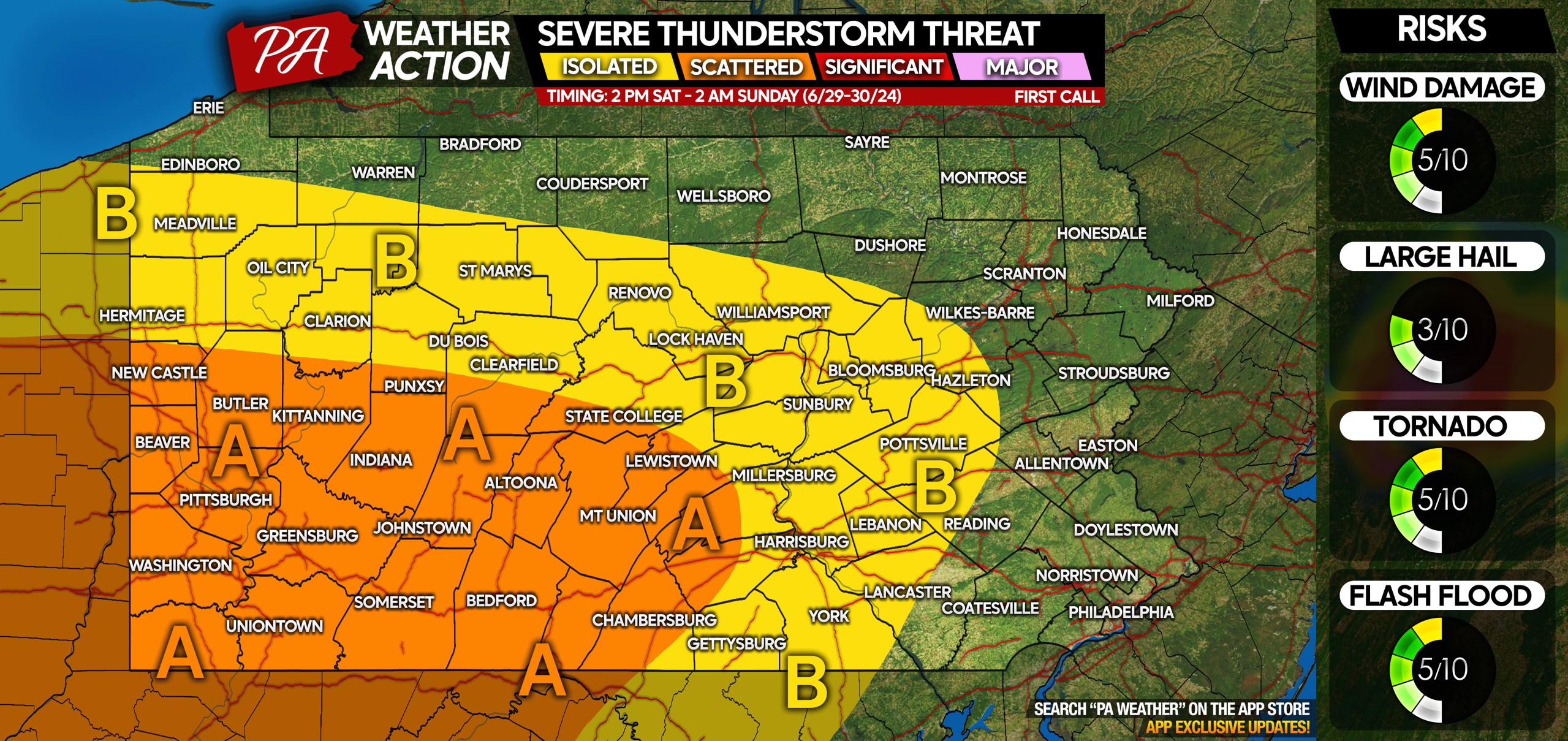
Area A: Scattered strong to severe thunderstorms are probable with a medium tornado risk, especially in Southwest PA. A few tornadoes are possible within this area. Wind gusts of 40 – 60 MPH are possible, along with urban flash flooding. Saturday evening outdoor activities may be canceled/postponed.
Area B: Isolated strong to severe thunderstorms are possible with a low tornado risk. Isolated wind gusts of 40 – 60 MPH are a threat as well.
Wee will have an update to this forecast on Friday evening!
Don’t forget to share this article with family and friends who have outdoor plans Saturday!

You must be logged in to post a comment.