
The same day Punxsutawney Phil proclaimed six more weeks of winter, a fresh inch of snow coated the region Sunday evening. Warmer air blew into our area today and boosted temperatures above freezing and melted the snow, especially across the southern valleys. A system will provide a snow-to-mix event Wednesday night into Thursday. And the pattern looks very active late this upcoming weekend through next week!
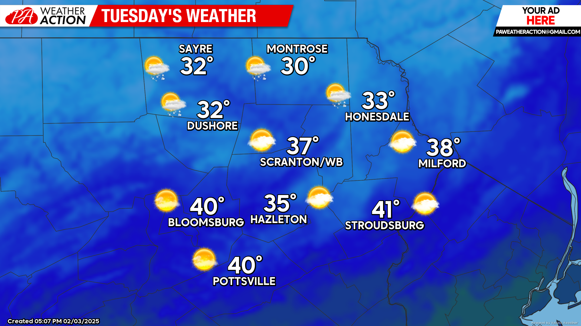
TUESDAY
High pressure will be in control. Temperatures will climb a few degrees above normal, melting some of the residual snow across all but the highest elevations.
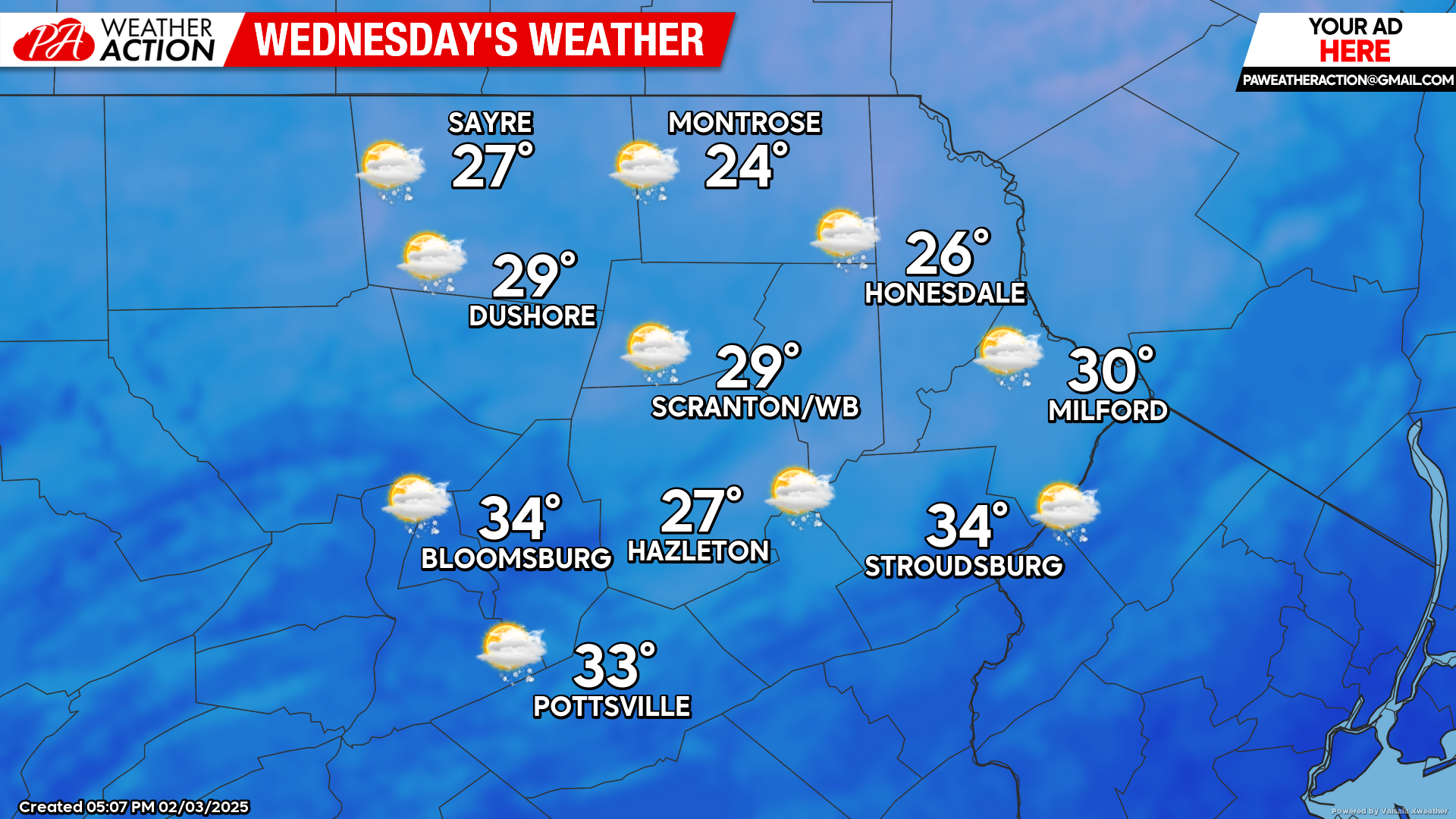
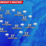
WEDNESDAY
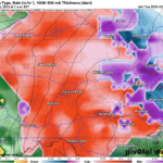
Most of Wednesday will be dry with increasing clouds. Precipitation will encroach upon the region from the southwest after sunset. The precipitation will start in the form of snow, but warmer air aloft will gradually melt the snowflakes a few thousand feet above the ground, which will refreeze into sleet or freezing rain. This will be a challenging event to predict details, but a few inches of snow/sleet crusted with ice on top is the most-likely scenario, ending midday Thursday.
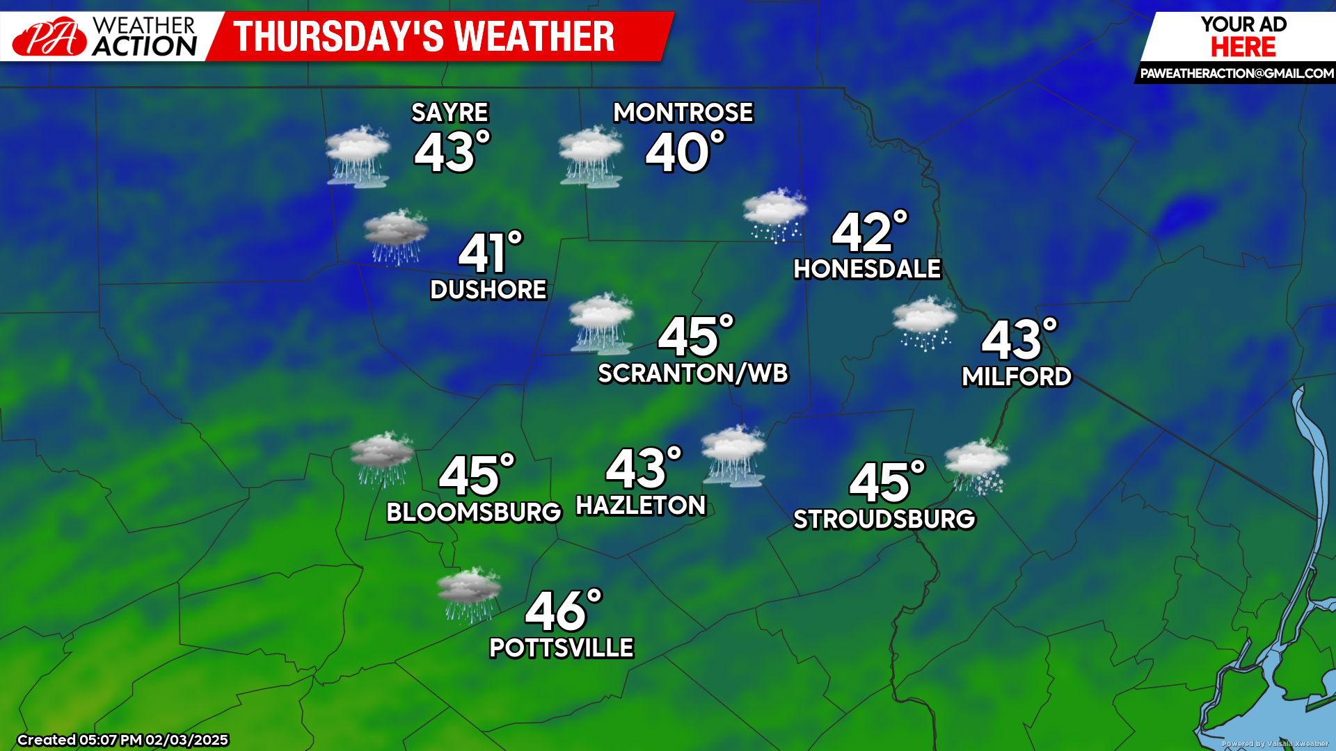
THURSDAY
Mixed precipitation will taper down early afternoon after depositing a mantle of snow and sleet capped with a crust of freezing rain. Temperatures will climb above freezing, but will struggle a bit to scour out the low-level cold air. Enjoy!
You must be logged in to post a comment.