
A parade of disturbances will maintain unsettled conditions with multiple opportunities for showers and thunderstorms through this weekend and likely into next week.
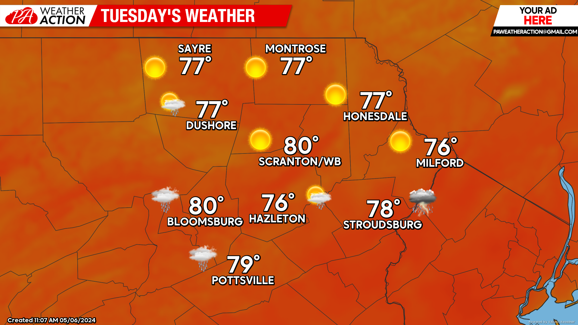
TUESDAY
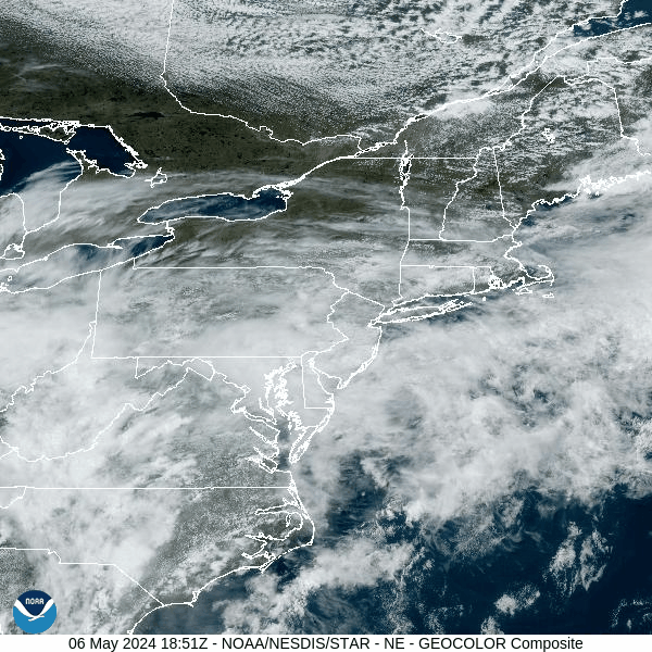
We will be in between disturbances Tuesday as a surface low to our south will exit out into the Atlantic and another one approaches us from the Midwest. Periods of sunshine will boost temperatures to warmer-than-normal levels, but with low humidity. There could be a few showers in the southern parts of our area.
An area of showers and thunderstorms associated with a warm front ahead of the next disturbance will enter western Pennsylvania after sunset. Those showers will decay over our area after midnight into Wednesday morning.
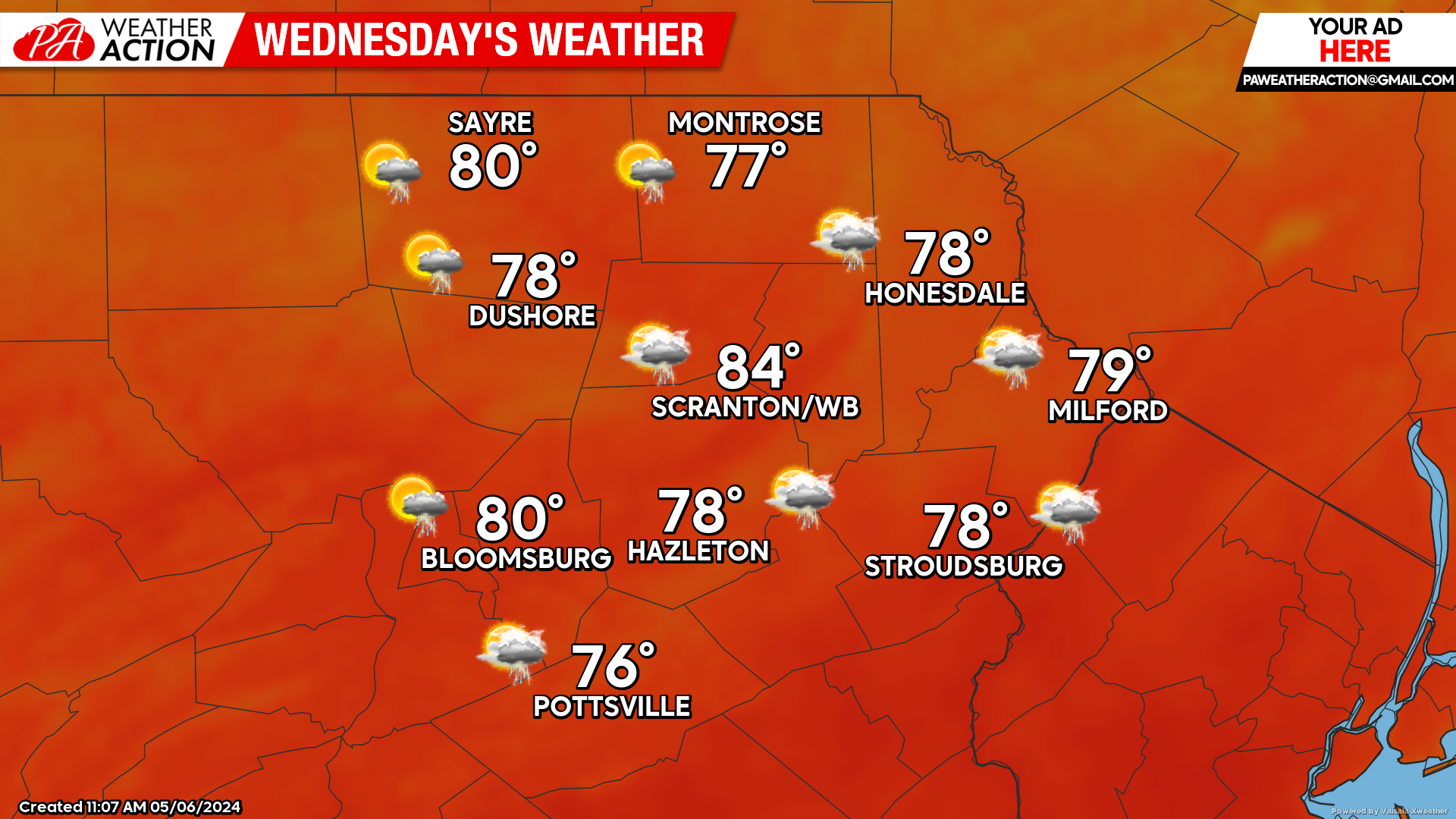
WEDNESDAY
A surface low will move northeastward to our north along the USA-Canada border. There could be some showers during the morning hours with the aforementioned warm front associated with that system.
Temperatures and humidity will increase as the warm front lifts to our north, resulting in a warm humid day. That surface low will also drag a cold front eastward across our area during the late afternoon and evening, potentially igniting some thunderstorms. Humidity will fall behind that front Wednesday night.
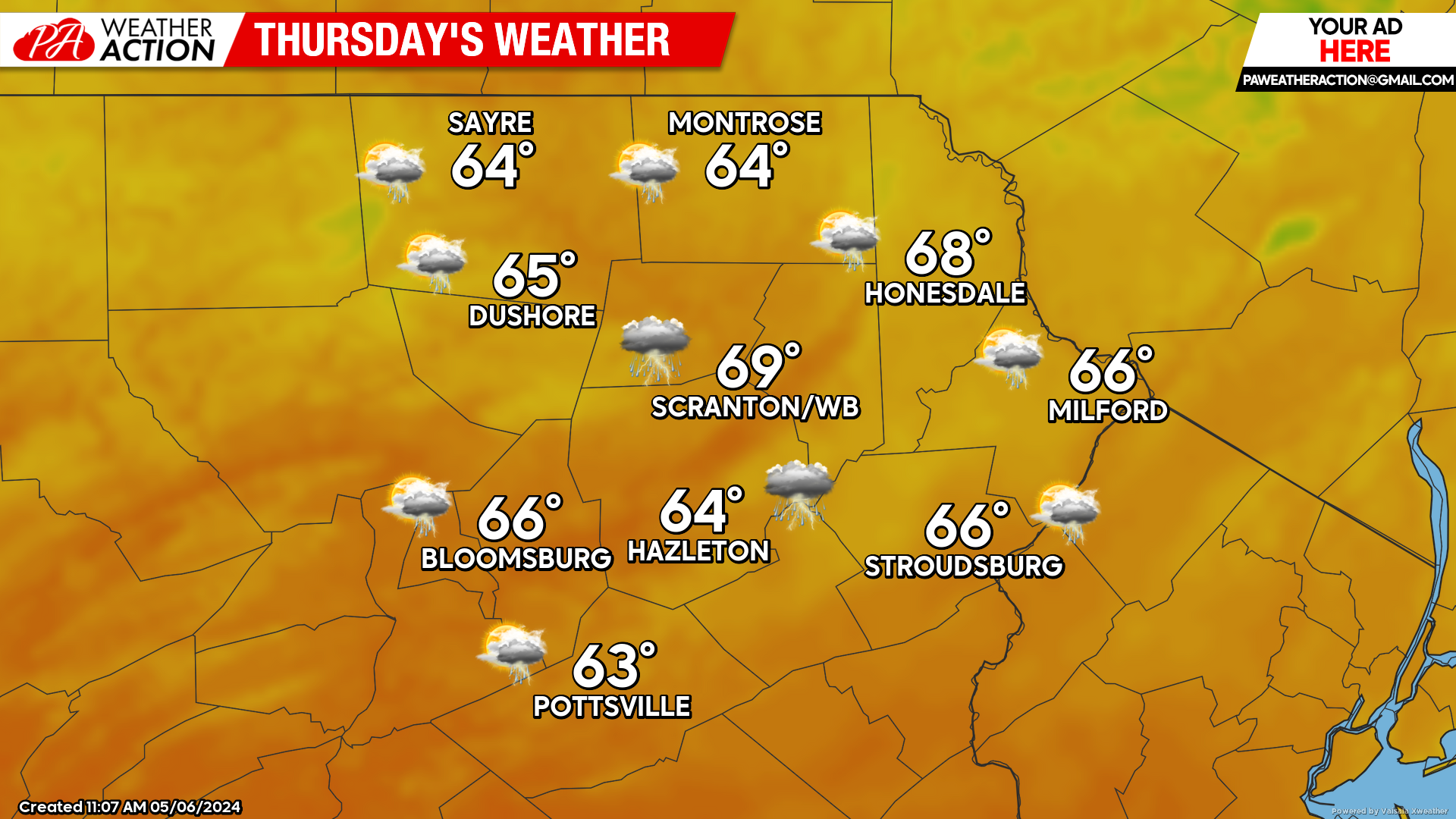
THURSDAY
Yet another surface low in that parade of systems will move into the eastern Great Lakes region, attempting to pull a warm front northward into Pennsylvania. Our area will remain on the north side of that front, resulting in clouds, showers, and cooler weather.
BEYOND THURSDAY (Friday-Sunday May 10-12)
The parade of disturbances will continue through the weekend, providing several more rounds of showers and thunderstorms. The best opportunity for precipitation will be Friday, and again Saturday night into Sunday. Those of you missing winter might consider a trip to the top of the Presidential Range (Mount Washington) in northern New Hampshire, which could enjoy some late-season accumulating snow on Friday.
Temperatures will be normal to slightly below normal. Max temperatures will range from the 60s in the valleys, to the mid-upper 50s in the higher elevations. Low temperatures will be in the 40s.

You must be logged in to post a comment.