
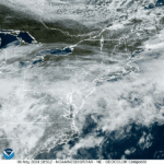
Clouds will be on the increase this morning ahead of our next weather maker that will push in before the afternoon commute. We’re starting out with fair skies this morning with mild temperatures. Check out NOAA GOES Satellite imagery this morning!
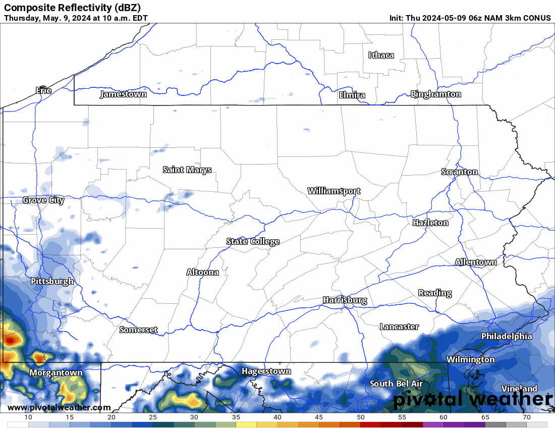
Hi-Res NAM Future Radar Thursday – Friday
Showers will begin to stream in around lunchtime today from southwest to northeast as a weak low pressure system moves our way. This system has been responsible for some serious severe weather down south, we are really getting the more pleasant experience as usual in spring severe storm season.
Rain will completely overspread the state by dinnertime this evening, with locally heavier pockets and embedded thunderstorms possible in near and south of I-76. Rain will unfortunately continue overnight into Friday as the low pressure slows down and then transfers to the coast.
This transfer will cause the eastern two-thirds of the state to see dreary conditions for much of Friday. Below is Hi-Res NAM Future Radar for today and tomorrow.
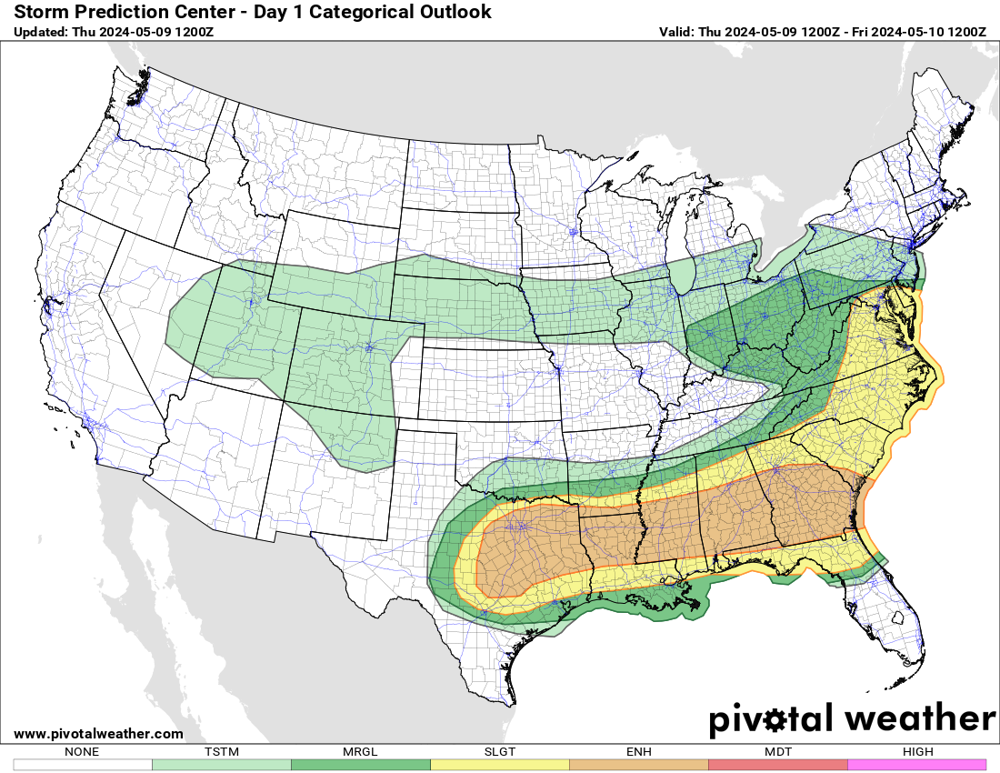
Severe Thunderstorm Threat Map
The Storm Prediction Center has placed parts of southern and western PA under a marginal risk for severe storms today, meaning a very low threat. The real severe threat will be across the Deep South. It’s been an extremely active past week across the Central and Southern US, which will finally calm down tomorrow.
Below is Thursday’s Severe Thunderstorm Threat map from the SPC.
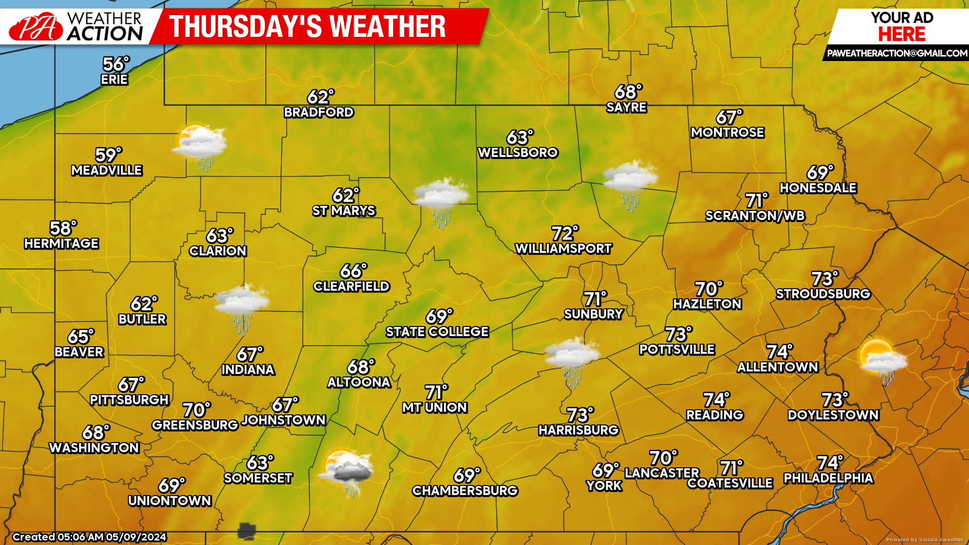
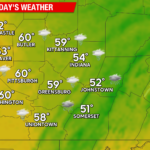
Today’s Forecast: 7/10 Weather Day
High temperatures will be much cooler today, only in the 60s across Western and Central PA, low 70s in Eastern PA. As mentioned, clouds will increase and rain will be arrive between lunchtime and dinnertime depending where you are.
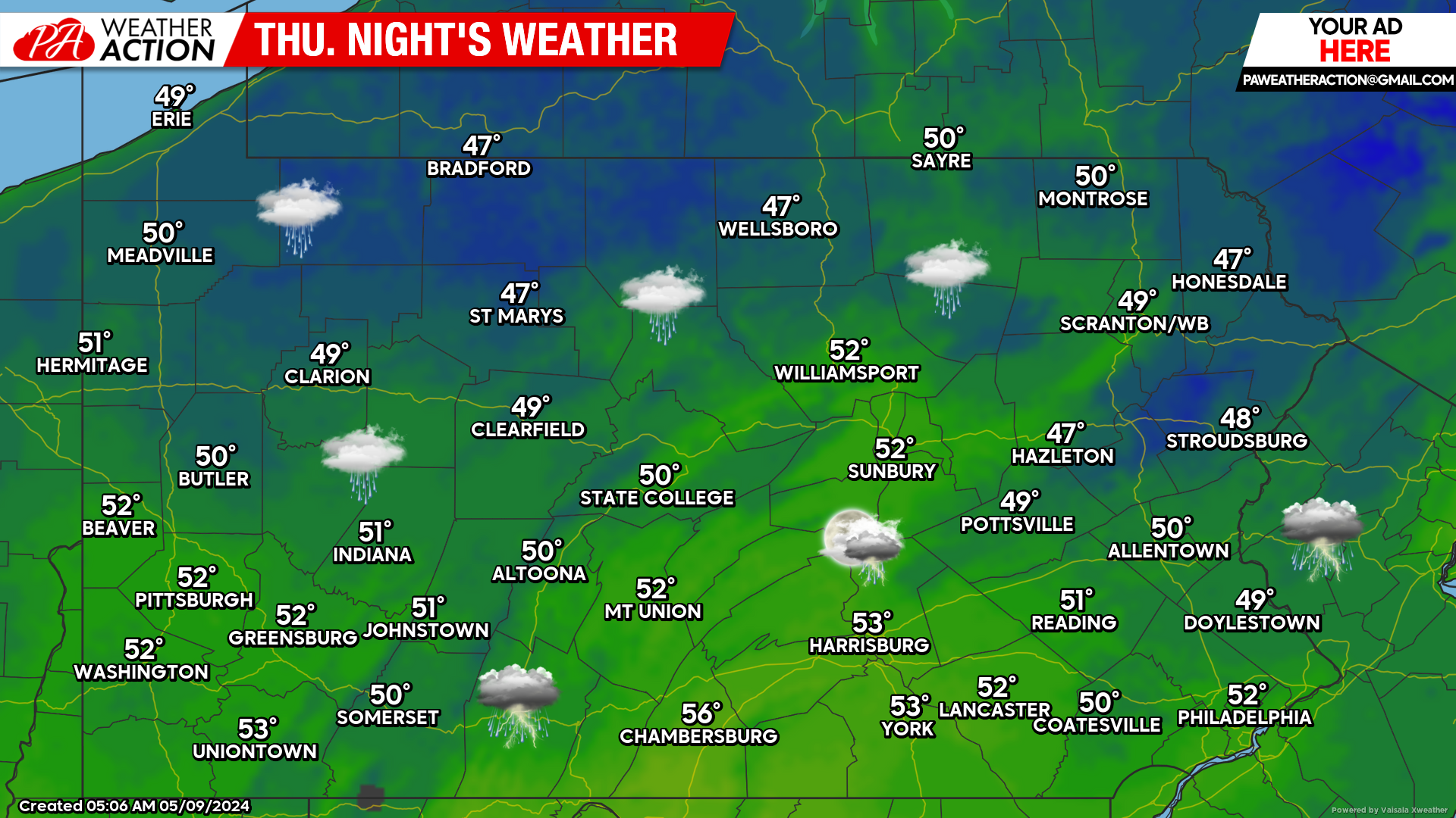
Tonight’s Forecast: 8/10 Weather Night
Temperatures won’t get too chilly overnight as rain continues – only getting into the 40s and 50s. But definitely optimal sleeping conditions to crack open the window or even camping.
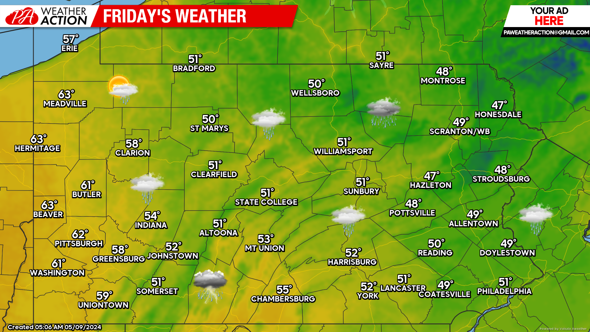
Friday’s Forecast: 1/10 Weather Day
Friday will be 1 out of 10 weather day for the middle of May in Eastern and Central PA, with temperatures struggling to hit 50 degrees under steady rain. Yikes! It’s becoming laughable, yet painful, that we have good weather nearly all the workweek and then it goes downhill by the weekend(s). Western PA should be mainly dry on Friday, and temperatures should crack 60 there.
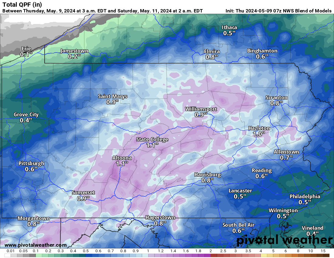
Thursday – Friday Rainfall Forecast
Rainfall amounts will be highest over the Appalachian Mountains, with upwards of an inch of rain expected along and west of I-81. Outside of the mountains, rainfall totals should be closer to half an inch, but locally heavier amounts from thunderstorms are possible.
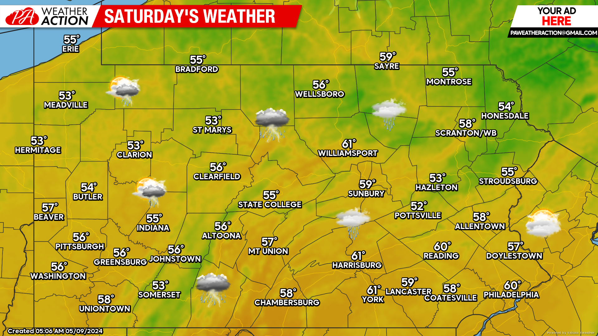
Saturday’s Forecast: 4/10 Weather Day
You didn’t expect me to tell you we would possibly have a good weather day this weekend, did you? Hopefully not, because a pesky system will swing through with scattered showers and provide overcast skies Saturday. Temperatures won’t be overly respectable, but not too bad. Highs in the 50s and maybe a few 60s on the map.
Mother’s Day Forecast: Not Terrible
Scattered showers with partly to mostly cloudy skies, with high temperatures in the 50s and 60s likely on Sunday.
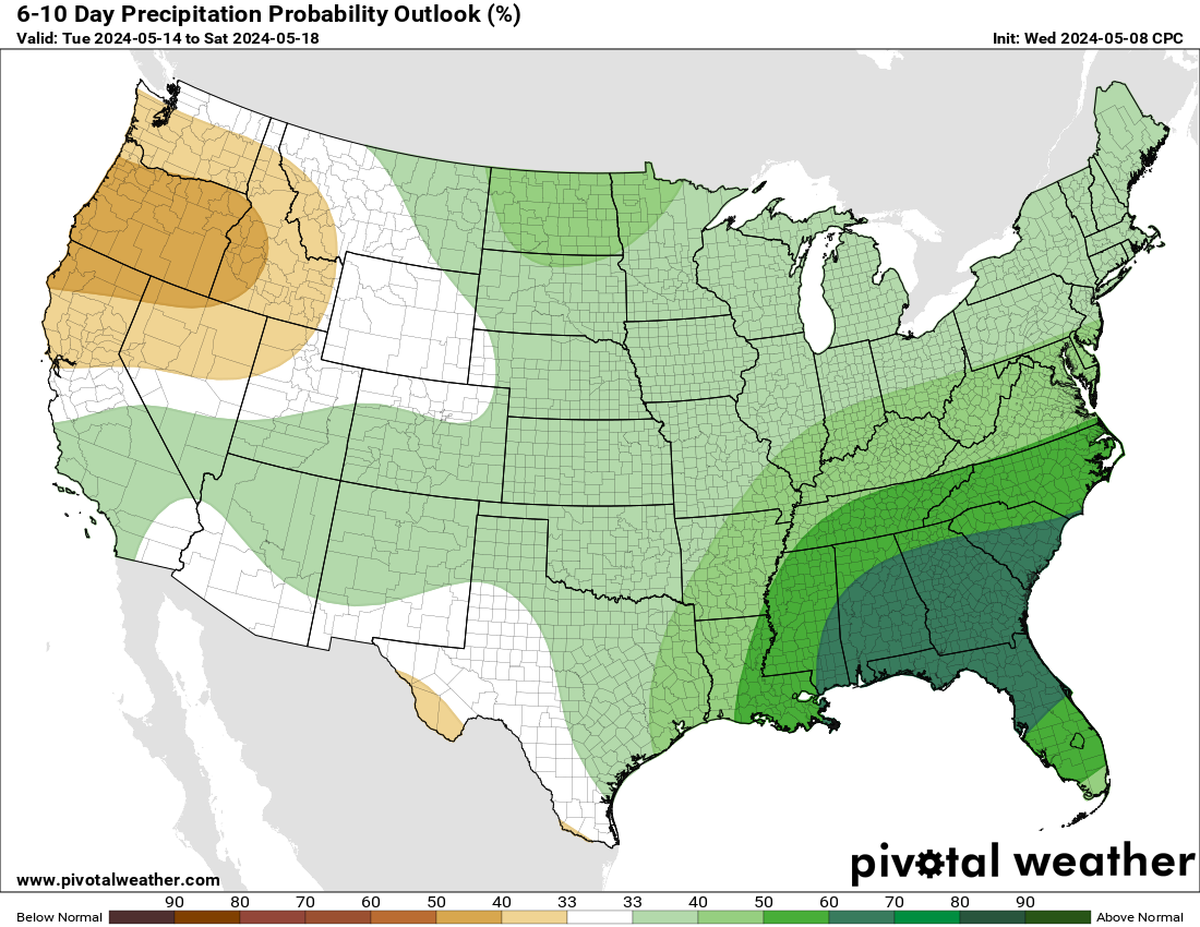
Mid-Long Range: Staying Active
We will have difficultly stringing together more than two consecutive dry days in the next two weeks as disturbance after disturbance sweeps through and add question marks to our outdoor plans. Hopefully by Memorial Day Weekend, we can enjoy dry and warm conditions.
For now, an active pattern across the Eastern US and especially the Southeast through the next couple weeks as shown below.
You must be logged in to post a comment.