

A surface high has settled over our area, providing today’s sunshine and will result in a clear chilly night tonight, with temperatures falling into the 30s.
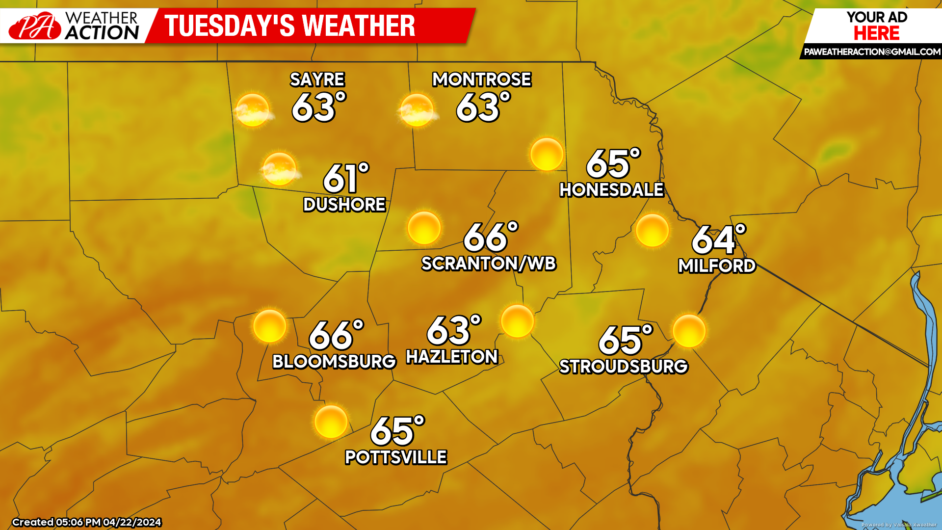
TUESDAY
That surface high will provide a sunny dry day, with gusty SW wind during the afternoon as a cold front approaches from the west. That front will spread light showers into our area late Tuesday night into Wednesday morning.
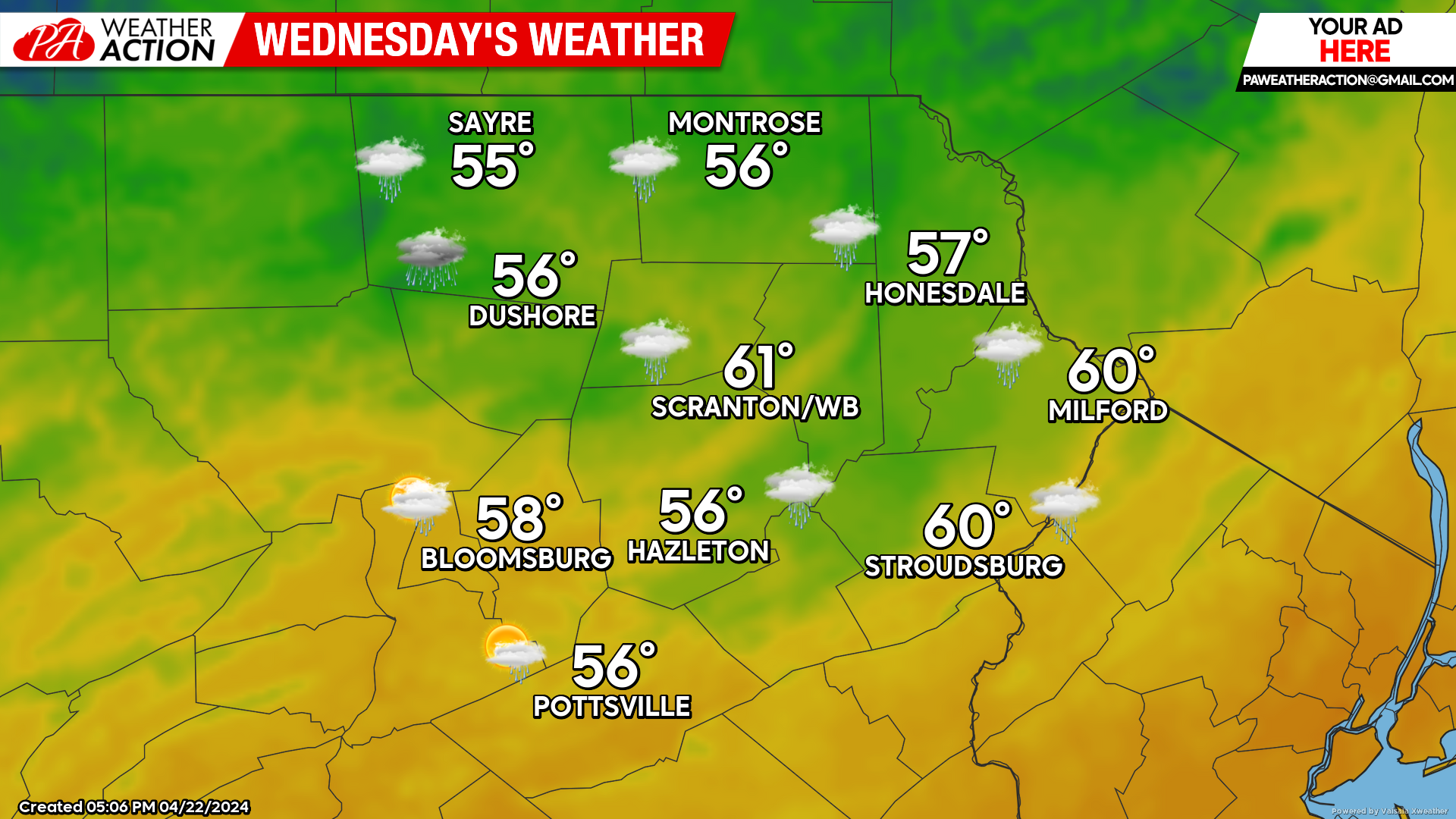
WEDNESDAY
A cold front will cross the area during the morning, followed by a period of dry weather for midday. A secondary front will push through the region later in the day, producing some spotty thunderstorms during the late afternoon and evening period. Total rainfall amounts will be under a tenth of an inch for most, with some isolated higher amounts for those lucky-enough to get one of the spotty thunderstorms.
THURSDAY
Thursday will be a dry and sunny day with below-normal temperatures. Morning lows will be in the upper 20s to lower 30s for most locations, with daytime temperatures in the 50s.


You must be logged in to post a comment.