

I suspect everyone enjoyed this morning’s barrage of thunderstorms that unleashed an inch of rain on parts of our area along with gusty wind and isolated small hail.
A cold front will push south of our area tonight. This will provide dry weather Friday into part of Saturday.
FRIDAY
Sunny skies, lower humidity and above-normal temperatures grace our area. There will remain the slight opportunity for an isolated shower in the southern parts of our area, but if you get one, consider yourself lucky.

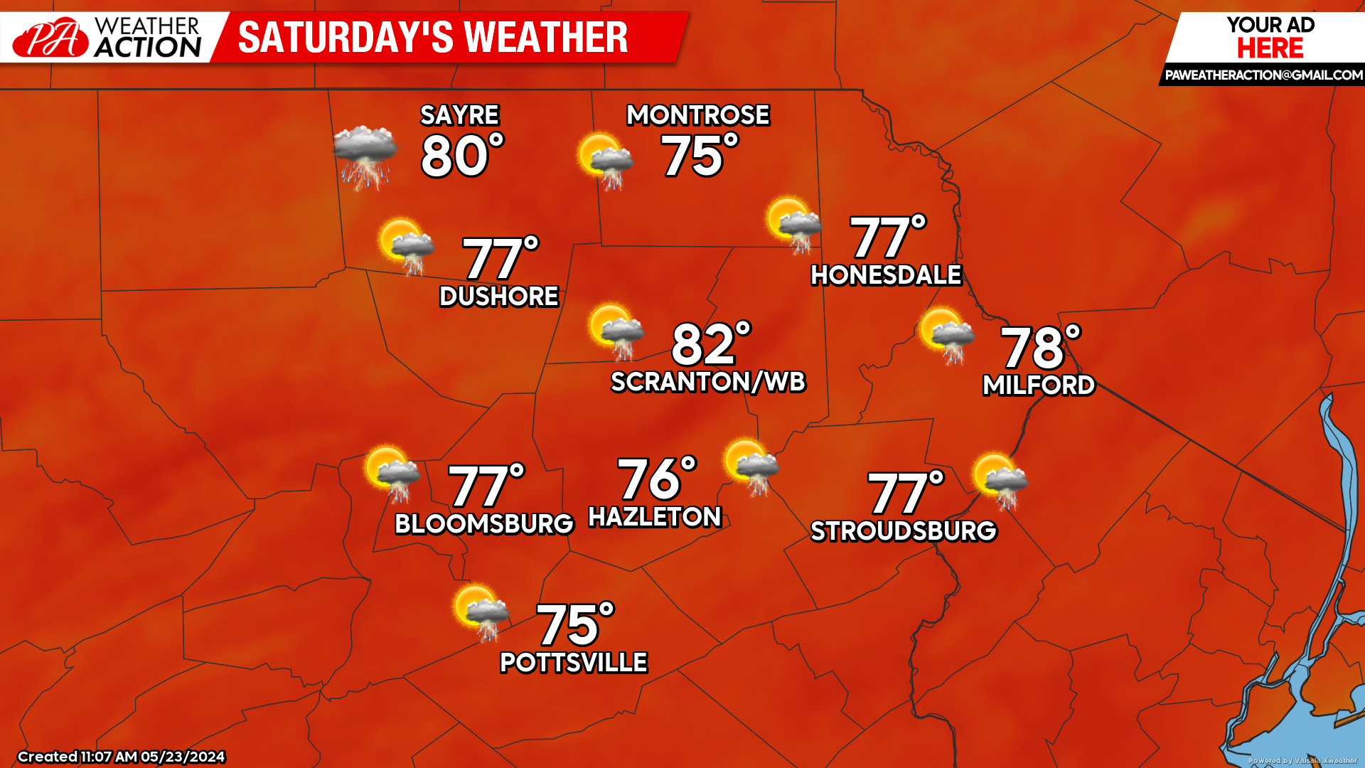
SATURDAY
The weather will be mostly dry on the start of the Memorial Day weekend. However, an approaching disturbance will bring increasing clouds with the chance for some showers or thunderstorms during the late afternoon and nighttime period.
SUNDAY
That disturbance will pass east of our area by Sunday morning. While most of the day will be dry, conditions will still be conducive for a few isolated showers or thunderstorms Sunday afternoon and Sunday night courtesy of yet another disturbance approaching our area. Temperatures will continue to be warmer than normal.

MEMORIAL DAY
That aforementioned disturbance will generate showers and possible thunderstorms Sunday night into Monday. Temperatures will continue to be slightly warmer than normal.
You must be logged in to post a comment.