
Spring and summer continue to clash, and it appears this coming round of strong to severe storms tomorrow (Saturday) will not be the end of it. Even next week looks to bring the potential for more severe weather, but let’s take it one day at a time.
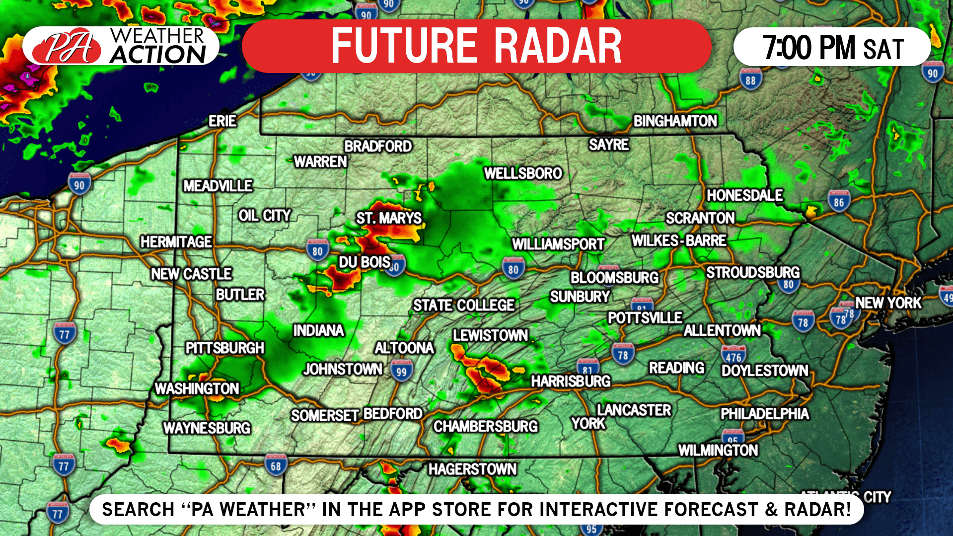
Storms will fire in the western half of PA late Saturday afternoon ahead of an approaching warm front. Damaging winds and hail will be possible in these cells. Later Saturday evening, an organized line of strong to severe storms will move southeast in western and central PA. Damaging winds will be the main threat posed by the line.
TIMING FORECAST
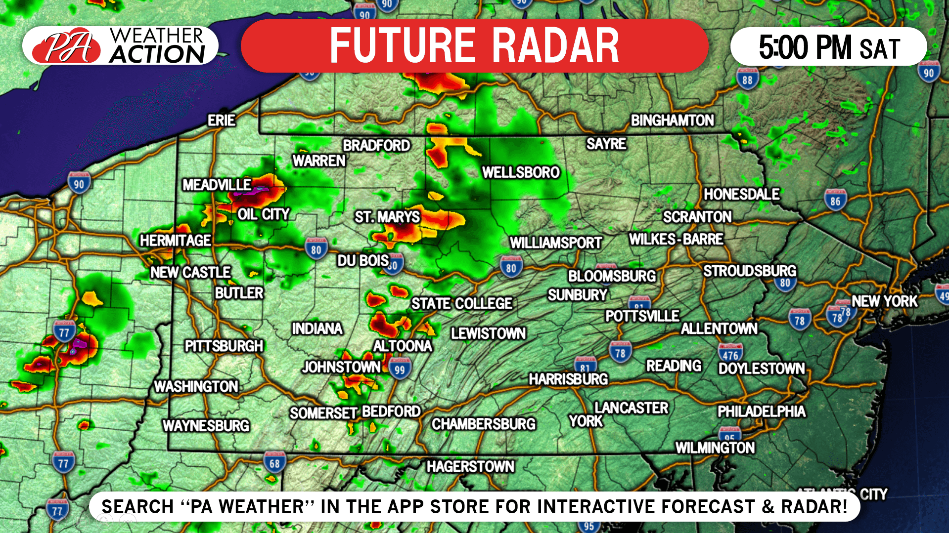
5:00 PM Saturday: Scattered storms will develop west of State College and Chambersburg in the late afternoon. They are likely to be most potent north of Pittsburgh.
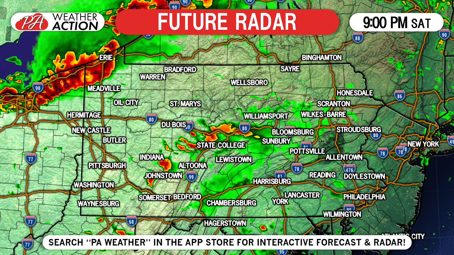
9:00 PM Saturday: A line of strong to severe storms will likely move through northwest PA around this time.
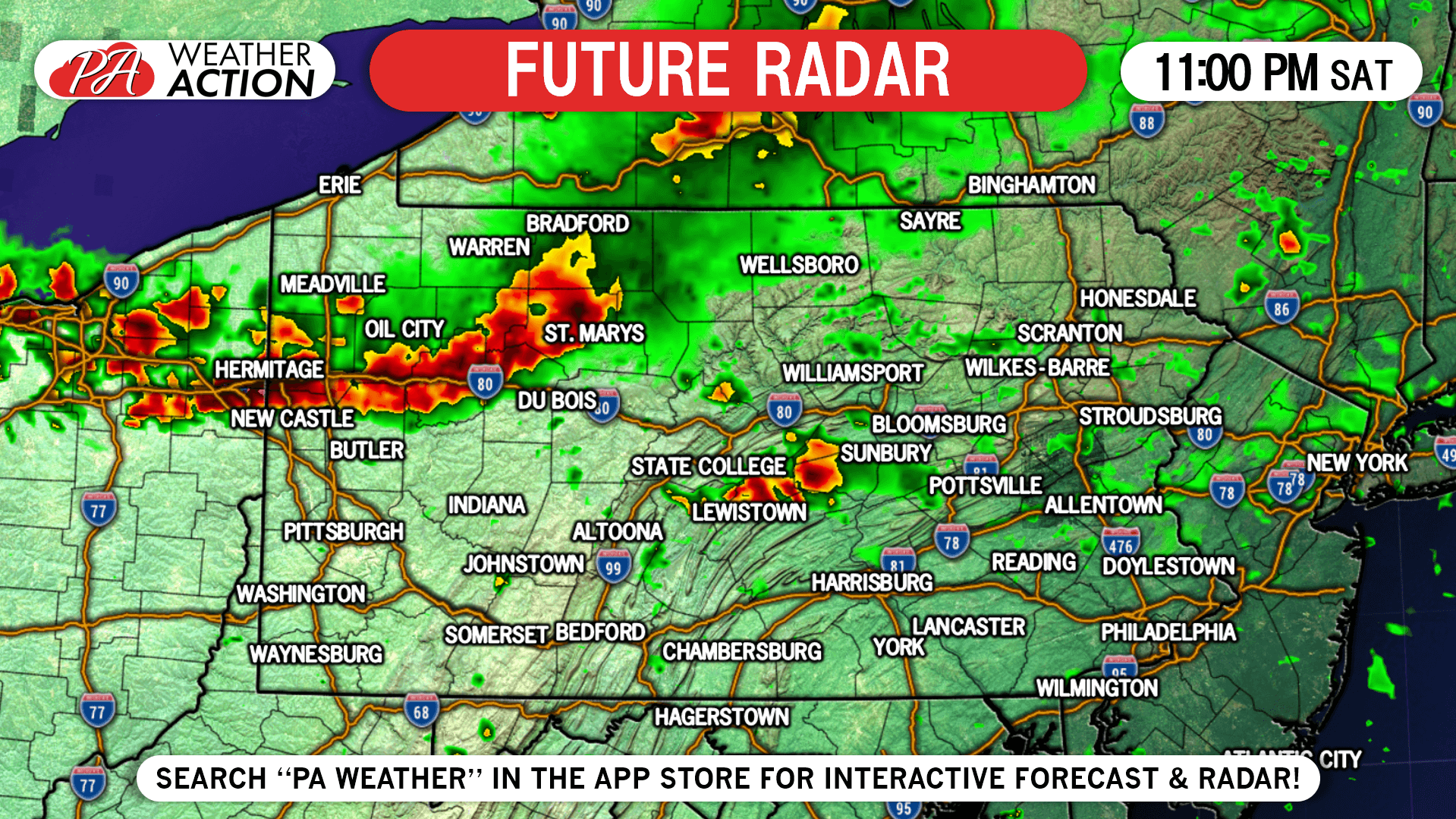
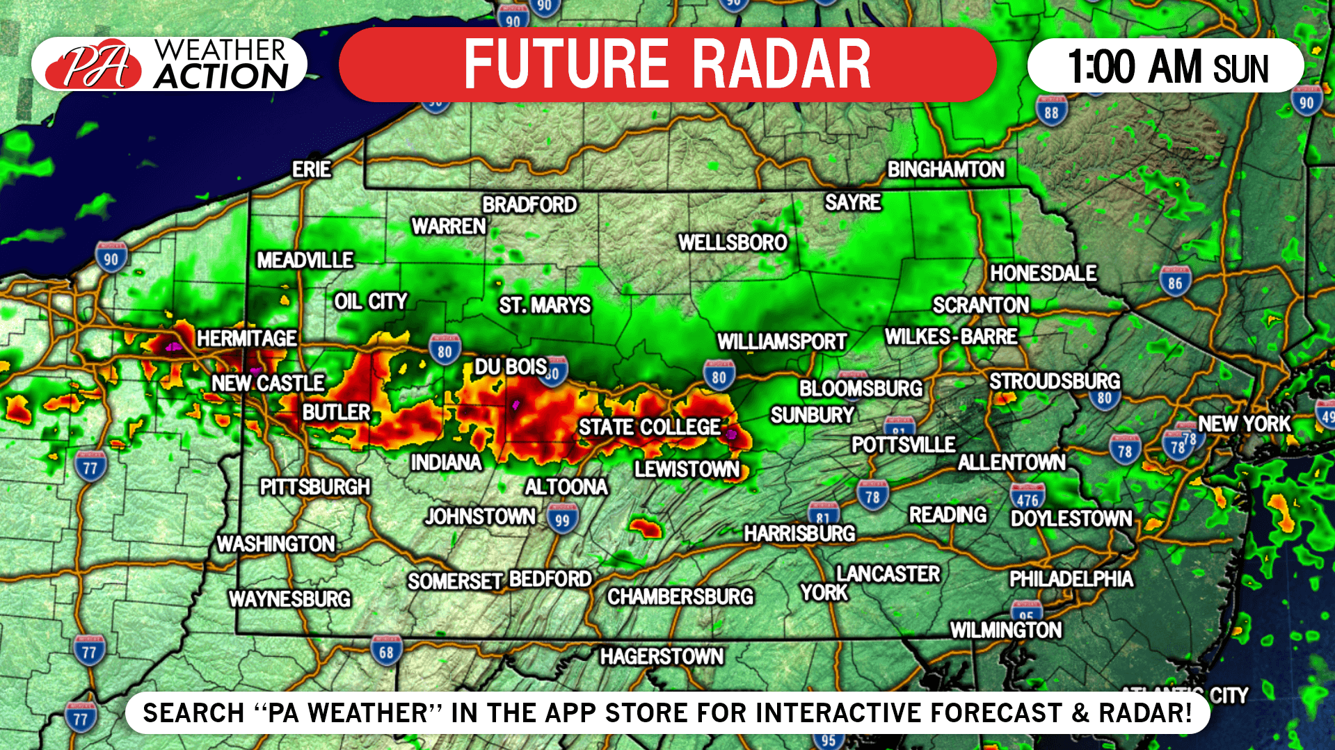
1:00 AM Sunday: As the line heads southeast, it will begin to weaken. It should make it to Pittsburgh and Altoona before falling apart.
SPC SEVERE THUNDERSTORM OUTLOOK
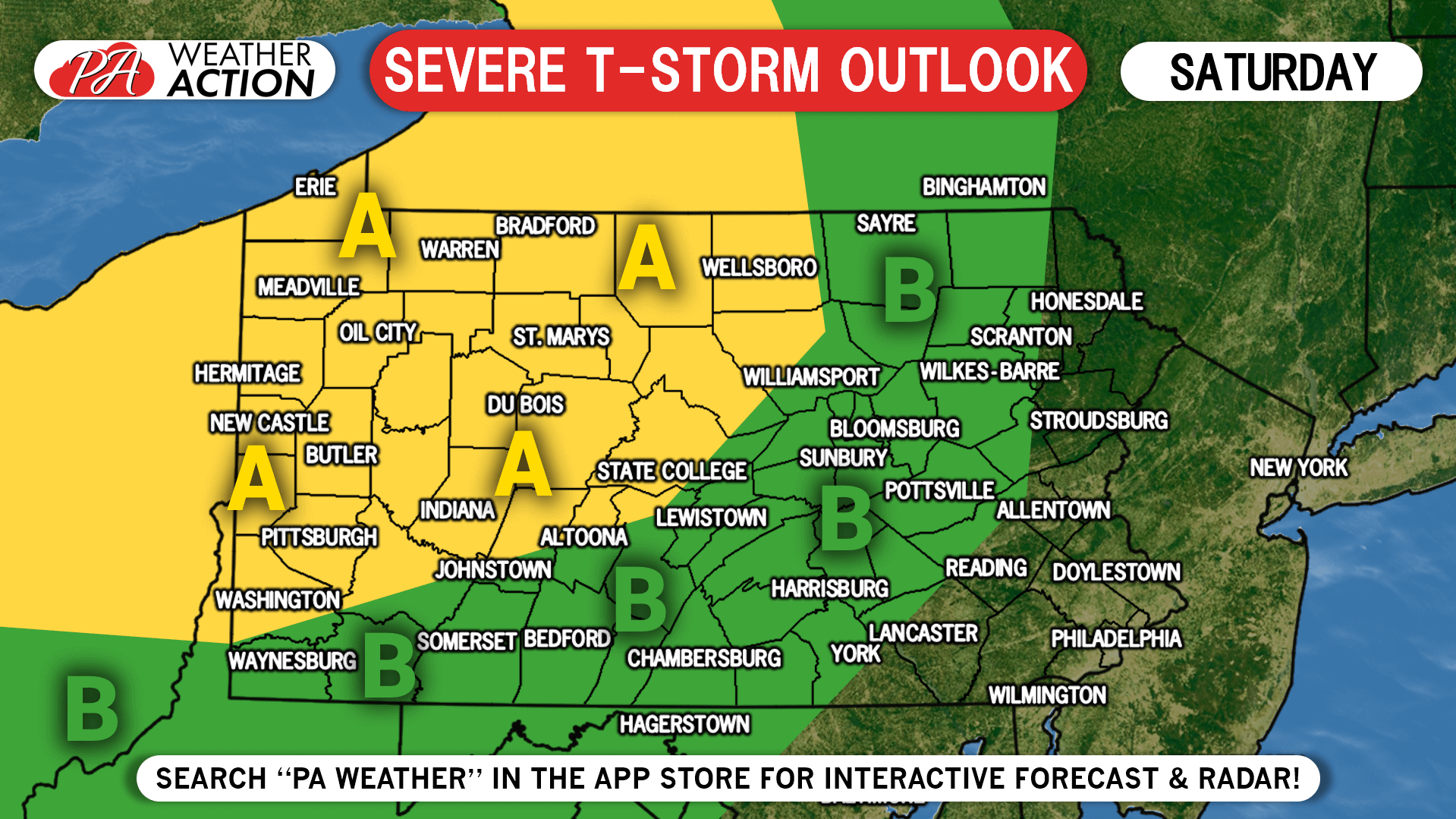
Area A: Scattered strong to severe storms possible late Saturday evening before a short break, followed by a line of storms in the late evening or early morning Sunday. Damaging winds is the main risk, with hail and a couple tornadoes also possible.
Area B: A few strong storms may find their way into this region both in the late afternoon Saturday and early Sunday morning. Wind gusts to 50 MPH and isolated small hail are the main risks.
Unfortunately we likely won’t be live streaming radar on facebook. You can always track the latest radar and alerts for your area with our free app. The radar is still in beta, and we will have all the bugs out soon along with new features in! Tap the banner below to download it! Stay safe!
You must be logged in to post a comment.