Josh Adams is the founder and lead forecaster of Pennsylvania Weather Action, a regional forecasting site he launched in 2015. With over a decade of experience analyzing weather patterns across Pennsylvania, his forecasts have reached millions of readers throughout the state.
Josh specializes in Pennsylvania’s complex microclimates and terrain-driven weather patterns, providing detailed coverage of severe thunderstorms, winter storms, and flooding events. His forecasting focuses on delivering precise, timely information to help Pennsylvanians stay informed and prepared during impactful weather.
Last Updated: March 10, 2026
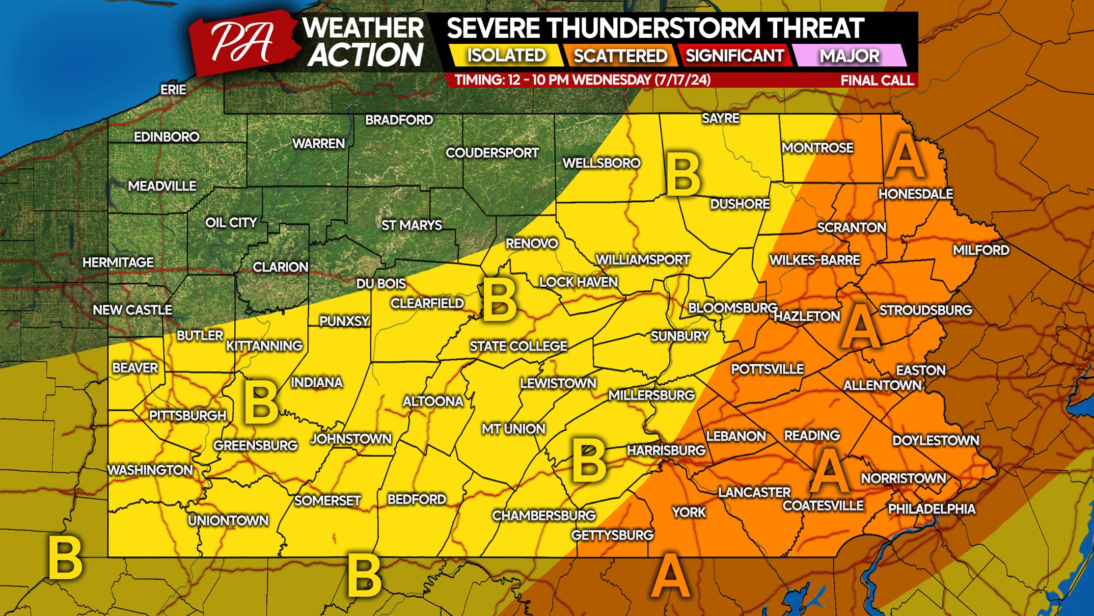
UPDATE: As of lunchtime Wednesday, most model guidance has trended towards only isolated thunderstorms this evening and early Thursday morning, as opposed to a large…
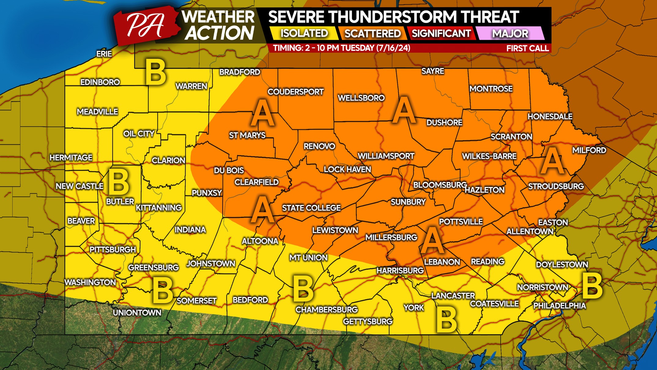
Slow-moving strong to severe thunderstorms will flare up early this afternoon in Eastern PA, and will pose a flash flood risk especially across Northeast PA.…
Thunderstorms were localized Tuesday across Southeast PA, while Upstate NY was hit very hard by tornadoes and widespread damaging winds that created an absolute mess…
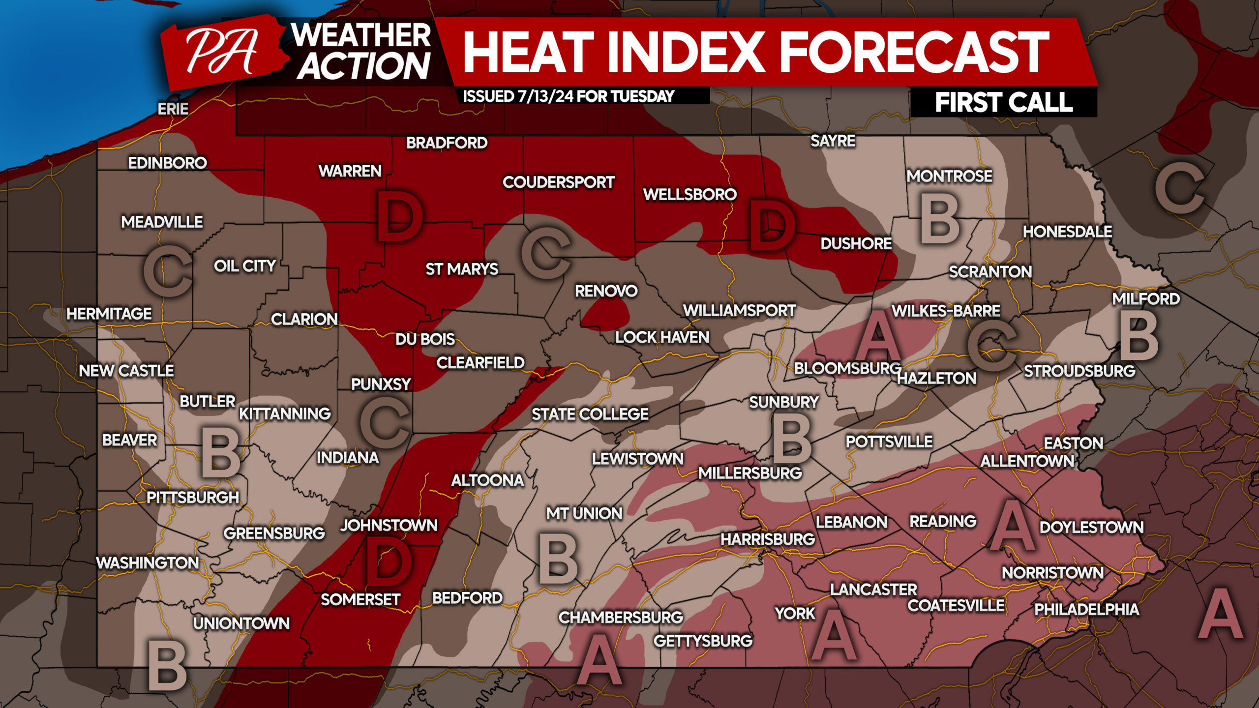
Blazing heat with feels-like temperatures approaching 110° weren't quite enough for mother nature, so she decided to throw in the chance for severe thunderstorms on…
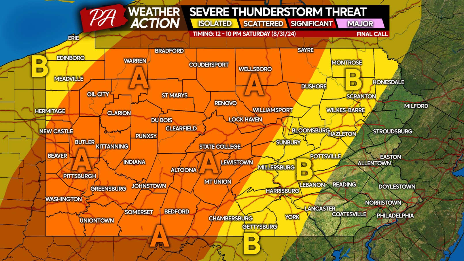
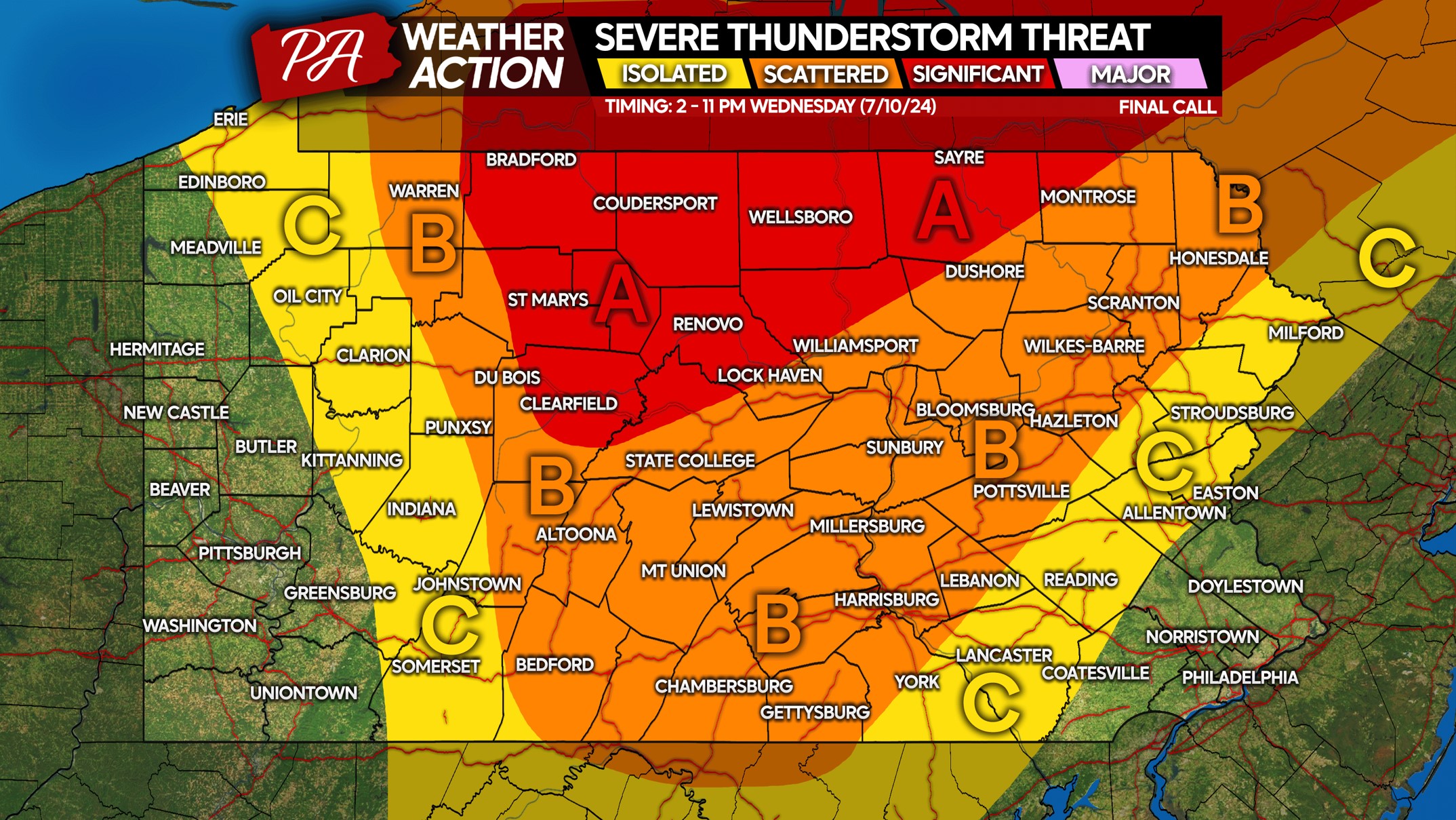
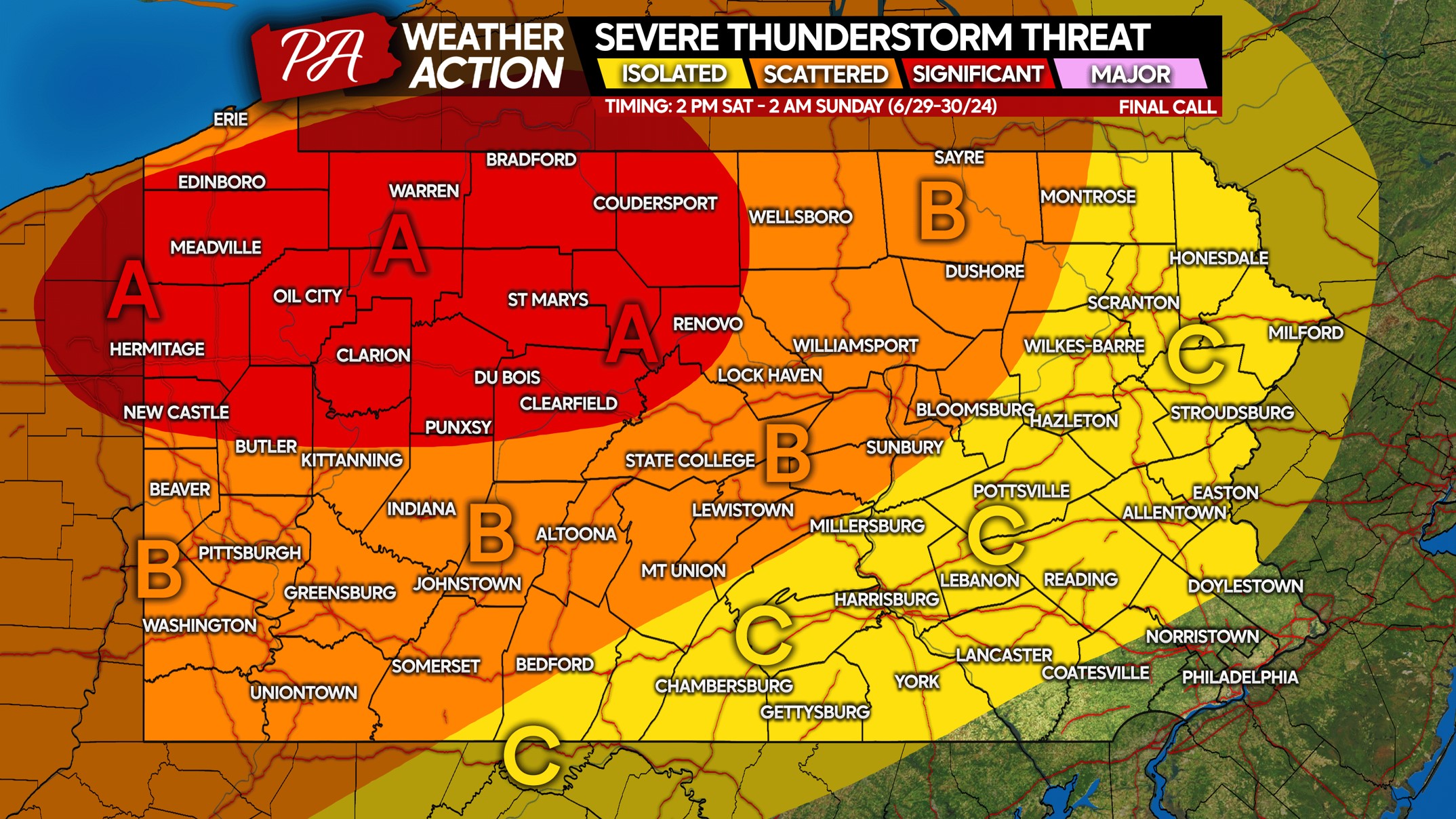
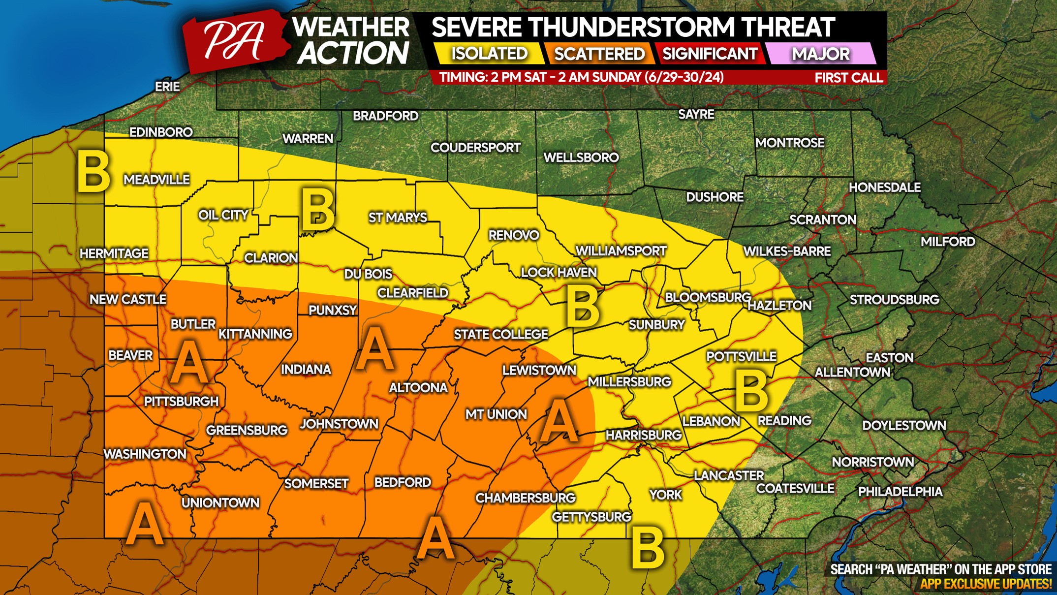
Severe thunderstorm season is nearing its peak in Pennsylvania, and another significant threat of severe weather exists Saturday. This time the threat will be a…