

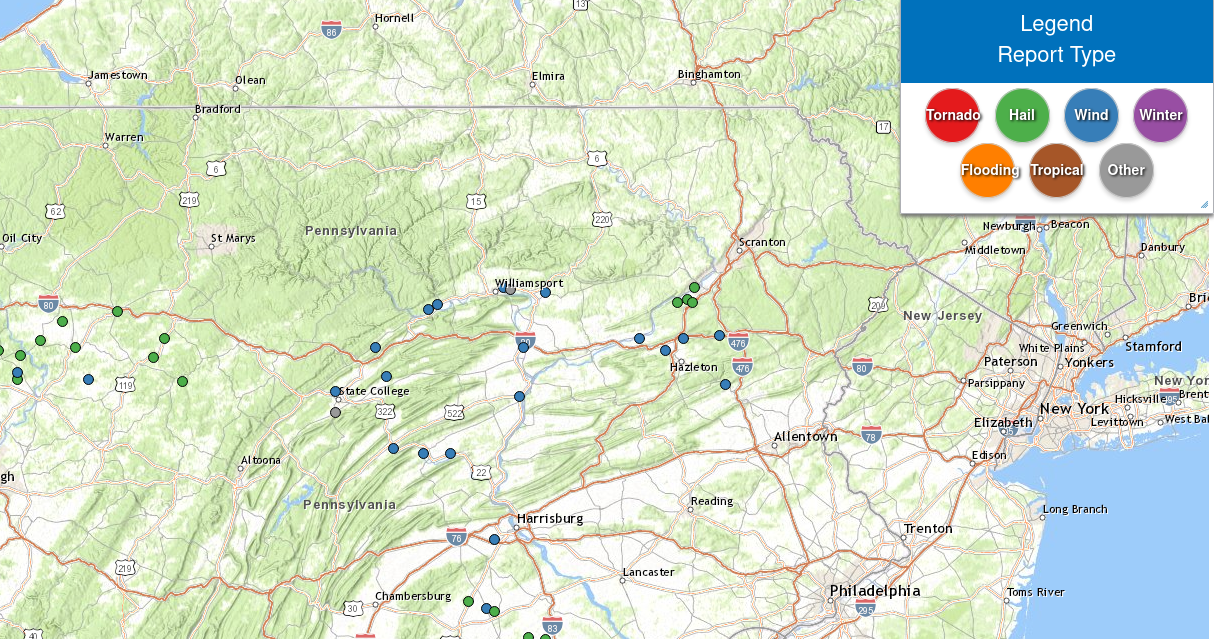
A cold front crossed the area Sunday evening, delivering a line of strong and isolated severe thunderstorms to our area late Sunday afternoon and Sunday evening. Ahead of that front, strong winds gusted over 40 mph Sunday. Behind that front, a surface high delivered partly sunny skies and breezy conditions today. That wind will die down overnight tonight.
Here is a map of Sunday’s severe weather reports:
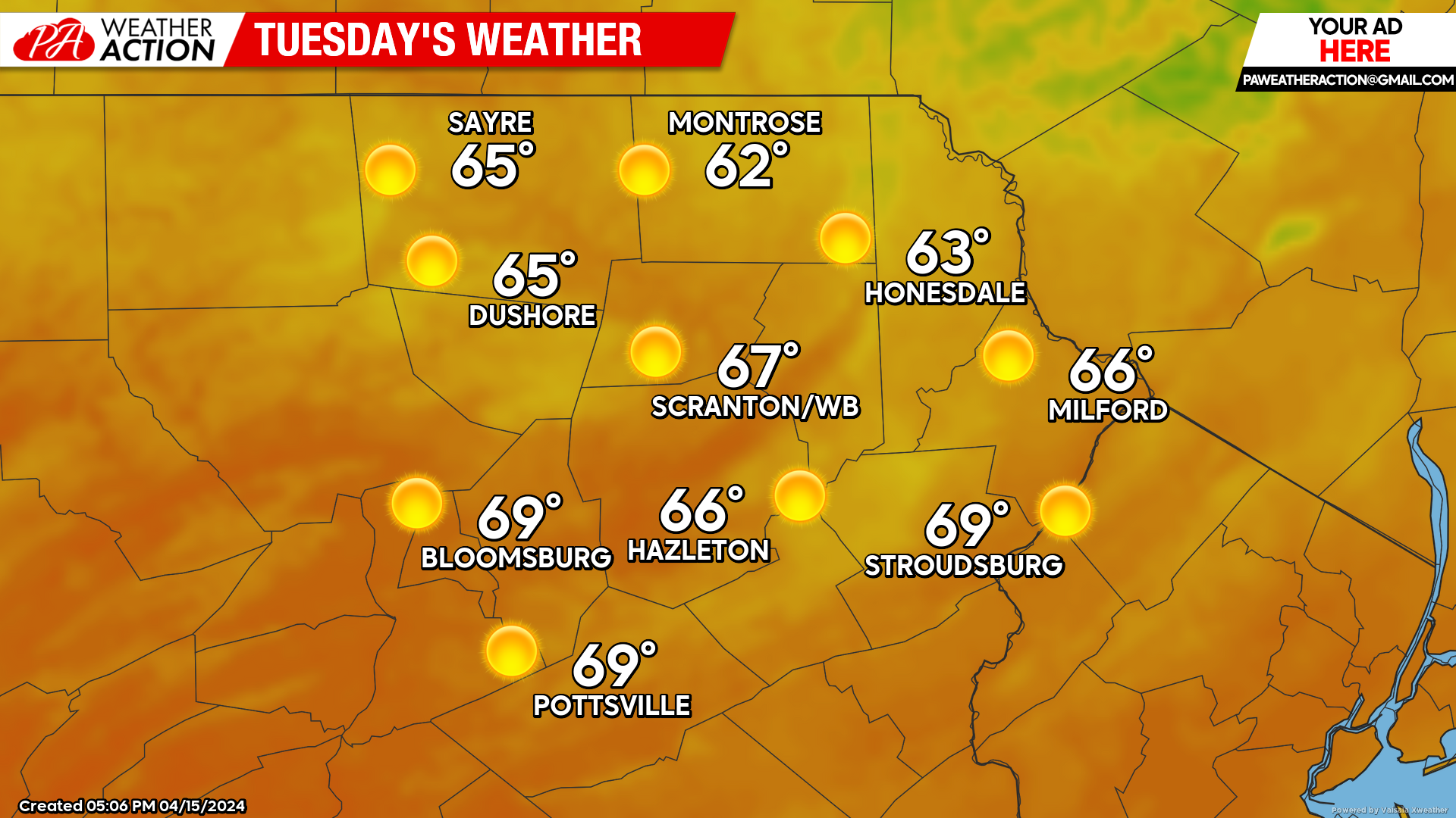
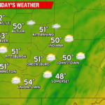
TUESDAY:
That surface high will settle over our area Tuesday to provide ample sunshine, and above-normal temperatures, along with a much-needed break from the constant wind of the past week.
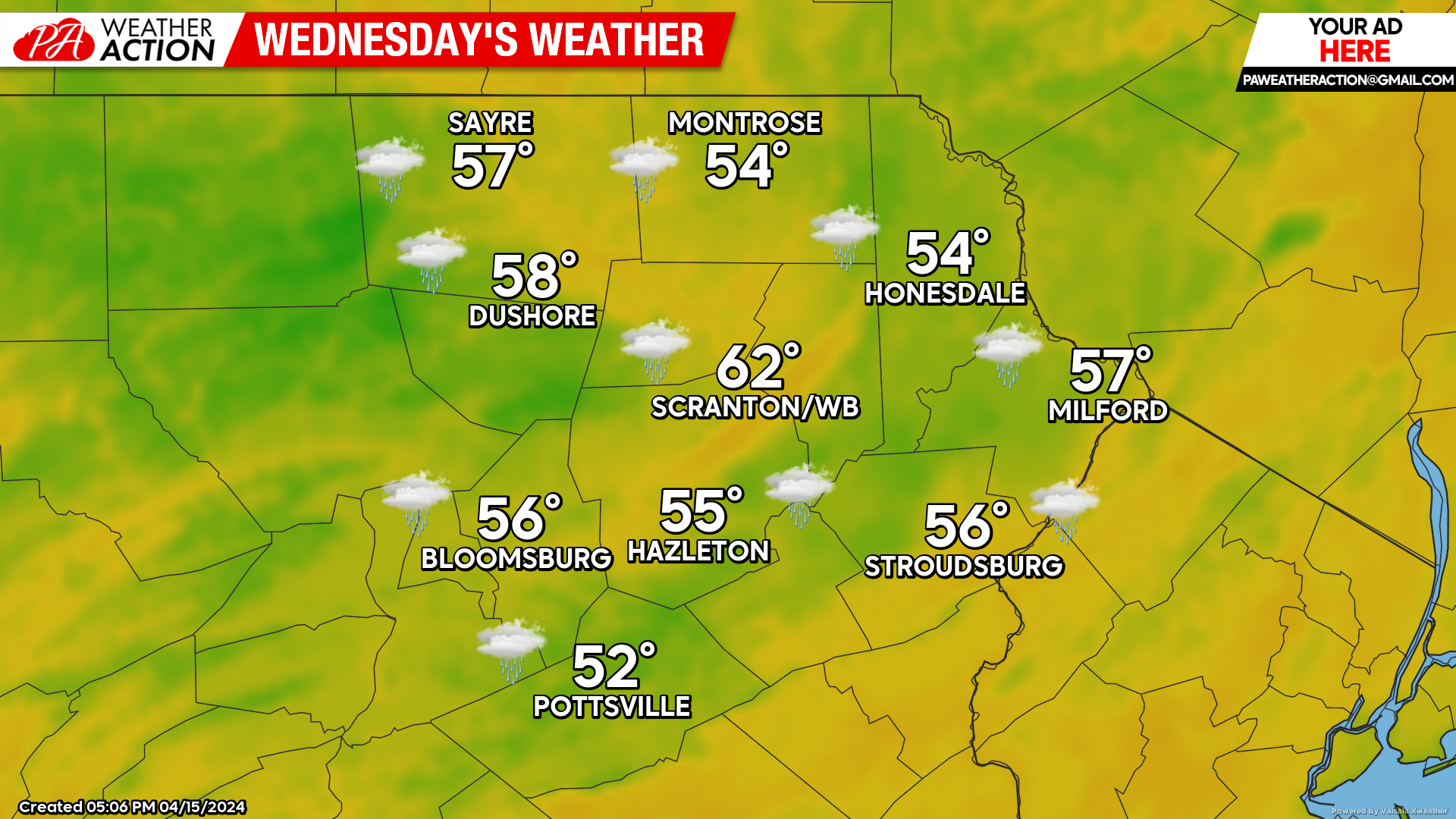
WEDNESDAY:
A disturbance moving into the Great Lakes will attempt to push a warm front into our area on Wednesday, generating showers. Meanwhile, the aforementioned surface high will be anchored across New England, impeding the progress of the warm front and inducing an ESE wind off the ocean.
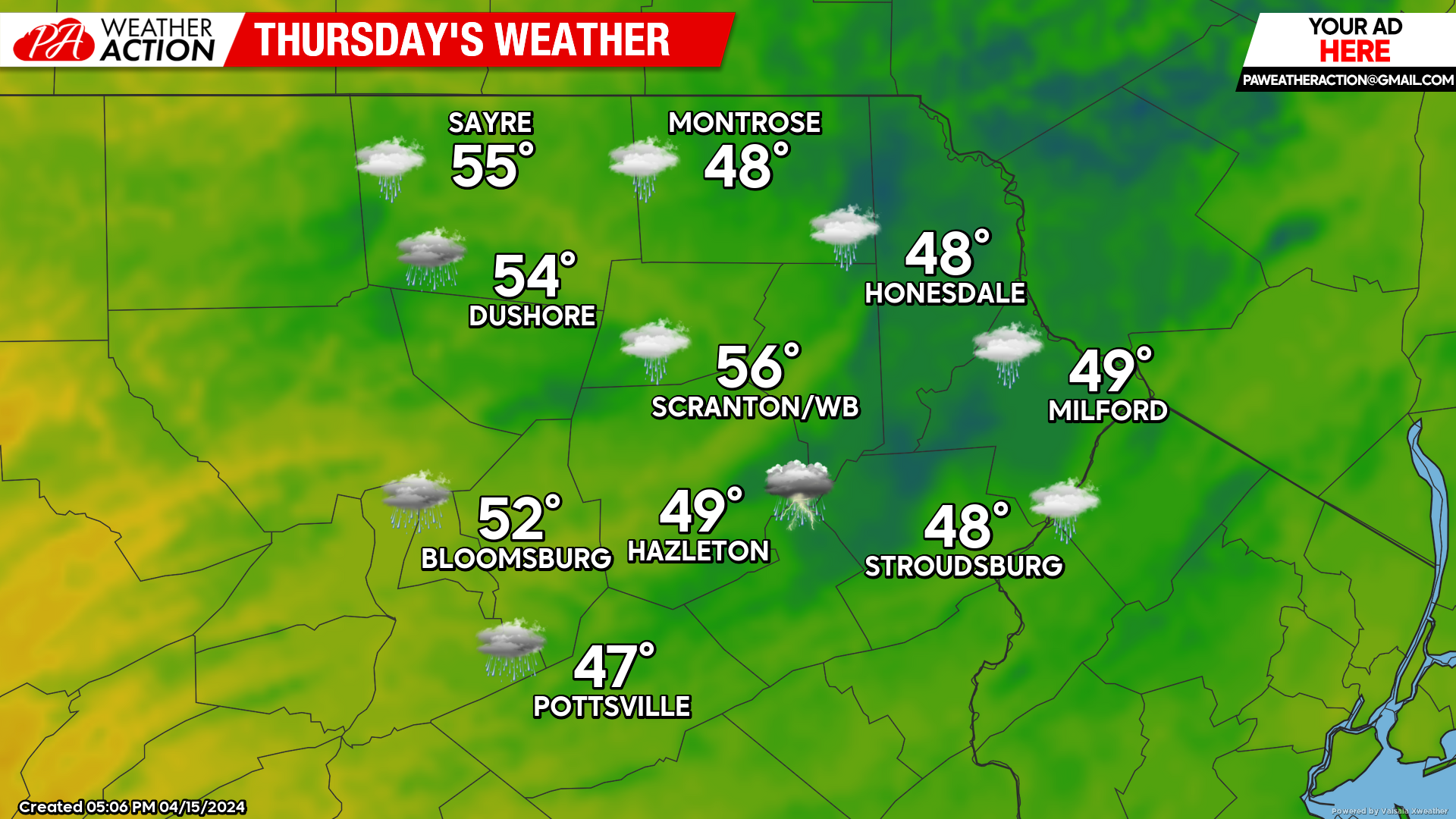
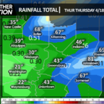
THURSDAY:
The warm front will remain stalled over our area as the surface high remains stubbornly entrenched over New England. Thus, the opportunity for showers will continue, and the circulation around the surface high will push increasingly cool damp maritime air into our region, resulting in temperatures remaining in the 40s, especially across the eastern portion of our area. If you are desiring more-springlike temperatures on Thursday, I suggest heading into western Pennsylvania where the maritime air will be blocked by the Appalachians. While we endure cool damp conditions, temperatures in Pittsburgh could reach 70!
BEYOND THURSDAY
A cold front will finally push the maritime air out of our area Friday evening, prolonging the opportunity for showers into Friday. Drier weather and normal temperatures will follow for the weekend into early next week. Normal high temperatures this time of year are in the low-mid 50s in the higher elevations and near 60 in the valleys. Normal low temperatures are in the 30s.
You must be logged in to post a comment.