
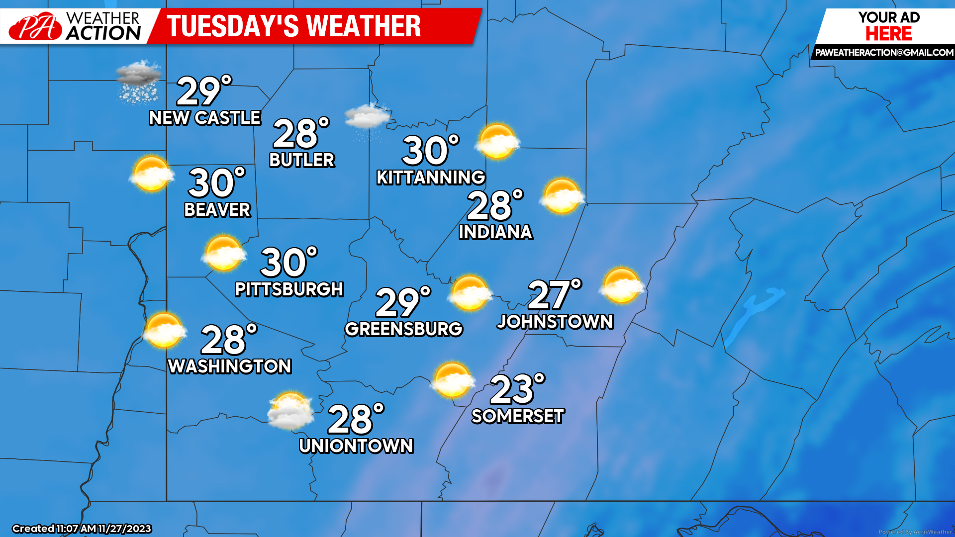
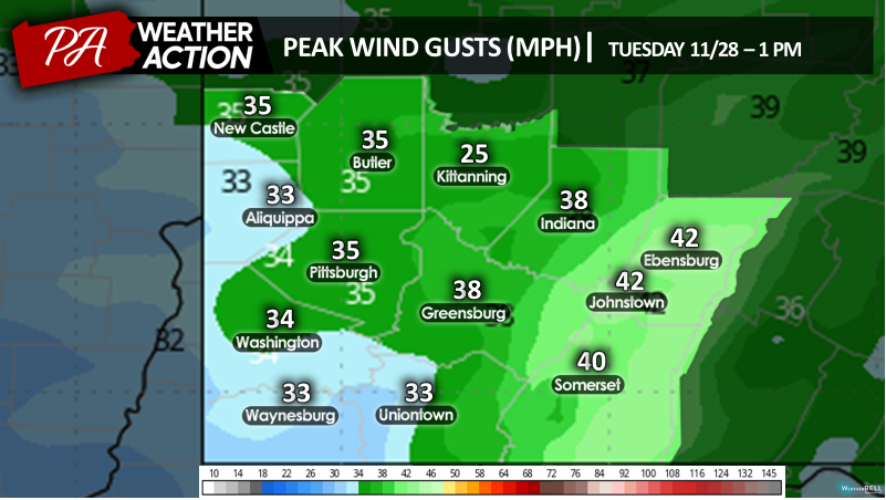
The National Weather Service has issued a Hazardous Weather Outlook for portions of the region for potential hazards during the day on Tuesday. Snow squalls are likely during that day which could produce hazardous travel conditions including limited visibility and icy roads. Winds gusting in excess of 45 mph are also possible in the higher elevations.
Tuesday
Periodic scattered snow showers will be accompanied by mostly cloudy conditions throughout the region. Highs will be in the low 30s to mid 20s. Windy conditions can be expected, with winds will be out of the west at 15 to 25 mph, wind gusts can range between 30-40 mph, with higher gusts in the higher elevations. Wind chill values will be in the single digits in most areas, with some areas having wind chill values below zero. Evening lows will be in low 20s to mid-teens.
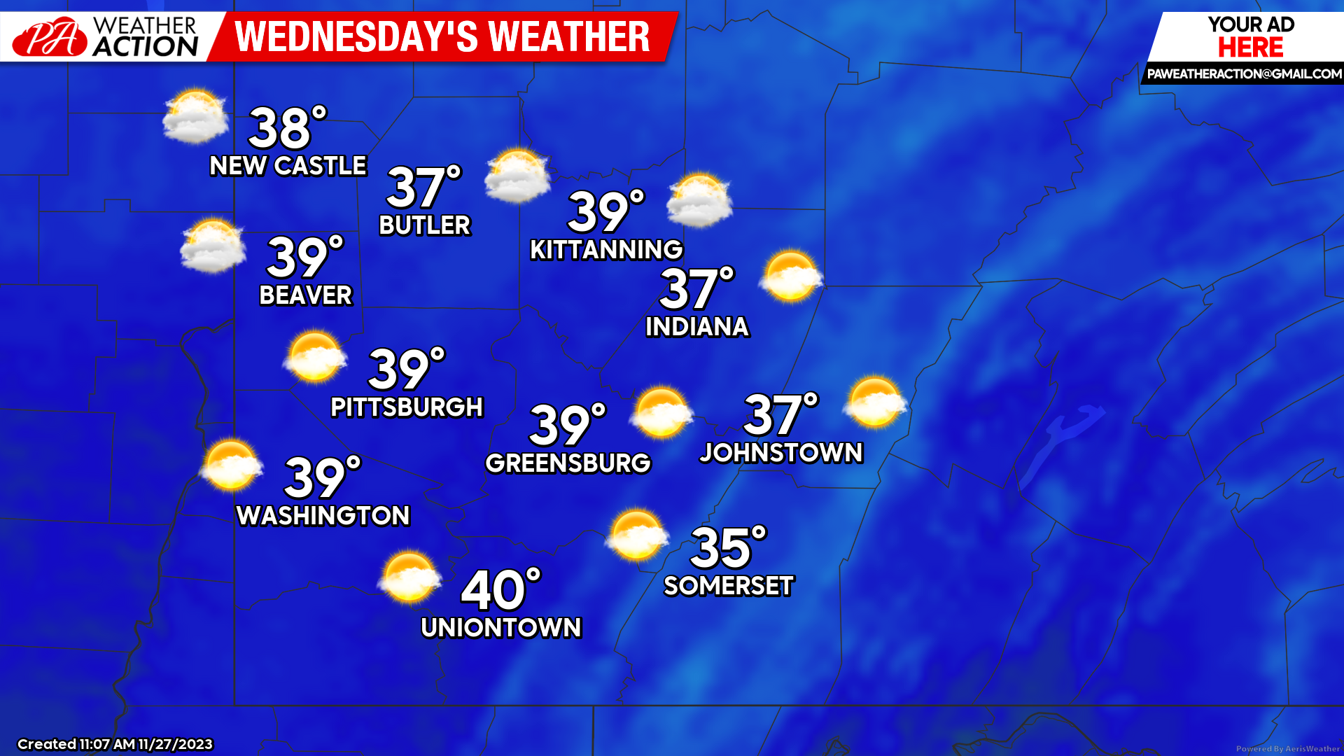
Wednesday
Partly to mostly sunny skies can be expected throughout the region. Highs will be in high to mid 30s. Winds will be out of the southwest at 13 to 17 mph. Lows will be in the mid to low 20s.
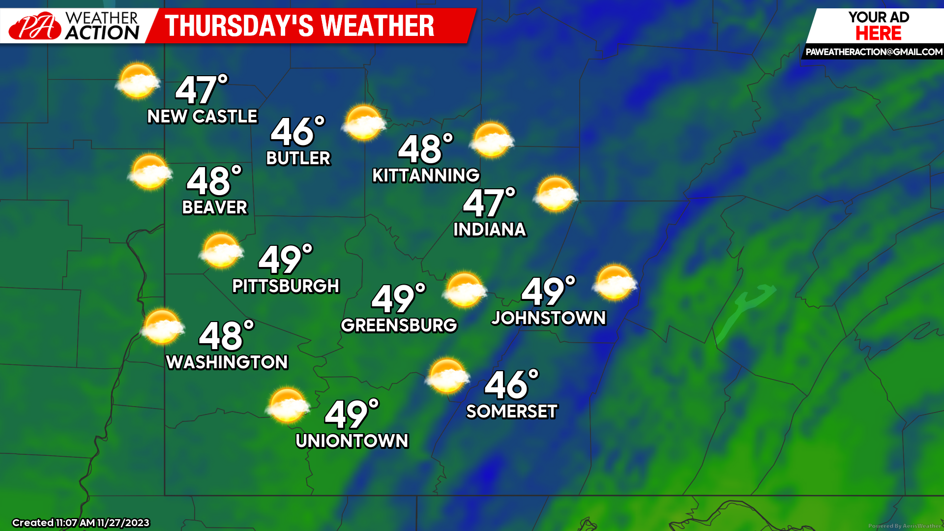
Thursday
Mostly sunny skies in the early hours of the day, transiting to mostly cloudy in the afternoon with an increasing chance for rain in the evening. Highs will be high to mid 40s. Winds will be out of the southwest at 7 to 10 mph. Lows will be in high to mid 30s.
Rain is highly likely to dominate the day on Friday. Be sure to follow PA Weather Action for updates to the regional forecast.


You must be logged in to post a comment.