
Good evening, everyone! I hope you all had a great Thanksgiving. After our drenching on Tuesday, the weather cooperated for the most part through the holiday. An area of polar high pressure has settled over the region, bringing calm and chilly conditions. Our next chance of rain comes Sunday night as a low-pressure system will slide West of the area, bringing the return of showers. Continue reading the blog for more details!
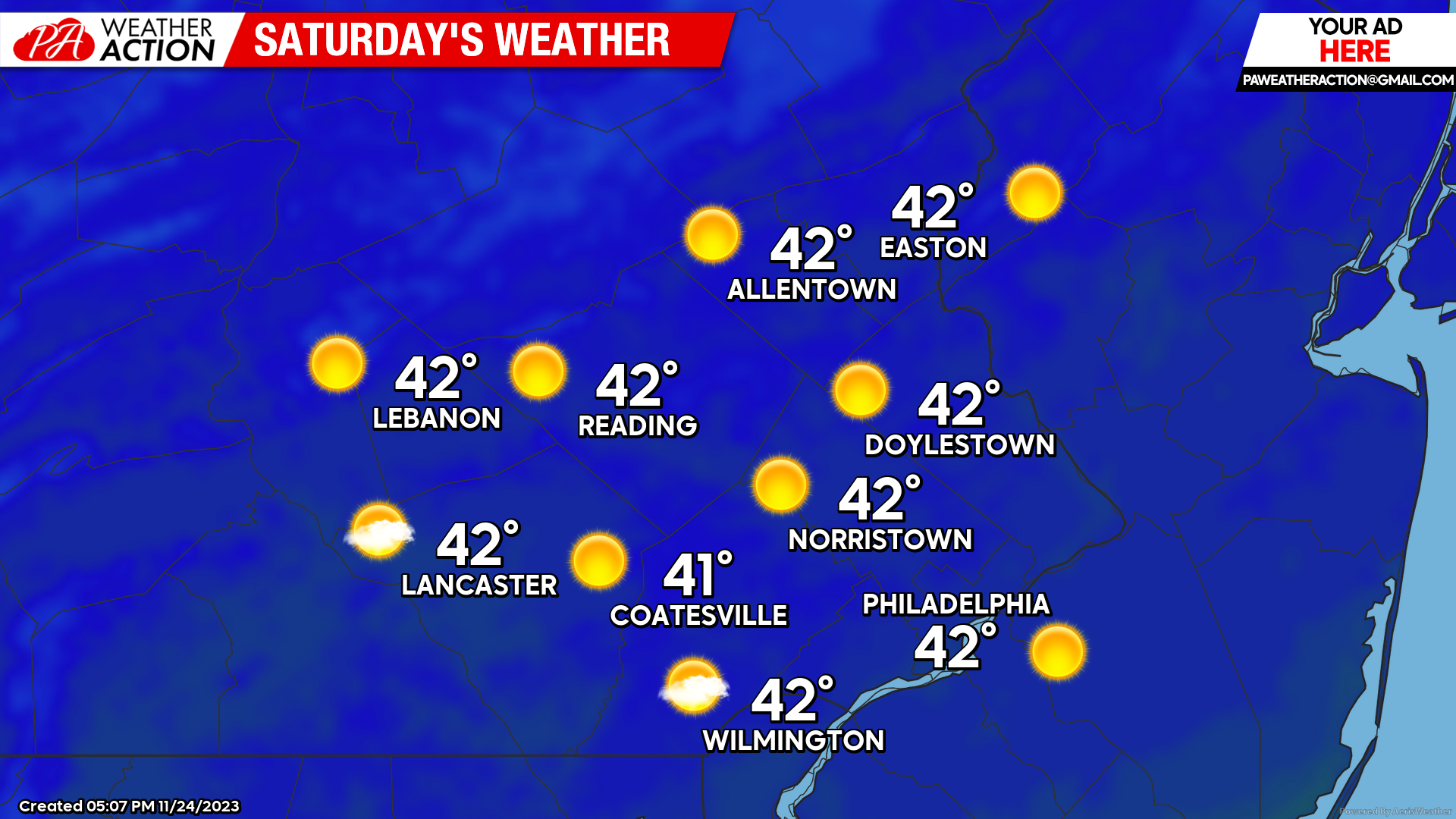
Saturday
Morning lows tomorrow will be some of the chilliest so far, with temperatures ranging in the mid-upper 20s region-wide. High pressure will keep skies clear throughout the day; however, temperatures will struggle to stay warm. Expect high temperatures Saturday afternoon to reach the low-40s with ample sunshine. Winds will remain mostly calm as well. Saturday looks chilly, but the better half to the weekend for travel.
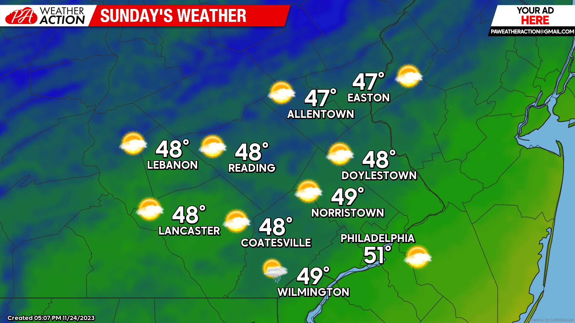
Sunday
Temperatures Saturday night will cool rapidly under clear skies and calm winds, giving Sunday another chilly start. Low temperatures will once again dip into the mid-upper 20s for most. Clear skies will give way to increasing cloud cover by the afternoon as our next low-pressure system arrives. As of now, rain should hold off until after dark. Highs will reach the upper 40s Sunday afternoon. Winds will be out of the S at 5-10mph
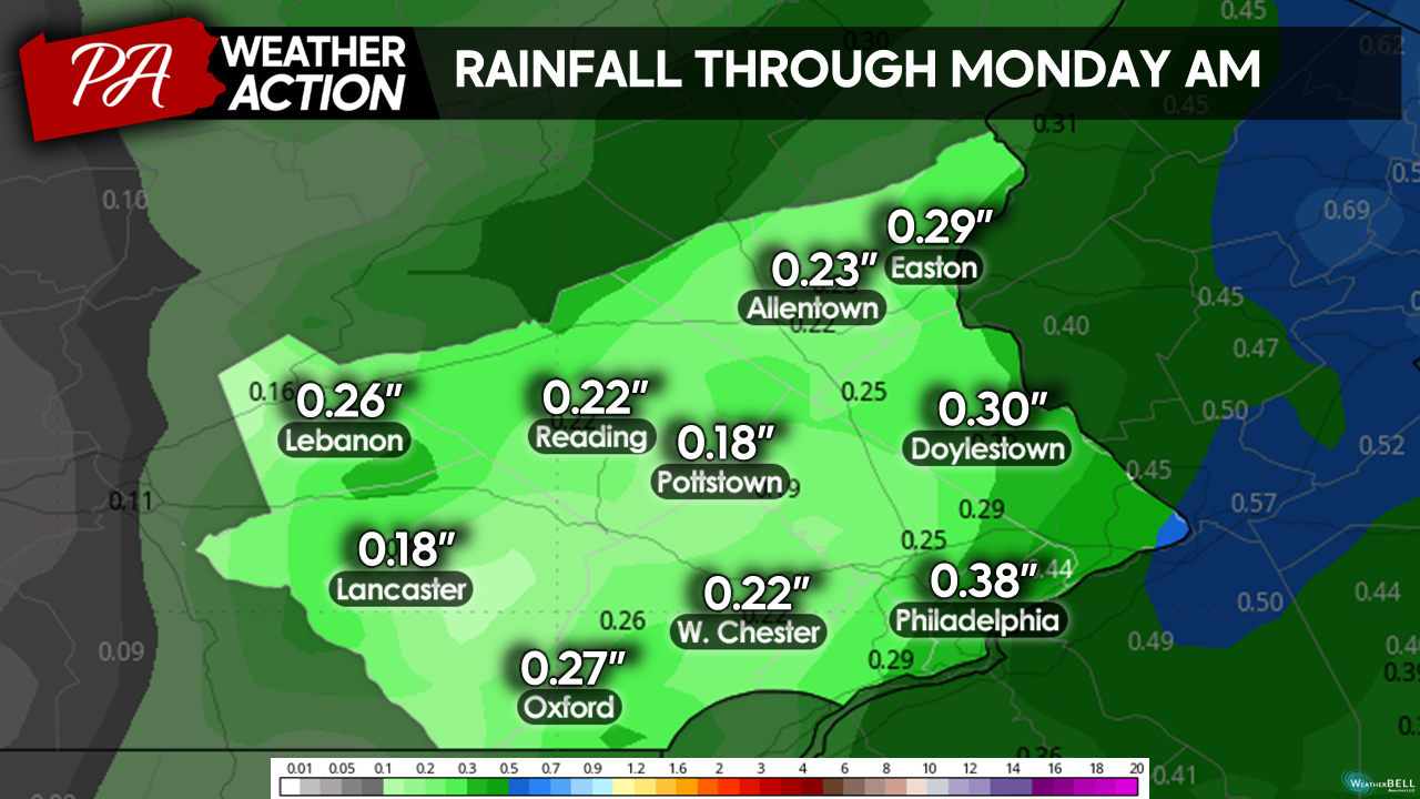
Scattered showers will stream north along a cold front Sunday night. Scattered showers will overspread the region after dark and will continue into the predawn hours on Monday. Rainfall should remain mostly light-moderate in nature and precip totals will remain generally low. A general 0.1″-0.5″ should fall Sunday night.
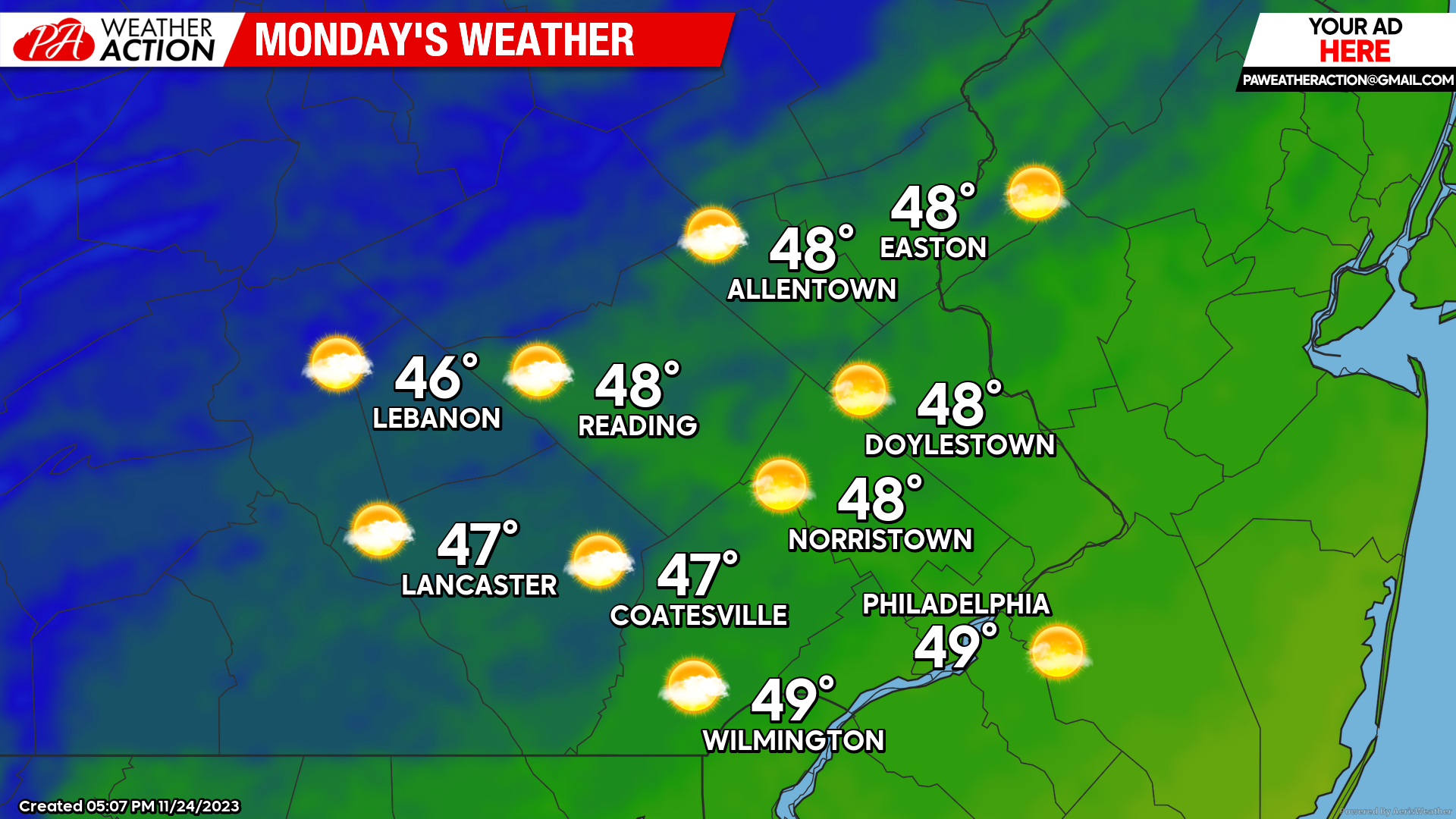
Monday
Overnight showers should clear by daybreak. Morning temperatures will start relatively mild in the mid-30s – to low-40s. Clouds will gradually clear throughout the morning hours giving way to mostly sunny skies by the afternoon. Behind the front breezy conditions will develop in the afternoon. Winds will blow out of the W at 15-20mph with gusts to 30mph. Highs Monday afternoon will top out in the upper 40s to low 50s.
Looking ahead towards next week, arctic high pressure will settle over the region bringing dry weather and the chilliest temperatures we have seen thus far. Expect winter-like conditions to linger through next week. I hope you all enjoy the weekend! If you have any questions or comments regarding the forecast feel free to let me know.

You must be logged in to post a comment.