
Colder weather with showers and a mix of snow is possible over the next few days. Drier weather conditions are expected this weekend.
Friday
Periods of rain and snow showers are expected throughout the region on Friday. The best chance for snow region wide will be in the morning hours which will transition to primarily rain in the late morning and early afternoon hours. Higher elevations will have primarily snow showers throughout the day, with snow accumulations approaching 1 inch in some areas. Highs will be in the mid 40s to mid 30s. Winds will be out of the northwest at 10 to 18 mph, gusts will approach 25 mph. Lows will be in the mid to low 30s. 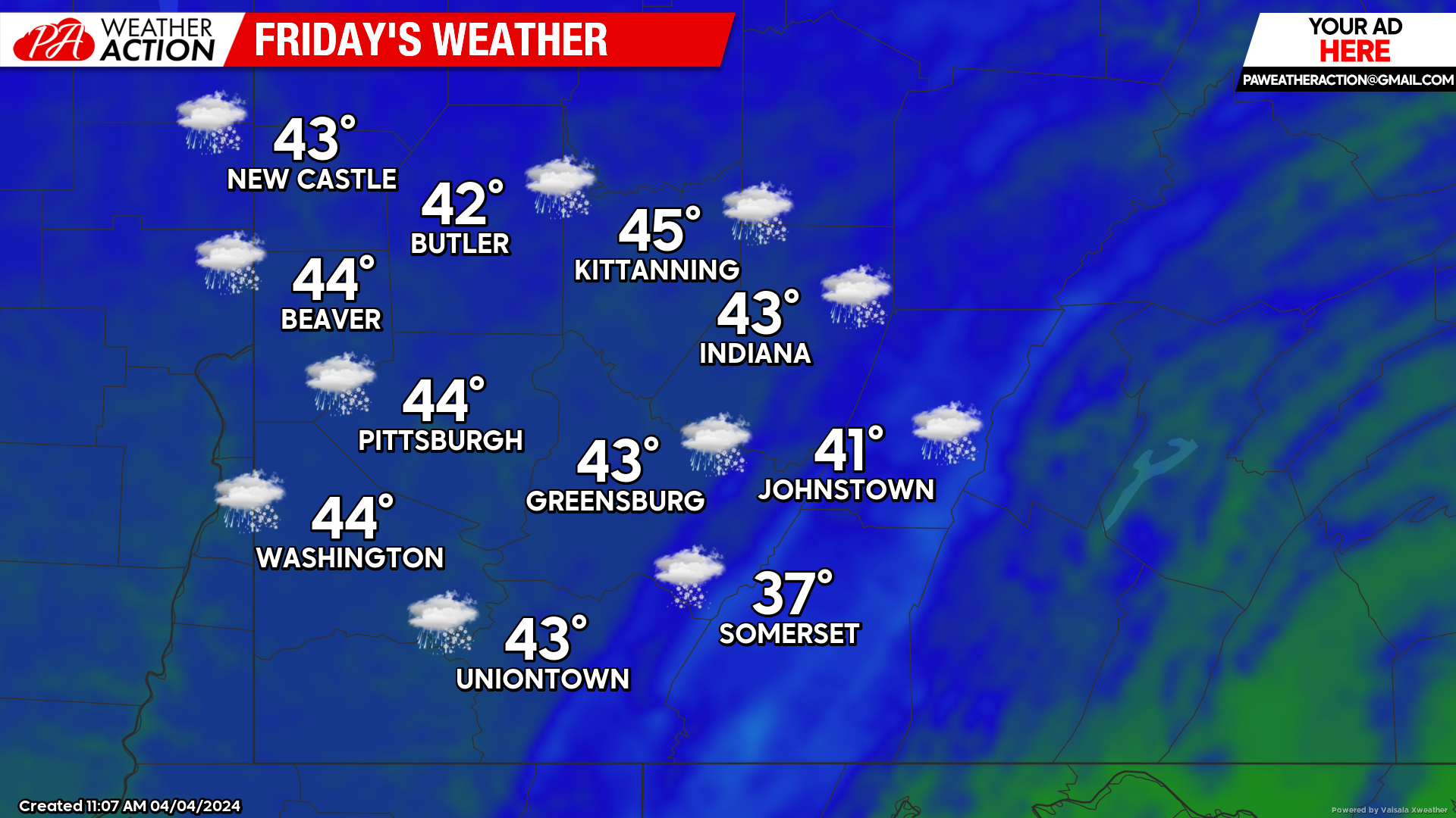
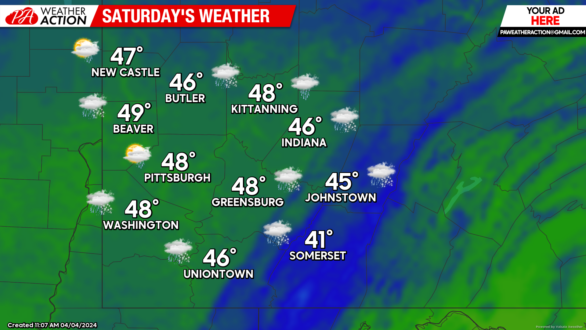
Saturday
Chance for rain and snow showers in during the daytime hours, higher elevations may see more snow than rain. Highs will be high to mid 40s. Winds will be out of the northwest at 11 to 18 mph, wind gusts may approach 25 mph. Lows will be in the low 30s.
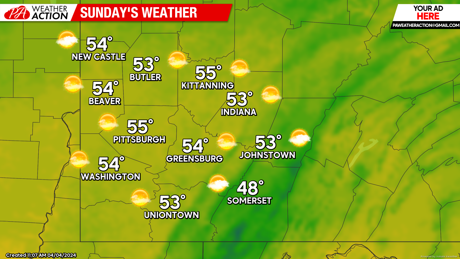
Sunday
Warmer, mostly sunny conditions throughout the region on Sunday. Highs will be in the mid 50s. Lows will be in the low 40s to mid 30s.
Warmer conditions are forecasted to begin the week as rain chances are expected to return. Be sure to follow PA Weather Action for more details.
You must be logged in to post a comment.