
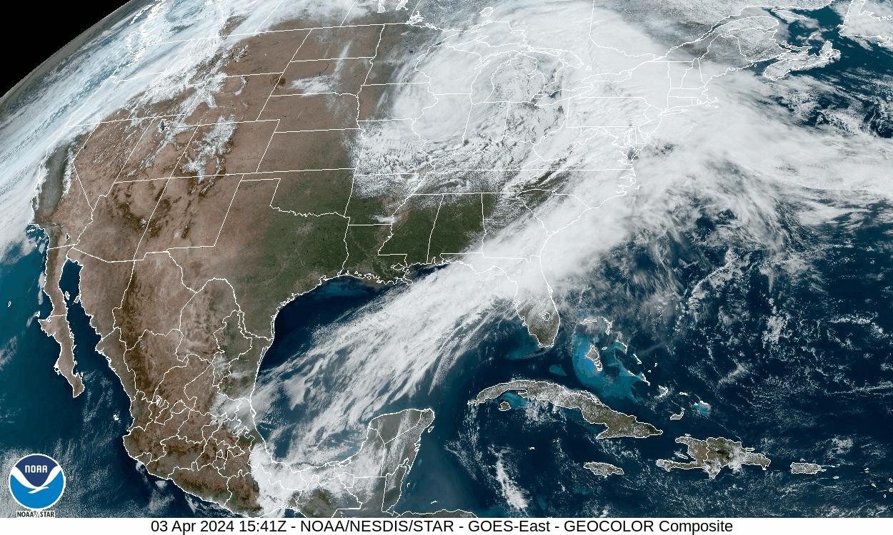
A coastal low currently intensifying rapidly over the Chesapeake Bay area will churn northeastward along the coast to reach Cape Cod by Thursday afternoon. The storm is generating strong wind off the ocean and into our area, with gusts in some areas exposed to the east experiencing gusts over 50 mph. Windy conditions will continue into this evening, but will subside overnight.
Around two inches of rain has already fallen, with another half-inch to inch possible. This could cause minor flooding for streams and poor drainage areas. Precipitation will change to snow overnight before tapering to snow showers by Thursday morning. There could be some light measurable accumulations in the higher elevations!
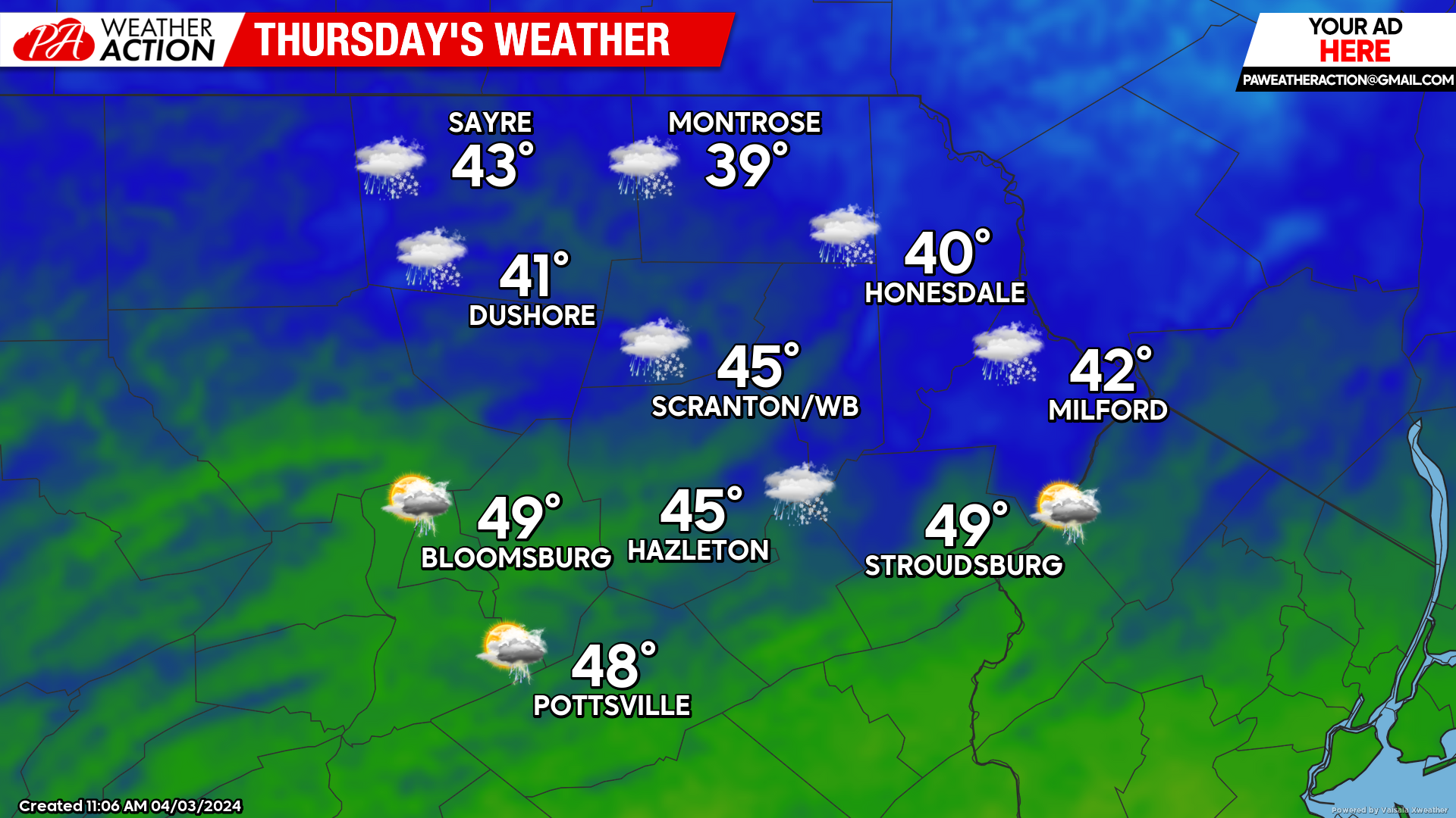
THURSDAY
A deep upper-level low will drop southeastward from the Great Lakes Wednesday night to the southern PA border by Thursday evening. This will generate scattered rain and snow showers for our area. Precipitation amounts will generally be around a tenth of an inch, although locally higher amounts are possible with heavier showers.
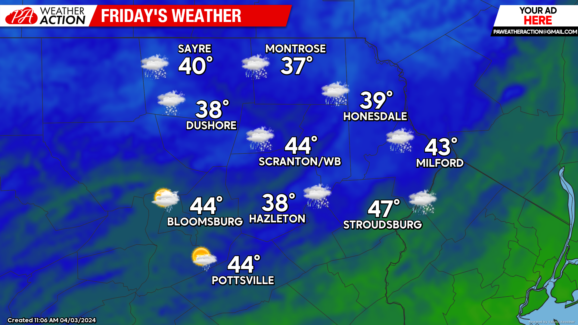
FRIDAY
Yet another upper-level disturbance will drop southeastward into our area, continuing the clouds with rain and snow showers. Amounts will be under a tenth of an inch.
SATURDAY
Variable clouds and scattered leftover rain/snow showers will persist, although amounts will be light and spotty.

ECLIPSE OUTLOOK
This week’s storm system will finally relinquish control for Sunday and Monday, resulting in mostly clear conditions both days. There will be a weak system in the Great Lakes area that could spread some high thin clouds over our area Monday afternoon, which will be something to watch as we get closer in time, but right now we have a good chance of being relatively clear for eclipse. If you are planning to journey to see totality, at this time northern New York and northern Vermont look like they should be clear. Obviously, there are still several days left for some tweaks to this forecast.

You must be logged in to post a comment.