
With over 300k homes and businesses still without power as of 5pm Wednesday, mainly between Pittsburgh and State College, the last news we need is that more storms are likely!
Unfortunately, that’s the exact news we have. Yet another day of damaging winds, hail, and an isolated tornado is coming on Thursday. And once again, short range models are very enthused that this will be a widespread threat in many of the same areas as Tuesday.
Because of all the power outages recently due to storms, we are introducing a new power outage forecast map which will be after future radar timing!
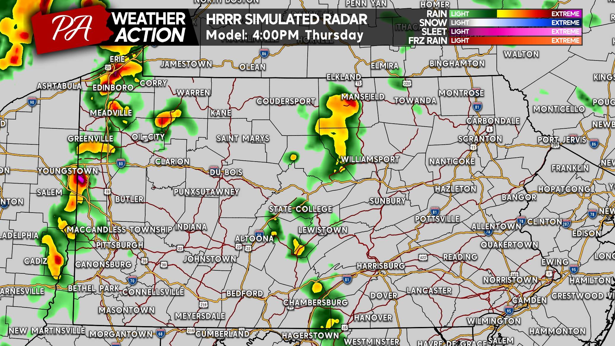
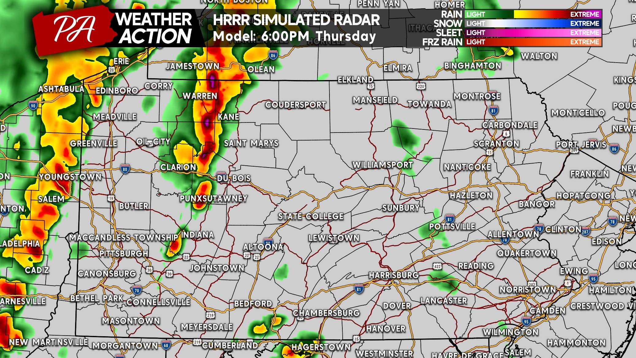
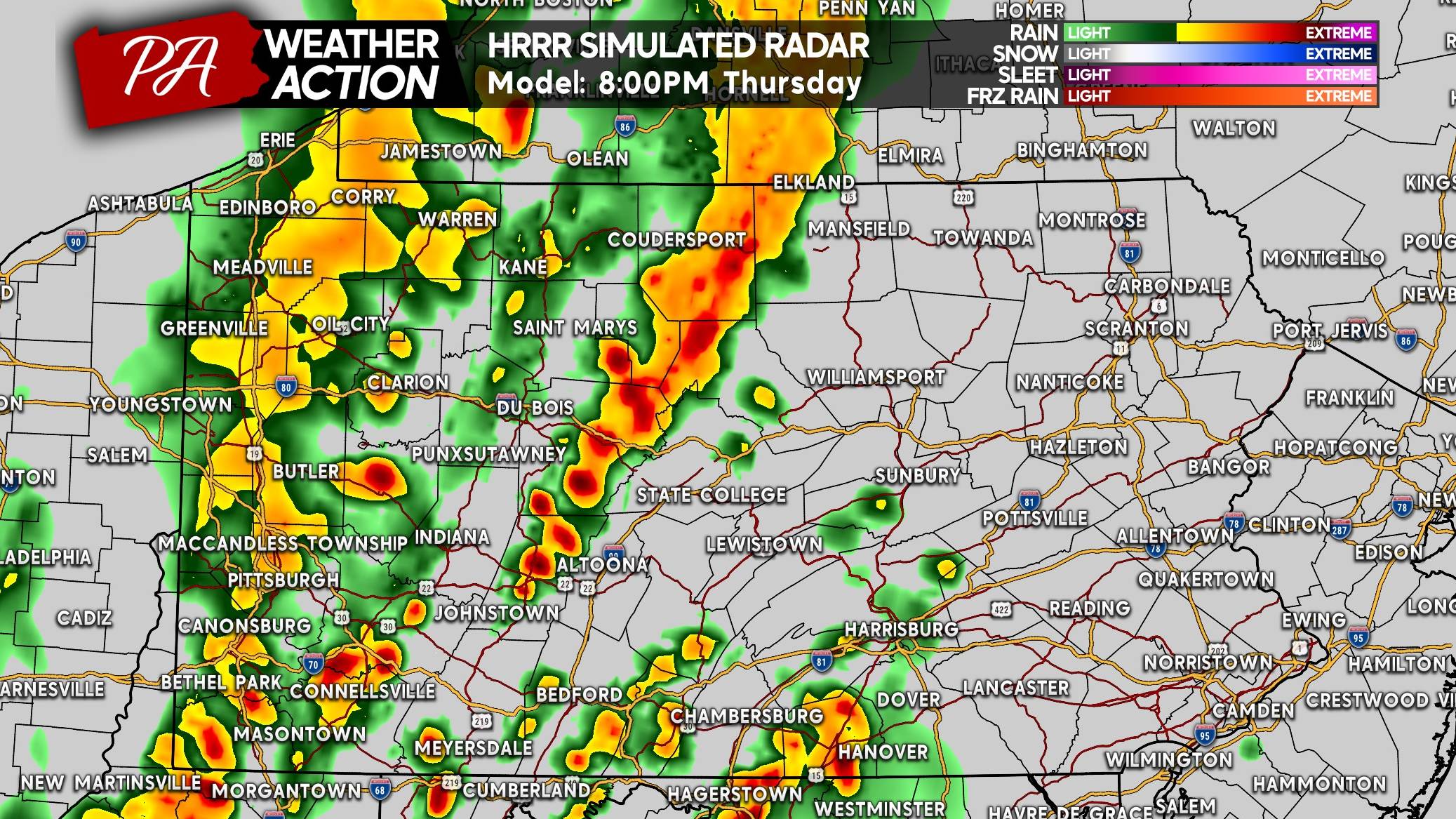
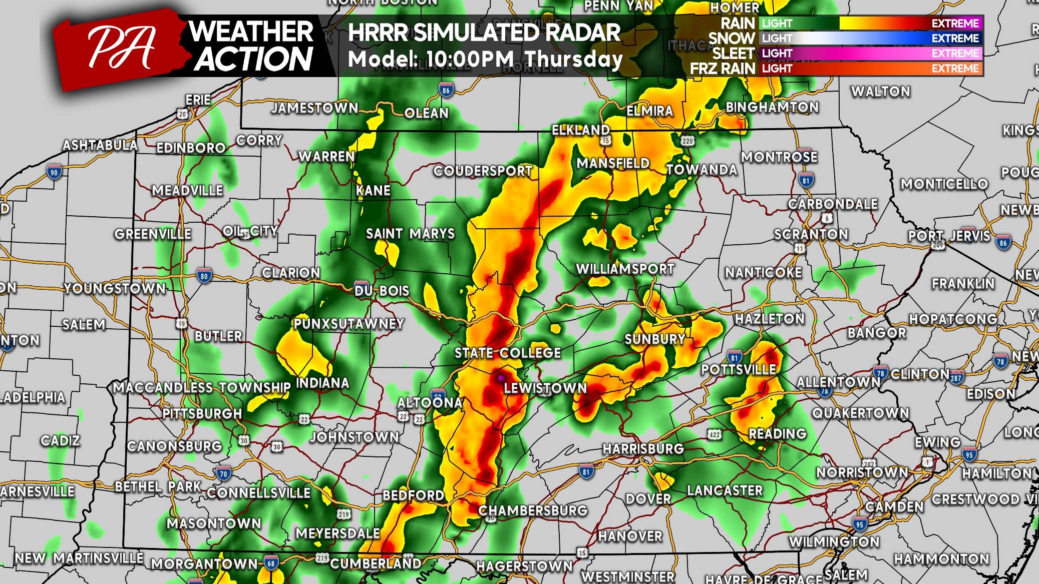
FUTURE RADAR STORM TIMING
Clusters of thunderstorms will begin to develop mid-Thursday afternoon in western and even central Pennsylvania, with the greatest severe threat west of Route 15. Here at 4pm Thursday, we see a broken line of strong to severe storms along the PA/OH border.
By dinnertime, those storms are modeled to push into the Alleghenies as another line of storms approaches Western PA in Ohio. We also see some pop-up potent storms in South Central PA that’ll be possible around 6pm.
The threat looks to most widespread around 8pm, with multiple clusters and lines of strong to severe thunderstorms in central and western PA. We think Central PA, from the Allegheny Front to the ridge and valley section will be the focal point of severe activity by sunset.
And even after sunset, models like the HRRR are showing a very strong line of storms in Central PA. It will weaken after this, but the last thing places like State College needs is another damaging storm!
THURSDAY’S POWER OUTAGE THREAT MAP
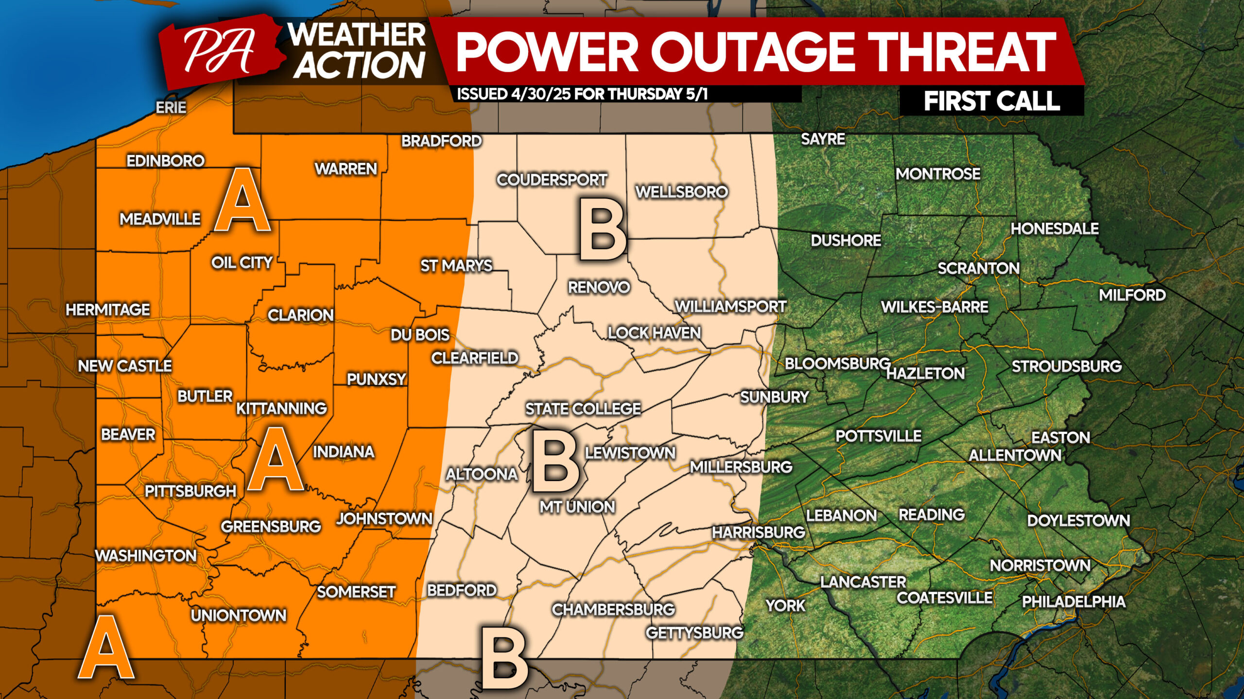
Area A: Scattered (10-25% of county) power outages are possible. If you currently have power, we recommend charging important electronics. If power goes out, don’t open your fridge/freezer often or for long!
Area B: Isolated (5-15% of county) power outages are possible. We still recommend have electronics charged ahead of time!
THURSDAY’S SEVERE THUNDERSTORM THREAT FORECAST
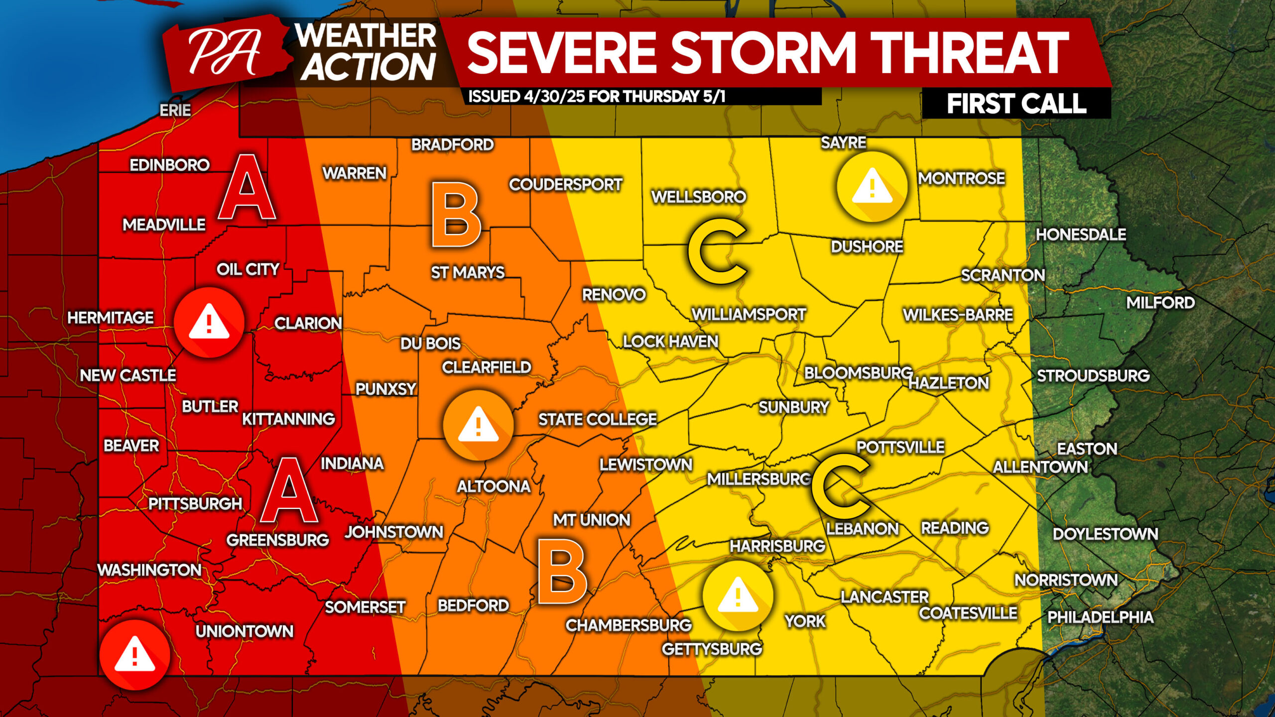
Area A: Widespread strong to severe thunderstorms are expected. A few supercells and bowing line segments will be particularly likely to produce damaging winds, hail, and a very isolated tornado.
Area B: Scattered strong to severe thunderstorms expected. Line segments will bring a damaging wind risk, with an isolated supercell or two posing the threat of hail and an isolated tornado.
Area C: Isolated strong to severe thunderstorms expected, mainly in the form of a weaken line or cluster of storms Thursday evening. Strong winds are the main concern, with most gusts likely under severe criteria.
Be sure to share this forecast with friends and family below!

You must be logged in to post a comment.