
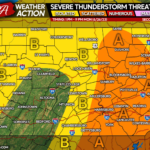
After one of the driest Spring seasons in recorded history, the tides will be changing starting midweek. A stationary boundary currently draped across the Southeast US will slowly push north late this workweek, introducing rain chances in Southern PA by Thursday and everywhere by Friday. Widespread showers and thunderstorms are likely Saturday and Sunday, before maybe a short break next Monday. But wait, there’s more!
Models are suggesting an upper level low will develop over the Eastern Great Lakes late next Monday (June 26th), and sit and spin for a few days. This is more so susceptible to change, but the period from next Monday night through next Wednesday night looks rainy as well. Then comes Independence Day Holiday Weekend, which of course weather plays a huge role in. It’s too early to tell, but early indications are that there may be a chance of rain, more so in Eastern PA. But don’t worry about that yet because we’re talking almost two weeks out.
I wouldn’t recommend canceling all outdoor plans for that entire weeklong period, because there will be times without rain. Due to the localized nature of this rain, I would highly recommend download our app that features hourly and daily forecasts crafted by your local NWS meteorologists, as well as interactive radar and our forecasts like this article! Tap below to get the PWA App!

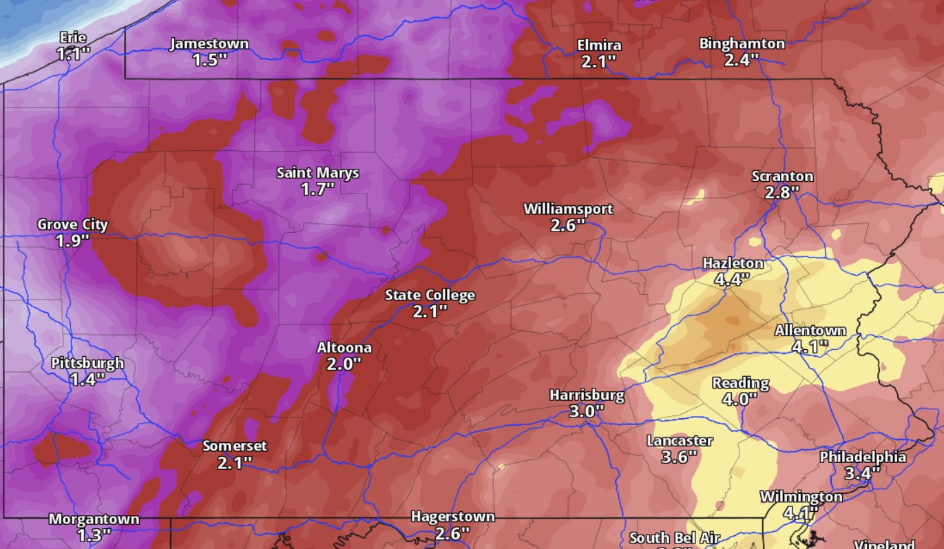
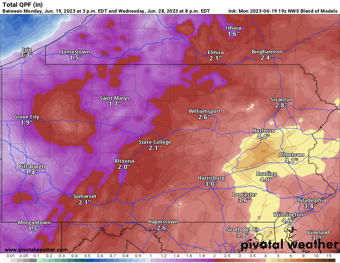
Now onto rainfall amounts. Once again, due to at least half the expected rain coming from scattered showers and thunderstorms (convective activity), totals will be localized and impossible to predict. However, we have a good idea of what region those storms are expected to form in. Here is the latest model blend for rainfall amounts through next Wednesday, which should cover over 90% of the event.
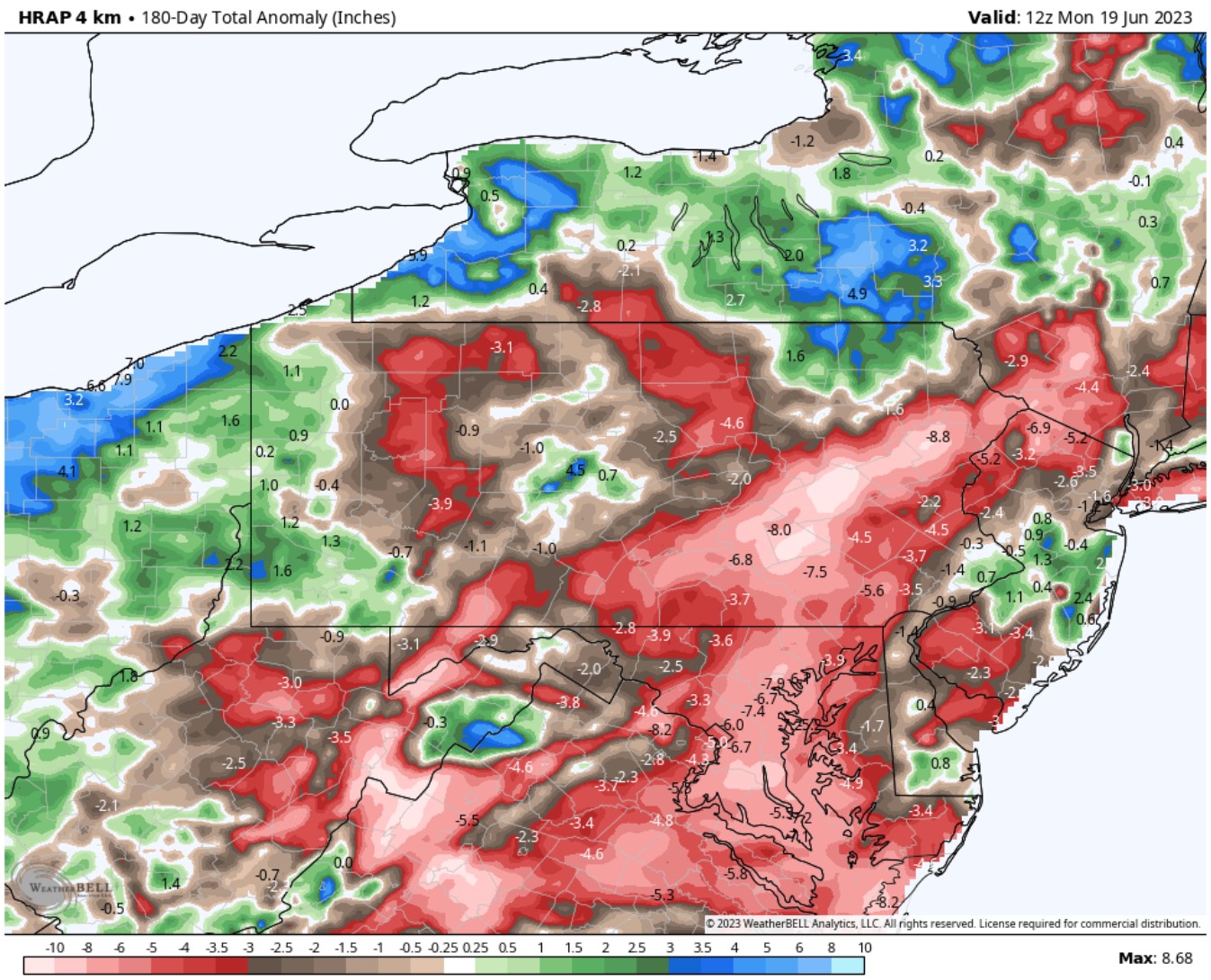
Will this by itself eliminate the drought? There’s a good chance it will take us from a Moderate Drought to just Abnormally Dry on the categorical Drought Monitor, so the answer may be yes. Also, it’s unlikely we will fall back into the previous pattern immediately afterwards, so things are definitely looking up. River and creek levels should be up decently by Independence Day Weekend as well. There won’t be issues with fireworks either. Here’s a look at the current rainfall deficit in the past 180 days.
So all in all, this is a good time to get the rain and it will be greatly beneficial. We will keep you updated with the latest forecast for the holiday weekend!
Pass along this forecast to friends and family using the blue button.
[social_warfare]
You must be logged in to post a comment.