
Good afternoon! I hope everyone had an enjoyable weekend. We had some nice sunny days over the weekend, although temperatures were quite a bit chilly with gusty conditions at times. As we head into the new week, we will see a system impact our region throughout the day on Tuesday, bringing some areas a wintry mix. However, the forecast does look to improve as we head into the Thanksgiving holiday. Lets dig in!
TUESDAY:
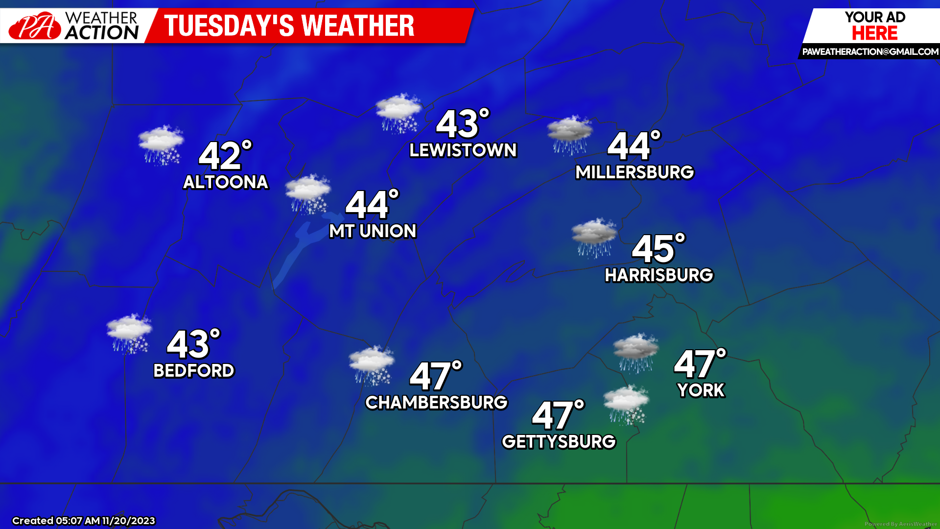
Tuesday will be a very active weather day across the region. During the early morning hours, we will see a wintry mix develop across portions of the western and northern areas of the region. This may include snow, sleet, and freezing rain. As warmer air continues to invade into the region, we will see all locations change to a steady cold rain, which may be heavy at times. Expect high temperatures to only rise into the lower-40s to mid-40s due to the ongoing precipitation throughout the day. On top of the dreary conditions, we will see a easterly wind develop during the afternoon hours of 10-15 MPH with gusts up to 35-40 MPH, making it for a rather dreadful day. Rain will continue into the overnight hours before tapering off early Wednesday morning.
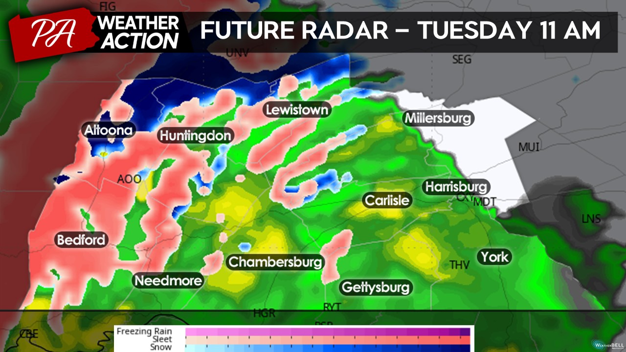
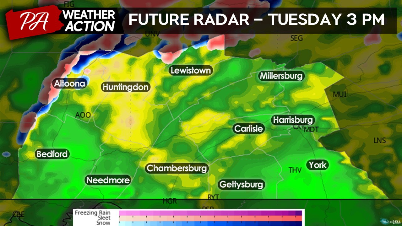
FUTURE RADAR:
Much of the area will be dealing with some sort of precipitation by the late morning hours on Tuesday. Expect a wintry mix for the western and northern counties while the southern areas stay predominately rain.
By the mid-afternoon hours, warm air will flood the region allowing the majority of the precipitation to change over to a cold, steady rain. A few areas in the highest elevations may see remnants of a wintry mix, although all areas will change to a plain rain by the evening hours.
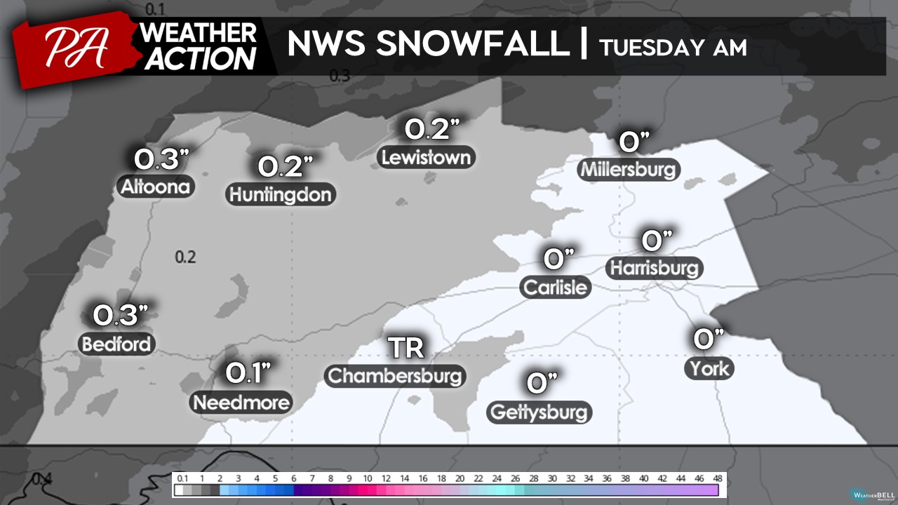
PROJECTED SNOWFALL AMOUNTS:
Areas could see an initial burst of wet snow before changing over to a wintry mix/plain rain. Expect the burst of snow accumulation to remain rather minimal, with less than a half inch expected for all areas. The highest elevations could see up to a half inch of snowfall accumulation, if not slightly more.
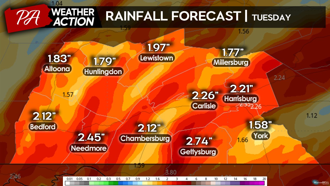
PROJECTED RAINFALL AMOUNTS:
Expect rainfall amounts to range between 1.5 – 2.5 inches, indicating that Tuesday will be a very wet day. Depending on where the heaviest rainfall bands form, a few isolated areas could see higher and/or lower than predicated rainfall amounts. After the dry pattern the last few weeks, this rain will surely be much-needed. At least it is not coming all down on the weekend!
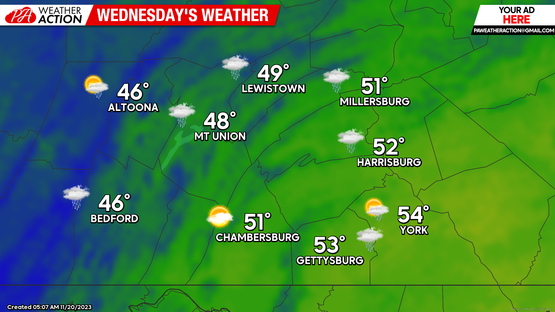
WEDNESDAY:
Wednesday will allow for much calmer conditions as we see the low pressure system move out of the region. A few isolated showers may fire in the mid-afternoon hours, however, those will stay very isolated and short-lived. Expect high temperatures on Wednesday to reach the mid-40s to mid-50s with generally mostly cloudy skies with a few peaks of sunshine. It will be a little bit windy as well, with gusts up to 25 MPH possible during the afternoon hours. It will not be too bad of a day for those travelling across the area!
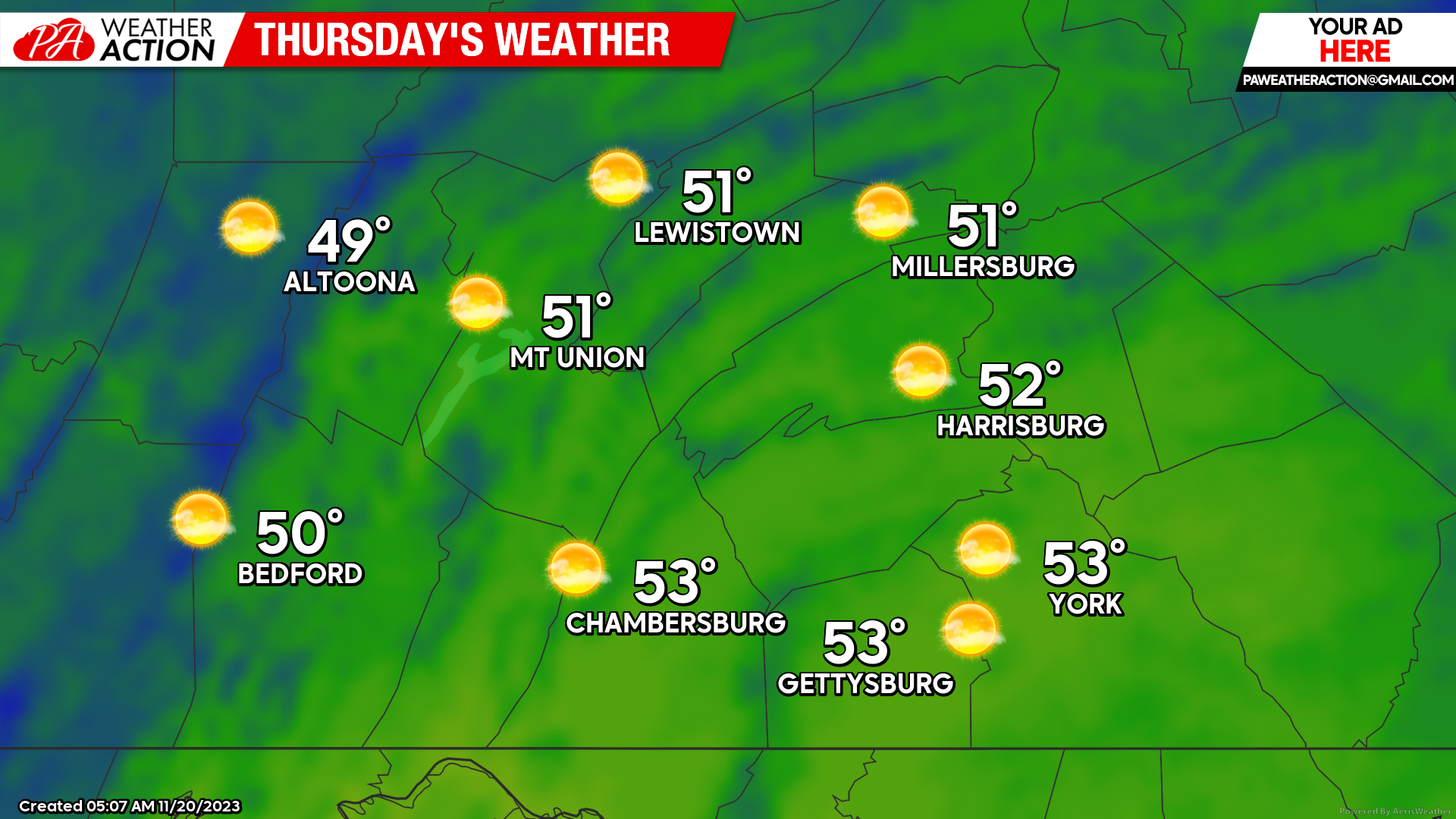
THURSDAY:
As we head into the Thanksgiving holiday, it will be a pretty spectacular day! With high pressure developing overhead, we will see temperatures climb into the upper-40s to low-50s across the region under mostly sunny skies. We will see a slight westerly wind develop during the afternoon hours of 5-10 MPH with gusts occasionally up to 20 MPH. The weather could be a whole lot worse for the holiday!
 In general, after a very active Tuesday we will see the conditions clear out just in time for Thanksgiving. Travel conditions look to be great on both Wednesday and Thursday, so if you have to travel do it then! I wish everyone a great holiday! For more updates, follow PA Weather Action on Facebook and download the app for more updates.
Denys

You must be logged in to post a comment.