
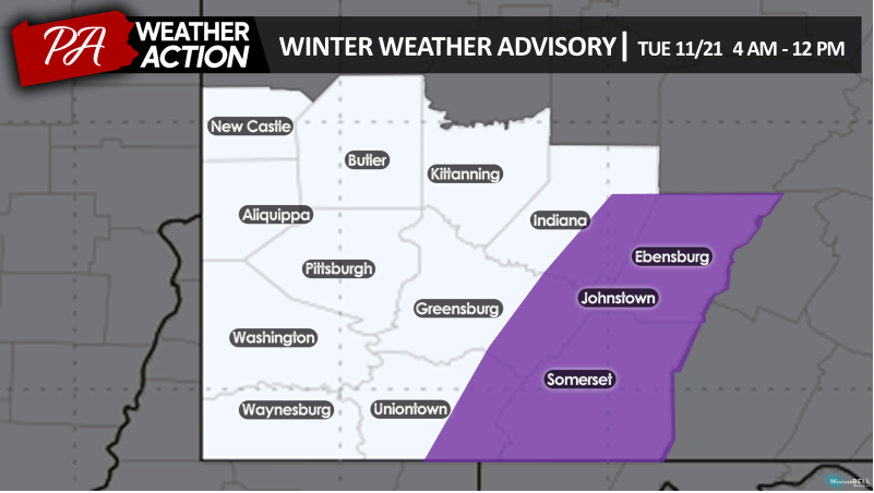
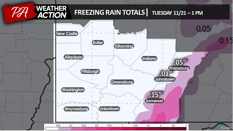
A Winter Weather Advisory will be in effect for the southeastern portions of the region, primarily in the higher elevations from 5 am to 12 pm Tuesday. Mixed precipitation, primarily freezing rain, is expected. Total snow accumulation of up to 1 inch and ice accumulation around one tenth of an inch is possible. Winds will be gusting as high as 50 mph. Primary impacts will be slippery road conditions that will impact the Tuesday morning commute, and downed tree branches from elevated wind gusts.
Tuesday
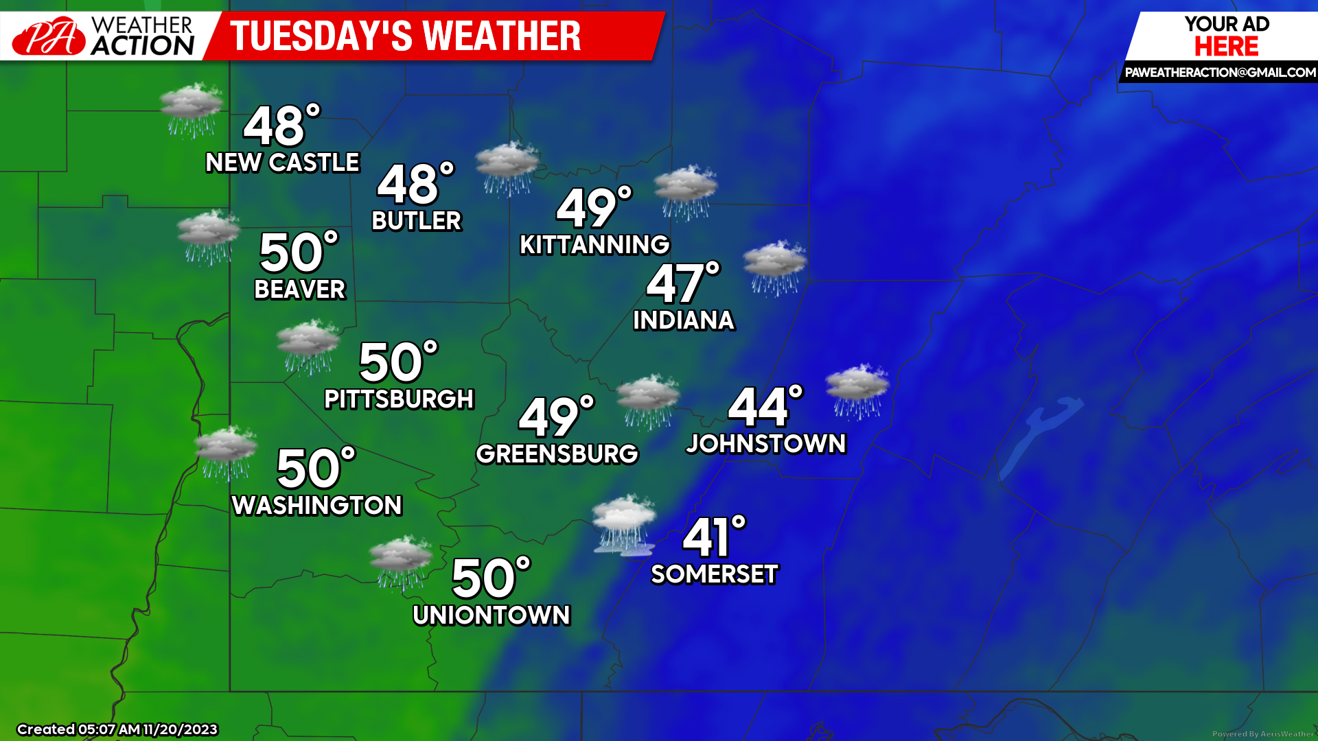
Rain will begin in the morning hours and last throughout the day. Breezy conditions will accompany the rainfall with winds out of the southeast 15-25 mph. Higher elevations will see higher windspeeds between 25-30 mph with potential wind gusts above 45 mph. Highs will range between 50 and 40 degrees throughout the region, with evening lows around 40 degrees.
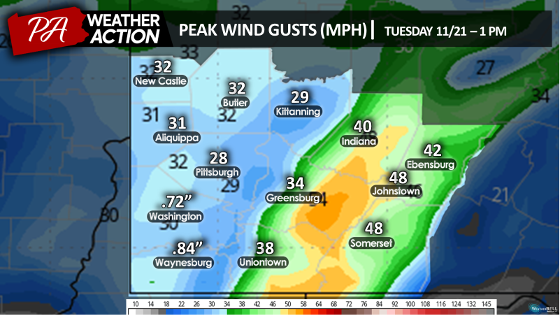
Windy conditions can be expected during the times of rainfall, with wind gusts ranging from 30-50 mph for most of the region. Peak wind gusts can be expected around the afternoon hours.
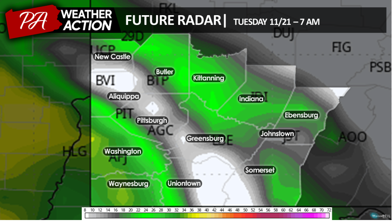
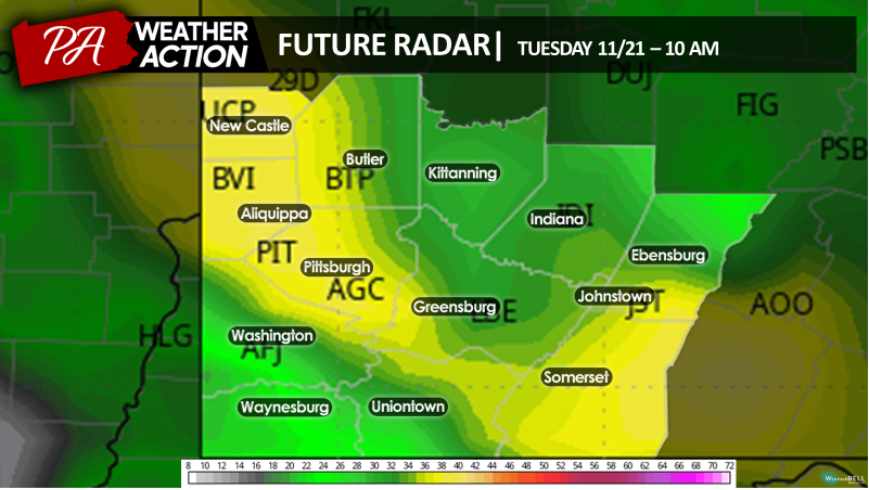
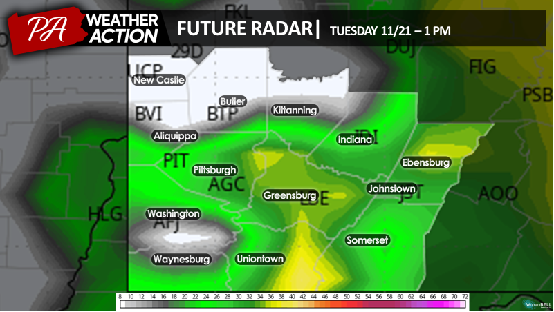
Future radar indicates that the heaviest of the rain will fall between 7 am and 1 pm throughout the region.
Wednesday
The chance for rain will continue to stick around for most of the region during the morning and mid-day hours on Wednesday. Eastern portions of the region may experience intermittent drizzle or light rain into the early evening hours. Highs will be in the mid to low 40s. Winds will be out of the west at 10-16 mph, higher elevations could experience wind gusts up to 25 mph. Evening lows will be in the low 30s.

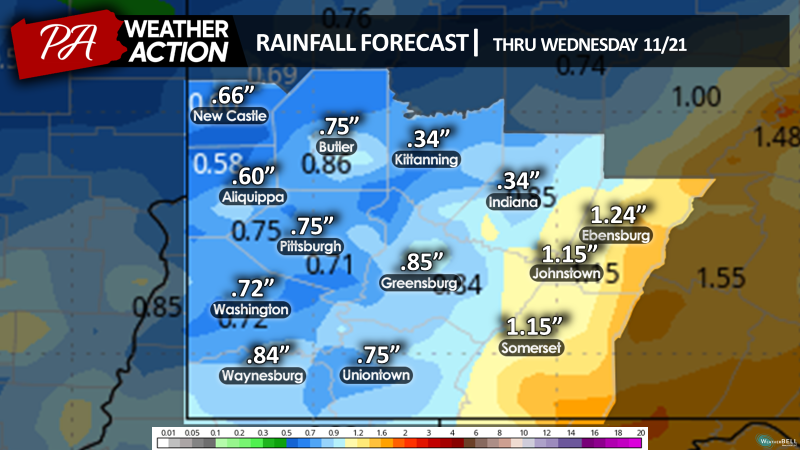
Rainfall totals for Tuesday and Wednesday for the region will primarily range between .75 to 1.25 inches.
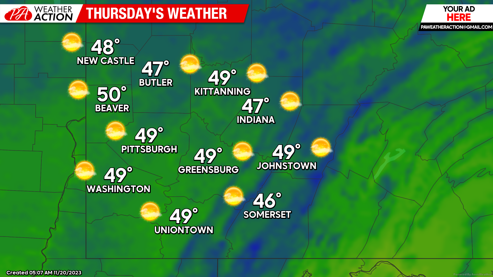
Thanksgiving Day (Thursday)
Most Sunny conditions return to the region on Thanksgiving Day. Highs will be in the high to mid 40s with lows in the low 30s and mid 20s.
PA Weather Action hopes everyone has a great Thanksgiving holiday!


You must be logged in to post a comment.