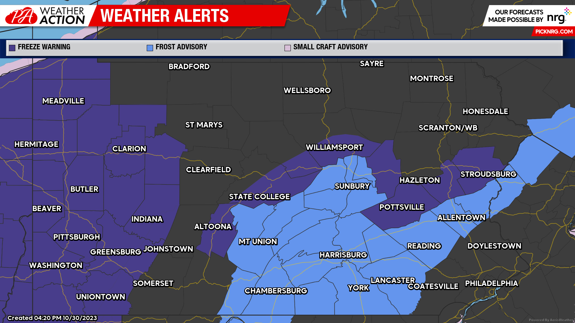
A Freeze Warning remains in effect from midnight to 10am Tuesday morning. Sub-freezing temperatures, ranging from the mid 20s to low 30s, can be expected throughout most of the region. Primary impacts will be frost and freezing conditions which could kill crops, other sensitive vegetation, and possibly damage unprotected outdoor plumping.
Tuesday
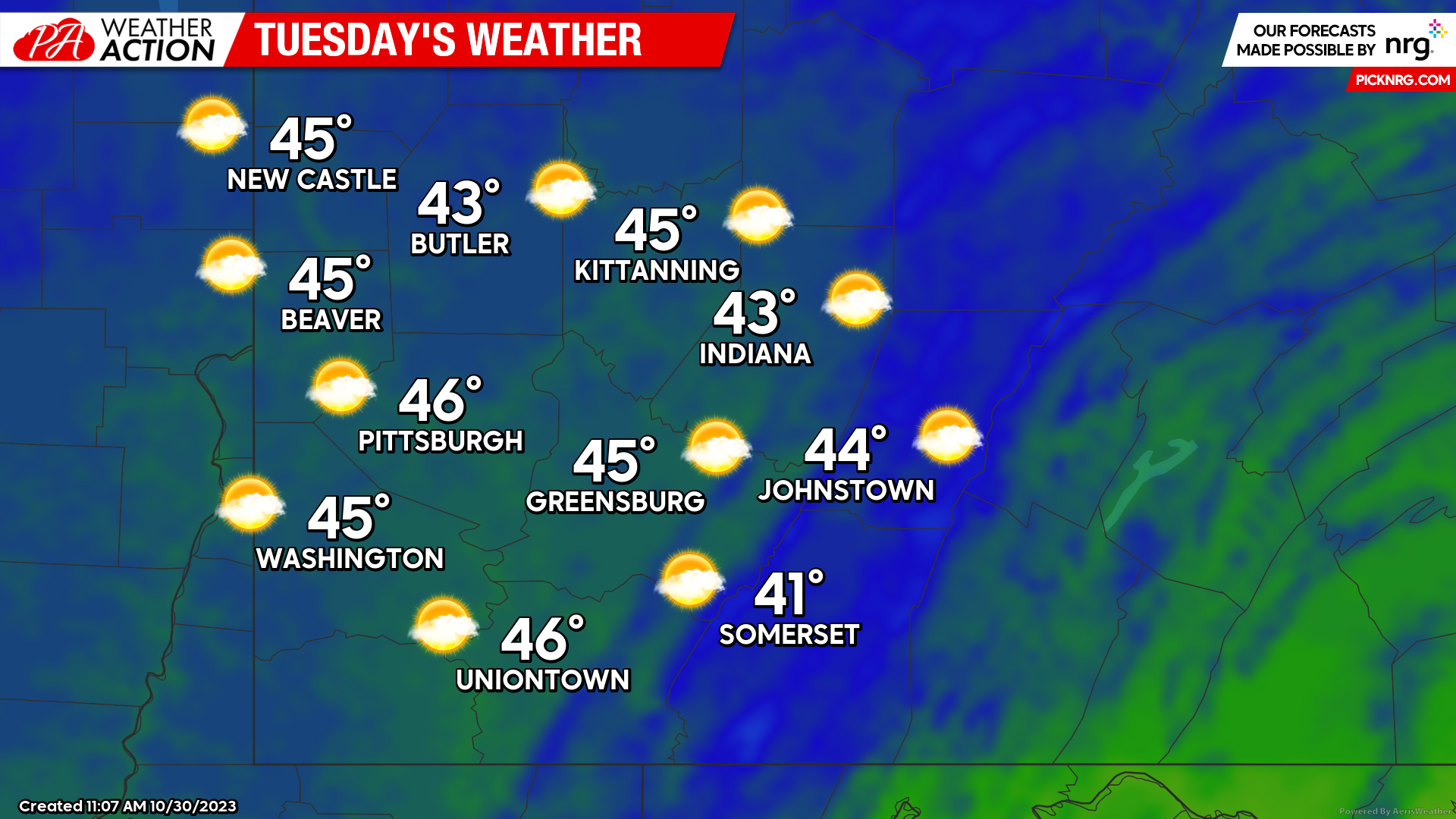
Clearing conditions are expected to occur overnight and into Tuesday morning behind the passage of the frontal system leaving behind cooler temperatures for the region. Areas of frost can be expected on Tuesday morning, additionally the Freeze Warning is scheduled to expire at 10 am. Increasing cloudiness can be expected with high temperatures in the mid to low 40s. Winds will be out of the west-southwest at 6-10 mph. Evening lows will be in the mid 20s to low 30s. A slight chance for snow showers can be expected late Tuesday and into Wednesday.
Wednesday
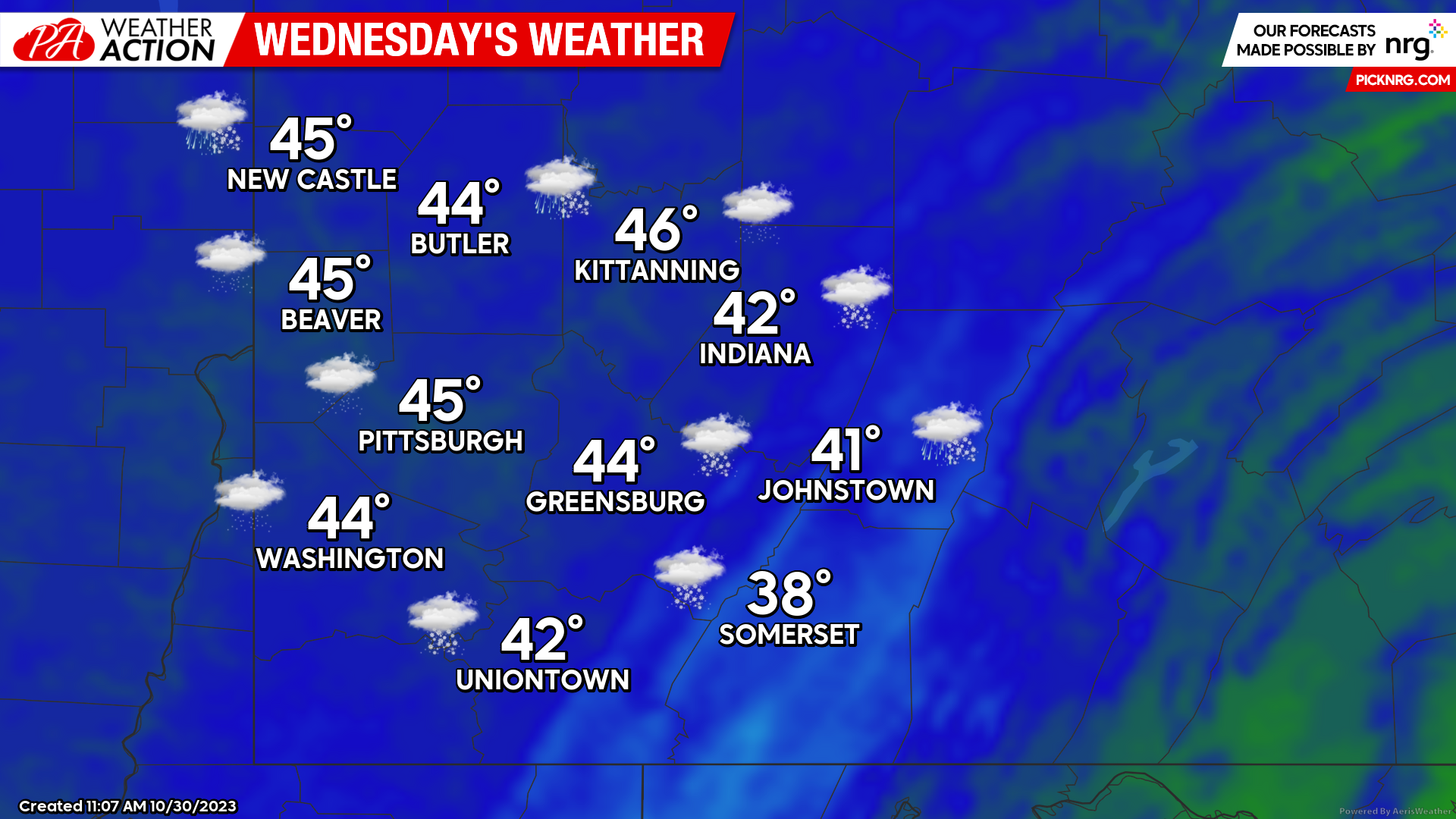
Snow showers can be expected, primarily in the northern and higher terrain areas of the region, however a slight chance for scattered snow showers cannot be ruled out for everyone in the early morning to midday hours on Wednesday. Highs will be in the mid to low 40s. Winds will be west-northwest at 6-10 mph, higher elevations could see wind speeds between 9-16 mph with gusts above 20 mph. Windchill values could range between 10 and 20 degrees in areas with higher wind speeds. Low temperatures will be in 20s throughout the region.
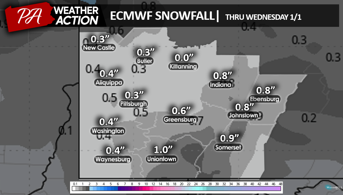
Most areas will see little, if any, snow accumulation, the ECMWF (European) model does indicate the potential for some snowfall throughout the region on Wednesday.
Thursday
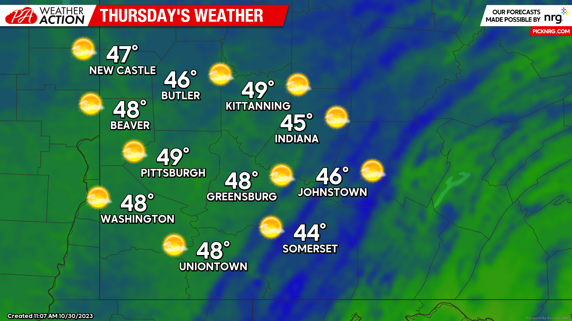
Warmer weather and clearing conditions are expected for Thursday. Mostly sunny skies with highs will be in the high to mid 40s. Winds will be out of the southwest at 5-9 mph. Evening lows will be in the mid to low 30s.
Be sure you stick with PA Weather Action as our weather conditions transition throughout the season. Be sure to follow us on our social media platforms and check in regularly on our website for updates and new regional forecasts.


You must be logged in to post a comment.