
After a wet and mild weekend, big changes are coming to the weather pattern as we close up October and heading into early November. A cold front that is currently moving through the area is bringing widespread showers and extensive cloud cover and will usher in much drier and cooler air in its wake. With potential disturbances riding into the region with the cold blast, there may be the threat for isolated snow flurries Halloween night and into the first day of November. Let’s jump in!
TUESDAY:
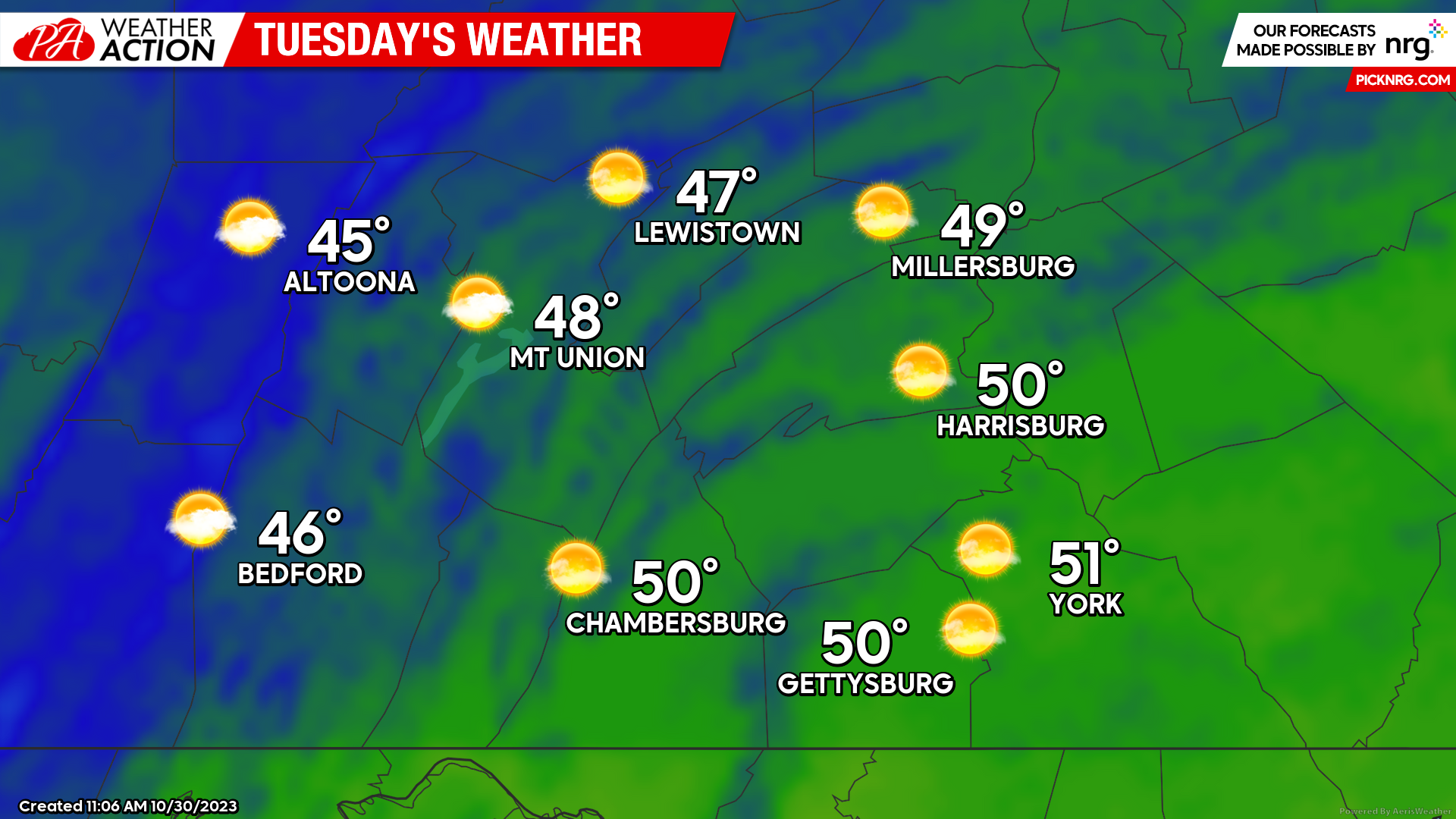
Tuesday will be quite chilly across the area with high temperatures ranging from the mid-40s to lower-50s. At least it will be mostly sunny, although the sunshine will be providing false hope as it will be much colder outside than it may look from indoors! Expect mostly calm winds as well, so the wind chill will not be a large factor in tomorrow’s weather. However that will be changing as we head into the middle of the week.
WEDNESDAY:
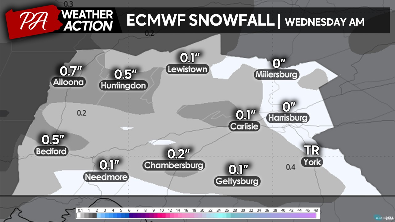
Wednesday will bring the coldest day of the season yet to open up the month of November. Expect high temperatures to range from the low-to-upper 40s with a mix of sun and clouds. Expect a northwesterly wind of 10-15 MPH develop during the afternoon hours, making the air temperature feel as much 7-15 degrees colder at times throughout the afternoon, making a return of the infamous wind chill! Additionally, there may be a few snow showers across the area Wednesday morning, although no accumulations are expected.

Expect wind chill temperatures Wednesday afternoon to be in the 20s, 30s and 40s across the region. It will be a very chilly afternoon so make sure you are prepared by bringing out some of your heavier coats, gloves, and hats!

The ECMWF (European) model brings the threat for the first flakes of the season across much of the region early Wednesday morning. While it has snow accumulate, due to the recent warmth, it will be unlikely any snow accumulates on surfaces. The highest elevations may see a quick coating in isolated heavier snow showers although expect no road impacts. If you are up early enough, you may see some of these flakes and maybe begin to tune up the Christmas music?
Temperatures will be dropping very rapidly Wednesday night into Thursday morning, which will likely be the coldest air temperatures in several months. Many locations will be in the 20s at sunrise on Thursday, with pretty much everyone at or below freezing. With these temperatures, expect a widespread killing freeze, which will likely put an end to the growing season which has been already extended for a rather long time.

THURSDAY:
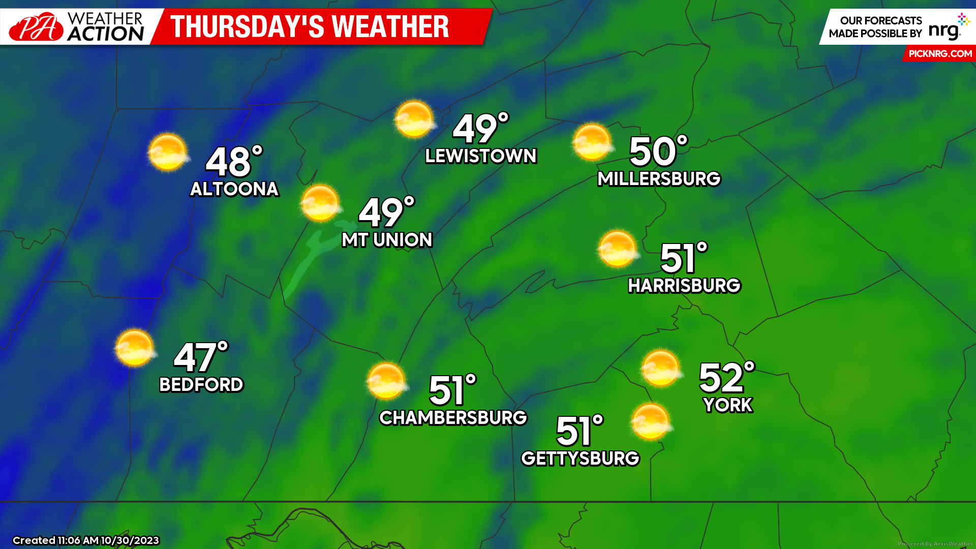
As we head into Thursday, the coldest portion of the air mass will begin to move out of the area, which will allow temperatures to slightly warm up into the upper-40s to low-50s during the afternoon hours under mostly sunny skies. Expect the winds to taper down as well, which will make for not to bad for an afternoon if you are out in the direct sun.
 That is all for now! If you have any questions or concerns regarding the forecast, feel free to reach out. For more updates, you may also download the PA Weather Action app.
Denys Khrulov

You must be logged in to post a comment.