
Good Evening Everyone! After the last week brought ample sunshine and near record high temperatures, a significant cool-down is coming for the upcoming week. A cold front is currently sliding through the region, bringing with it showers and leaving behind an early taste of winter in its wake. Cool weather is set to linger throughout the week, with drier weather for most. However, a minor system on Wednesday may bring the first flakes of the season to higher elevations in the northern reaches of our region. Continue reading for more details!
Tuesday
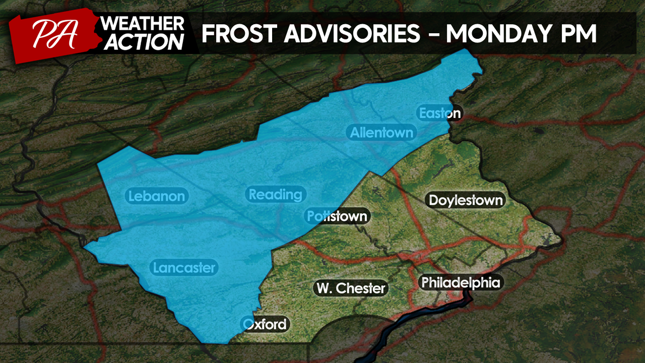
Our cold front, which brought the wet weather, will finally clear the region by Tuesday morning. Temperatures this evening will continue to fall steadily throughout the overnight hours, settling the stage for a chilly night. Temperatures tomorrow morning will range from the mid-30s across Northwestern portions of the region to the low-40s around the Philly metro. For this reason, the National Weather Service has issued frost advisories for Northhampton, Lehigh, Berks, Lebanon, and Lancaster counties within our region.
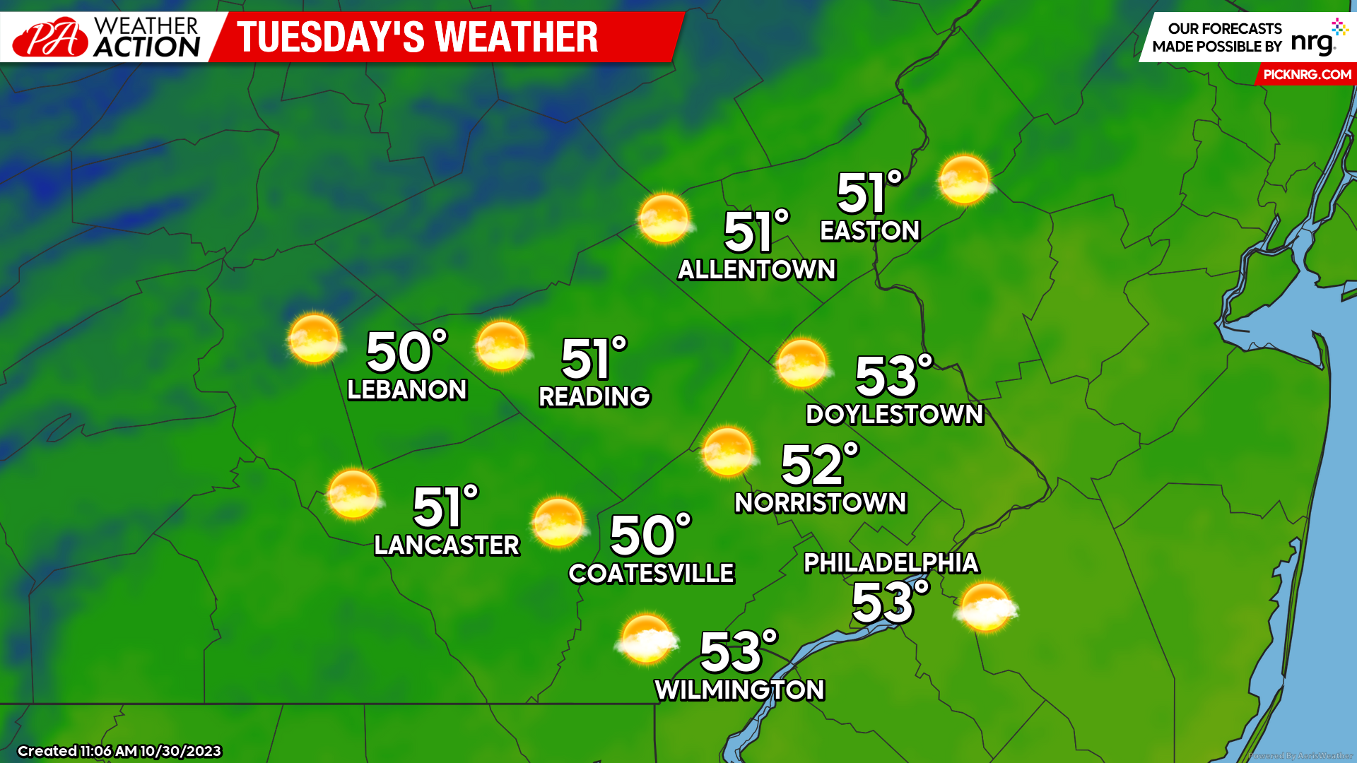
Mostly sunny skies should remain in place throughout the day on Tuesday, setting up for a chilly but clear Halloween afternoon! Highs Tuesday afternoon should top out in the low-50s for most. Winds should remain relatively calm throughout the day.
Wednesday
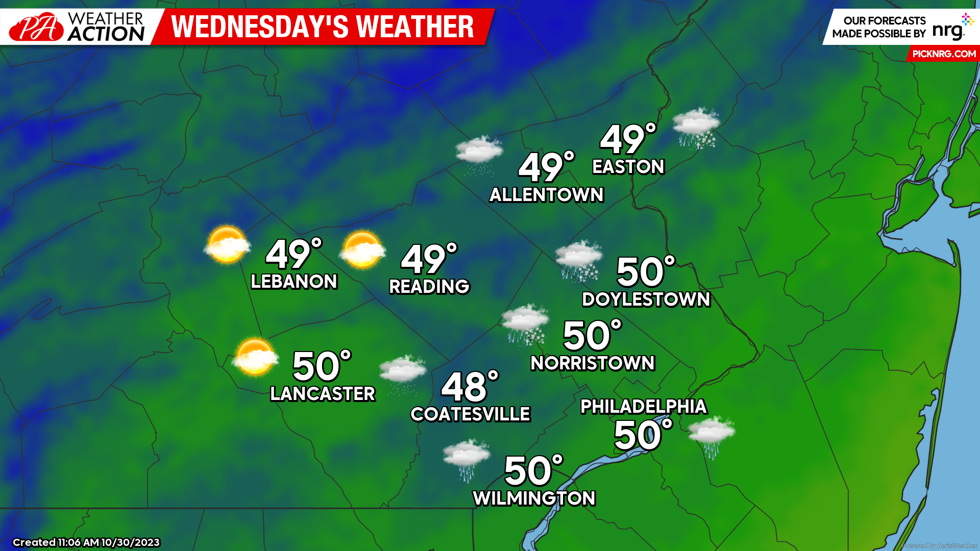
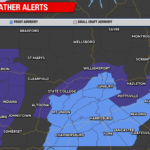
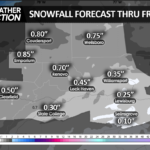
Kicking off November, a quick-hitting upper-level low-pressure system will slide through the region early Wednesday morning. Although most regions will remain dry, a few showers are possible, especially across our northern counties. Temperatures Wednesday morning will be quite chilly as well, starting in the low-upper 30s across the region. Temperatures early in the morning may be cold enough to support snow mixing with rain, especially across higher elevations of Northampton, Lehigh, Berks, and Lebanon counties. No accumulation is expected across our region. Rain and Snow showers should clear the region by mid-morning Wednesday. A mix of sun and clouds will linger throughout the day with blustery conditions. Highs will top out in the upper-40s to near 50, with winds out of the NW at 10-20 mph.
Thursday
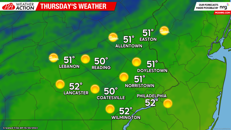
Clearing skies and calming winds Wednesday night will set the stage for the first widespread freeze across the region. Lows Thursday morning will start off quite chill, ranging from the mid-20s to the low 30s. Expect freeze watches and warnings to be issued in the coming days ahead of Thursday morning. Despite the cold, Thursday afternoon should be fairly pleasant, with abundant sunshine and highs reaching the low 50s.
You must be logged in to post a comment.