
Seasonably cool and cloudy to start the week with an improvement in weather conditions expected by midweek. Wednesday and Thursday will be the most favorable, breaking up the cloudy and rainy conditions we have seen over the past few days.
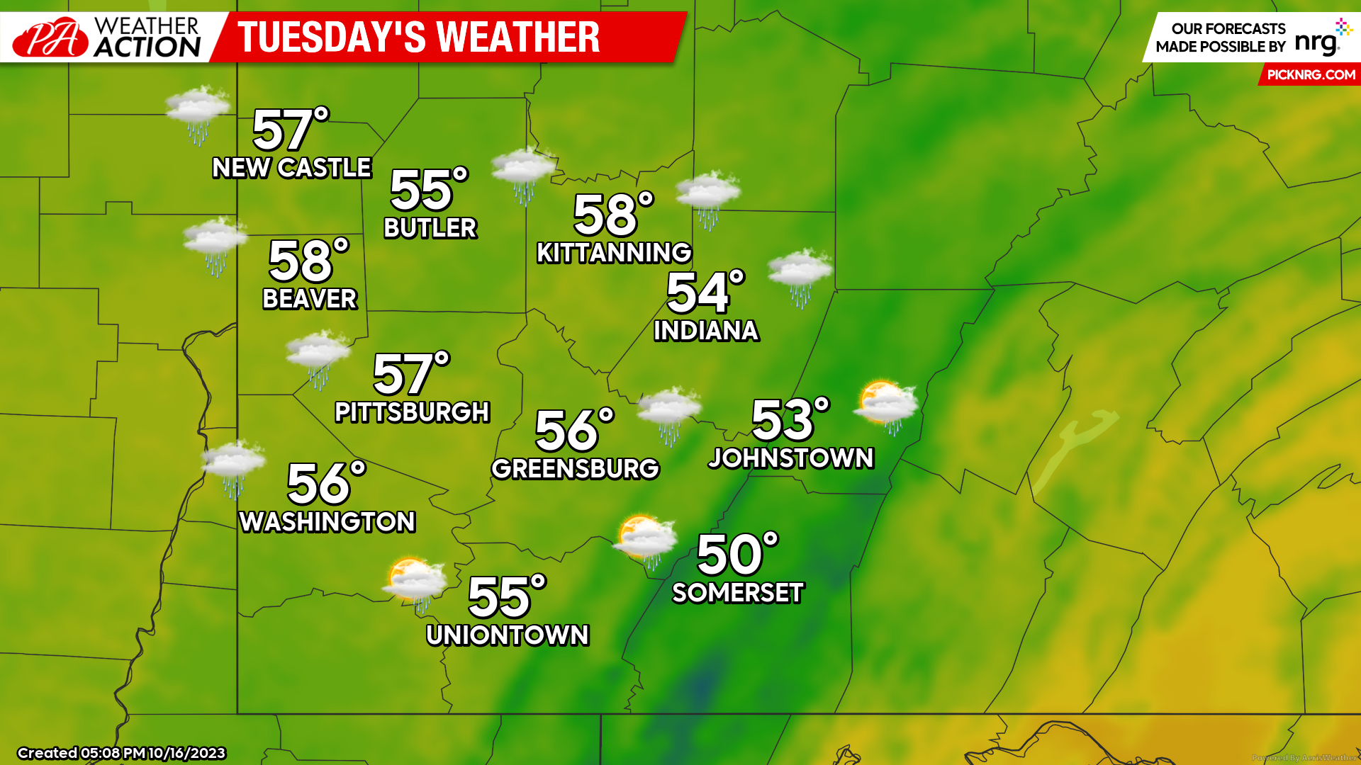
Tuesday
A slight chance of rain will continue for most the region, primarily in the early morning hours of the day. Mostly cloudy conditions will continue to follow. Temperatures will remain cooler with highs in the mid to low 50s. Winds will be out of the Northwest between 5-7 mph. Evening lows will be in the mid 40s. As high pressure moves in overnight it brings with it the potential for clearing skies. Any clearing brings with it the potential for areas of fog and limited visibility Wednesday morning.
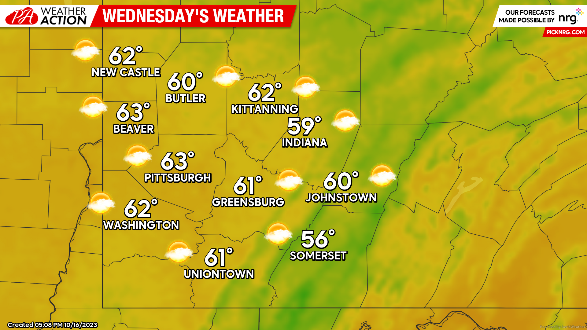
Wednesday
More seasonable temperatures and clearing skies are expected. Most of the region will have Partly Sunny skies with highs in the low 60s. Winds will be out of the South between 4-8 mph. Evening lows will be in the mid to low 40s.
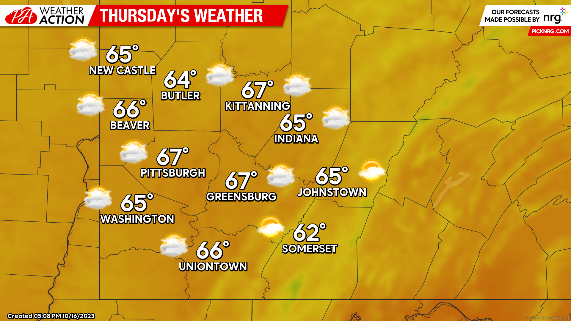
Thursday
Warmer temperatures and partly sunny skies can be expected for most of the daylight hours. Highs temperatures will be in the mid to upper 60s, with some areas approaching 70 degrees. Winds will increase throughout the day, with winds out of the South between 10-15 mph. Increasing clouds will set in during the late afternoon bringing a chance of rain overnight. Low temperatures will be around 50 degrees.
The upcoming period of decent weather looks to be a bit different for the weekend. Be sure you are stay connected and are informed by PA Weather Action.


You must be logged in to post a comment.