
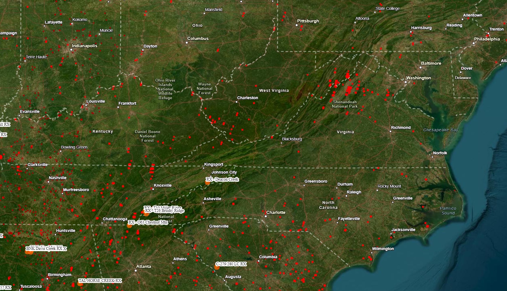
After a most dry, sunny, and windy week, there have actually been an increase in wildfires especially across the Shenandoah Valley of Virginia. The good news is a coastal storm will provide widespread moderate rain which will greatly help efforts to extinguish those fires. This is also good news for ski resorts across Northern New England trying to continue their season several more weeks! Here’s a look at wildfires currently burning in the Central Appalachians.
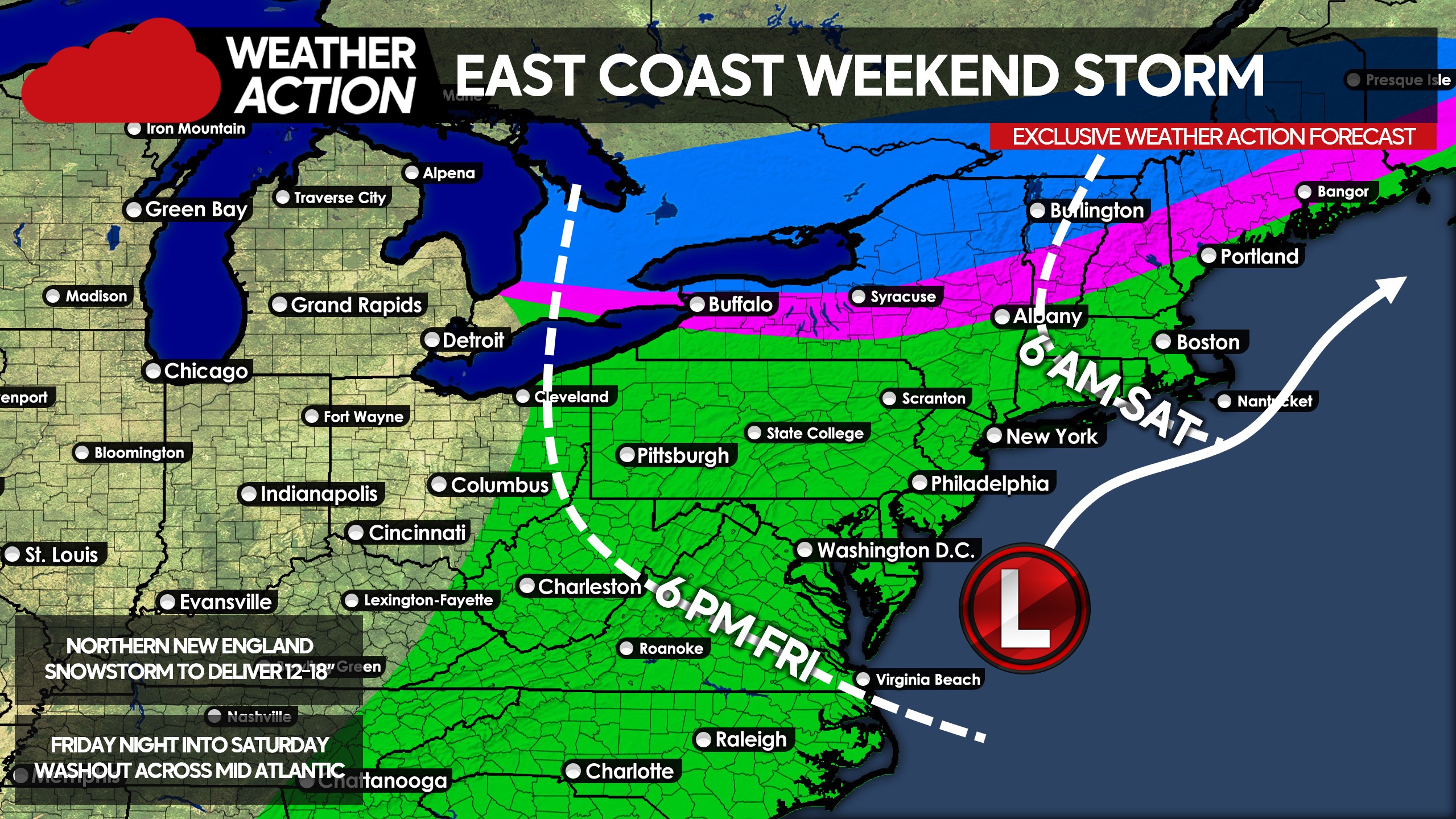
Steady rain will begin in the Carolinas after lunchtime Friday, and will push into Virginia by Friday evening. By the early hours of Saturday morning, rain will make its way north into the Upper Mid Atlantic (PA, NJ, etc), before finally moving into New England by around sunrise Saturday. Snow will begin in Northern New York in the early morning hours of Saturday and quickly move into Northern New England before sunrise. Snow, heavy at times, will continue in Northern New England through late Saturday afternoon.
As the low enters the Gulf of Maine, snow will change to rain from south to north across Maine, mainly south of Bangor and Calais. Rain will wrap up farther south from west to east midday Saturday. Below is approximate timing of precipitation onset, along with precipitation type for the vast majority of the storm.
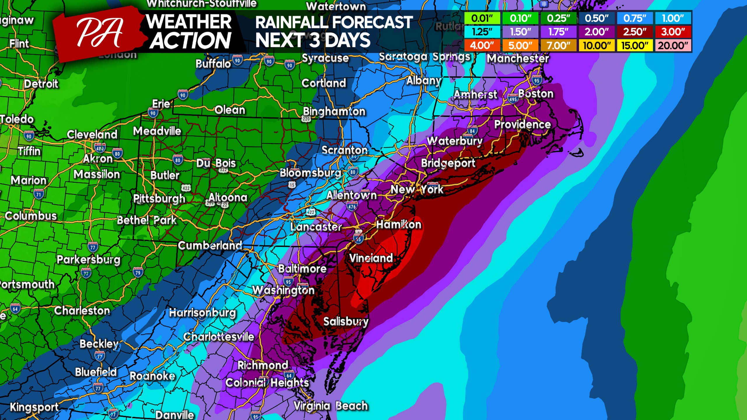
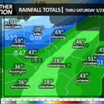
Rainfall amounts will be highest along I-95, where 2 – 3″ of rain will be common. Localized flash flooding is possible mainly in urban areas with poor drainage, but not a significant concern. There is a bit of uncertainty on the western edge, as some models have a sharper cutoff and others have precipitation a bit farther west in general. Regardless, the map below gives you a very good idea on what to expect.
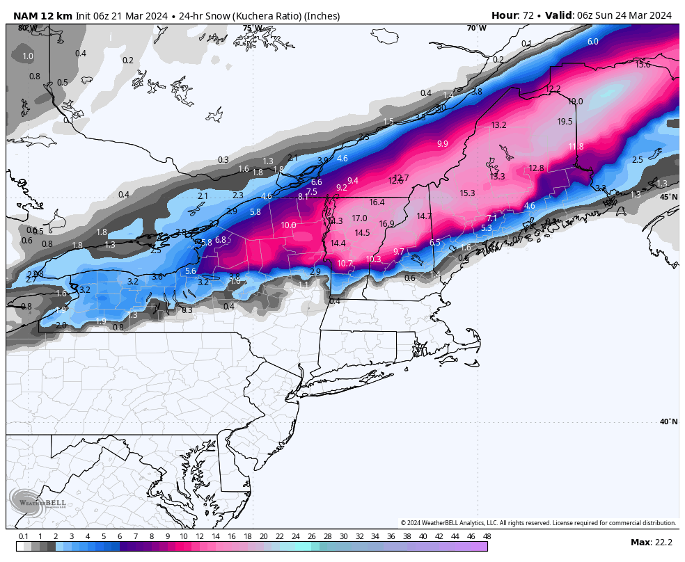
Models are dropping some very impressive snowfall amounts for this storm from the Adirondacks into Northern New England, with widespread snowfall accumulations of 12 – 18″ possible. A few inches of snow are possible along I-90 in New York State, although it’s probable the cutoff for significant snow will be a bit north of there.
Stay tuned for the latest updates on the Weather Action Facebook Page! You can follow us here: https://www.facebook.com/usweatheraction
Don’t forget to share this article with family and friends in the area!

You must be logged in to post a comment.