
The passage of a cold front will bring the chance for rain and decreasing temperatures this weekend.
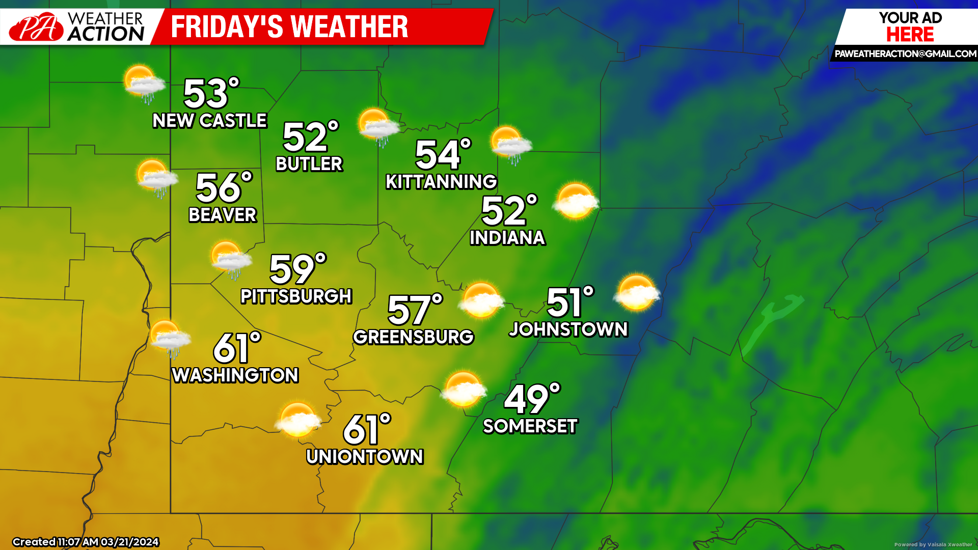
Friday
Mostly sunny conditions with warmer temperatures are expected the majority of the day. Chances for rain showers will begin in the evening and overnight hours. Highs range in the 50s. Winds will be out of the east-southeast at 7 to 15 mph, wind gusts in the higher altitudes could reach 25 mph. Lows will be in the low 40s.
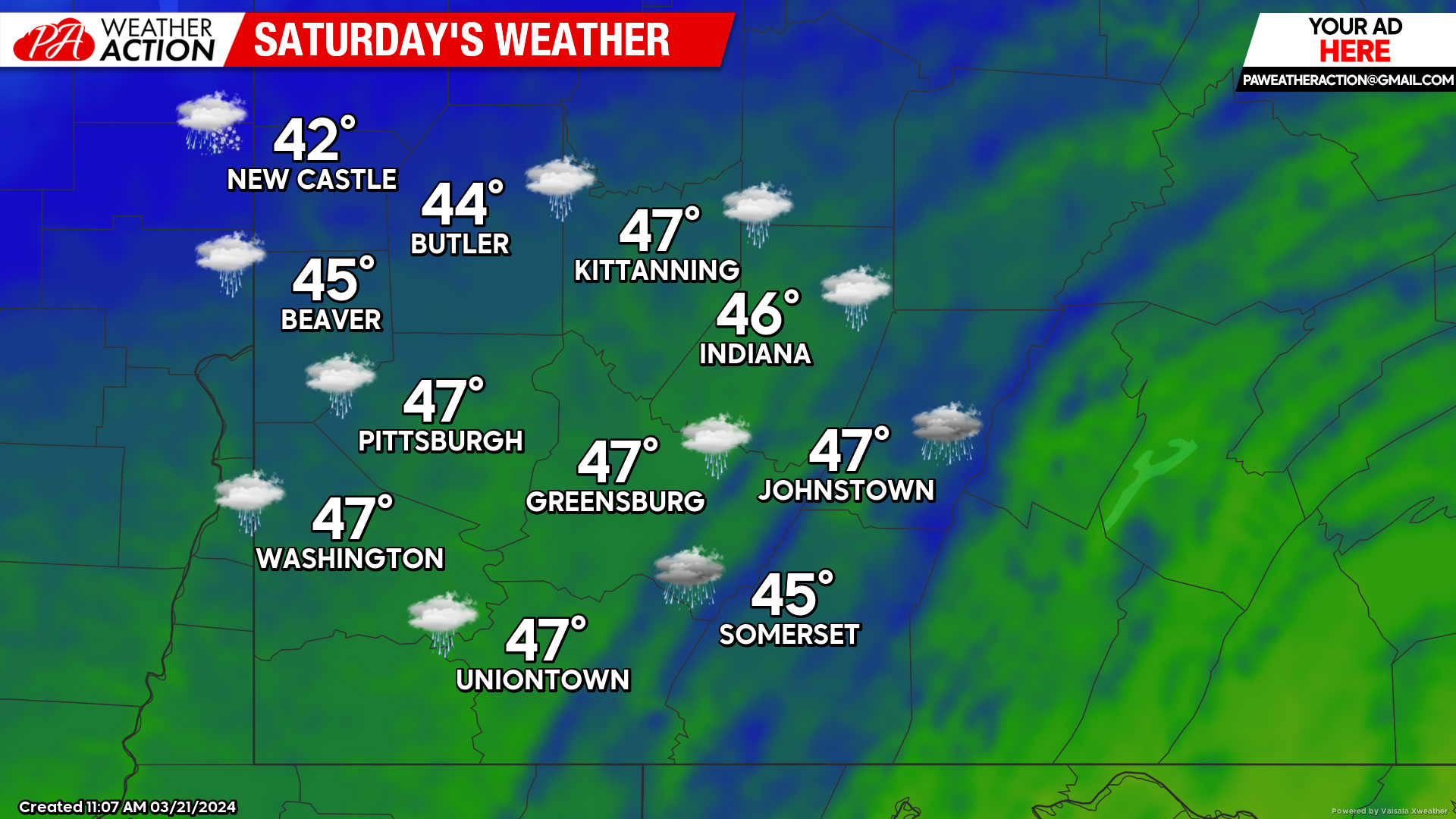
Saturday
Rain is expected throughout the region for the majority of the day. Highs will be in the mid to low 40s. A southerly wind will change direction throughout the day to a northerly wind, speeds will be between 8 to 16 mph, with gusts reaching 25 mph. Lows will be in the mid to low 20s.
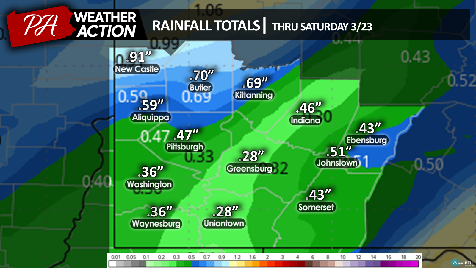
Rainfall totals are expected to be much greater in the northern portions of the region.
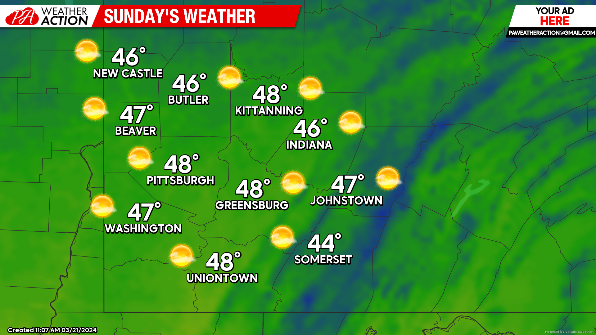
Sunday
Mostly clear, sunny skies return to the region on Sunday. Highs will be in the high to mid 40s. Lows will be in the mid to low 30s.
Be sure to follow PA Weather Action for updated State forecasts, and now follow the new Weather Action account for weather information on a national scale.


You must be logged in to post a comment.