

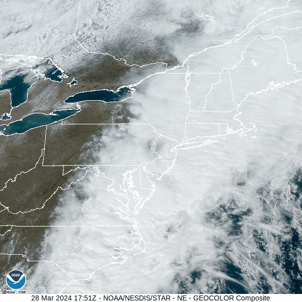
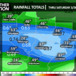
A cold front delivered showers and even a few isolated thunderstorms to our area Wednesday, mainly over the eastern portions where some small hail was reported. Rainfall amounts ranged from about a half inch near the Delaware River to just a trace in Bradford County.
That cold front stalled just east of the Delaware River last night and today. Meanwhile an upper-level trough stretches from the Great Lakes southward over the Mississippi River, channeling waves of clouds and rain northward along that front throughout today. While the rain remained east of our area today, we remained on the dismal side of a half-sunny state.
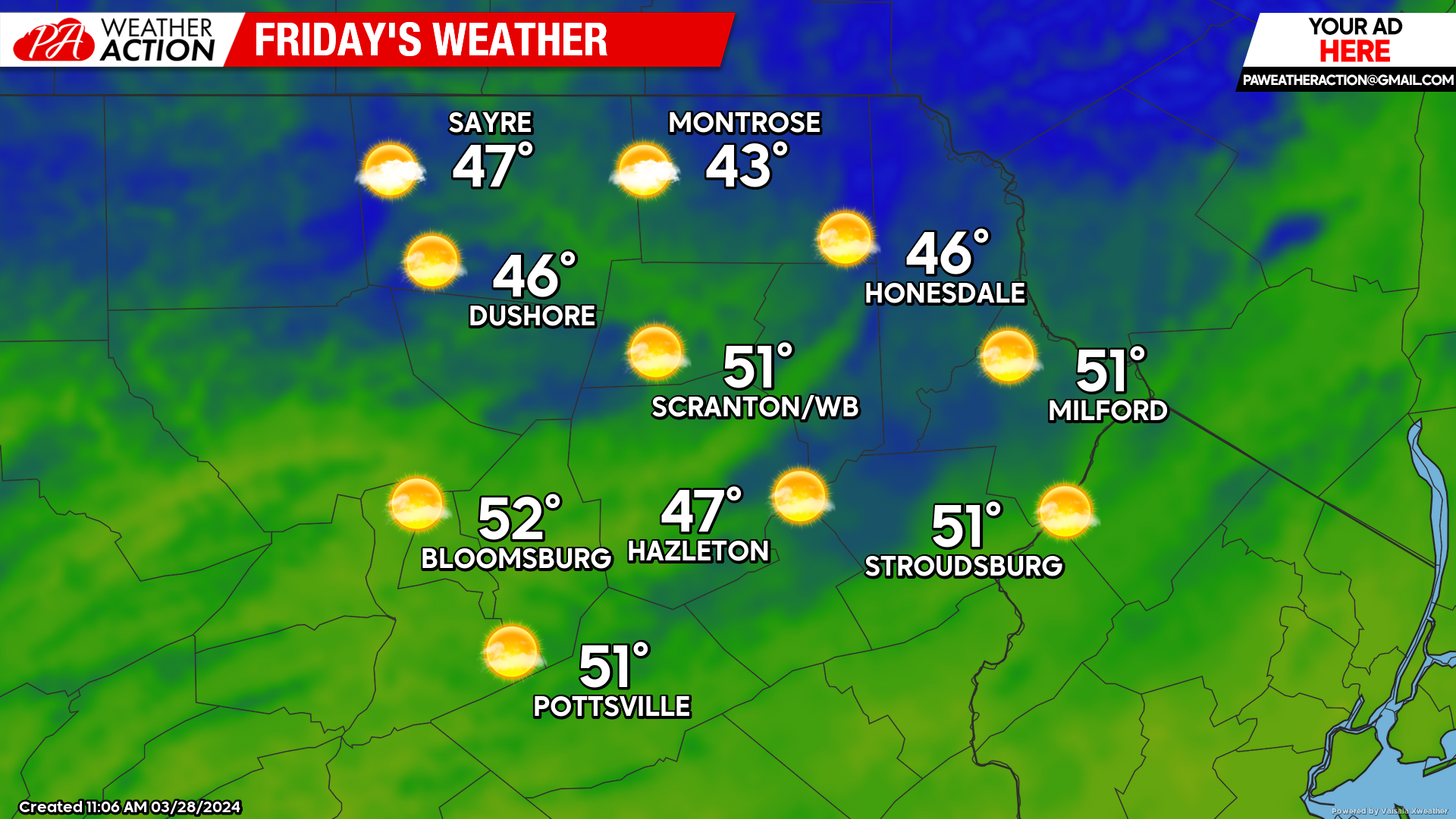
FRIDAY:
The upper-level trough currently to our west will swing through our area tonight, delivering sunnier weather for Friday. That trough will ignite a rapidly-intensifying surface low well to our east which will move northward into the Canadian Maritimes by Friday night, inducing gusty NW wind across our area Friday into Friday night.
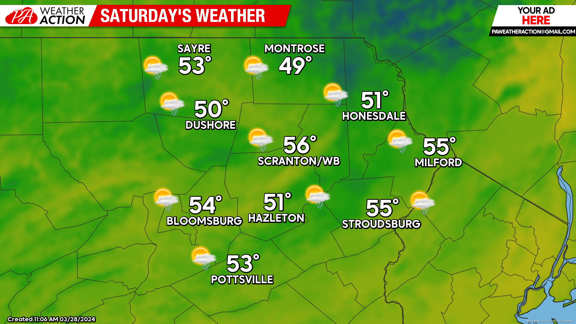
SATURDAY:
Saturday will dawn mostly sunny, but a disturbance will spread clouds and showers across the region during the afternoon. Breezy conditions during the morning will subside somewhat during the afternoon, but will resume Saturday night as that disturbance departs.
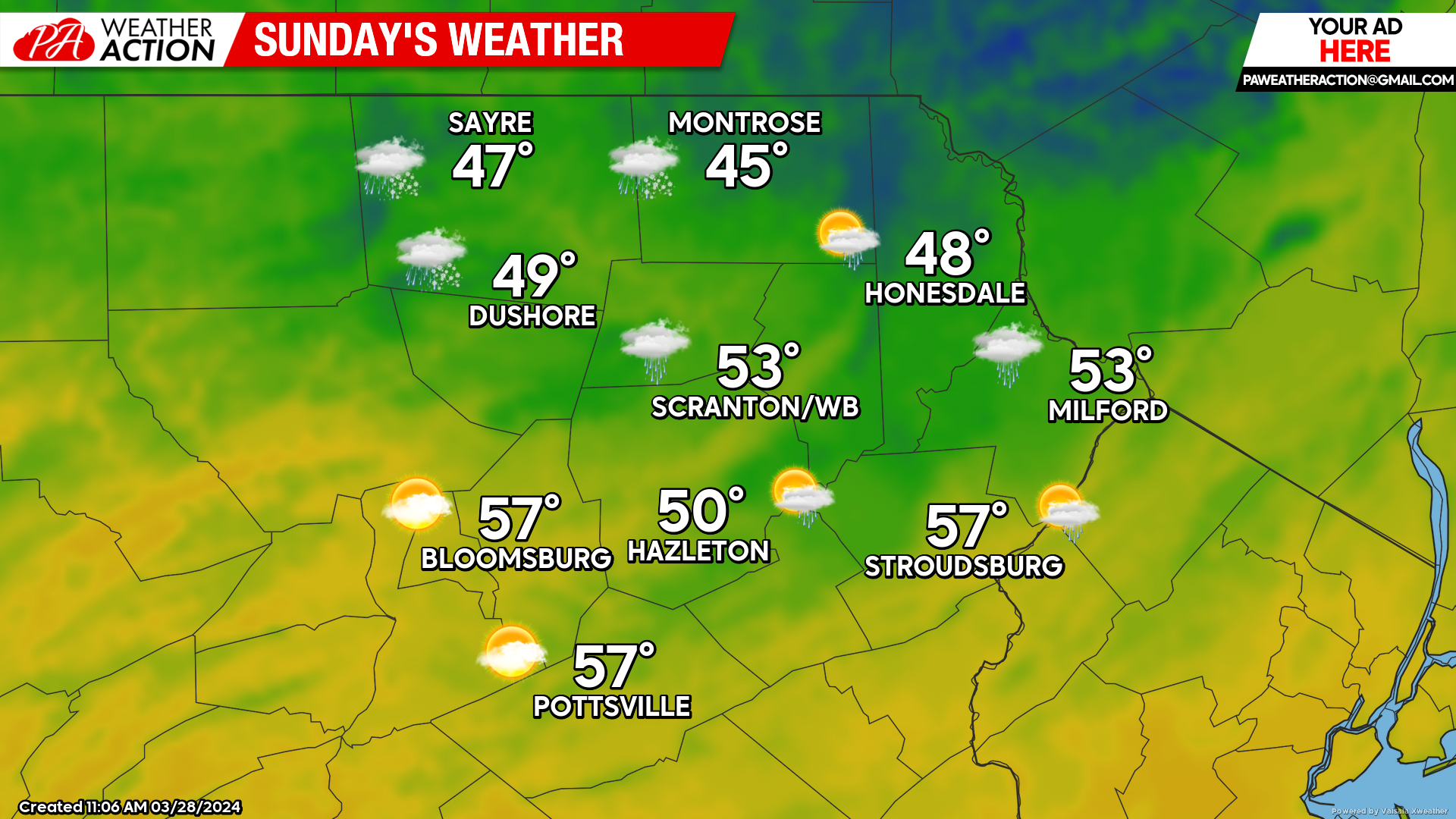
EASTER SUNDAY
Weak high pressure will move into the region, providing partly cloudy skies and breezy conditions, along with slightly above-normal temperatures.
You must be logged in to post a comment.