
After a long lull of activity, we have an active week of weather upcoming with a few inches of rain, severe thunderstorms, and even accumulating snow possible in different parts of Pennsylvania.
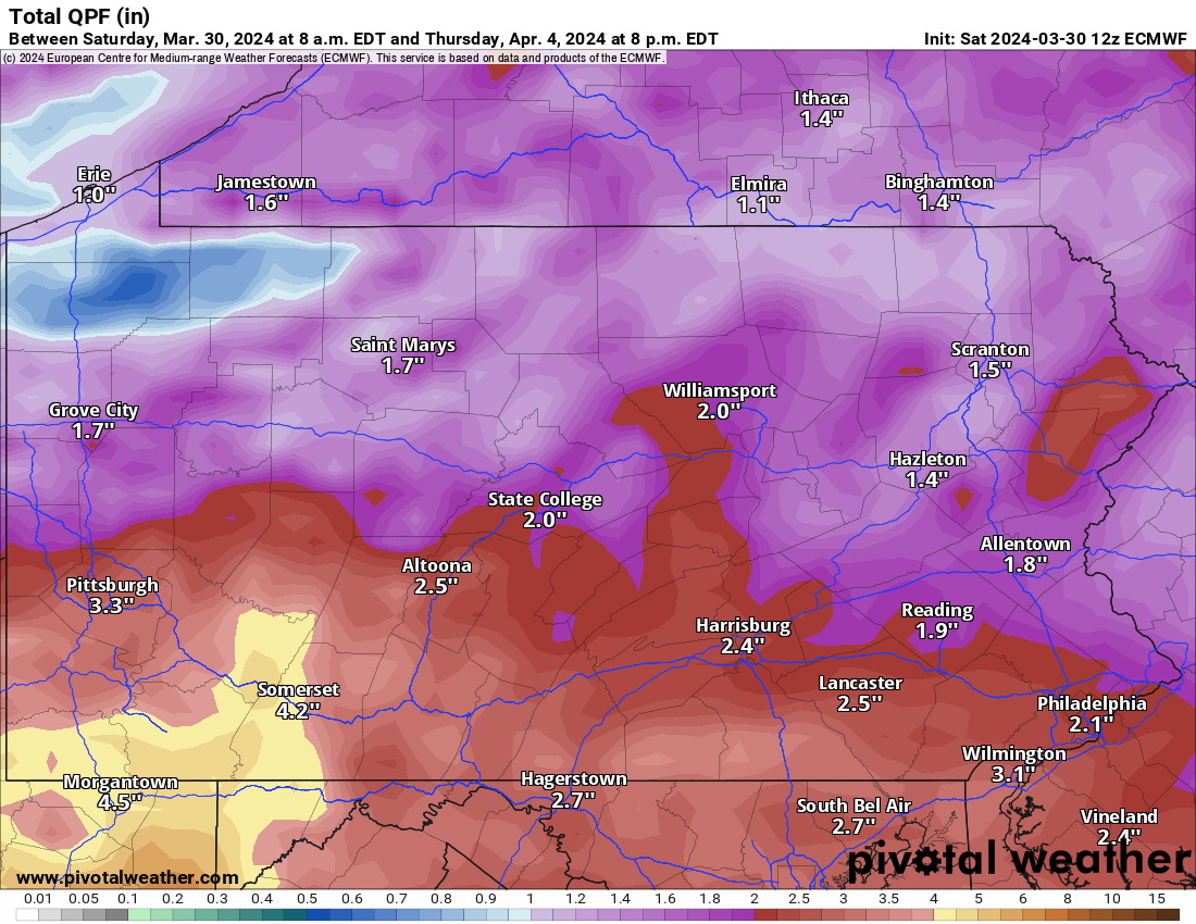
Rain will enter the southern half of Pennsylvania early Monday morning from west to east, falling hardest from the PA Turnpike to the Mason Dixon line.
Another round of soaking rain will move in late Monday evening with the exact same configuration, with heaviest rain across Southern Pennsylvania. This time though, rain will spread throughout the entire state.
Below is the rainfall forecast through Tuesday, showing highest amounts generally in Southern PA.
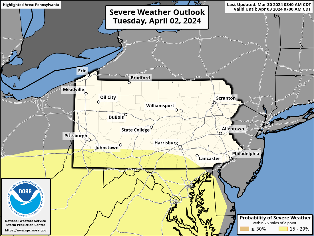
The Storm Prediction Center has outlined Southern PA for severe weather potential on Tuesday afternoon and evening, however models suggest that severe threat will stay south of the state in Virginia.
Here is that SPC Outlook for Tuesday.
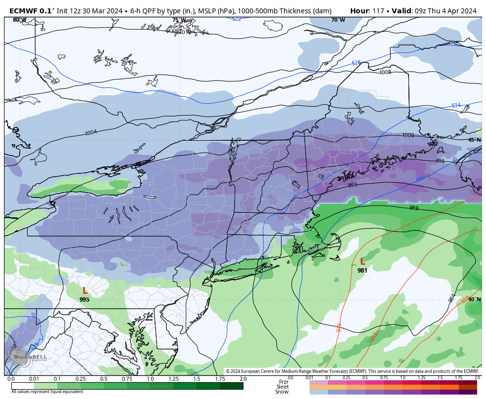
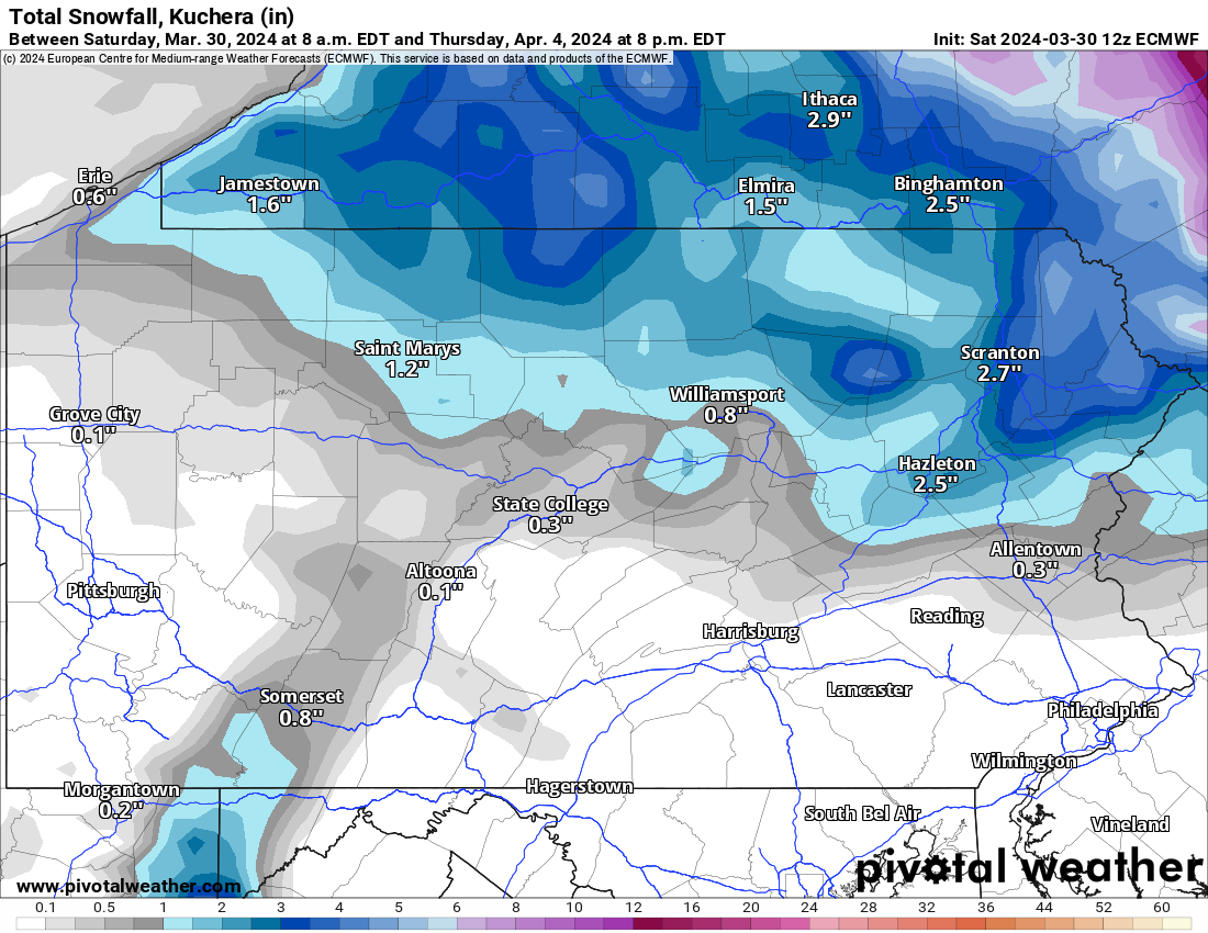
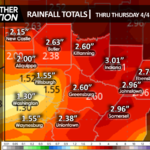
Finally, we are watching a winter storm threat for the end of this coming week, April 3-4. However just as the last major storm a week ago, the major snow threat looks to stay farther northeast. Of course there’s still a lot of time.
Any snow that falls in Pennsylvania with this will likely be on the backside and in the Poconos and Endless Mountains, and perhaps some lake effect in typical lake effect zones behind the storm.
Below is the Euro model for that storm for April 3-4, albeit we are still a ways out.
A lot on our plate this week, so be sure to share this forecast with family and friends! No matter where you are, you’ll experience sizable impacts from the weather this coming week!

You must be logged in to post a comment.