
We know, severe thunderstorms are starting to get old and it’s only May! Much of the state is once again under an enhanced risk Tuesday, and areas of southern PA that don’t get hit Tuesday will likely see storms Wednesday.
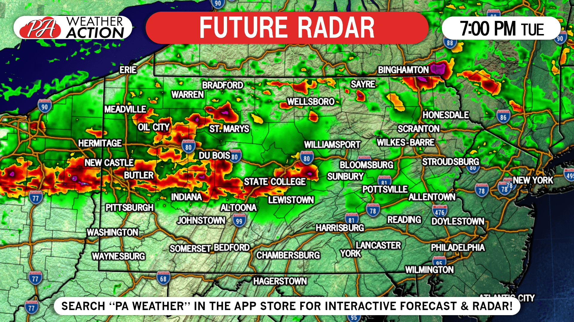
Tomorrow’s setup is very similar to last Thursday’s. A batch of moderate rain will move through tomorrow morning, but should exit early enough to allow the atmosphere to destabilize. Storms will then develop near I-80 in the late afternoon before moving southeast.
TIMING FORECAST
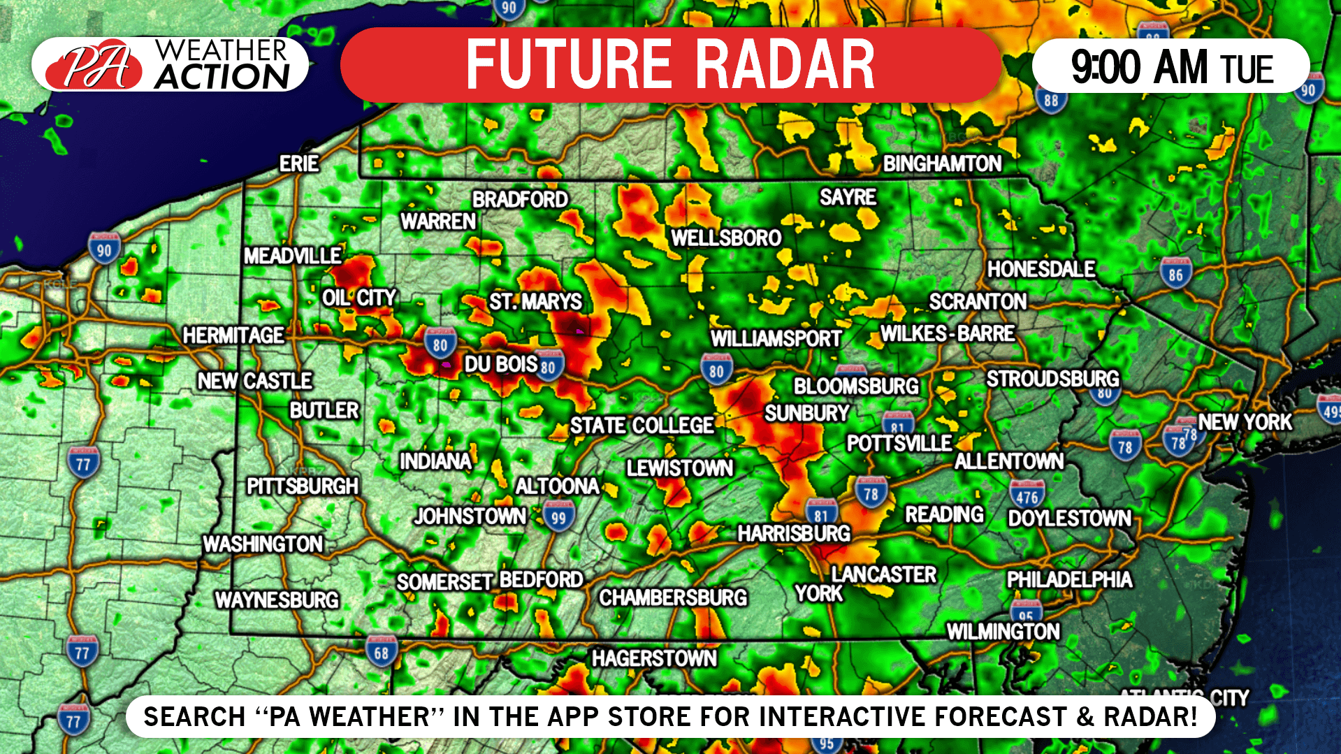
9:00 AM Tuesday: Locally heavy rain with embedded thunderstorms will weaken as the morning goes on. Skies will then partially clear in the afternoon.
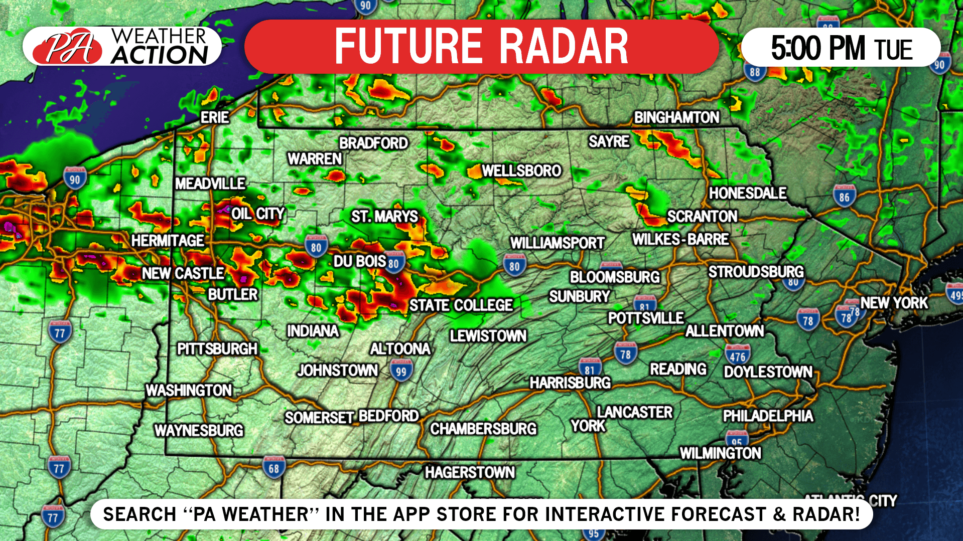
5:00 PM Tuesday: Strong to severe storms will develop in the area of I-80 in the late afternoon. Some storms may contain hail and winds of 50 – 65 MPH.
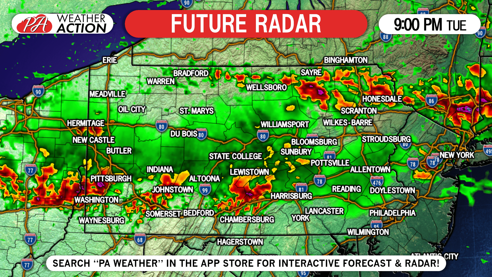
9:00 PM Tuesday: The line will head southeast before running out of steam around the PA Turnpike just after sunset.
SPC SEVERE THUNDERSTORM OUTLOOK
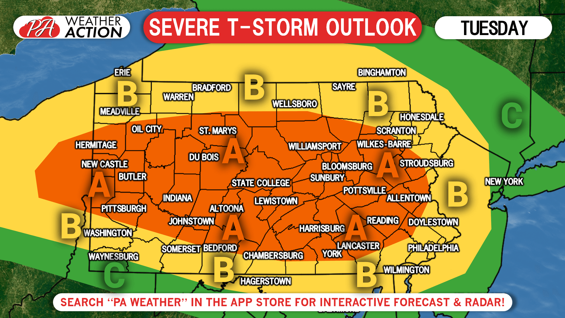
Area A: Damaging winds and large hail are the main threats, with a few tornadoes also possible. Short range models keep most of the severe activity west of the Susquehanna River. Either way, monitor the radar tomorrow if you are anywhere within this area.
Area B: Northeast PA has the highest chance to see severe storms out of anywhere within this region. Southern PA is likely to see the leftovers of the line in the late evening. Damaging winds are the main threat, with hail possible in Northeast PA.
Area C: This region will most likely not see anything from this threat.
If you’re a fan of severe storms in southern PA, Wednesday may be your day.
We will have live radar on our facebook page tomorrow evening. You can also track interactive radar and alerts for your area with our app, just click the banner below to download it in your phone’s app store! Stay safe!
You must be logged in to post a comment.