
The weekend’s arctic blast culminated this morning with widespread temperatures in the single digits.
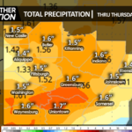
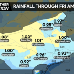
A parade of disturbances will maintain unsettled conditions and nearly constant opportunity for precipitation into early next week, starting with a period of freezing rain and snow tomorrow, changing into soaking rain the rest of the week, and possibly ending as wintry precipitation Sunday or Monday.
TUESDAY
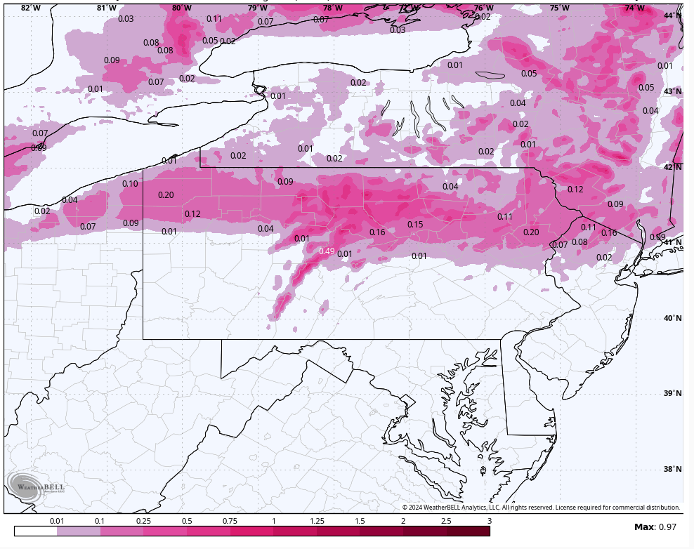
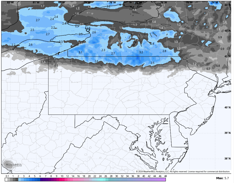
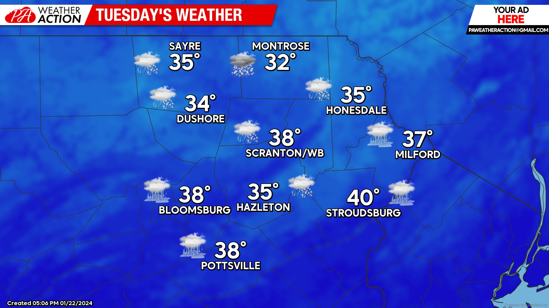
Mixed precipitation will arrive during the morning, mainly north of I-80. Precipitation could be mostly snow by the PA-NY border. There could be a brief lull in the precipitation later in the afternoon, but another round of mixed precipitation will arrive after sunset. 1-3″ snow could accumulate for the northern counties. Further south there will be less snow, but over than a tenth of ice accretion is possible in the Poconos. Temperatures will remain steady overnight Tuesday night.
Possible freezing rain Tue-Wed:
Possible snowfall Tue-Wed:
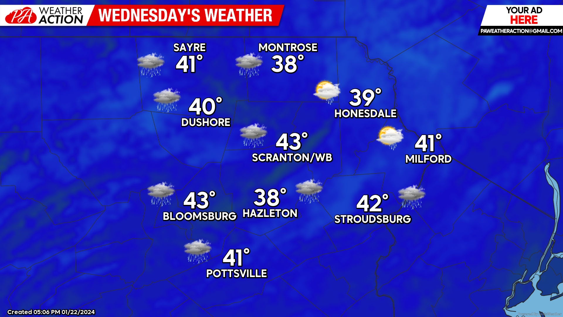
WEDNESDAY
There could be some residual mixed precipitation during the morning, but yet another round of soaking precipitation will arrive during the afternoon. This batch of precipitation should be mostly rain for all but the highest elevations, where there is the slight chance that it will be marginally cold enough for some additional light icing. Temperatures will continue to slowly rise overnight Wednesday night.
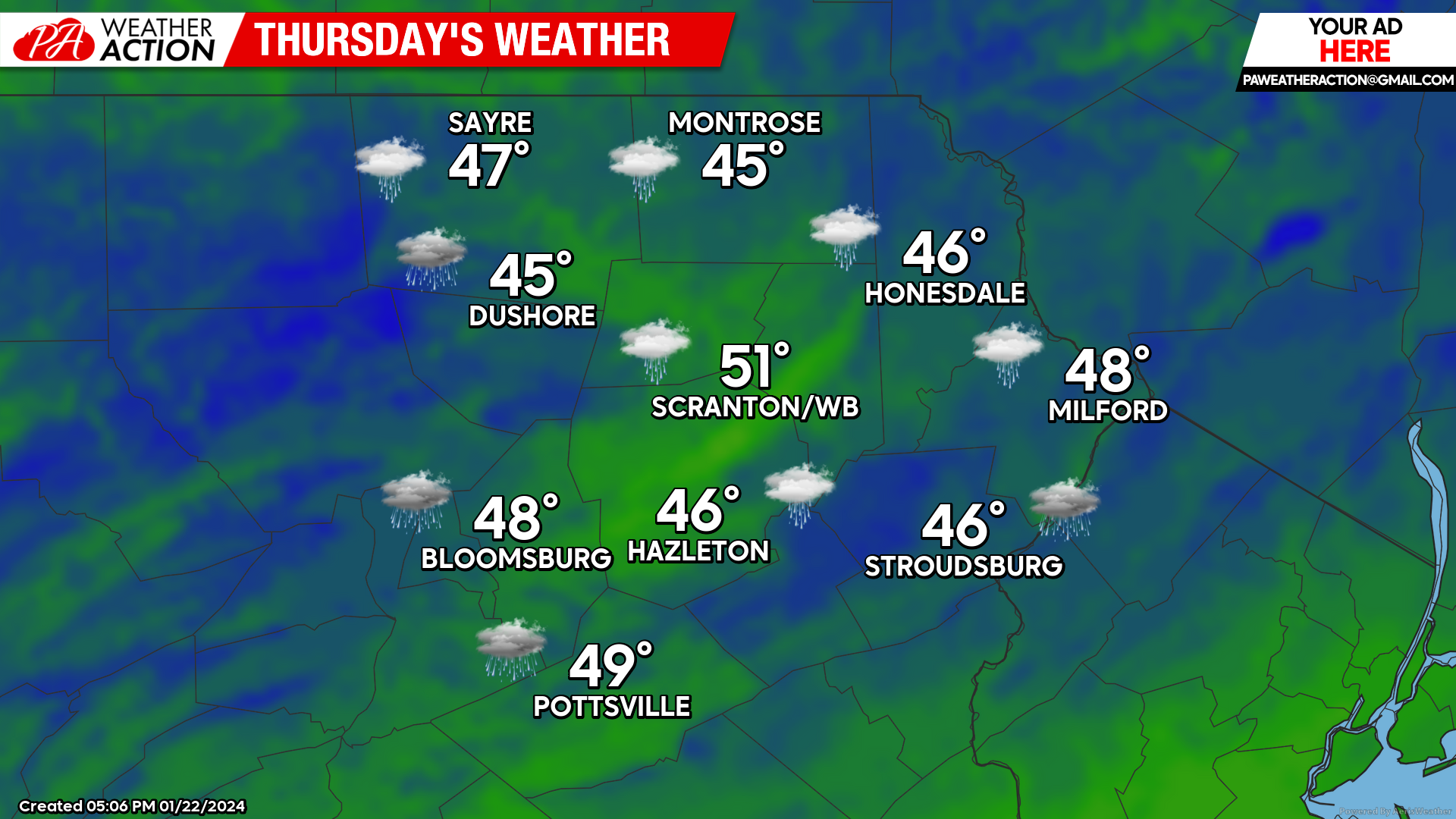
THURSDAY
Additional rain showers will stream eastward across the region, but only light amounts are anticipated, with much-above-normal temperatures.
BEYOND THURSDAY
Yet another disturbance will prolong the warm rain through Friday night. There could be a break between systems to allow for a dry Saturday, but another storm could impact our area Sunday into Monday. There are hints that just enough cold air could bleed southward to provide wintry precipitation with that event. Keep those fingers crossed!
You must be logged in to post a comment.