
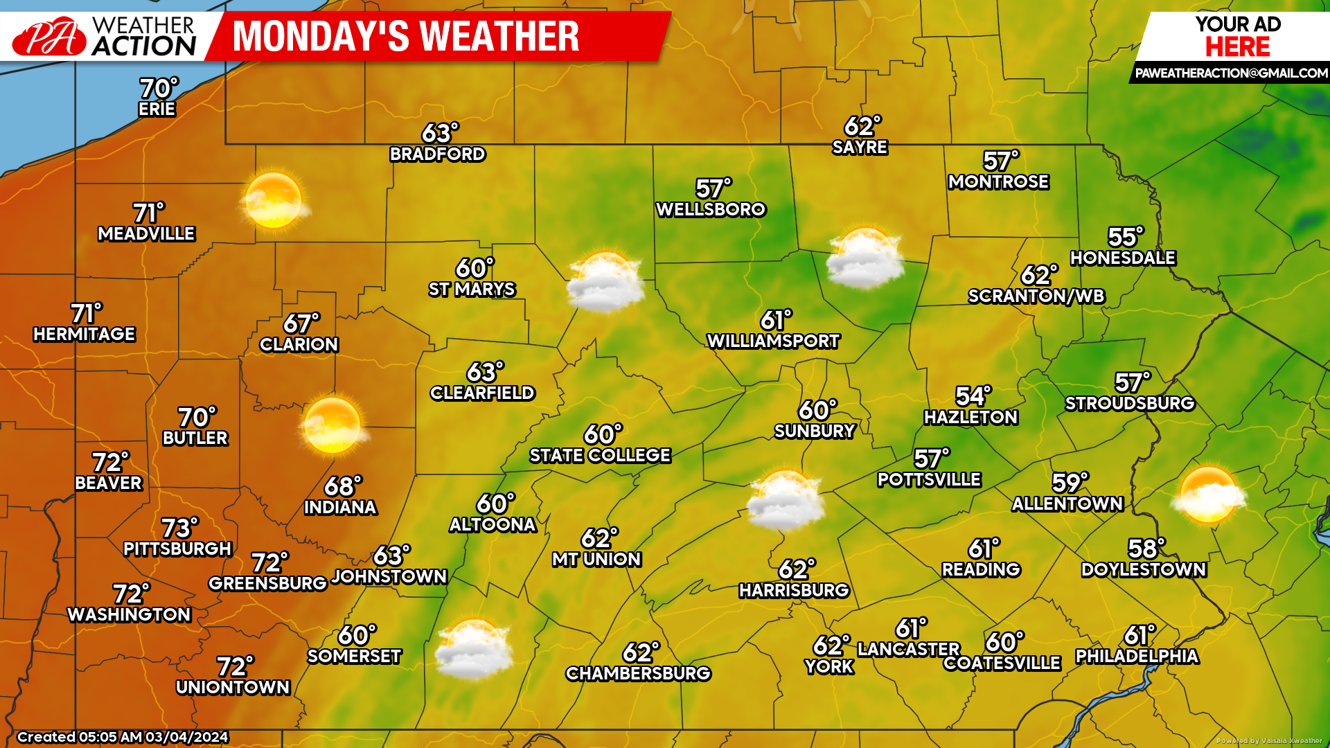
With how the last several years have gone, temperatures in the 60s and 70s in early March aren’t as shocking as they once were, though nonetheless they are 20-30 degrees above average. Many people approved of Sunday’s beautiful weather, and the good news is that we’ll do it again today! The extreme warmth will be along the I-79 corridor, where highs will reach the 70s. Safe to say there’s no ice on Lake Erie anymore, even though there hardly ever was this winter.
Tuesday will be on the rainy side in the eastern half of Pennsylvania as a mini tropical-like system will move directly north across the region. Rain will begin by the early morning hours of Tuesday, continuing off-and-on for several hours. Rain will be most persistent across Southeast PA, where highest rainfall totals are likely. Below is the Hi-Res NAM future simulated radar for Tuesday into Wednesday.
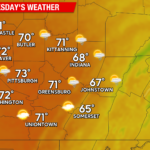
Here is the statewide forecast map for Tuesday. Again, warmest temperatures will be in Western PA, this time due to the dry conditions.
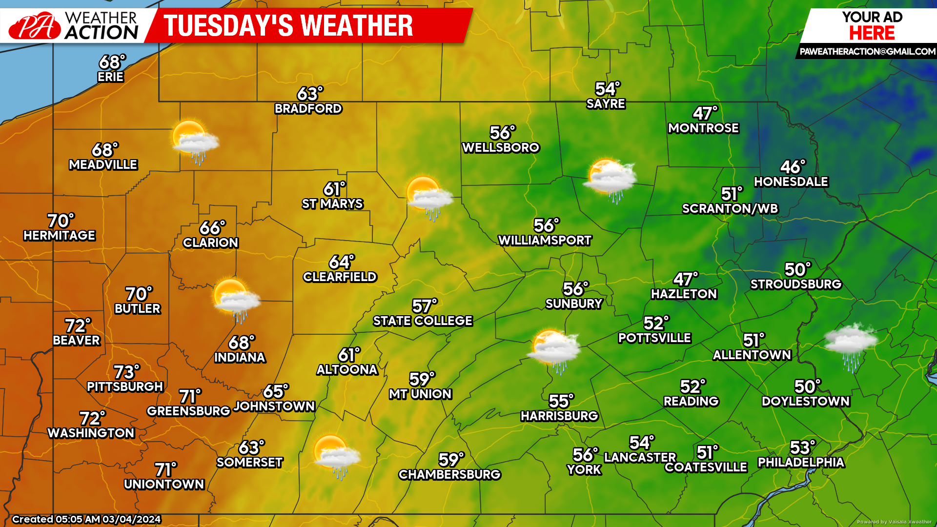
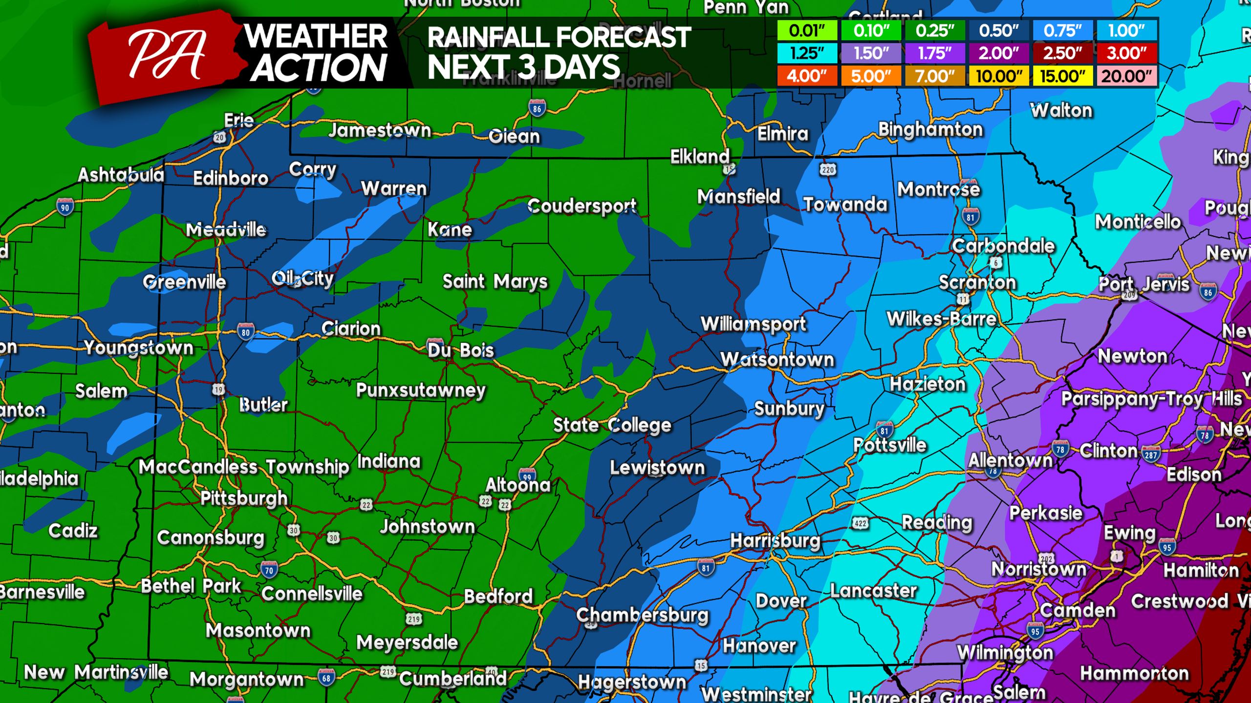
Remarkable warmth will continue across the western half of the state Tuesday, before things begin to “cool” down Wednesday. Models have yet to really nail down Wednesday’s rain prospects, but there is a chance of rain for much of Wednesday across the state. Below is the rainfall forecast through Wednesday night.
You can view regional forecast maps for Wednesday and Thursday here.
Thank you reading and try to take advantage of the warm weather while it lasts! Have a great Monday!

You must be logged in to post a comment.