
Severe thunderstorm season is nearing its peak in Pennsylvania, and another significant threat of severe weather exists Saturday. This time the threat will be a bit farther northwest than Wednesday, centered in Northwest PA. Still, others areas of the state may see impacts sometime Saturday afternoon through early Sunday morning.
The severe threat will shift southeast on Sunday, but we are still determining what areas of southern and eastern PA may be in line for those storms. Let’s get into the details for Saturday!
SATURDAY THUNDERSTORM TIMING
Thunderstorms will fire up throughout the western half of Pennsylvania late Saturday afternoon, with greatest coverage across Northwest PA. Don’t be surprised to see a few tornado warnings already by this time, as some stronger supercells will be rotating. Below is HRRR Model future radar for 4:00 PM Saturday.
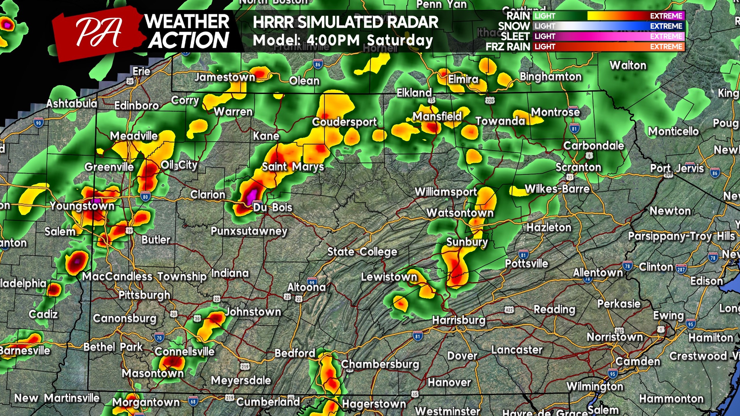
There is some disagreement among the models regarding timing and placement of these storms. The HRRR is a good middle ground. By dinnertime, scattered strong to severe thunderstorms will be pushing through the Pittsburgh Metro and Southwest PA, as well as North Central PA.
The greatest tornado potential will be across Northern PA, but with Southwest PA being on a hot streak for tornadoes, we certainly won’t rule out a couple on Saturday. Below is future radar for 6:00 PM Saturday.
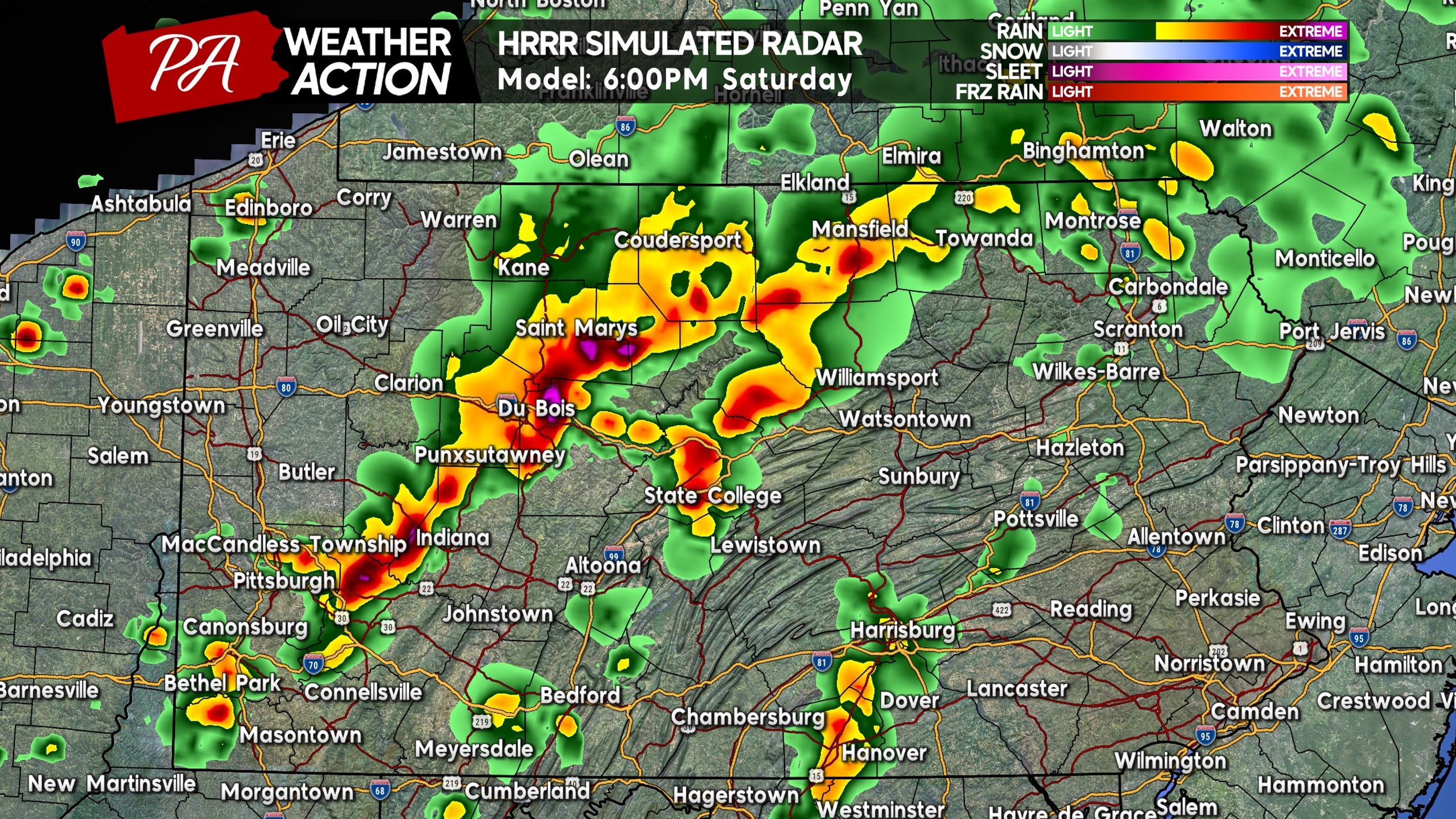
As we head into Saturday evening, a more congealed line of storms may develop as they push east into Central PA. The tornado threat will be lessened as a result, and will be lower across Central PA especially south of I-80.
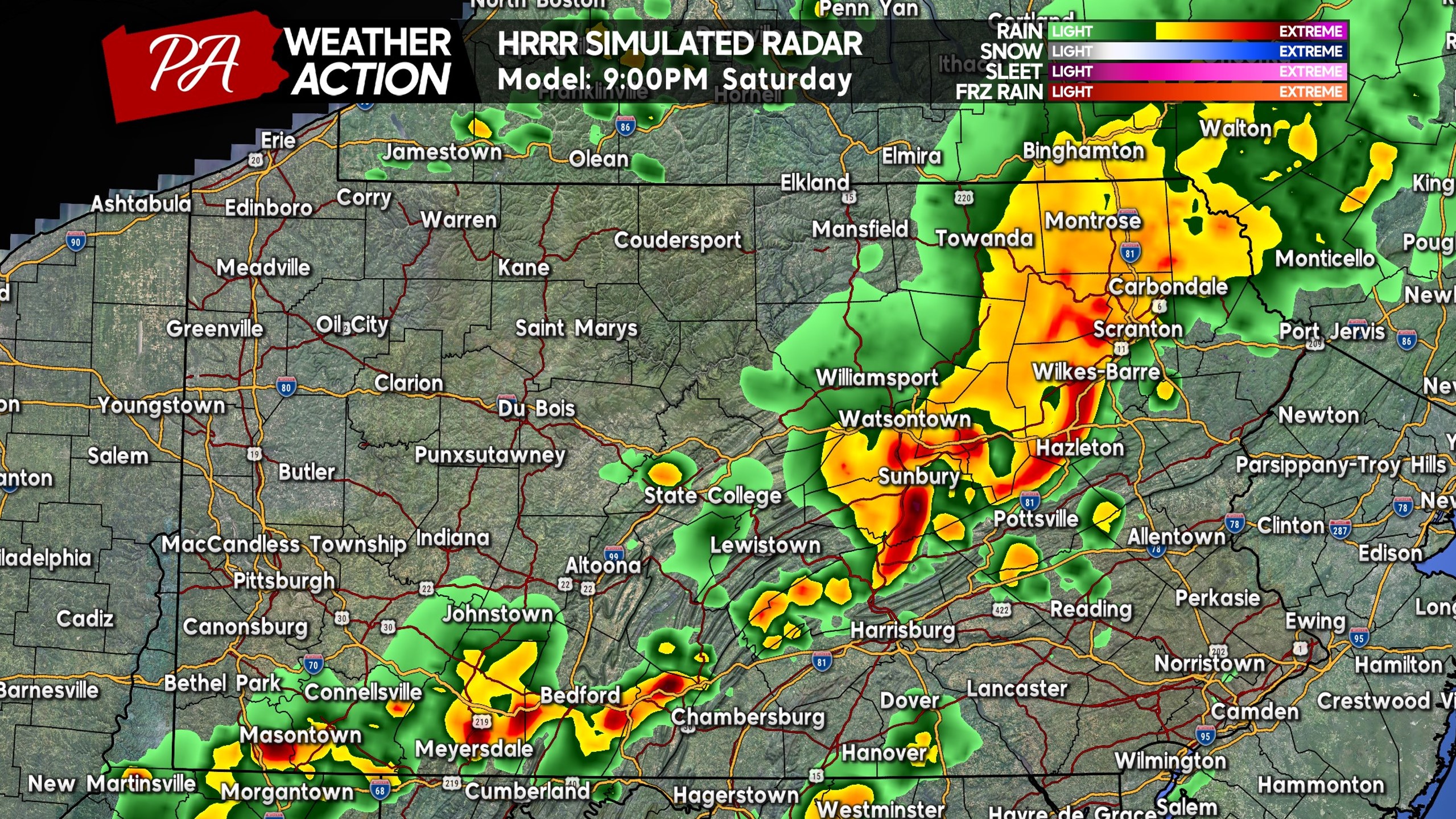
By 8-9 PM, we expect these thunderstorms to push through the Allegheny Mountains, Central Susquehanna Valley, and Endless Mountains of NE PA. Below is future radar for 9:00 PM Saturday.
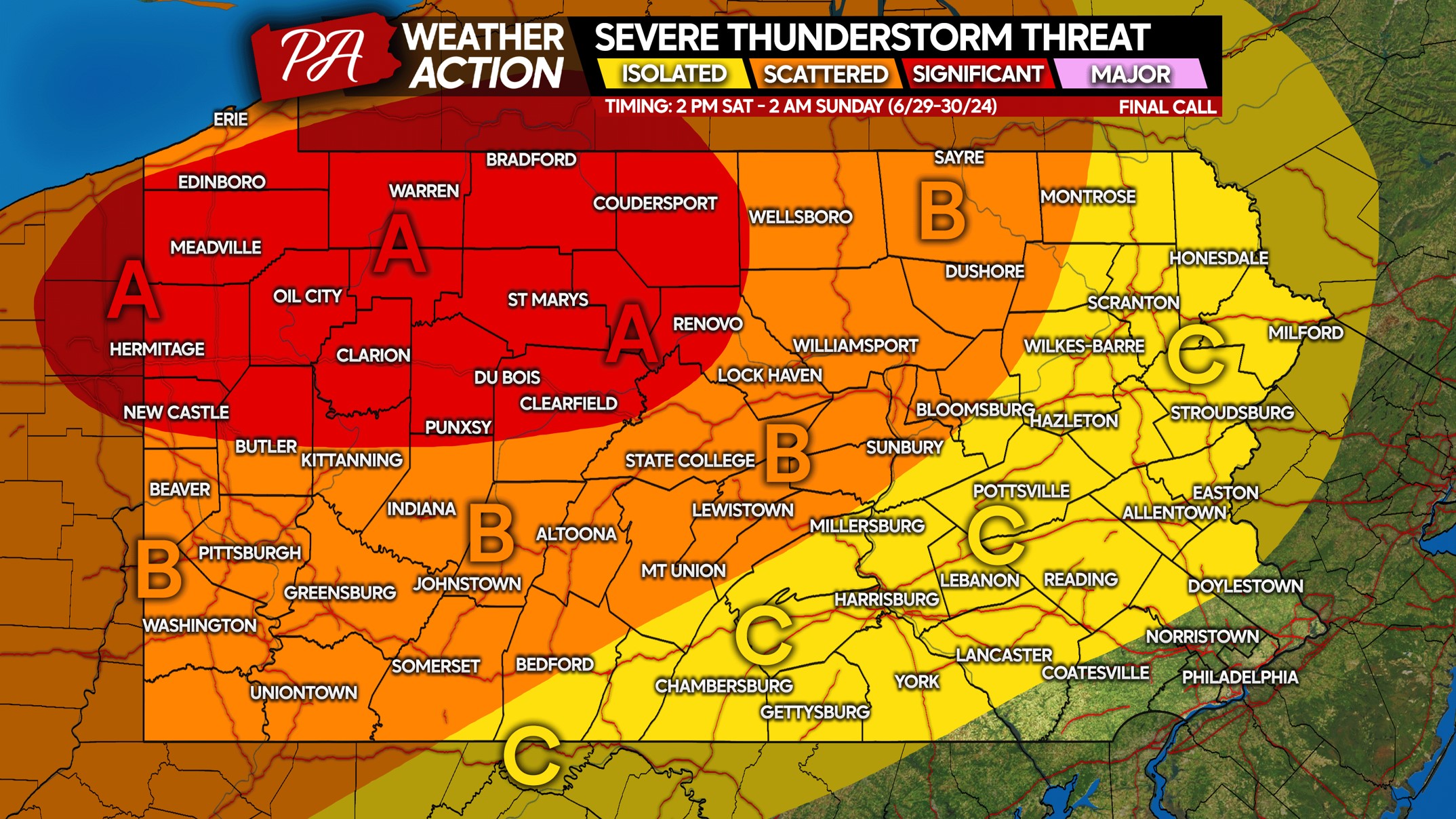
SATURDAY 6/29 SEVERE THUNDERSTORM RISK MAP
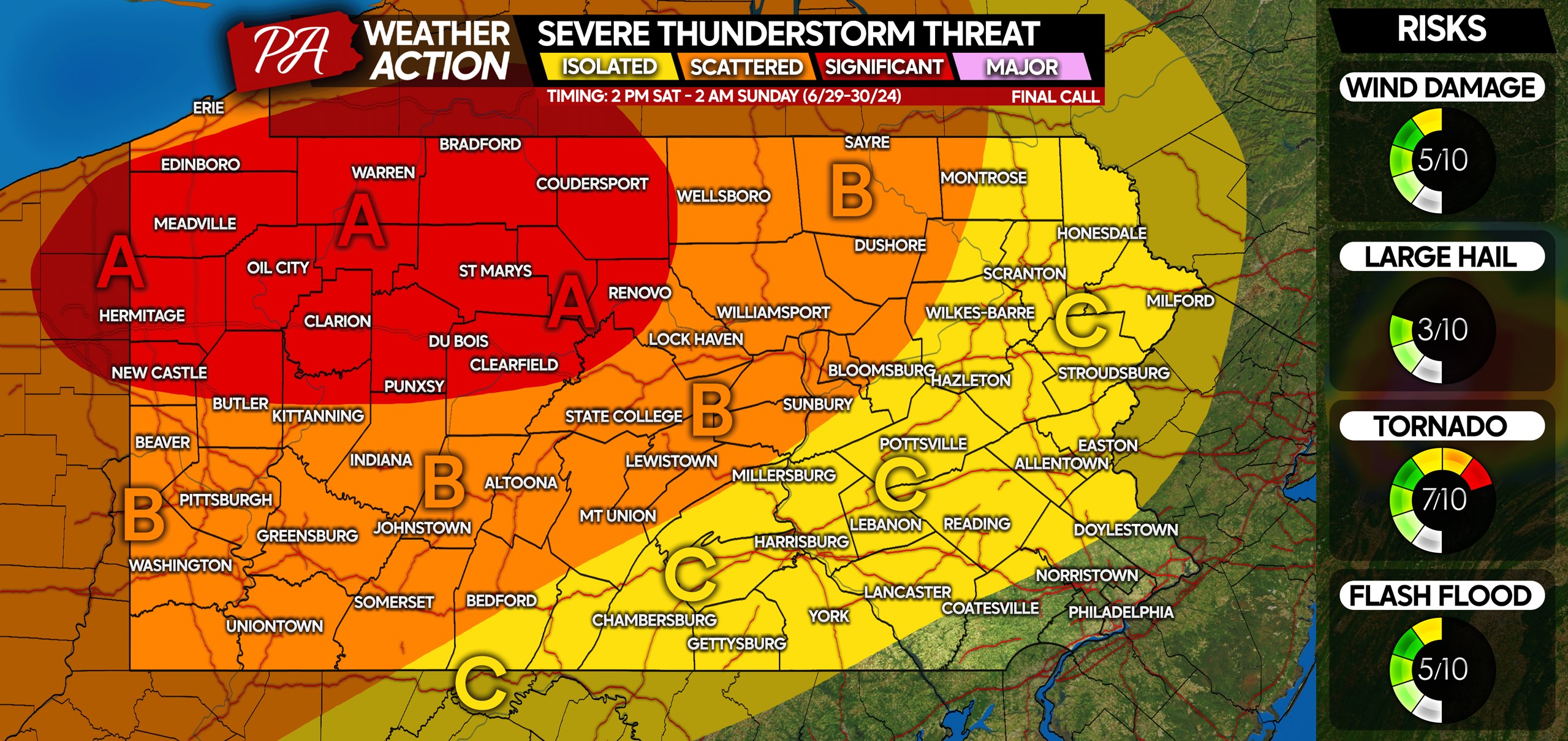
Area A: Scattered significant severe thunderstorms likely. Damaging tornadoes and straight line wind gusts possible Saturday afternoon and early evening.
Area B: Scattered strong to severe thunderstorms likely. An isolated tornado or two possible, along with damaging wind gusts up to 60 MPH. View timing above.
Area C: Isolated strong to severe thunderstorms possible. Gusty to damaging wind gusts are the main concern, with gusts of 40-60 MPH in strongest storms.
Many people have outdoor plans Saturday afternoon and evening! Share this article to warn friends and family of this threat.
Finally, if you don’t already follow us over on Facebook, be sure to tap below to do so. Stay safe!
You must be logged in to post a comment.