
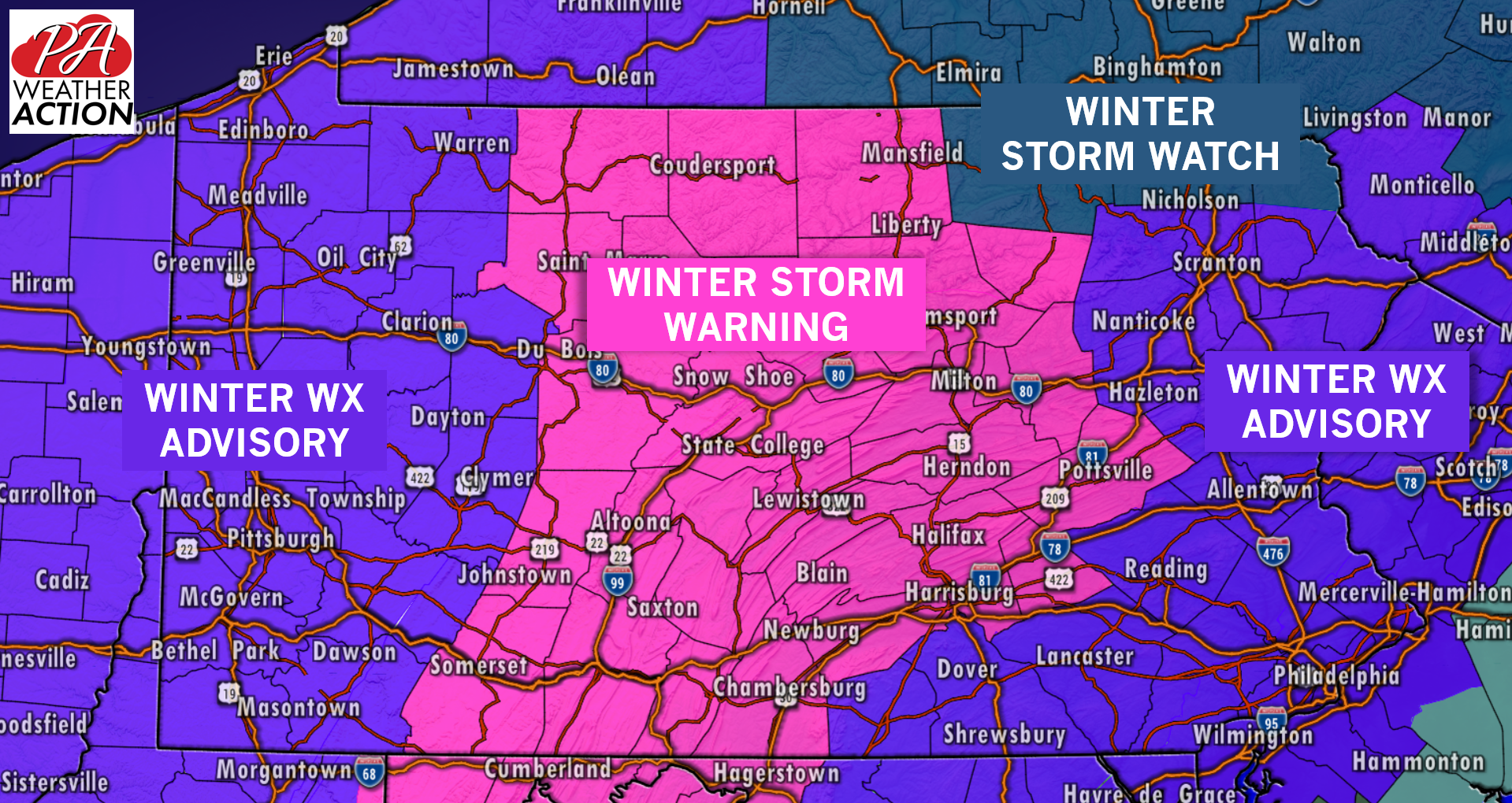
A rare mid-November winter storm is less than 18 hours away from impacting our state. Since the release of our first call last night, observations and model data continue to hold strong for a wintry mix across the state with some areas holding onto snow longer than others. Because of this, the National Weather Service has issued Winter Storm Warnings and Watches, as well as Winter Weather Advisories for just about every county. We do not recommend traveling anywhere in the state tomorrow, especially across Central Pennsylvania. If you absolutely have to travel, please take your time traveling to your destination.
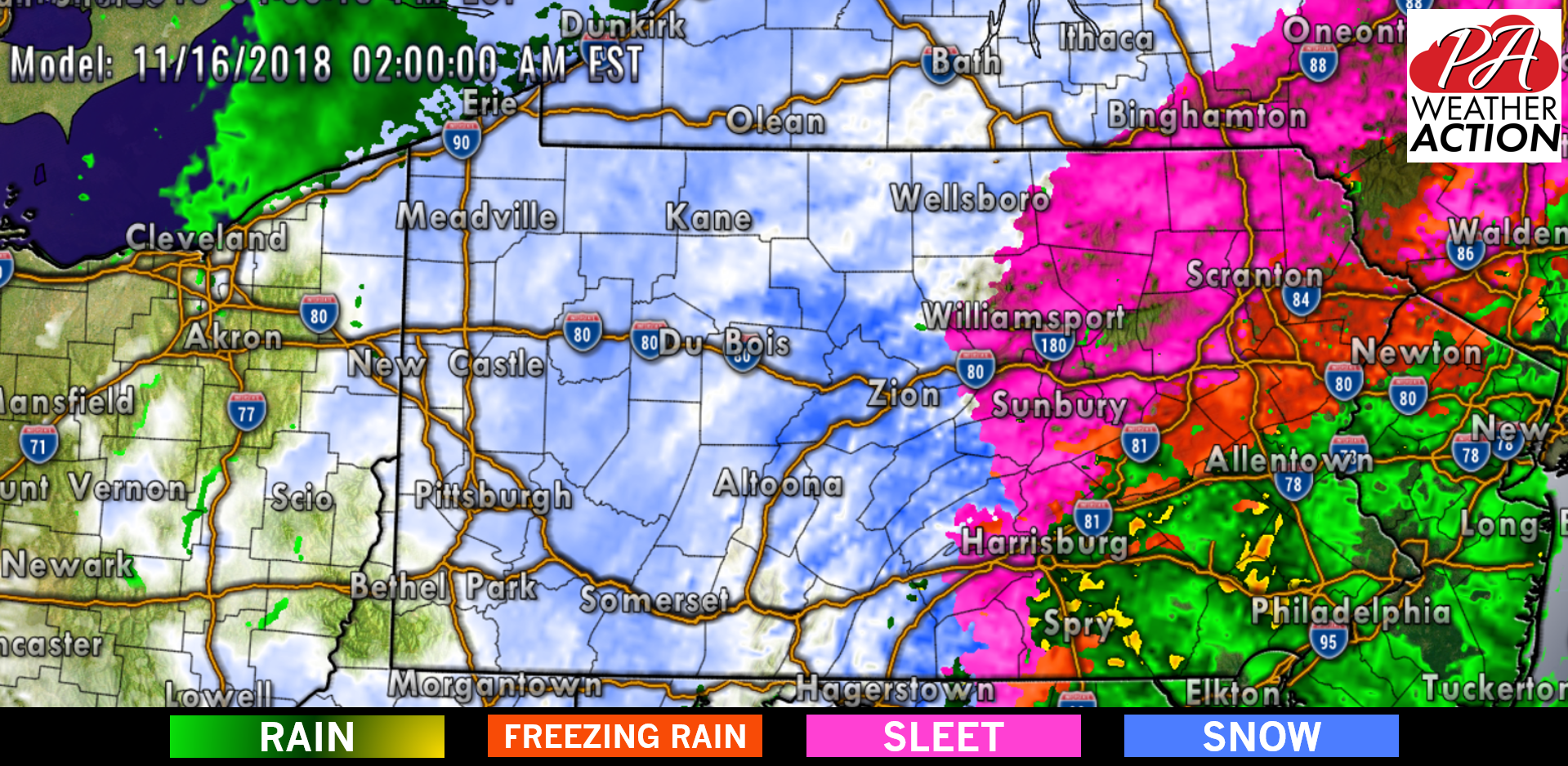
 Precipitation will begin from south to north tomorrow, likely starting across our southern counties after 8:00 AM. Initially precipitation may start off as a sleet/snow mix for everyone, but as the precipitation rates strengthen, it will turn over to all snow for many areas in Central and even parts of Eastern Pennsylvania. Below is a look at 2:00 PM tomorrow afternoon:
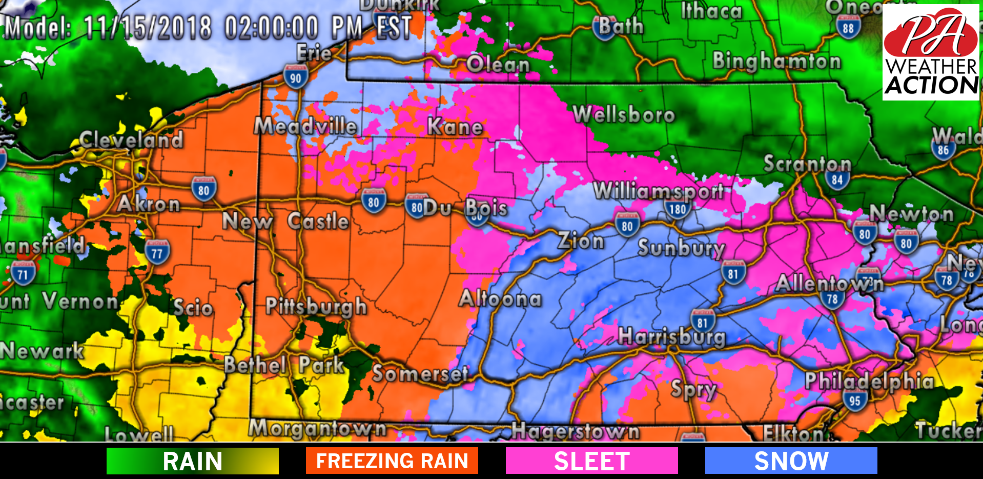
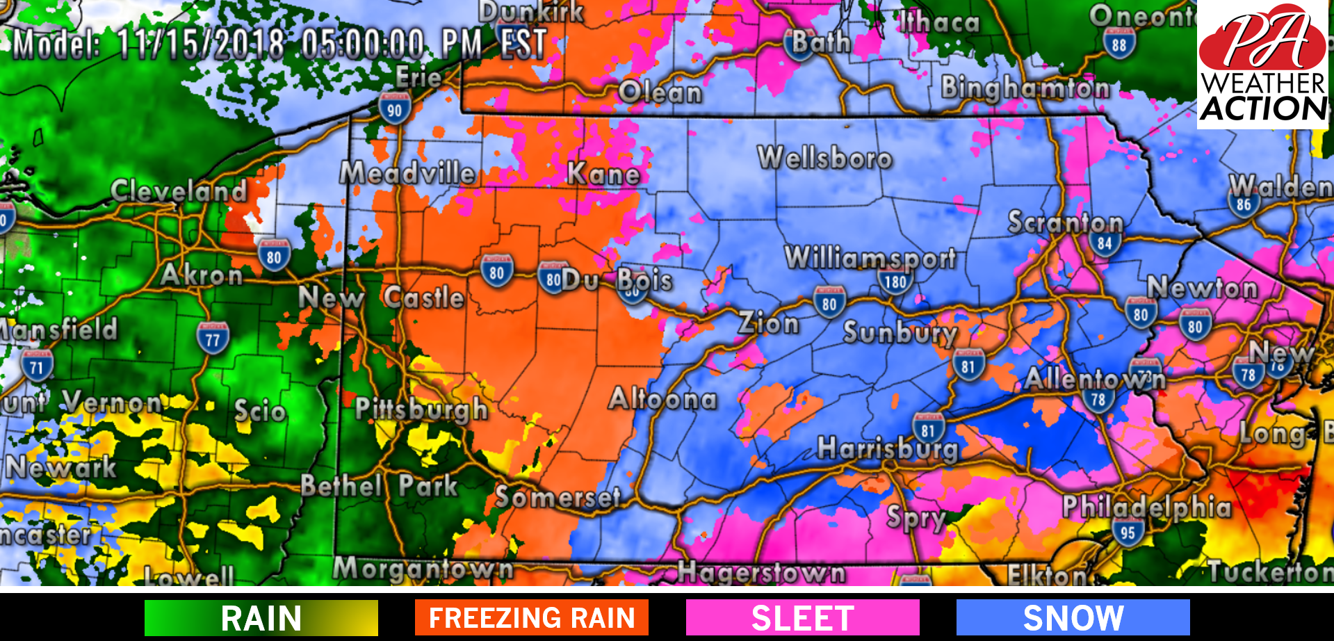
Extreme Southeast and Southwest Pennsylvania will have the greatest chances of receiving the least amount of frozen precipitation, instead just a cold rainfall. For just about everywhere else however, a heavy mixed mag of snow, sleet, and freezing rain will continue into the nighttime hours Thursday. Below is a look at 8:00 PM: 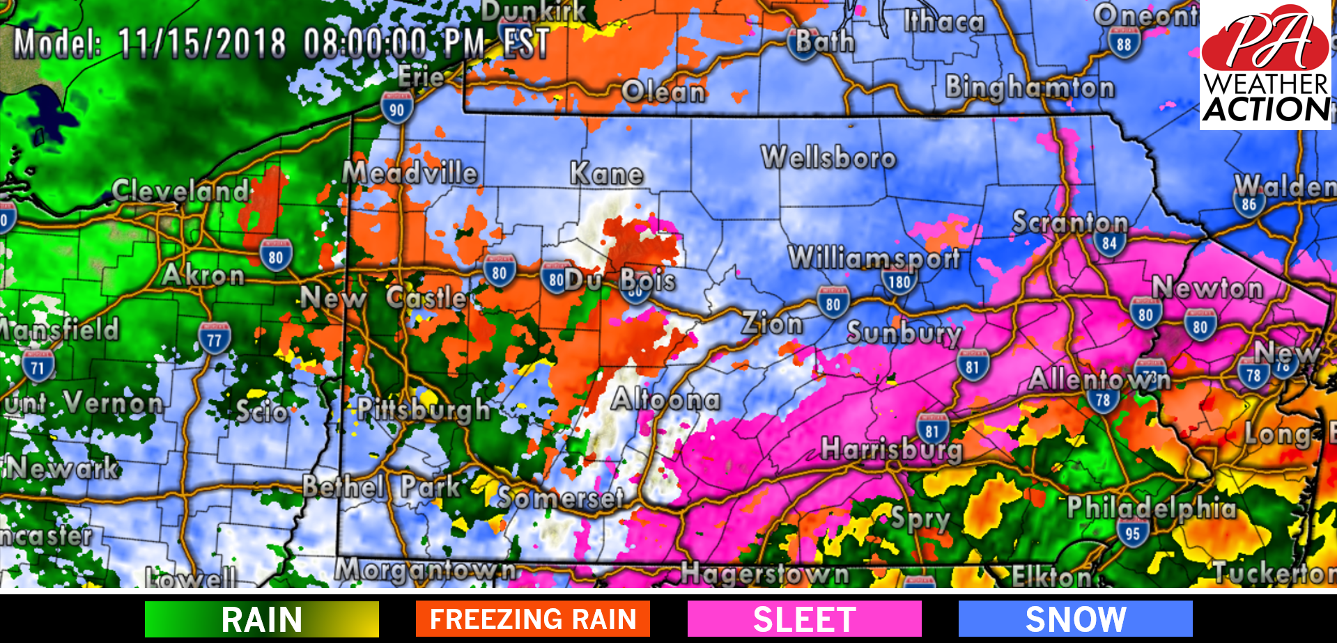
This wraparound snow band will advance eastward early Friday morning changing most areas as far south and east as the I-95 back over to snow before tapering off. Below is a look at 5:00 AM: 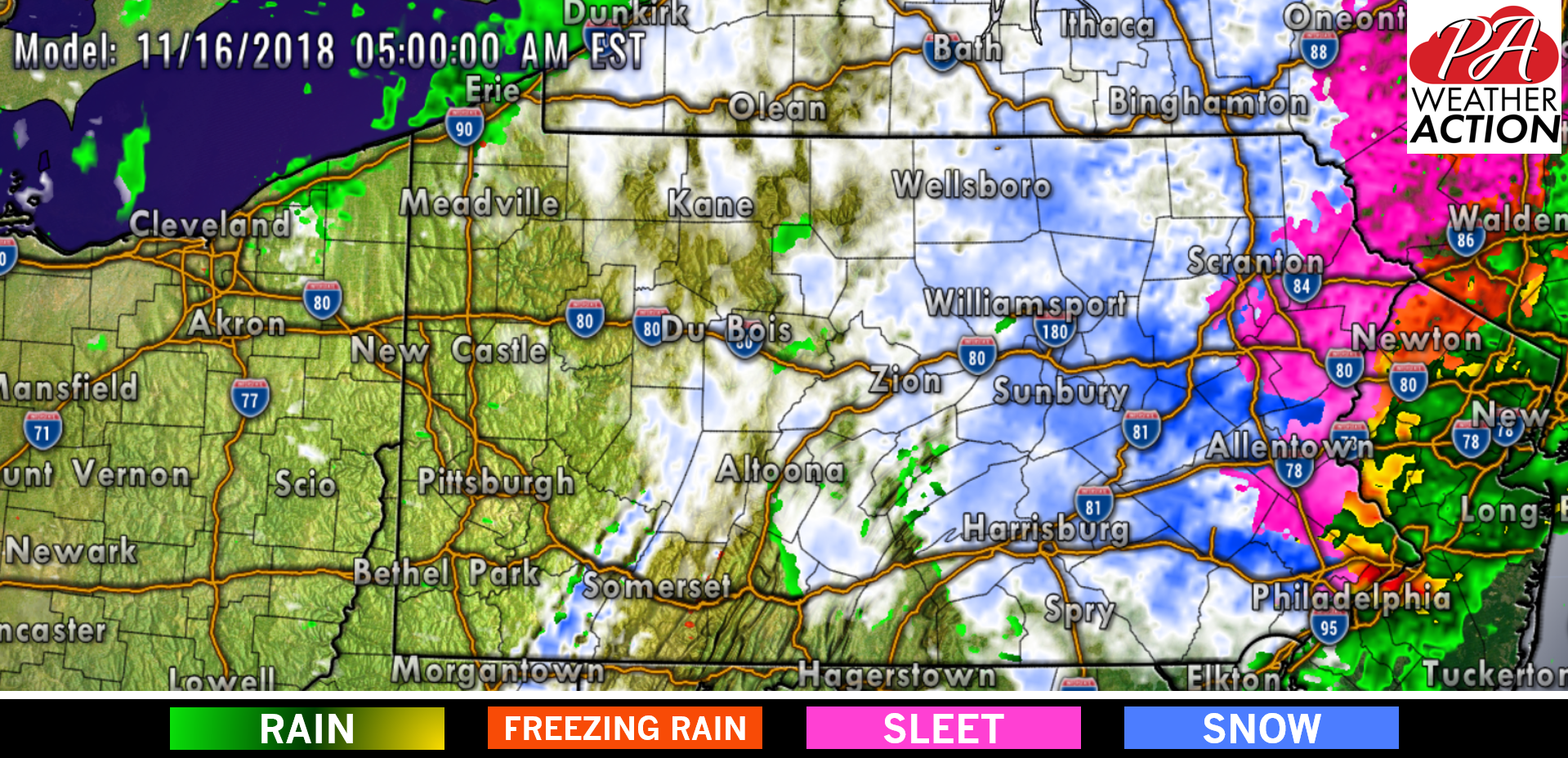
FINAL CALL FOR THURSDAY INTO FRIDAY’S WINTER STORM
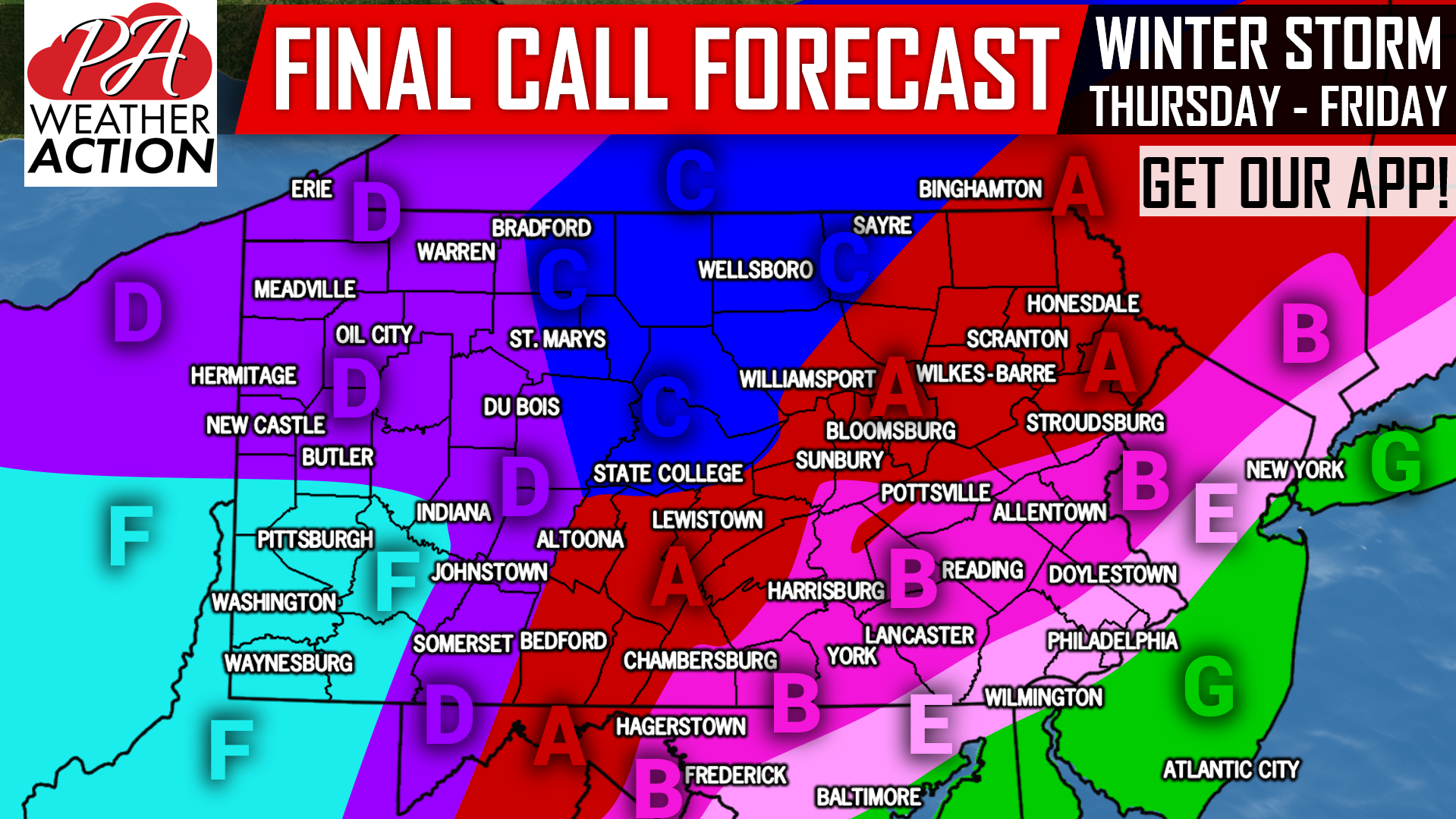
Area A: Snow, possibly mixed with sleet, will move into the area from south to north Thursday Morning, and will continue for four to seven hours before changing to sleet and freezing rain. Mixed wintry precipitation will then change back over to snow early Friday Morning. Snow accumulations of 3-5″ expected, with a tenth to a quarter inch of ice accumulation expected.
Area B: Snow, possibly mixed with sleet, will move in Thursday Morning from south to north. After two to five hours of snow, this area will then change over to sleet, then freezing rain, then possibly all rain by late Thursday Evening. Rain will switch to a wintry mix early Friday Morning. Snow accumulations of 1-3″ expected, with a tenth to a fifth of an inch of ice accumulation likely.
Area C: Snow will move into the region late Thursday Morning, continuing through the daytime and into the evening. Snow may mix with sleet and freezing rain late Thursday Evening, before changing back over to snow early Friday Morning. Snow accumulations of 5-8″ expected, and a trace of ice possible.
Area E: A brief period of snow and sleet is likely Thursday Morning, before changing over to freezing rain for a one to two hour period. Temperatures will then rise above 32 degrees, changing everything over to rain by late afternoon Thursday. Rain is then expected for the rest of the storm.
Area F: Sleet and freezing rain will move into the area mid Thursday Morning, and continue through the mid afternoon. Temperatures will then rise above 32 degrees, changing freezing rain to rain. Rain will change to snow just after the Thursday Evening Commute, which will continue until just before sunrise Friday. Snow accumulations of 2-3″ expected, along with a trace of ice.
Area G: This region will stay all rain through the duration of the storm.
We will have frequent updates throughout the storm, make sure you like our facebook page (Click Here), and download our app (Click Here) to receive these updates.
Share this important forecast with your friends and family using the button below!
Pick up an inexpensive, high quality fleece jacket or sweatshirt, or our “Typical Weather in PA” long-sleeve tee on our store >>> Store Link
You must be logged in to post a comment.