
March brings the most diverse weather to Pennsylvania, with anything from snowstorms to severe weather possible in this transition month. With the pattern flipping to ridging east of the Rockies with systems running through the Midwest, it’s no surprise that severe weather is already on our doorstop here in Pennsylvania.
After a deadly tornado struck overnight in Oklahoma, we’re looking at a large-scale severe weather outbreak in the Eastern Plains and Midwest today. As the system moves northeast, so will the severe weather. Now as usual, here in PA we aren’t looking at the magnitude of severe weather as the Central US is.
With that said, severe weather including the risk of damaging winds, hail, and an isolated tornado or two is possible Saturday across the western half of PA. Cold air damming which has been plaguing the eastern half of the state with gloomy conditions all week will help diminish the severe threat east of the mountains.
SEVERE STORM TIMING
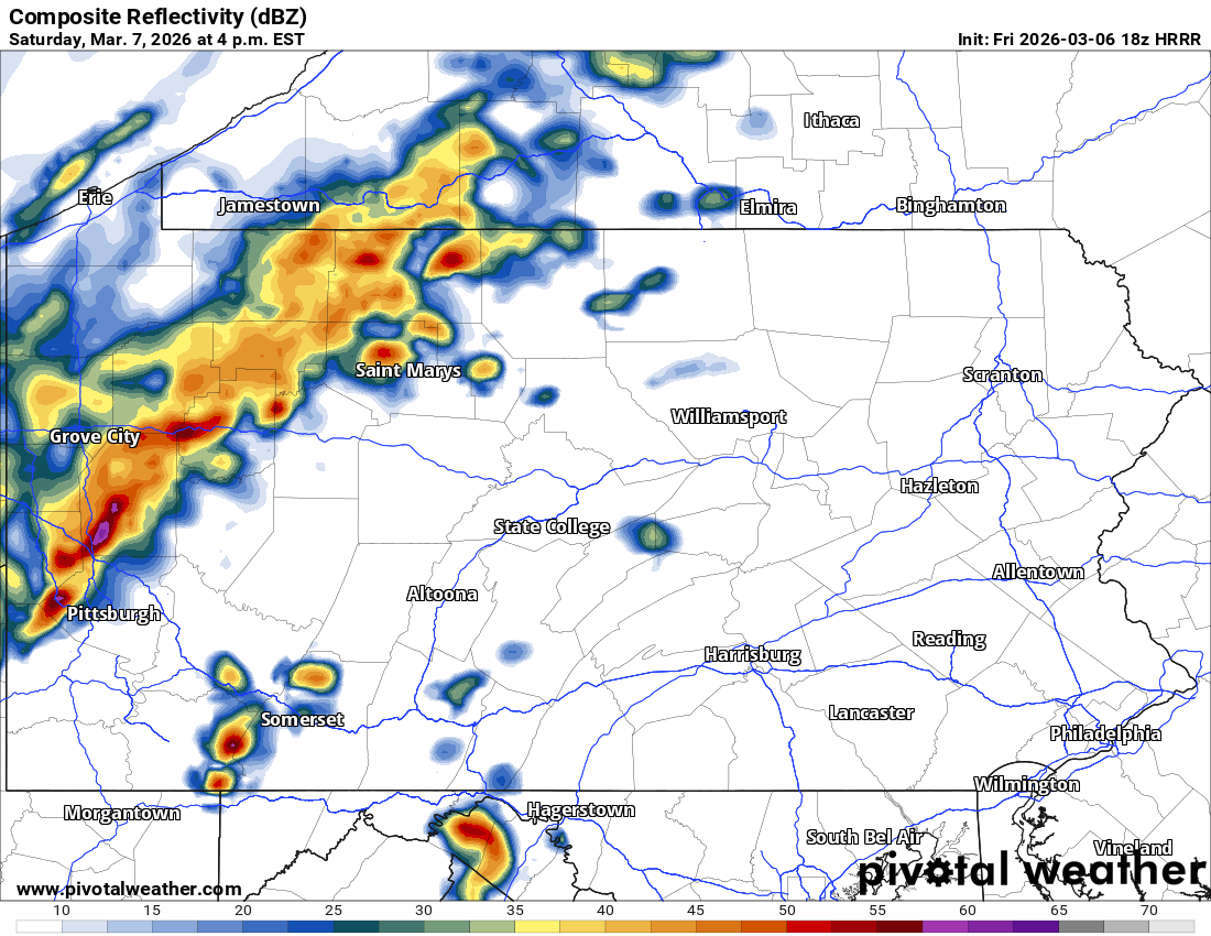
A cluster of strong to severe thunderstorms will move into Northwest PA first, around 2-4 PM Saturday. Storms on the leading edge may bring wind gusts of 40-60mph and with isolated rotation possible.
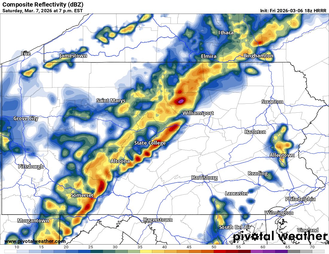
The Pittsburgh Metro looks to see strong to severe thunderstorms around 4-8 PM Saturday. While the tornado risk is low, the highest chance of seeing a tornado-warned supercell comes in this window in Southwest PA.
Below is the Hi-Res NAM for 4 PM Saturday.
As these storms push east around sunset, they will move into a very stable environment east of the spine of the Appalachians. As a result, the severe risk will quickly diminish. Strong wind gusts will be the main concern along this line of storms as it pushes through Central PA around dinnertime Saturday.
By late Saturday evening, the severe thunderstorm risk will be lowered and mainly in South Central PA. The Hi-Res NAM actually has a fairly impressive line of storms lining the I-81 around 9 PM Saturday.
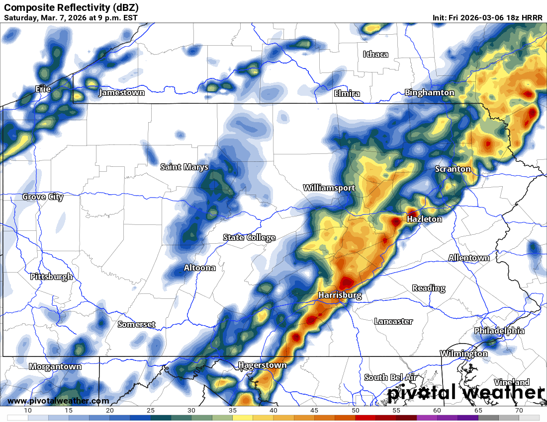
Beyond that, storms will weaken due to no instability present in Eastern PA and no daytime heating. A few rumbles of thunder are possible in Eastern PA very late Saturday evening with no concern for severe weather.
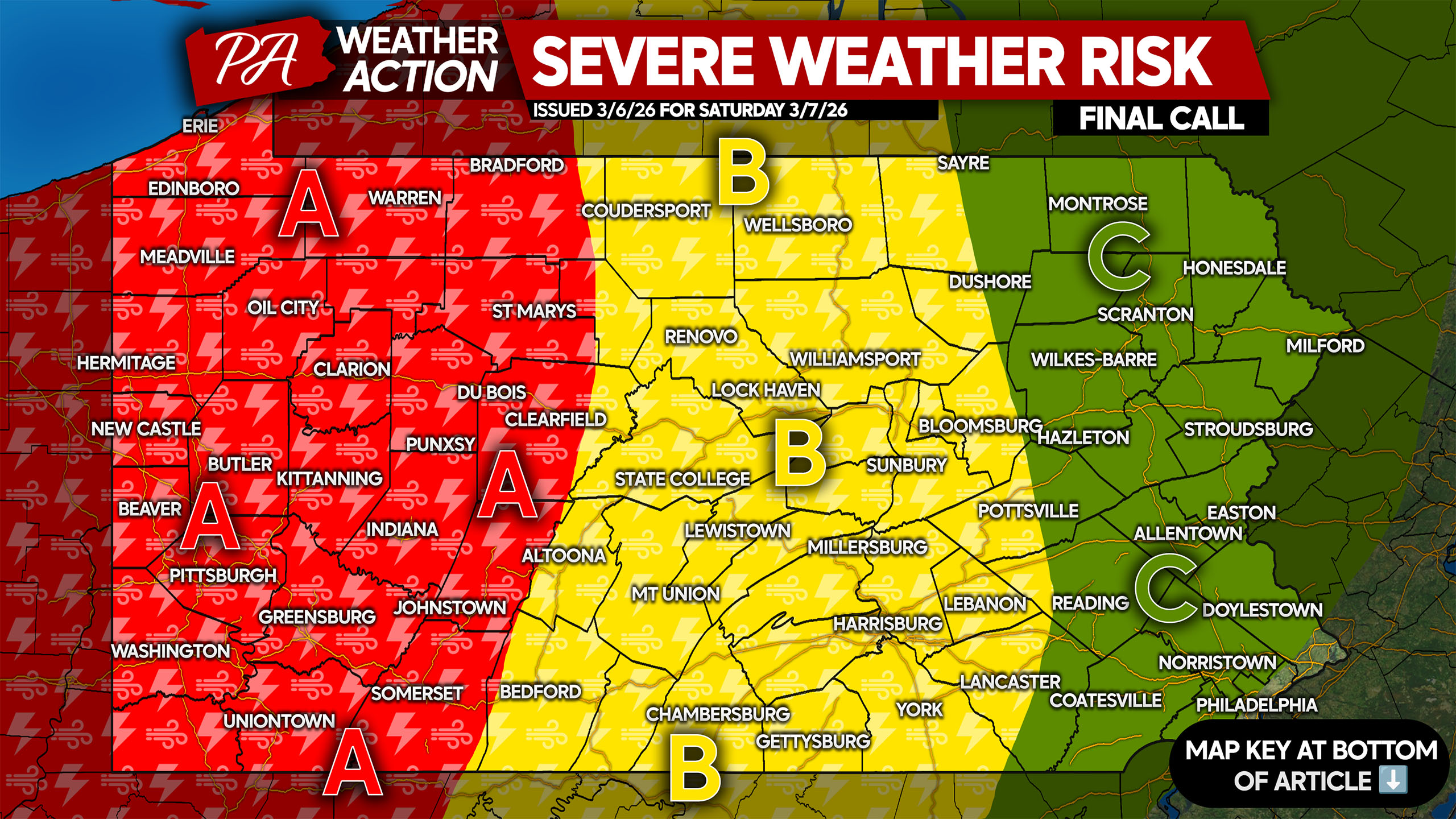
SATURDAY’S SEVERE THUNDERSTORM RISK MAP
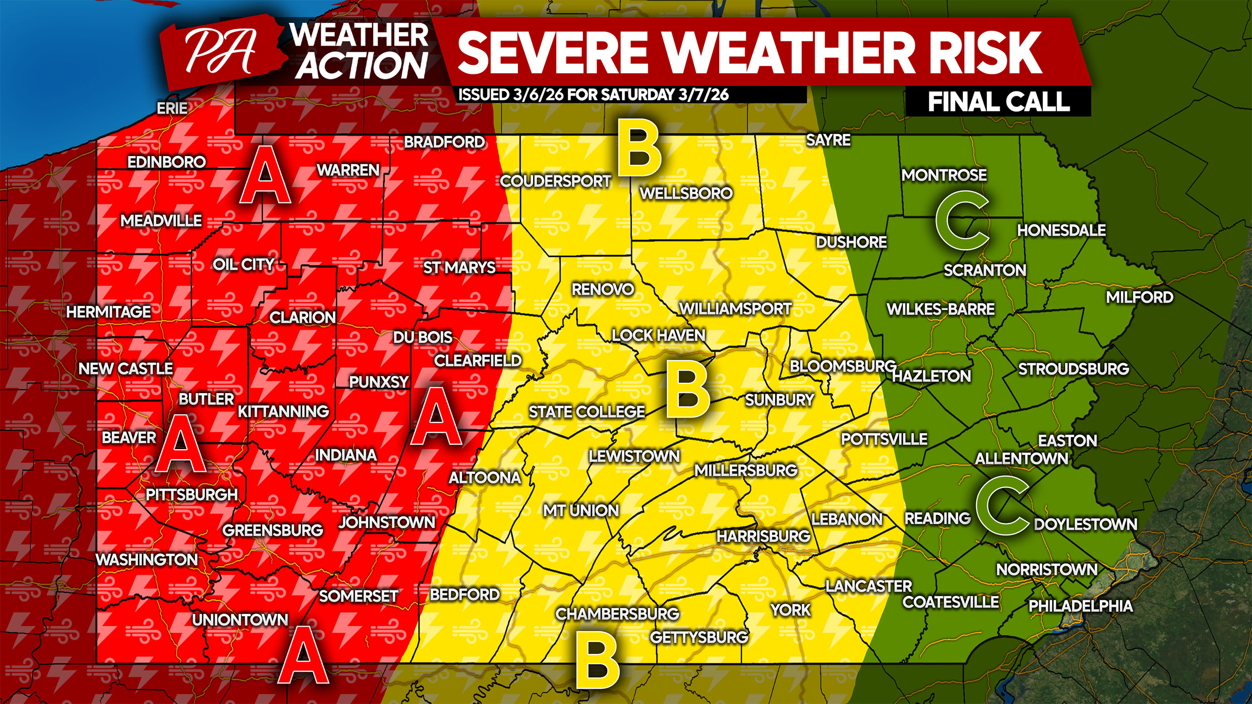
Area A: Scattered strong to severe thunderstorms are expected Saturday afternoon and evening. Damaging winds up to 60mph are the main hazard, with hail and an isolated tornado possible.
Area B: Isolated strong to severe thunderstorms expected late Saturday afternoon and into the evening. Most places will not see severe weather, with wind gusts of 30-50mph more common amidst thunderstorms with heavy rain and lightning.
Area C: Severe thunderstorms are not anticipated due to a very stable environment across Eastern PA. A few ordinary non-severe thunderstorms are possible late Saturday evening, potentially producing the first lightning of the year.
Don’t forget to share this forecast with friends and family who may have outdoor plans on this very warm March Saturday!
You must be logged in to post a comment.