
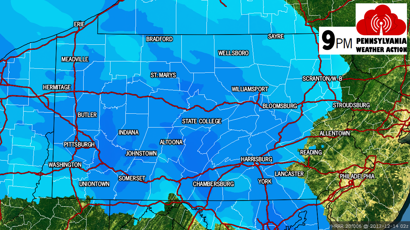
Snow is already falling across Western PA, and will move east as the evening progresses. By 8-9 PM, snow will overspread all of Central PA. This is when travel conditions will begin to deteriorate in areas like State College, Altoona, Chambersburg, Harrisburg, and up the river into Williamsport. Visibility will be reduced to under a half mile in many areas, and snowfall rates of a half inch to an inch an hour will be possible in heavier bands.
Here is HRRR short range model’s radar projection for 9 PM:
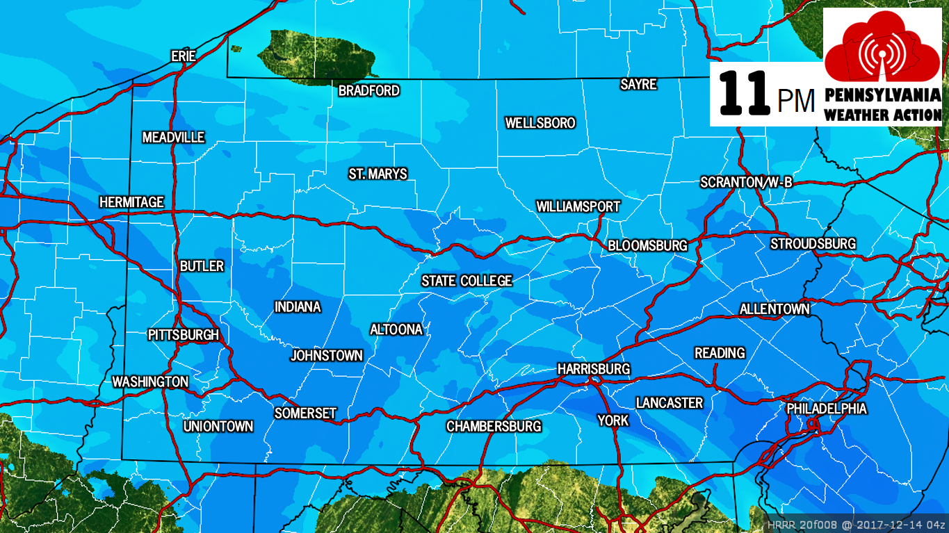
This will be a very fast moving system. By 11 PM, all of Eastern PA will be seeing moderate snow. Locations throughout Central and Western PA will also be seeing light to moderate snowfall at this time. Here is the radar projection for 11 PM:
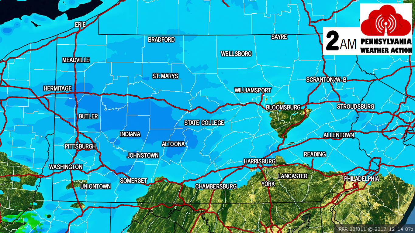
After midnight, snow will begin to shut off in many areas south of the turnpike with the exception of the Laurel Highlands. This will be due to the low pressure transferring to the coast, likely creating a dry slot in Southcentral PA. Here is the radar projection for 2 AM (Thursday):
All untreated/unplowed roads will be snow-covered Thursday Morning. This will result in a hazardous Thursday Morning Commute especially in rural/suburban locations.
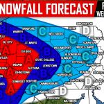
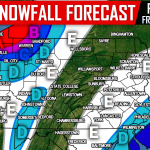
FINAL CALL SNOWFALL FORECAST MAP

Area A: 4-6″+ of snow accumulation is expected. Travel on untreated roadways will be hazardous Wednesday Evening into Thursday Morning.
Area B: 2-4″ of snow accumulation is expected. Travel on untreated roadways will be hazardous Wednesday Night into Thursday Morning.
Area C: 1-2″ of snow accumulation is expected. Travel on untreated roadways will be difficult late Wednesday Night into Thursday Morning.
Area D: A coating to an inch of snow accumulation is expected. Watch for slick spots late Wednesday Night into Thursday Morning.
Make sure you have us liked on Facebook for live updates during this storm and much more, click here>>>Pennsylvania Weather Action’s Facebook Page. Also, download our app for the latest alerts and interactive radar. Click here to download our app!
Share this urgent forecast with your family and friends using the button below, stay safe!
You must be logged in to post a comment.