

An early season severe weather outbreak is likely Monday from Pennsylvania to Georgia. Damaging winds are a significant concern, and the threat of spin-up tornadoes is particularly high in South Central PA.
A massive system across the Great Lakes will put us on the warm side, with impressive instability at play for the middle of March. The applicable guidance is to bring in anything that could blow away in 70mph gusts, such as outdoor furniture and garbage cans. Also, do not park your car under a tree when your area is under a warning.
As usual as of late, models don’t agree on timing and placement much. The Hi-Res NAM seems realistic, however I think the line of storms will be more intense than it depicts.
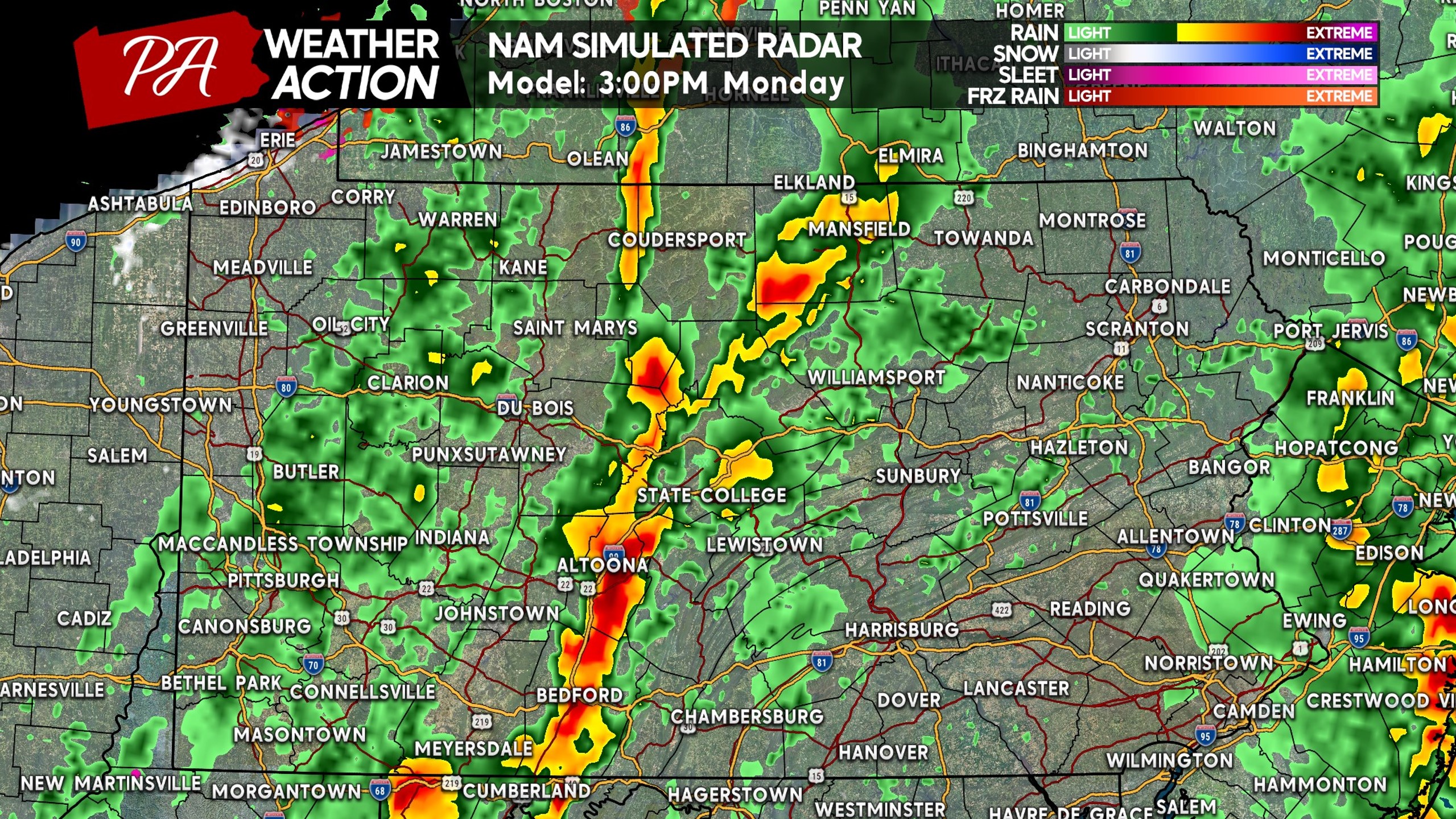
Storms will get going over the Appalachians in the hours following lunchtime. We expect storms to near severe criteria as they reach the I-99 corridor. A few cells may also develop ahead of the line in Central PA, and it’s those where the highest tornado concern will be. Below is future radar for 3:00 PM Monday.
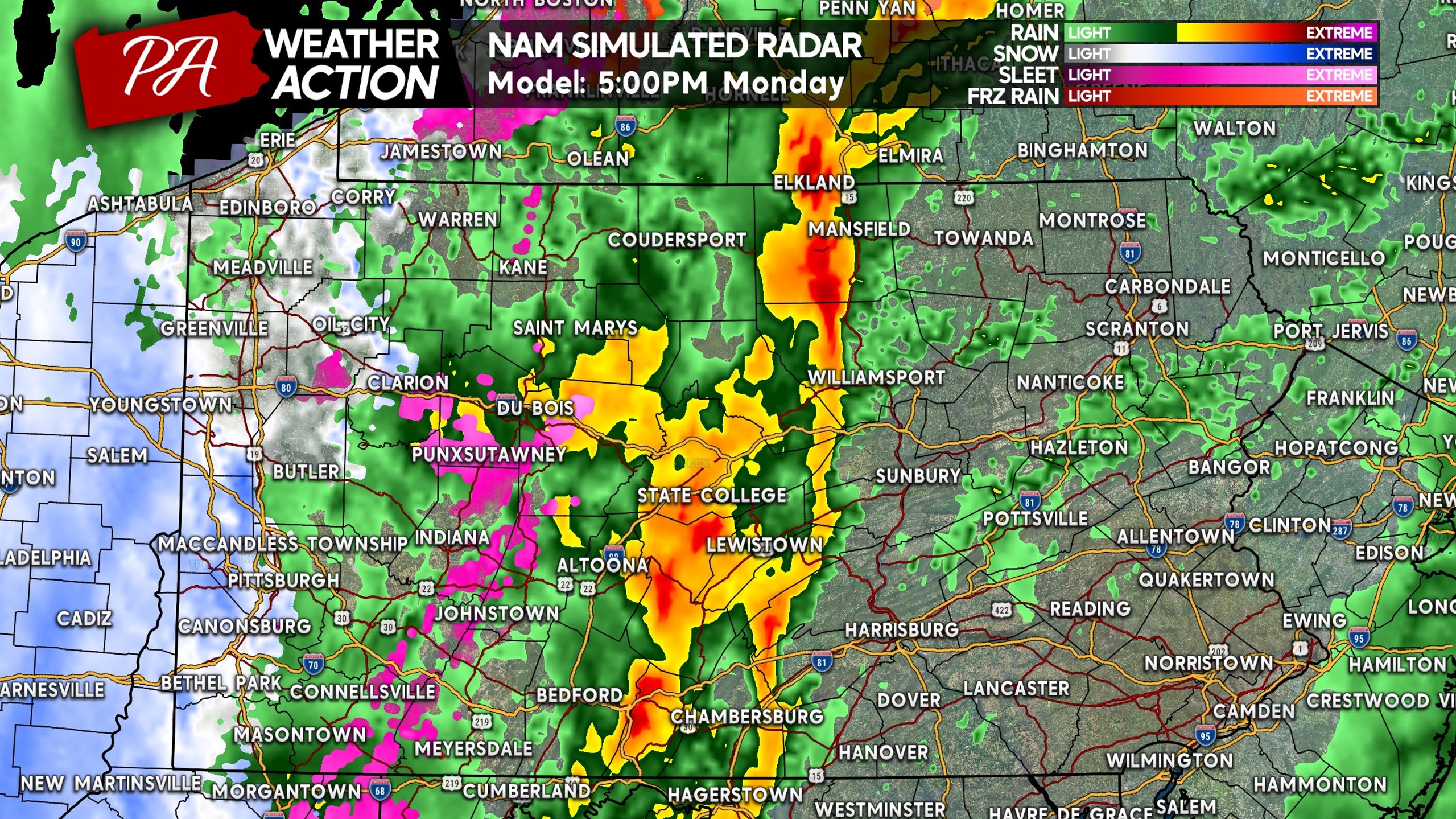
By the afternoon commute, storms will be approaching Route 15 in Central PA likely in severe form. Widespread damaging winds will be a threat with this line, with some areas certainly being hit harder than others. Severe weather is a game of luck (or misfortune), unlike winter weather. Here is future for 5:00 PM Monday.
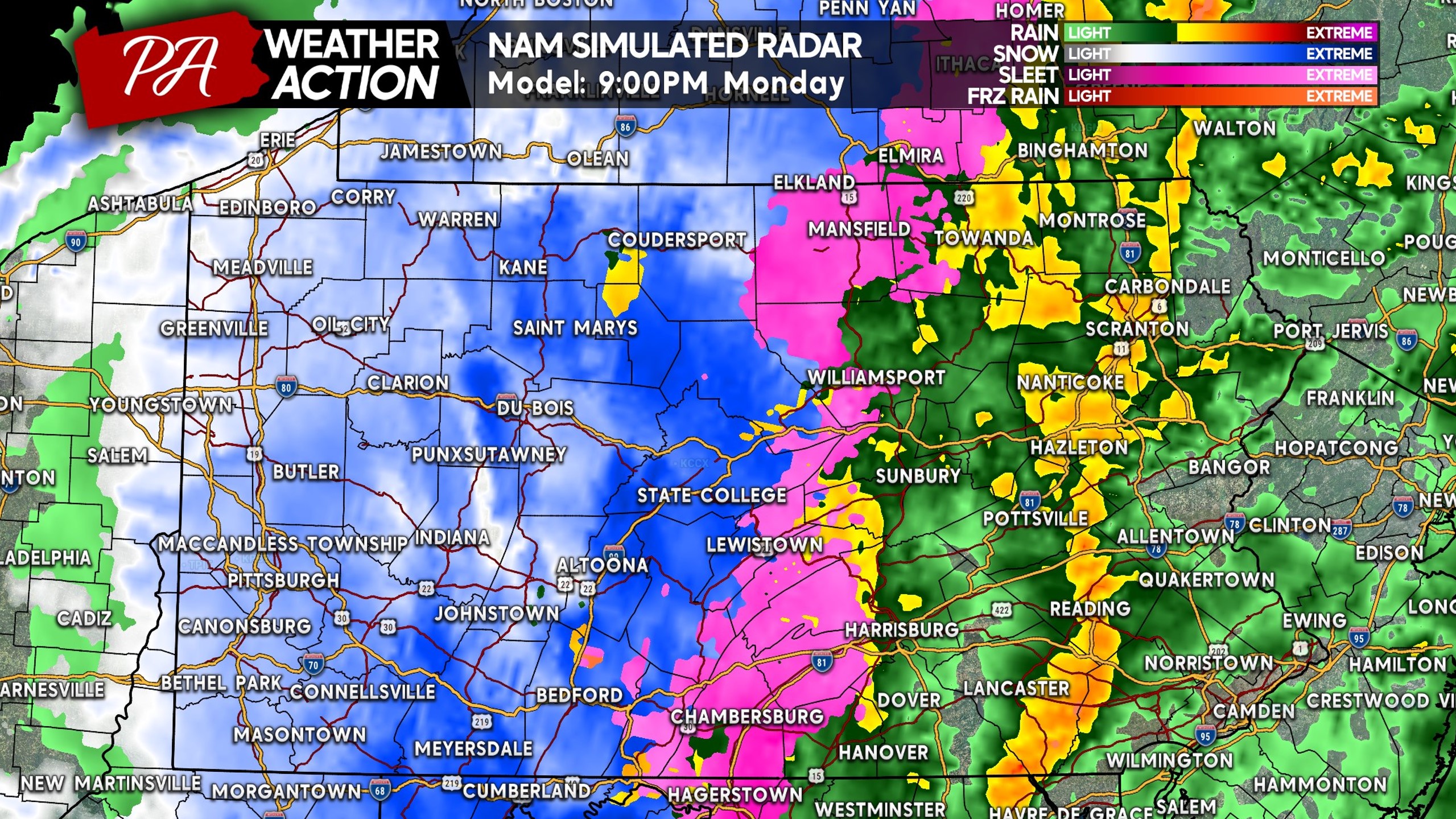
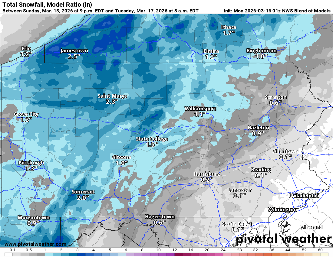
The NAM model is very enthusiastic about bringing snow into Western PA Monday evening. Very light accumulations are expected, which we’ll show in a second.
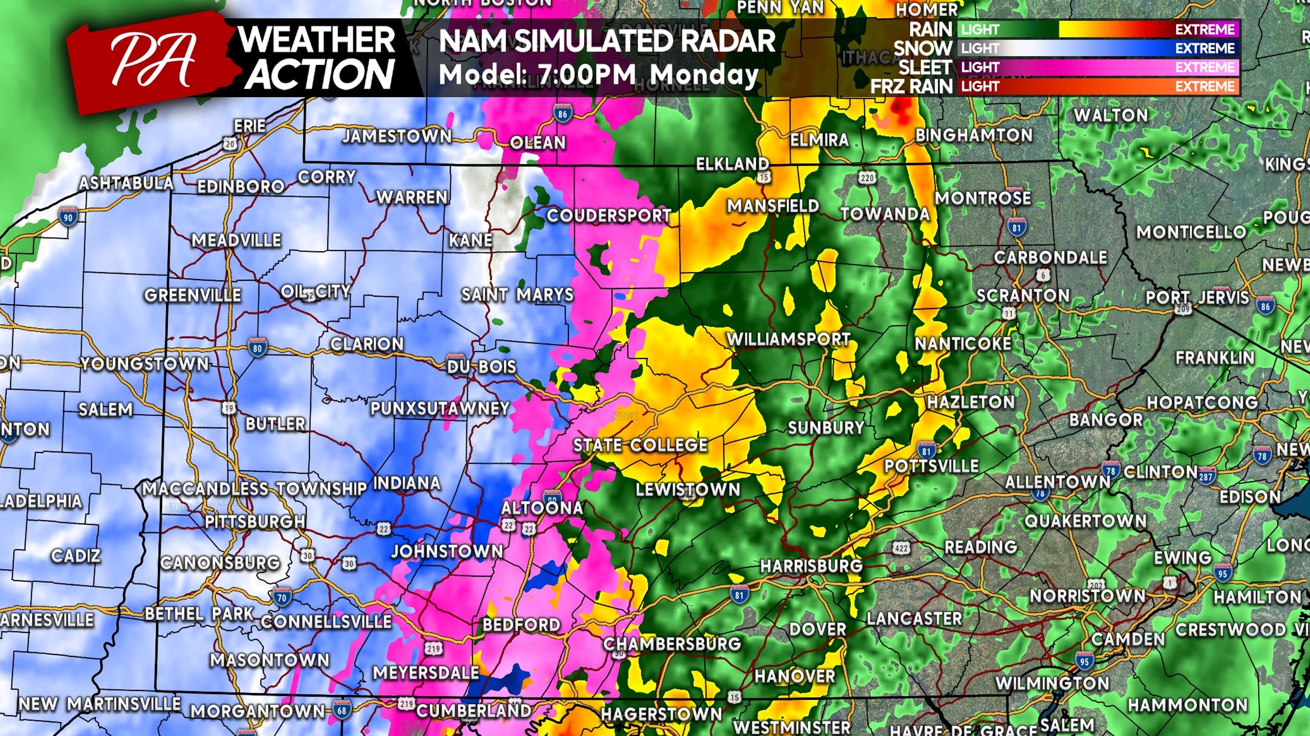
You’ll notice the line of storms looks weak on this model, but focus more on the placement. By dinnertime, the Lower Susquehanna Valley up I-81 to the Wyoming Valley will be facing an imminent threat of severe storms.
As we head into the late evening, the line of severe thunderstorms will be moving into Eastern PA. It will begin to weaken around 9pm as daytime instability lessens. But nonetheless, places from Lancaster to the Lehigh Valley and Poconos will be impacted between 7-10 PM Monday.
The Philadelphia Metro is looking at timing in the late evening, between 9-11pm Monday. There may also be some cells that develop in the early afternoon and push north.
A coating to an inch of snow is likely in Western and Northern PA, with mountain tops and areas near the lake seeing a few inches.
MONDAY’S SEVERE WEATHER RISK FORECAST (FINAL)

Area A: Widespread severe thunderstorms are expected. Wind gusts of 55-75mph will cause scattered downed trees/branches and power lines. Isolated tornadoes possible especially in South Central PA. Scattered power outages are likely, and may last a while. Getting bags of ice ahead of time may not be a bad idea. Be careful when driving during and after the storms, as there will likely be objects on roadways.
Area B: Scattered severe thunderstorms are expected. Wind gusts of 50-70mph will cause scattered downed branches isolated downed trees and power lines. An isolated tornado is also possible. Power outages are possible especially in areas more prone to outages. Be cautious when driving during and after the storms, as there may be objects on roadways.
Area C: Isolated severe thunderstorms are expected. Wind gusts of 40-60mph may cause scattered downed trees/branches. Be on the lookout for objects in the roadway during and after the storms move through.
This is a rare event for March! Pass this article along to friends and family!
You must be logged in to post a comment.