
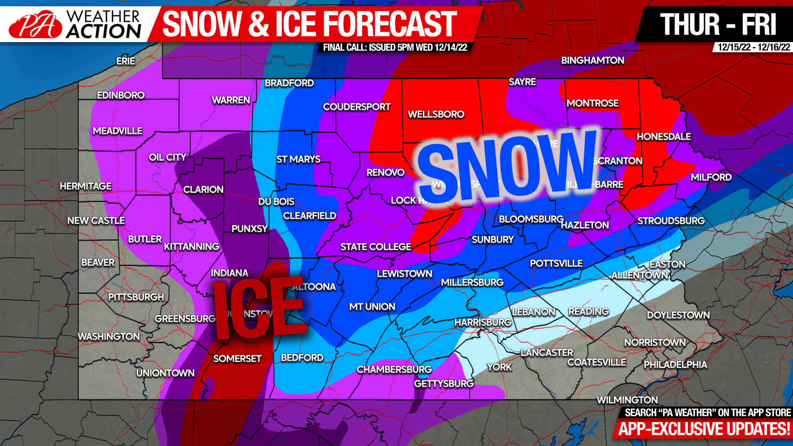
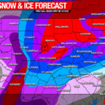
A large winter storm will impact the state mainly Thursday, but will last into Friday in Northeast PA. Widespread closures are expected, and are certainly warranted on Thursday. Let’s begin with the latest alert map.
Weather Alert Map

Timing
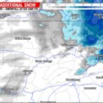
Timing will be completely dependent on where you are in the state. Refer to your local NWS forecast for most precise timing details for your area. Your NWS forecast can be found in our app (tap here), or on weather.gov. Here is the latest High Resolution NAM future radar for its take. Short range models are still in a bit of disagreement, with this model being on the warmer side of average.
Road Impacts
While road impacts will also depend on your location, as a whole, this will be a high impact event on the roads. We encourages businesses in areas under Winter Storm Warnings or Ice Warnings to view timing for their location and close during those hours. The National Weather Service has stated travel could be near impossible on Thursday in areas under Ice Storm Warnings.
Final Call Ice Forecast for Thursday
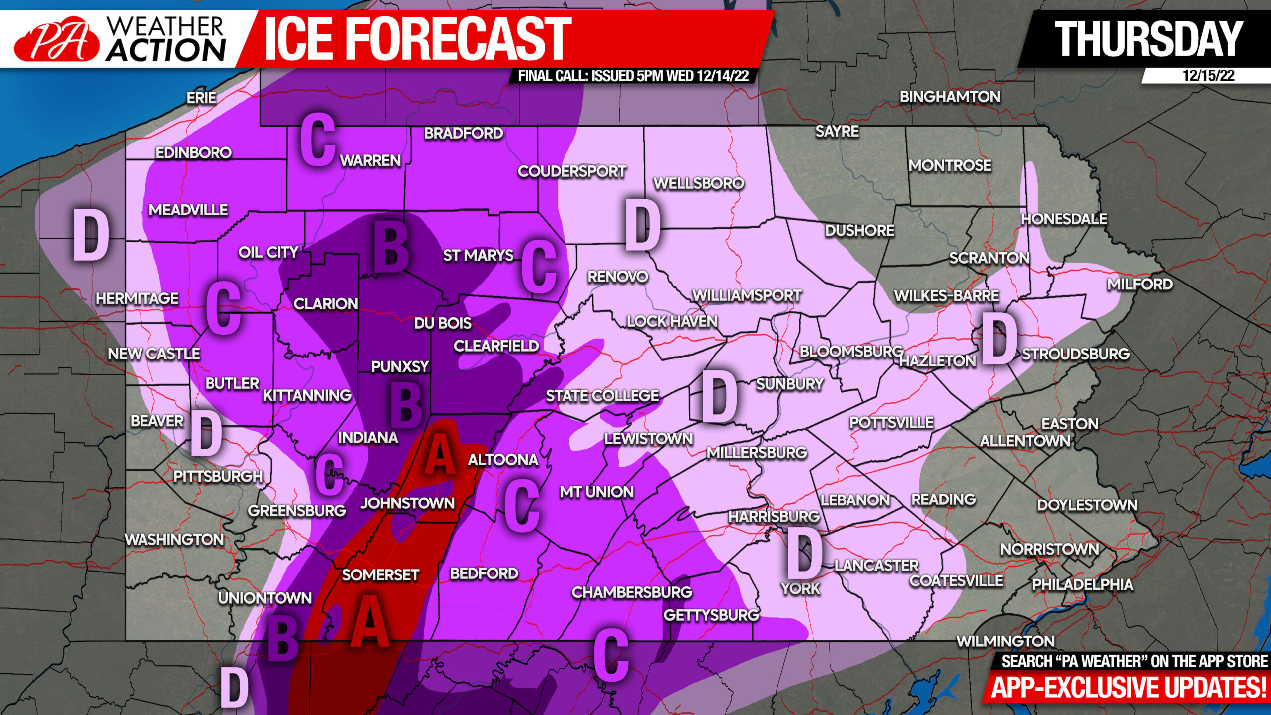
Area A: Ice accumulation of .50 – .75″ expected. Widespread power outages are expected Thursday, lasting into Friday.
Area B: Ice accumulation of .25 – .50″ expected. Scattered power outages are expected Thursday, lasting into Friday.
Area C: Ice accumulation of .10 – .25″ expected. Scattered power outages possible Thursday.
Area D: Ice accumulation of .01 – .10″ expected. Isolated power outages possible Thursday.
Final Call Snowfall Forecast for Thursday – Friday
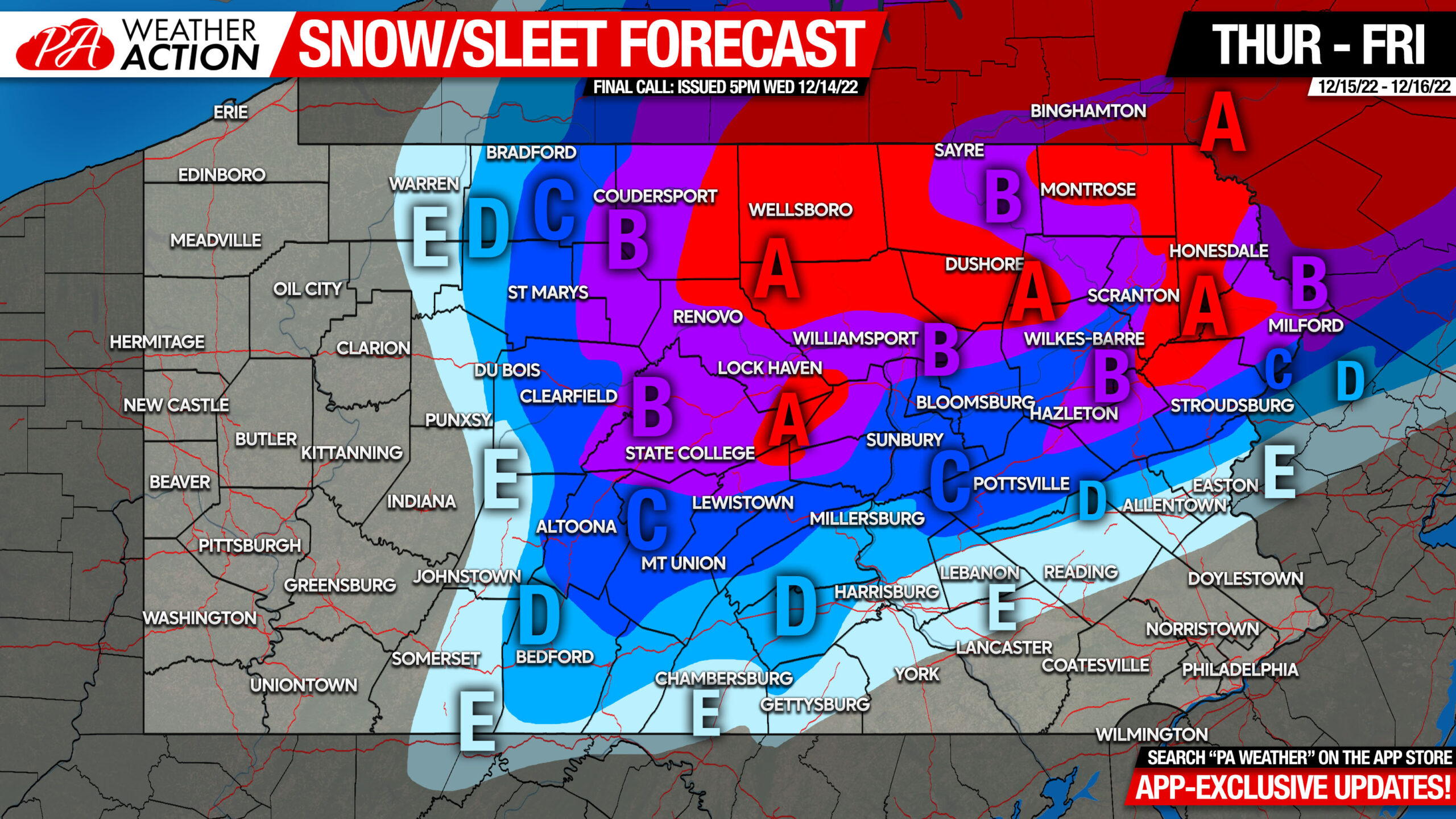
Area A: Snow and sleet accumulation of 6 – 10″ expected. Snow-covered roads likely late Thursday morning through Friday evening.
Area B: Snow and sleet accumulation of 4 – 6″ expected. Snow-covered roads likely late Thursday morning through Friday morning in Central PA and evening in Northeast PA.
Area C: Snow and sleet accumulation of 2 – 4″ expected. Slushy roads are likely late Thursday morning through late Thursday evening, possibly into Friday in Northeast PA.
Area D: Snow and sleet accumulation of 1 – 2″ expected. Slushy roads possible late Thursday morning through mid Thursday evening.
Area E: Snow and sleet accumulation of less than 1″ expected.
Consider sharing this forecast with friends and family. It’s not worth venturing out during ice unless you absolutely have to!
[social_warfare]
Track all future winter storms this season with our handwritten forecast, frequent model updates you won’t find elsewhere, as well as forecast and radar straight from your local NWS office. Tap the banner below!
You must be logged in to post a comment.