
December 16, 2022 Morning Update
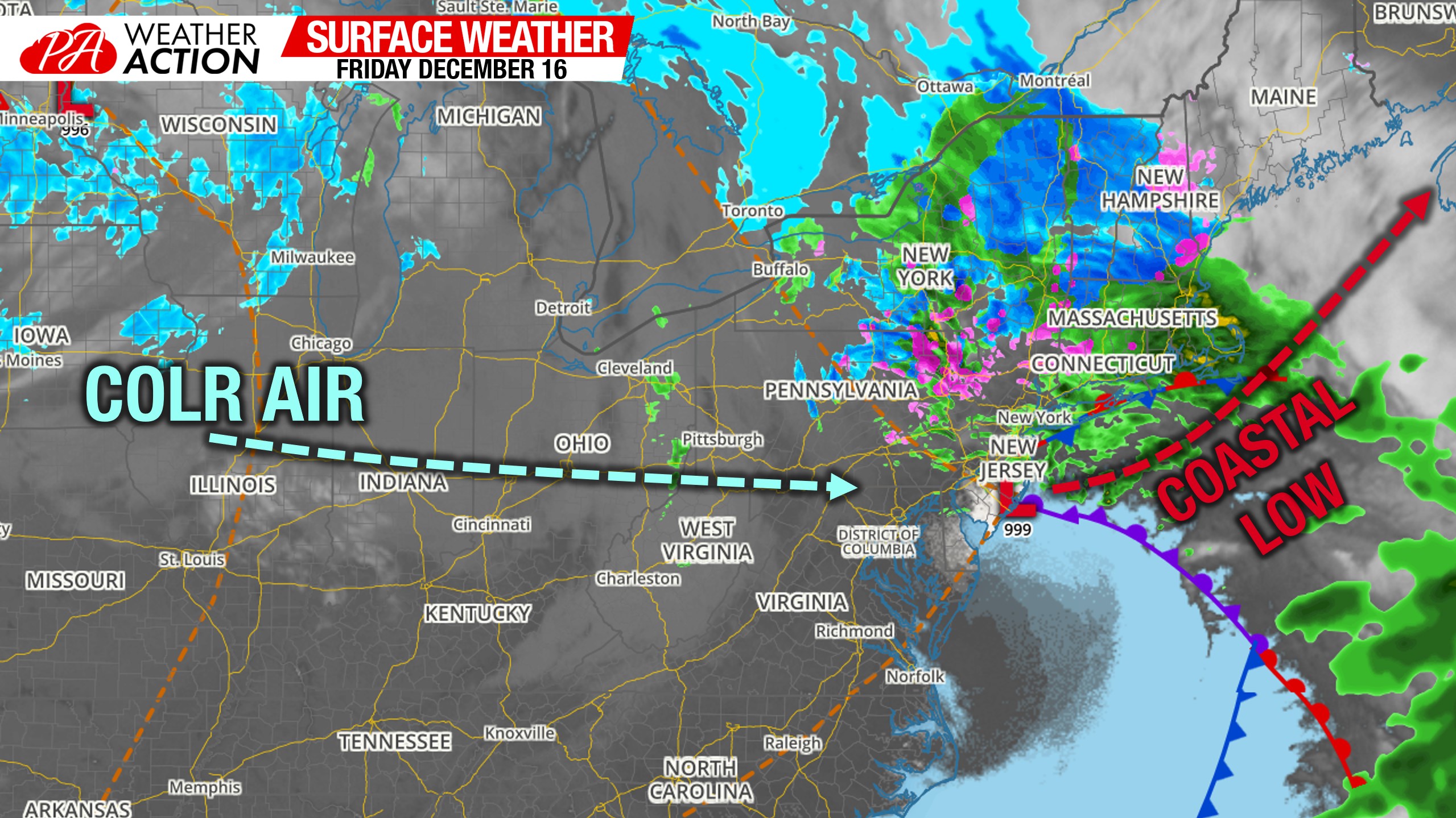
Morning Surface Weather Map
Rain and sleet are falling in Eastern PA this morning. Elsewhere, it’s dry but cloudy. Clouds overhead will push out late morning and into the afternoon from southwest to northeast as the new coastal low crawls up the coast.
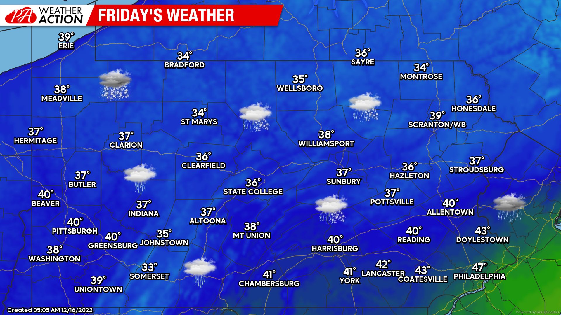
Friday’s Weather Map
A wintry mix of mostly rain and sleet, but some snow later this morning in Poconos, will slowly lift out from southwest to northeast late this morning and into the afternoon. The Northern Poconos will see a wintry mix through the evening. Elsewhere, dry and clearing skies. Temperatures won’t increase much today.
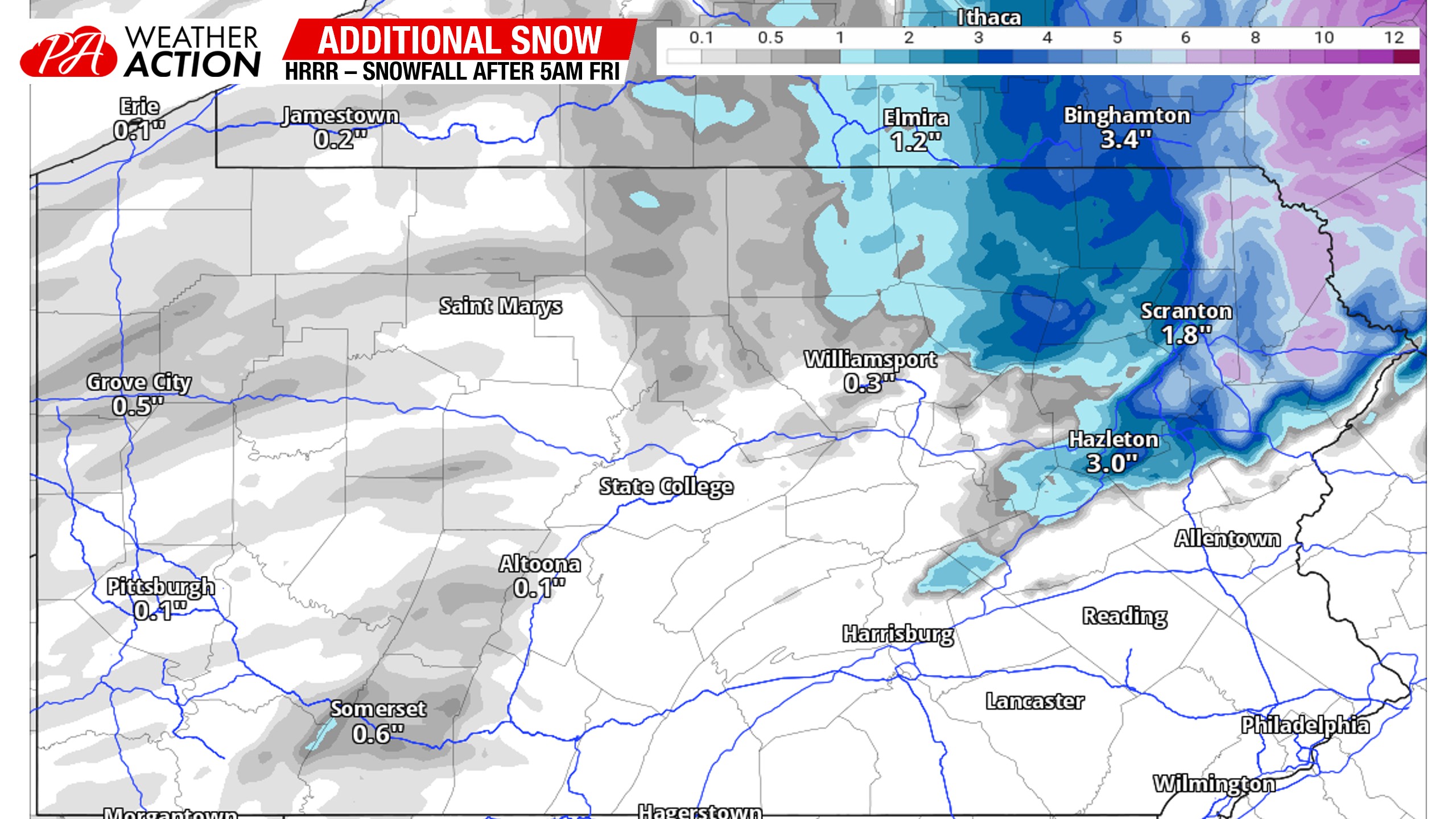
Additional Snow & Sleet Accumulations
The Northern Poconos will are expected to switch back to sleet and then mostly snow by later this morning. Additional accumulations may be enough to keep the roads in bad shape, so take that into consideration if you’ll be in those areas. Here is the HRRR for additional accumulations today. I think it’s a bit aggressive, so expect about two-thirds of what is shown. I don’t think the Wyoming Valley will see any accumulation but we’ll see!
Overnight Snow Showers in Western PA
Lake effect snow showers will begin late this evening and last through about 4am Saturday morning in Western PA, with some flurries after that through the day Saturday (except Erie where heavier snow will fall later Saturday).
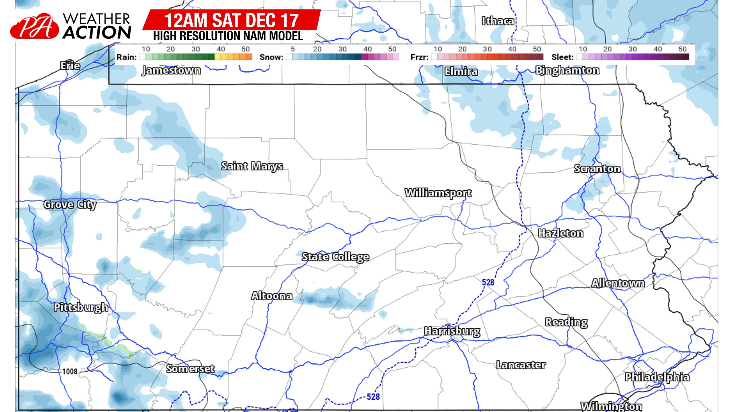
Here’s an idea of what the 3km NAM future radar looks like at 12:00 AM tonight.
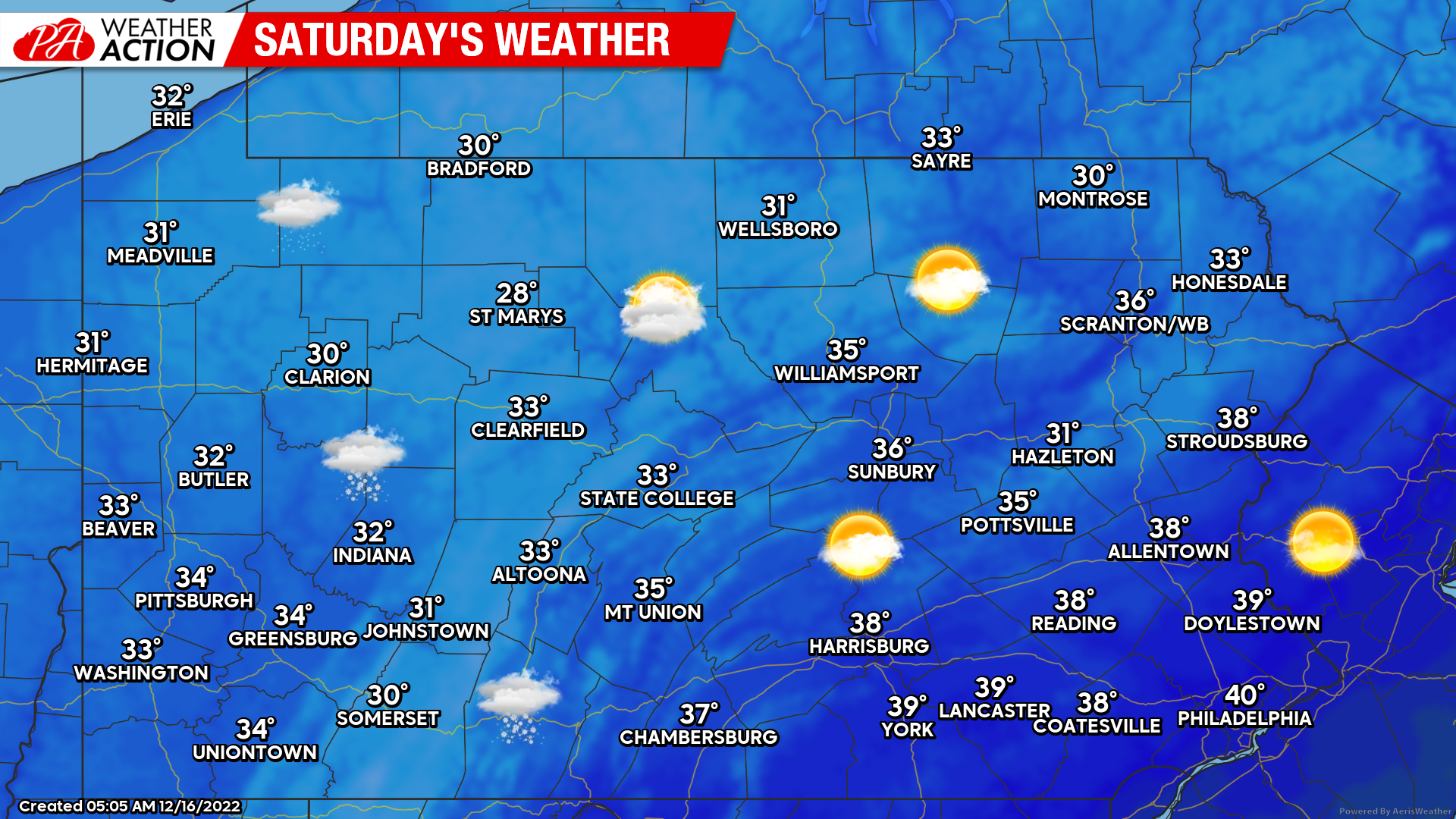
Saturday’s Weather Map
As mentioned, some flurries or light snow showers are expected Saturday in Western PA, with partly to mostly sunny skies likely east of the Alleghenies. Temperatures will be around average.
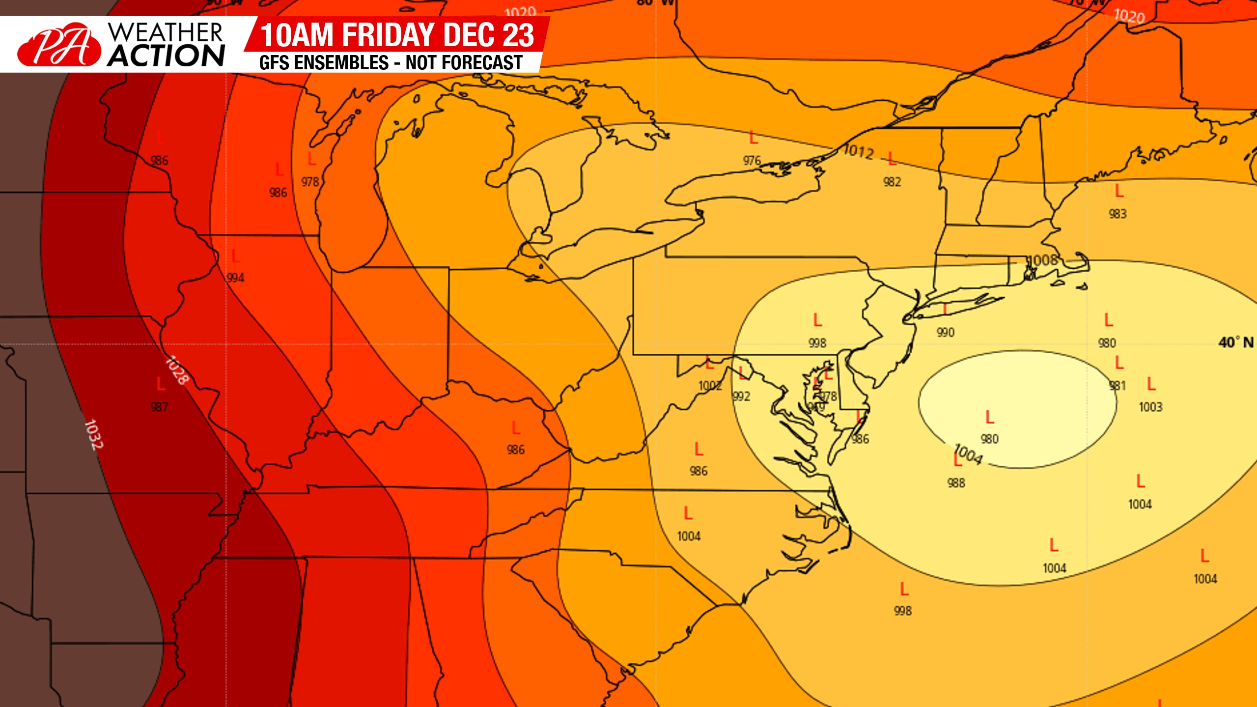
Very Brief Thoughts on Dec 23 Storm Signal
I’ve heard a lot of people talking about this topic already, and not just on social media! Here are my initial thoughts. The PNA will be positive, and there will likely be a blocking high in Canada. The ceiling is pretty high for this. However, atmospheric memory may be at play. So that may not work in the favor of snow lovers in Southern PA. I think there’s a higher possibility this storm tracks over Philadelphia than it being off the coast. So I wouldn’t get too excited especially if you’re in Southeast PA, just yet.
Give it time though, no doors have closed. They’re all open, and it could also be far off the coast and it’s a big storm for the fish. It’s 7-8 days out, even on Monday we won’t have a great idea on who will get what. Here’s the GFS Ensemble low pressure map. If you want snow, you want the low pressure center near Cape May. There will be lots of cold air to work with, so you won’t have to be more than 50 miles west of the low to see mostly snow.
Thanks for reading. If you liked this update and want to track this potential with frequent model breakdowns from us, head to the Updates page of our app. Yes, it costs $1.25 a month. There’s expenses for us, and it takes time too. Appreciate the support! Tap the banner below:

You must be logged in to post a comment.