
FINAL CALL FORECAST HAS BEEN REVISED AS OF SAT MORNING >>>
REVISED FINAL CALL SNOW & ICE FORECAST FOR THIS WEEKEND
We continue to track a major winter storm that will impact the area of the state this weekend. Since our forecast last night, there has been a lot of waffling back and forth between the model guidance. However, it appears the storm will be slightly colder than initially expected. This will allow for a substantial amount of snow and ice for a large portion of the state Saturday into Sunday. It is HIGHLY recommended that you avoid driving at all costs Saturday evening through at least the first half of Sunday.
Governor Tom Wolf has signed a state of emergency declaration ahead of the storm. The state will impose reduced speed limits and restrictions, as well as a ban on all commercial trucks on most interstates and the Pennsylvania Turnpike.
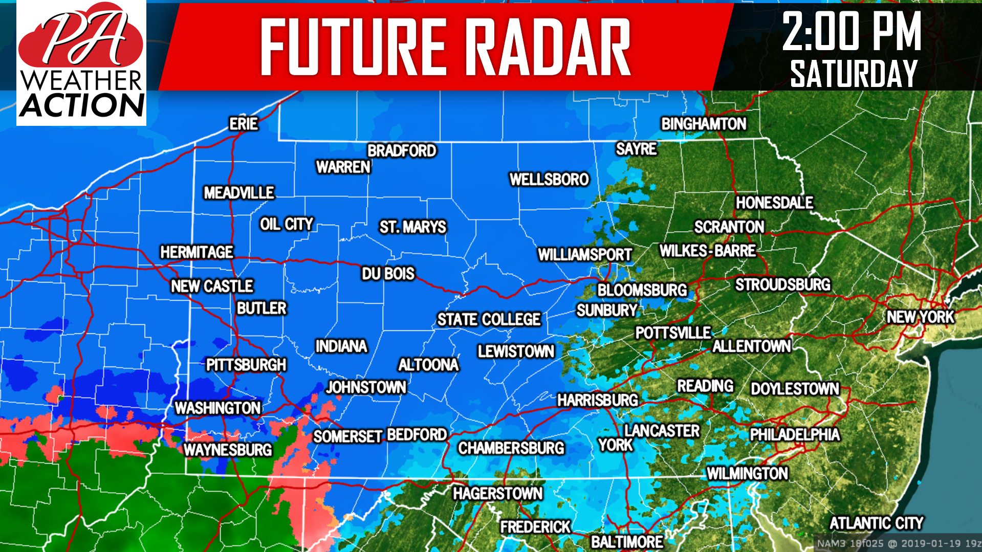
The precipitation will begin in Western PA by the early afternoon hours. Take a look at our future radar for 2:00 PM Saturday:
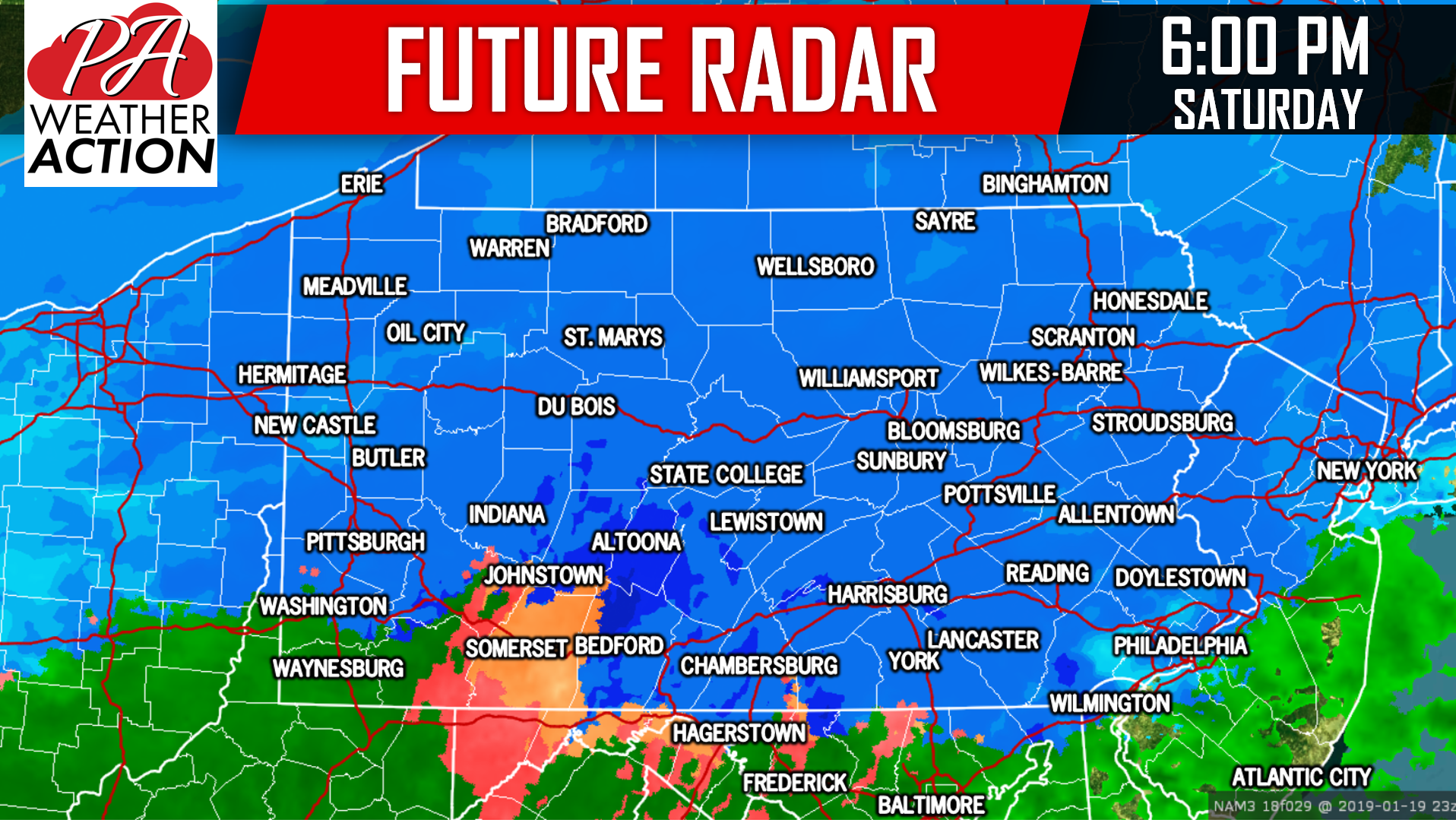
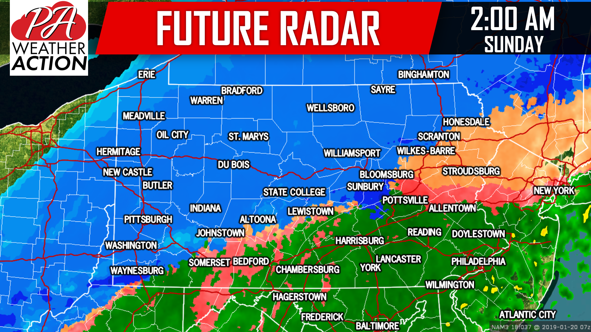
Even for areas that change over to an icy mix or plain rain, when the snow does fall at the onset, it will snow upwards of 1 to 2 inches an hour. The snow will pile up rapidly. Road conditions will deteriorate in less than an hour of the snow starting. Below is future radar for 2 AM Sunday Morning:
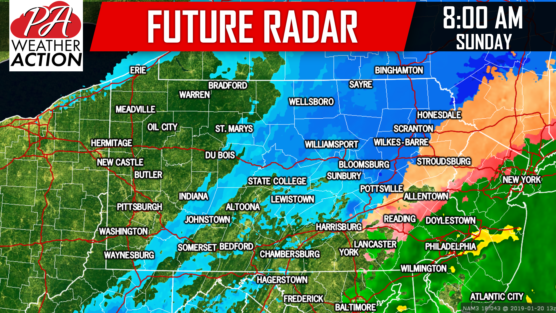 Before the precipitation ends, it is possible for areas to change back over to snow as the storm pulls away. We expect most areas will be precipitation-free by noontime Sunday.
Just like yesterday, we will start with our Ice Accumulation Forecast, followed by our Snowfall Accumulation Forecast.
FINAL CALL ICE ACCUMULATION FORECAST
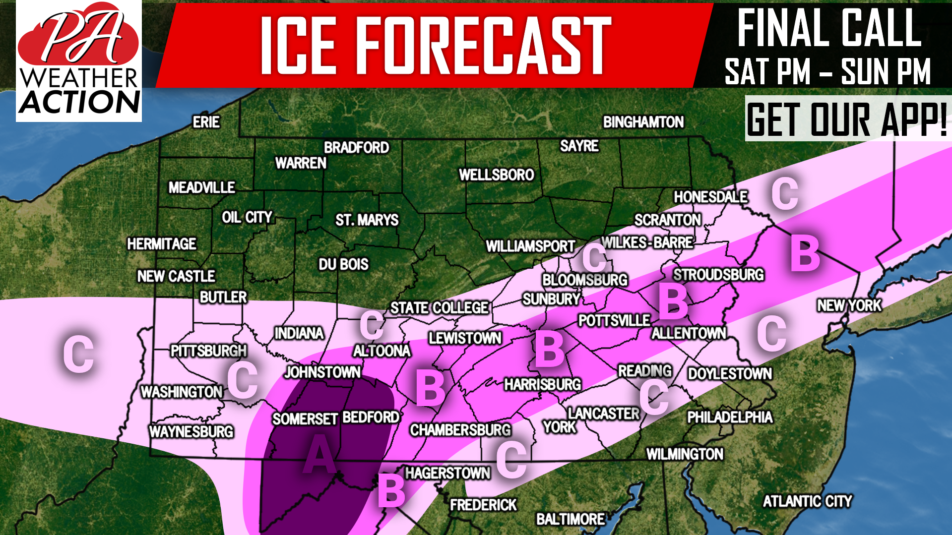
Area A: Ice accumulation of .25 – .50″ expected. Widespread power outages are possible, especially due to high winds partnered with this ice.
Area B: Ice accumulation of .10 – .25″ expected. Scattered power outages possible as a result of icy, and windy conditions.
Area C: Ice accumulation of .01 – .10″ expected. Isolated power outages possible as a result of icy, and windy conditions.
All ice will occur directly after the initial period of snow switches to freezing rain.
FINAL CALL SNOWFALL FORECAST
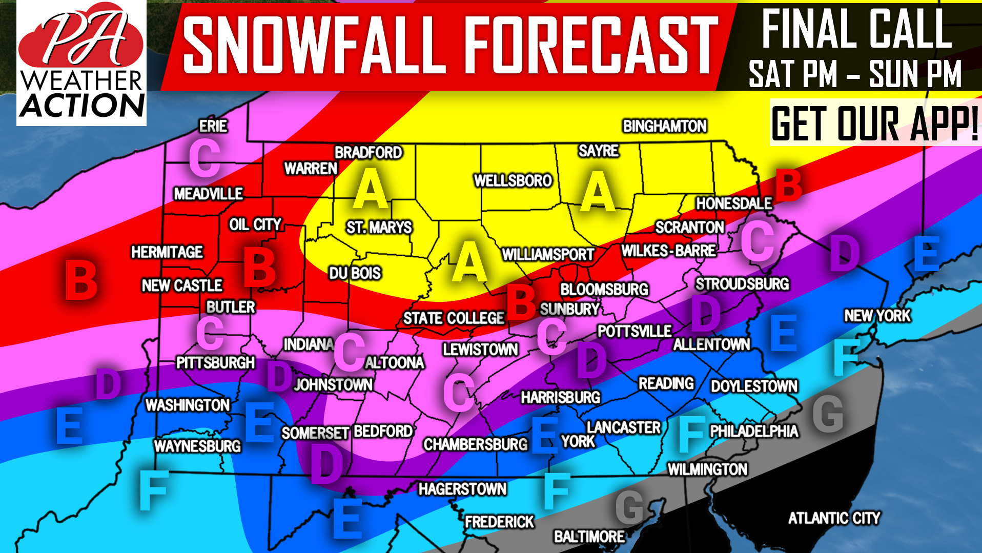
Area A: Snowfall accumulations of 15″ + expected. Travel will be near impossible early Saturday Evening into Sunday, and potentially beyond in more rural areas.
Area B: Snowfall accumulations of 10 – 15″ anticipated. Travel will be near-impossible early Saturday Evening into Sunday.
Area C: Snowfall accumulations of 6 – 10″ expected. A period of sleet and freezing rain is likely, cutting down totals somewhat. Still, travel will be dangerous early Saturday Evening into Sunday.
Area D: Snowfall accumulations of 4 – 6″ anticipated, before turning to sleet and freezing rain, and then plain rain for a period. Travel will be hazardous early Saturday Evening into Sunday Morning.
Area E: Snowfall accumulations of 2 – 4″ expected, before turning to sleet and freezing rain, then rain.
Area F: Snowfall accumulations of 1 – 2″ anticipated, before briefly turning to sleet and freezing rain, then rain.
Area G: Snowfall accumulations of < 1″ expected, before turning to rain.
We will post any last second adjustments Saturday Afternoon. Receive forecast updates through the storm with our free app >>> PA Weather App Link
We will be posting frequent updates on our facebook page. Be sure to like us if you haven’t already >>> PA Weather Action Facebook Page
Share this important Final Call Forecast with friends and family using the button below, stay safe everyone!
You must be logged in to post a comment.