
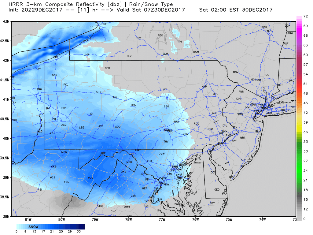
Snow will move into Western Pennsylvania late this evening. Due to extremely cold temperatures, ratios will be 25:1, meaning very fluffy snow. Here is the HRRR model for 11 PM this evening:

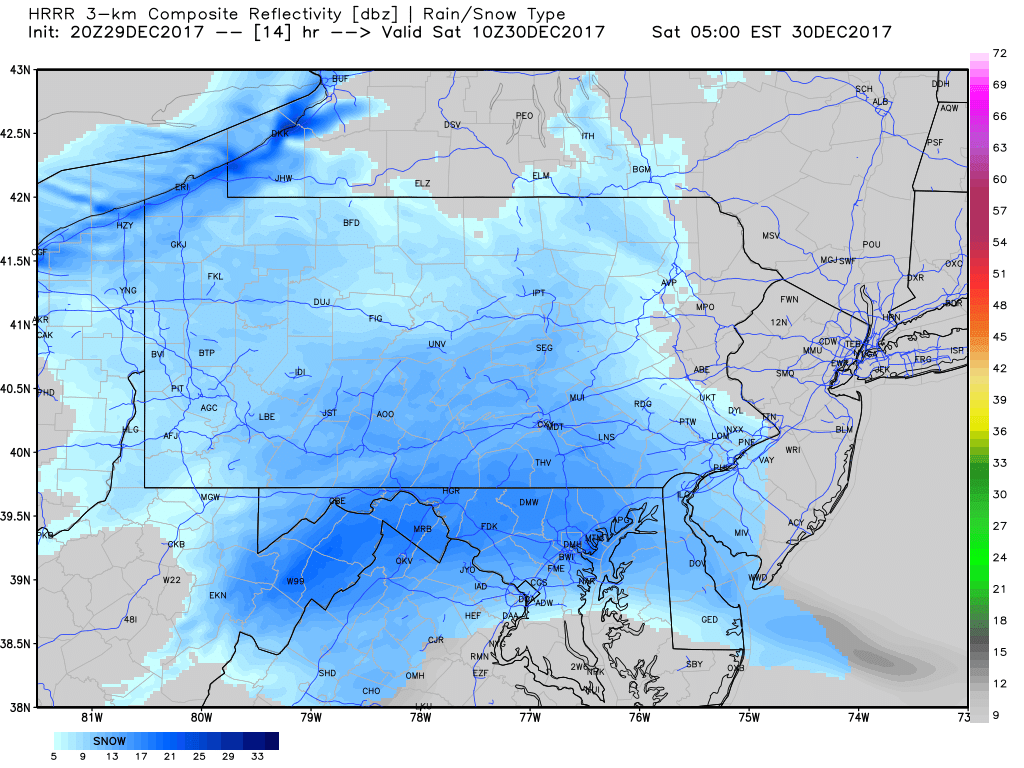
There will be some dry air to fight off at the onset of this event. Due to timing, this won’t be much of an issue thanks to high dew points. Snow will quickly move east through the night, with heaviest snowfall rates near the Maryland Line. Below is the HRRR model for 2 AM Saturday.
The snow will rapidly accumulate, with rates of half an inch an hour likely. By 2 AM, snow will be falling in all of Western PA along with Southcentral PA. Moving on, here is the HRRR model for 5 AM:
By this time, snow will be entering the Delaware Valley and Lehigh Valley as well as the Northern Mountains. The clipper will be ending by Saturday Morning as light snow in the eastern half of the state. Here is the HRRR for 8 AM:
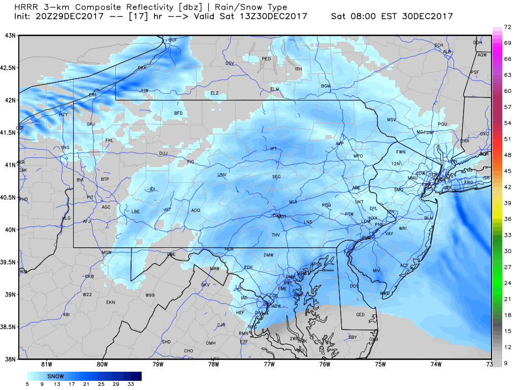
Although snow will only fall for eight hours in most places, light to moderate snow accumulations. Latest data suggests highest amounts near the Maryland Line.

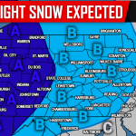
Area A: 3″+ inches of light-powdery snow is expected. Snow covered roads are likely. For areas expecting lake effect snow, this does NOT include lake effect snow accumulations.
Area B: 1 to 3 inches of light-powdery snow is expected. The best chance for amounts over 3″ is near the MD Line. Snow covered roads are likely. For areas expecting lake effect snow, this does NOT include lake effect snow accumulations.
Area C: A coating to 1 inch of light-powdery snow is expected. Snow covered roads are possible.
For more updates regarding this incoming snowfall and more, like our Facebook page by clicking here>>>Pennsylvania Weather Action’s Facebook Page
Download our app today to stay ahead of the upcoming weather>>>Click here to download our app!
Share the snowy forecast with your family and friends using our icon below!

You must be logged in to post a comment.