
We are back tracking another round of light to moderate snow for the whole state of Pennsylvania on Saturday. A clipper system dropping out of Canada will swing through the area, bringing with it a fairly large swath of snow. It is a quick hitter, so accumulations will remain on the lighter side. However, depending on your location, this might be your town’s biggest snowfall of the season. Especially for the Lower Susquehanna Valley where many areas have received only a coating to 3 inches of snow this season in total.
Typically clipper systems only deliver a quick coating to an inch or two of snowfall, but for this clipper, totals will be higher for some areas thanks to ratios being much greater than 10:1. With temperatures in the teens and lower 20s, ratios will be around 20:1.
Taking a look at our future radar below, the snow will begin to overspread Western PA late Friday night. The radar image below is valid for 11:00 PM Friday night: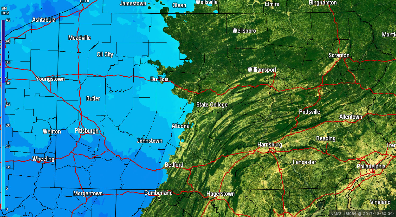
Snow will overspread much of the state by the Saturday morning rush hour and could fall moderate at times. The snow will quickly lay on all surfaces. If you have travel plans for the first half of Saturday, plan on slow travel. Below is Saturday 5:00 AM: 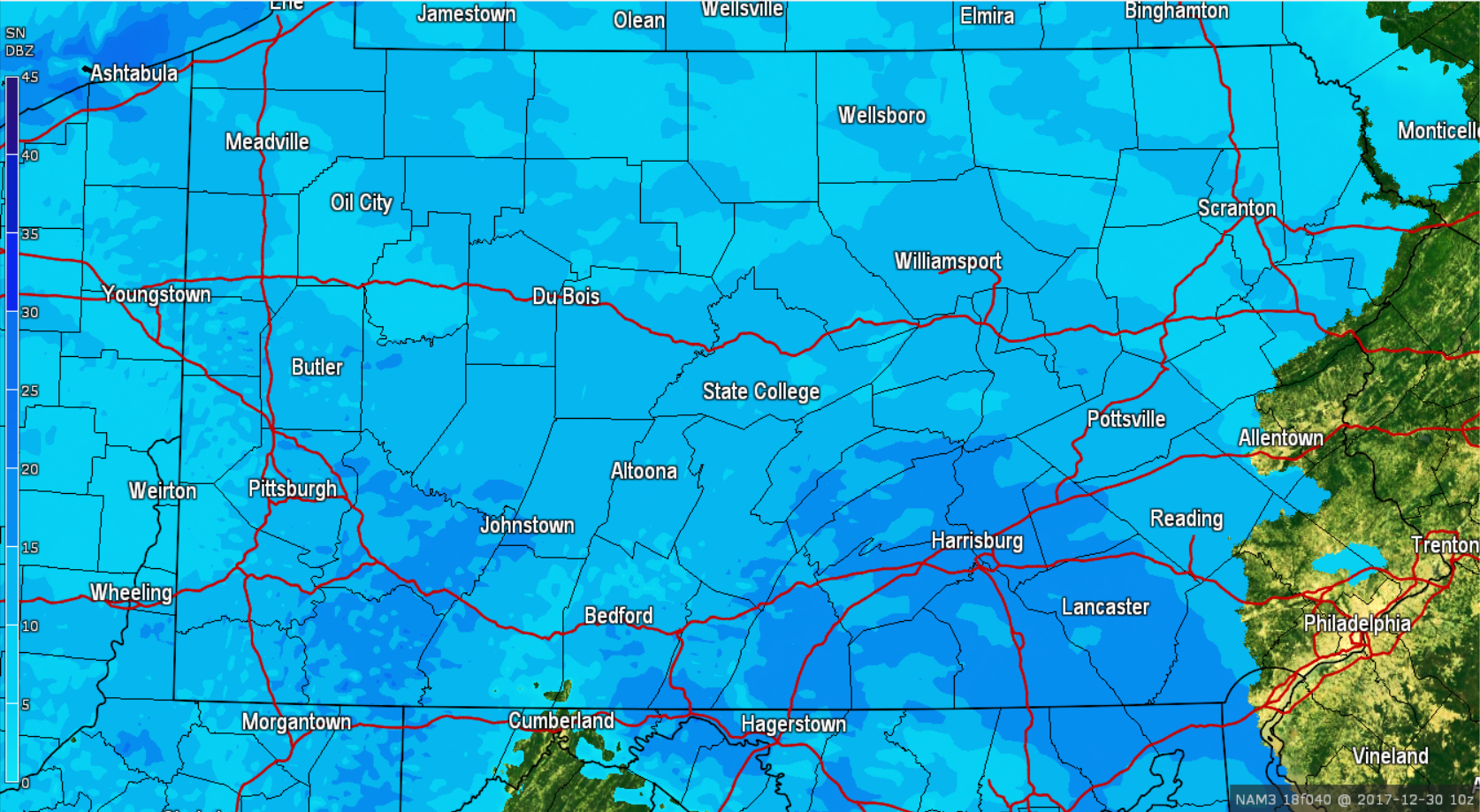
The steadier snows will continue to push eastward as we head into the mid-morning hours Saturday. By 9:00 AM the heaviest of the snows is focused over Eastern PA: 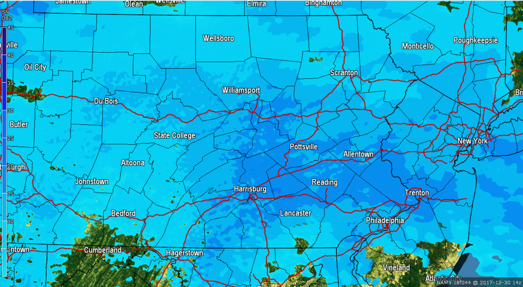
The snow will quickly wrap up and exit the region shortly after lunchtime. Below is valid for 1:00 PM Saturday afternoon: 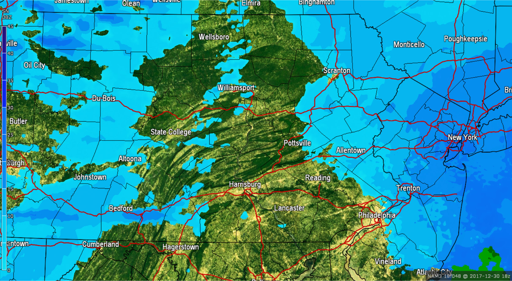
Following the clipper, another round of heavy lake effect snow is expected. Our snow accumulation map below DOES NOT include lake effect snowfall. The snowfall totals below are strictly for the clipper system.
FIRST CALL SNOW TOTALS FOR SATURDAY’S CLIPPER:
Timing: Snow will begin late Friday night after 10:00 PM for Western PA, will overspread the rest of the state by 5:00 AM and will exit Eastern PA after 2:00 PM Saturday afternoon.
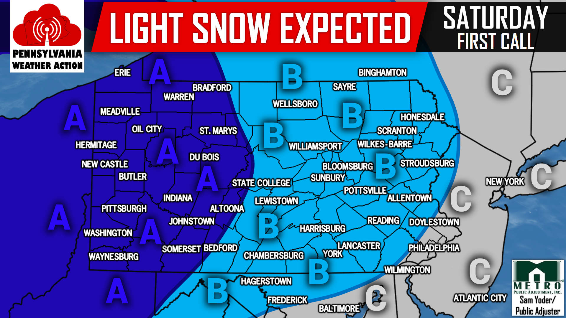
Area A: 3 to 5 inches of light-powdery snow is expected. Snow covered roads are likely. For areas expecting lake effect snow, this does NOT include lake effect snow accumulations.
Area B: 1 to 3 inches of light-powdery snow is expected. Snow covered roads are likely. For areas expecting lake effect snow, this does NOT include lake effect snow accumulations.
Area C: A coating to 1 inch of light-powdery snow is expected. Snow covered roads are possible.
For more updates regarding this incoming snowfall and more, like our Facebook page by clicking here>>>Pennsylvania Weather Action’s Facebook Page
Download our app today to stay ahead of the upcoming weather>>>Click here to download our app!
Share the snowy Saturday news with your family and friends using our icon below!
You must be logged in to post a comment.