
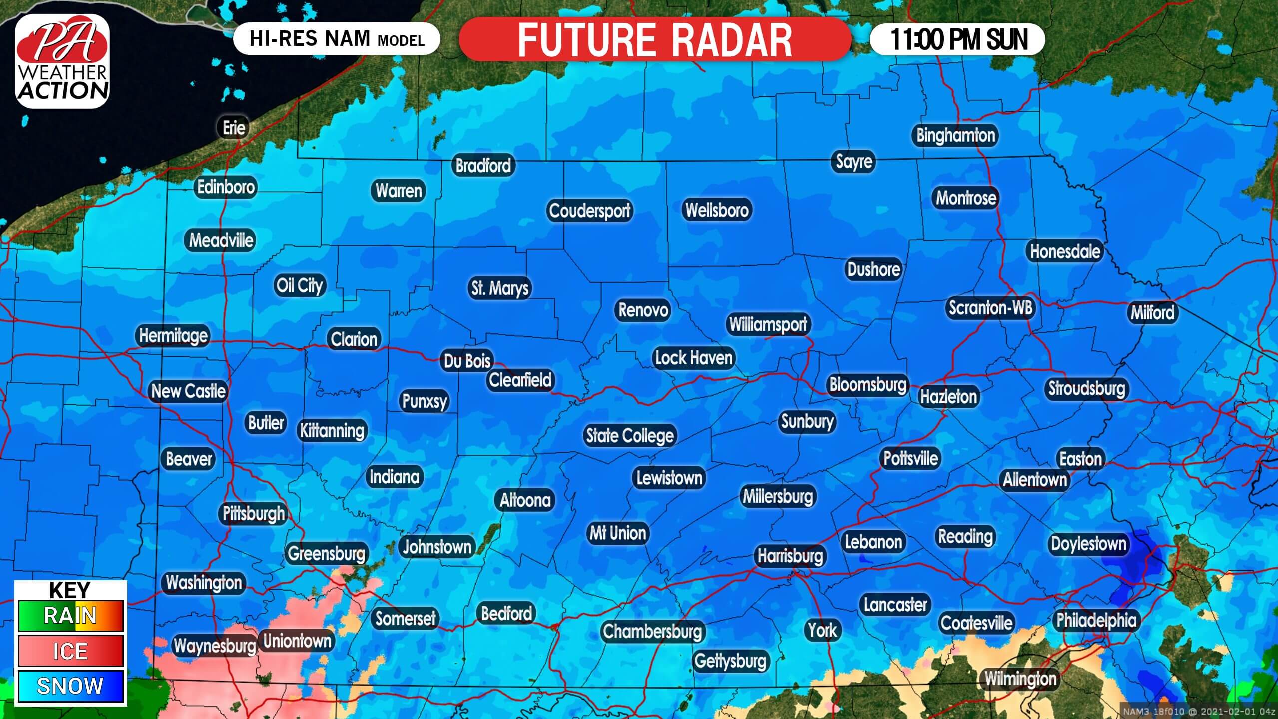
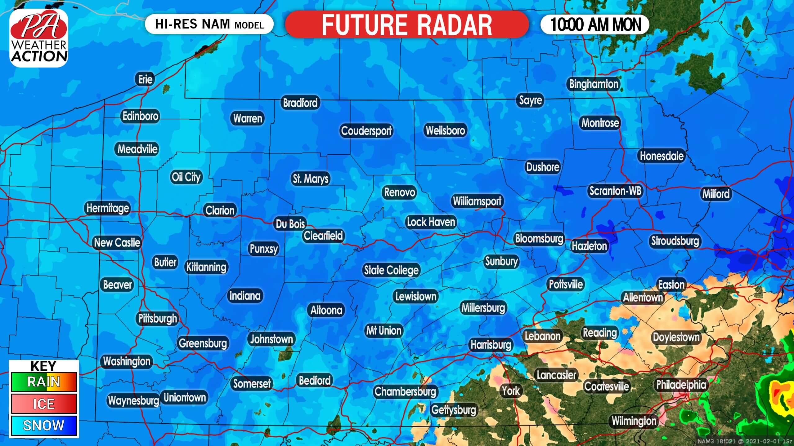
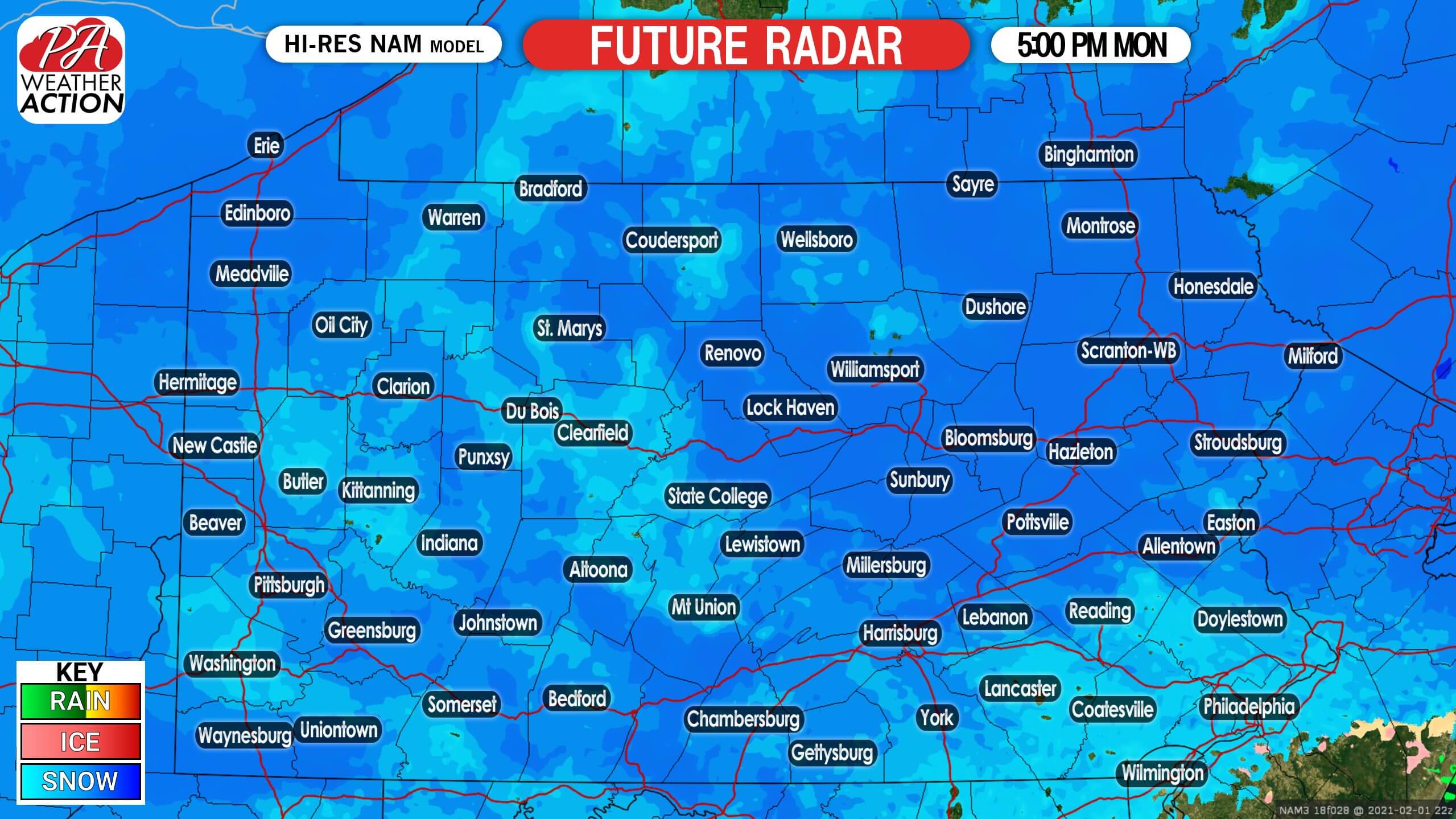
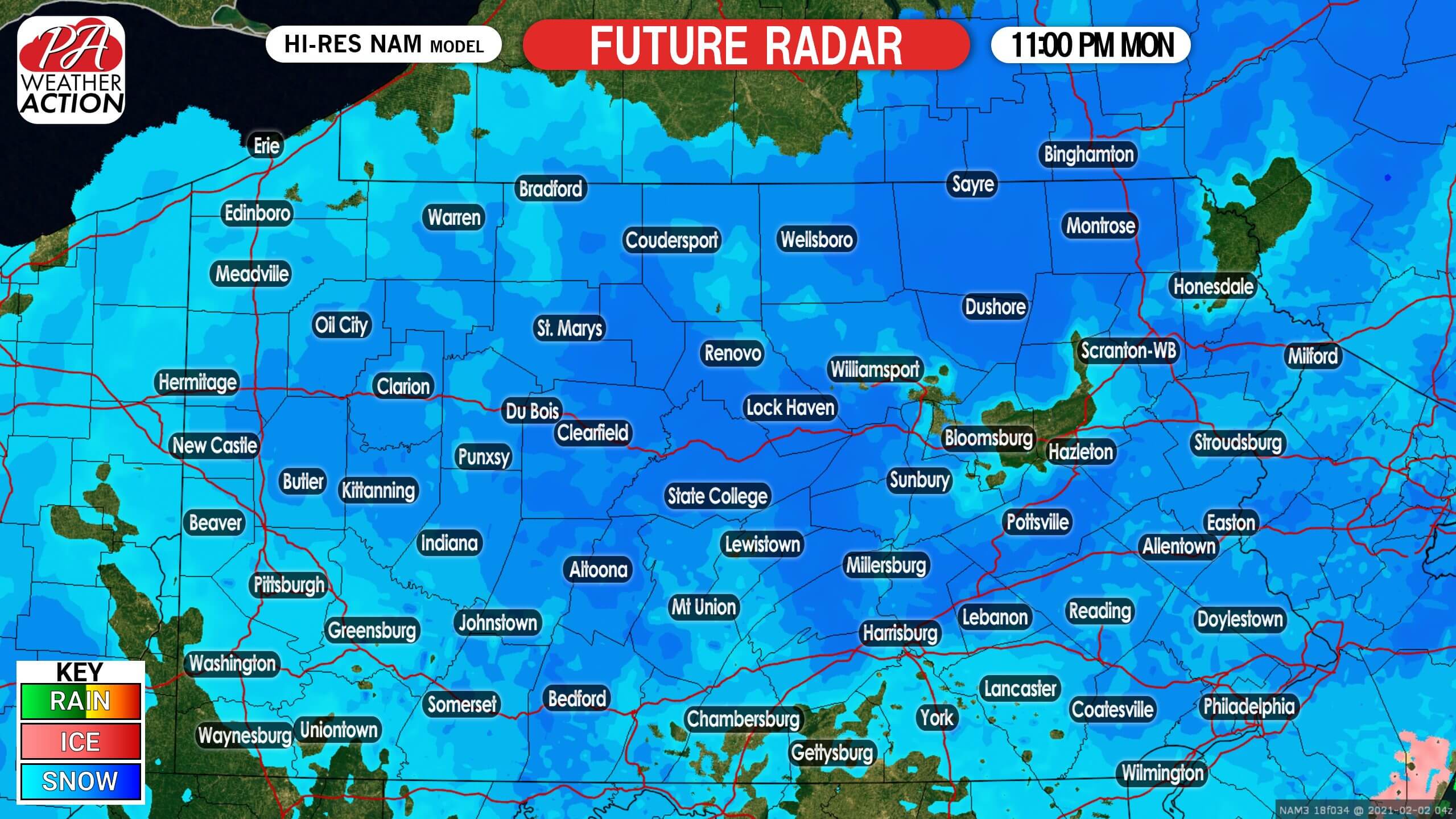
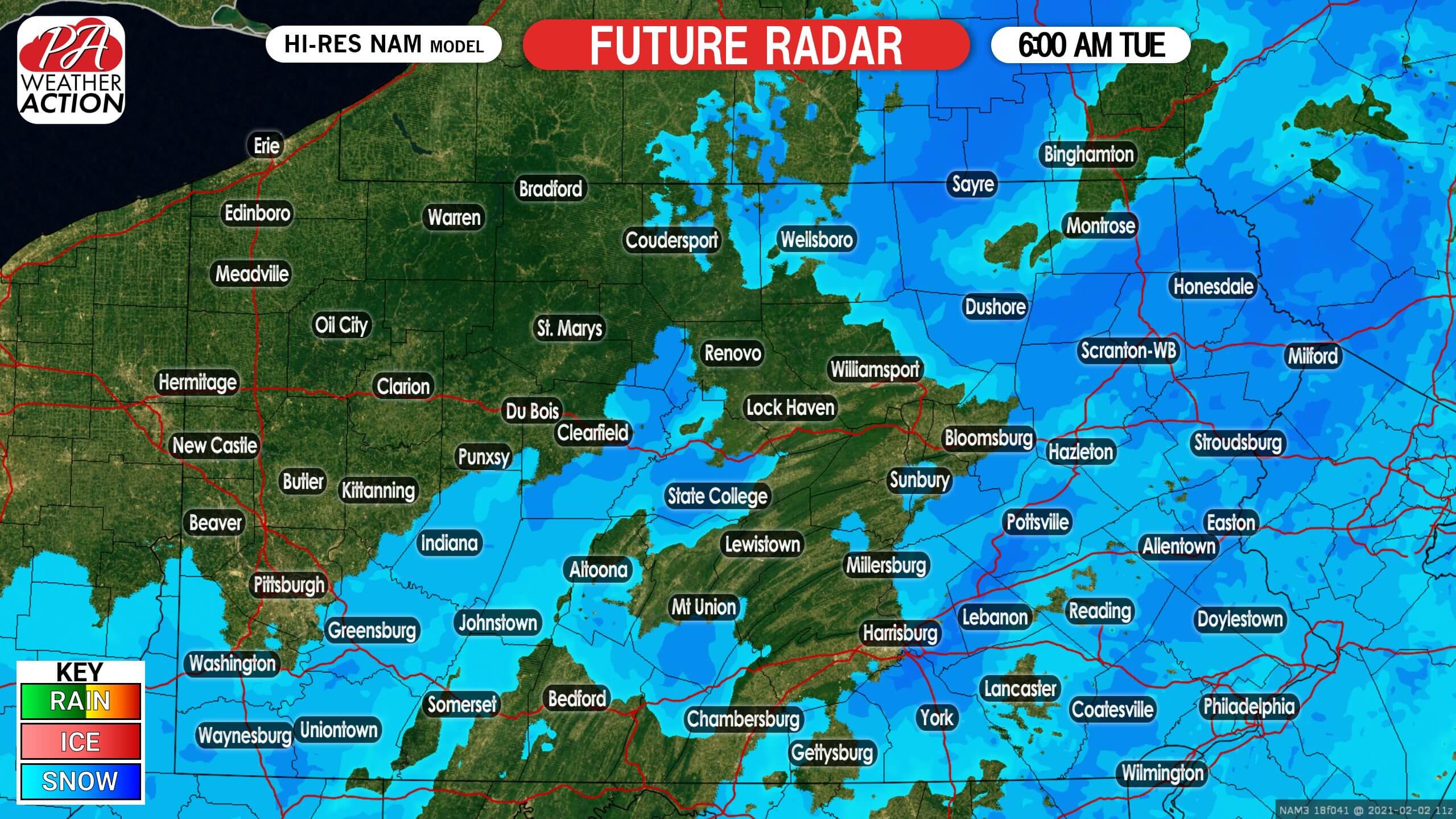
While some locations mainly south of I-76 picked up a few inches so far today, most of the snow from this major storm will come Monday when the coastal low pressure really gets going. Snowfall rates of 2-3″ an hour are expected in the heaviest snowfall banding across eastern PA Monday. Central PA will see mainly light to moderate snow, with a few periods of heavy snow possible. Snow will finally exit from southwest to northeast Tuesday morning.
FUTURE RADAR
11 PM SUNDAY
10 AM MONDAY
5 PM MONDAY
11 PM MONDAY
6 AM TUESDAY
FINAL CALL SNOWFALL FORECAST (INCLUDING WHAT HAS FALLEN)
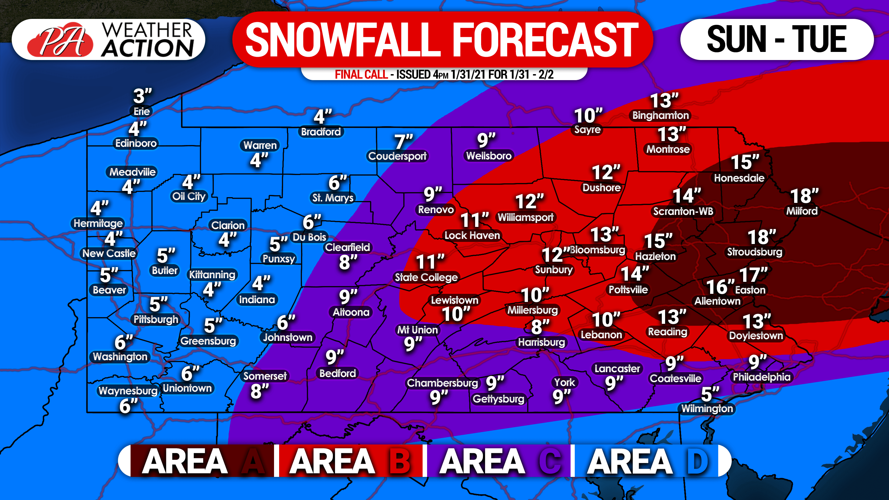
Area A: Snow accumulation of 14 – 18″ expected, with locally higher amounts.
Area B: Snow accumulation of 10 – 14″ expected, with locally higher amounts.
Area C: Snow accumulation of 6 – 10″ expected.
Area D: Snow accumulation of 3 – 6″ expected.
We will have live radar on our Facebook page during the storm, stay tuned and stay safe!

You must be logged in to post a comment.