
Our first widespread snowstorm of the season is expected to take shape across western Pennsylvania Tuesday into early Wednesday morning. Winter Storm Warnings and Winter Weather Advisories have been issued, and travel may be very difficult during the storm. Below is future radar timing, followed by our final snowfall map.
SNOWSTORM TIMING
Light to moderate snow will move in from the west early Tuesday morning. At first, it may have a hard time sticking as temperatures will be near freezing. Temperatures will quickly drop a few degrees below freezing. Below is future radar for 2:00 AM Tuesday.

The light to moderate snow will push east through mid-morning Tuesday. Some snow showers may make their way into central PA, but aren’t expected to accumulate. Here is future radar for 7:00 AM Tuesday.

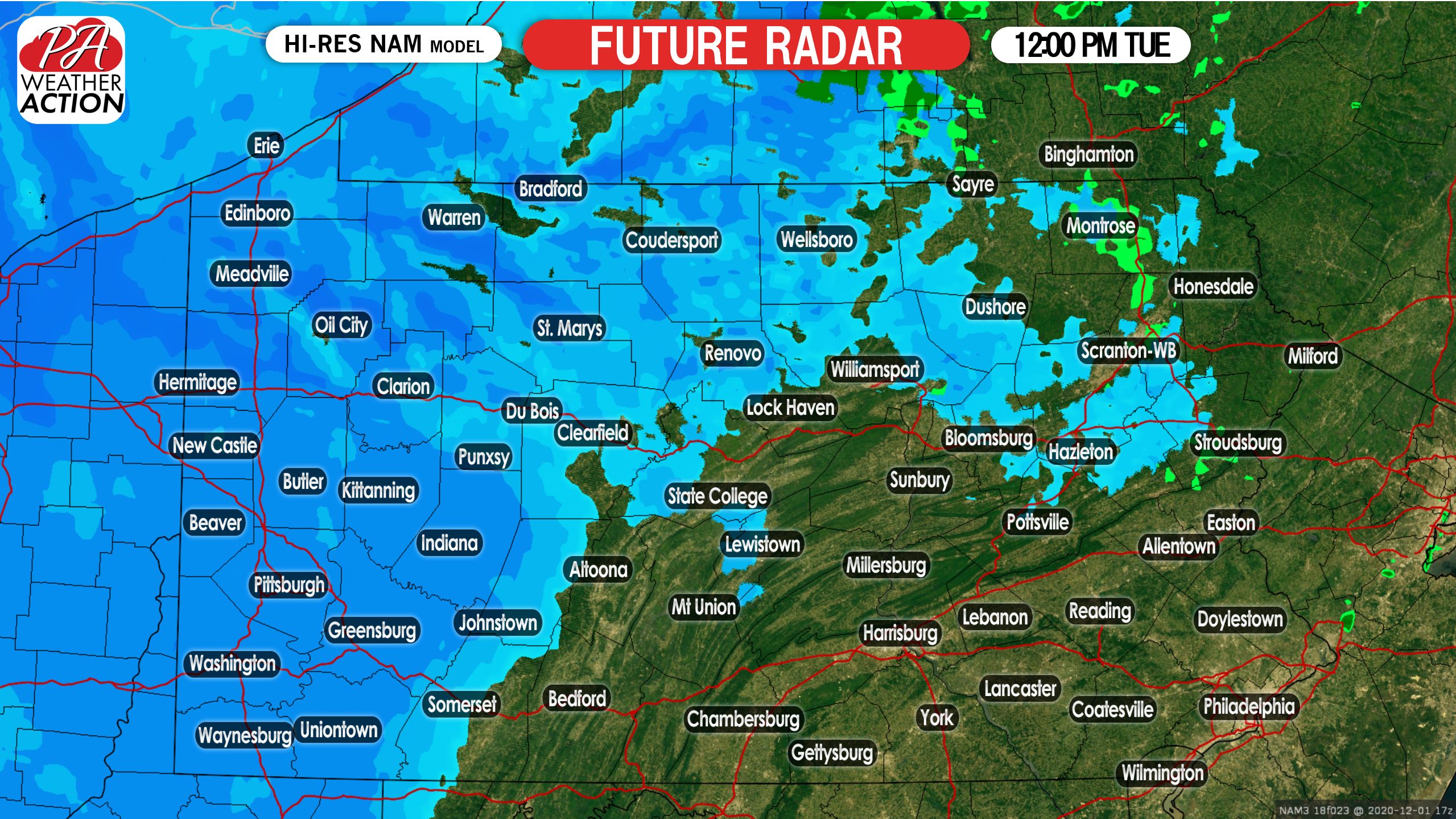
Snow will continue in western PA as we head into Tuesday afternoon. Lake-effect snow will enhance snowfall rates in the snowbelts of northwest PA. Below is future radar for 12:00 PM Tuesday.
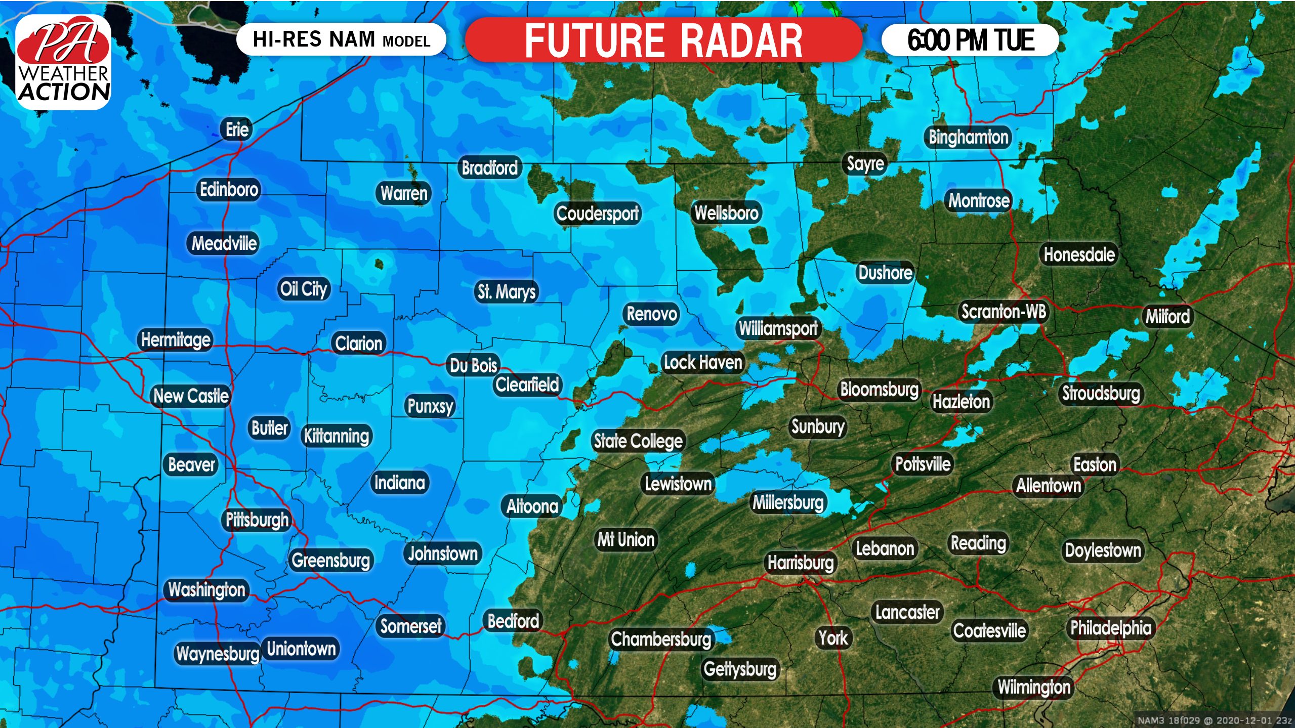
As you can see, this will be a long duration snow event, and won’t feature heavy, blinding snow. Instead, it will be a light to moderate snowfall that gradually accumulates. The snow will persist into Tuesday evening. Here is future radar for 6:00 PM Tuesday.
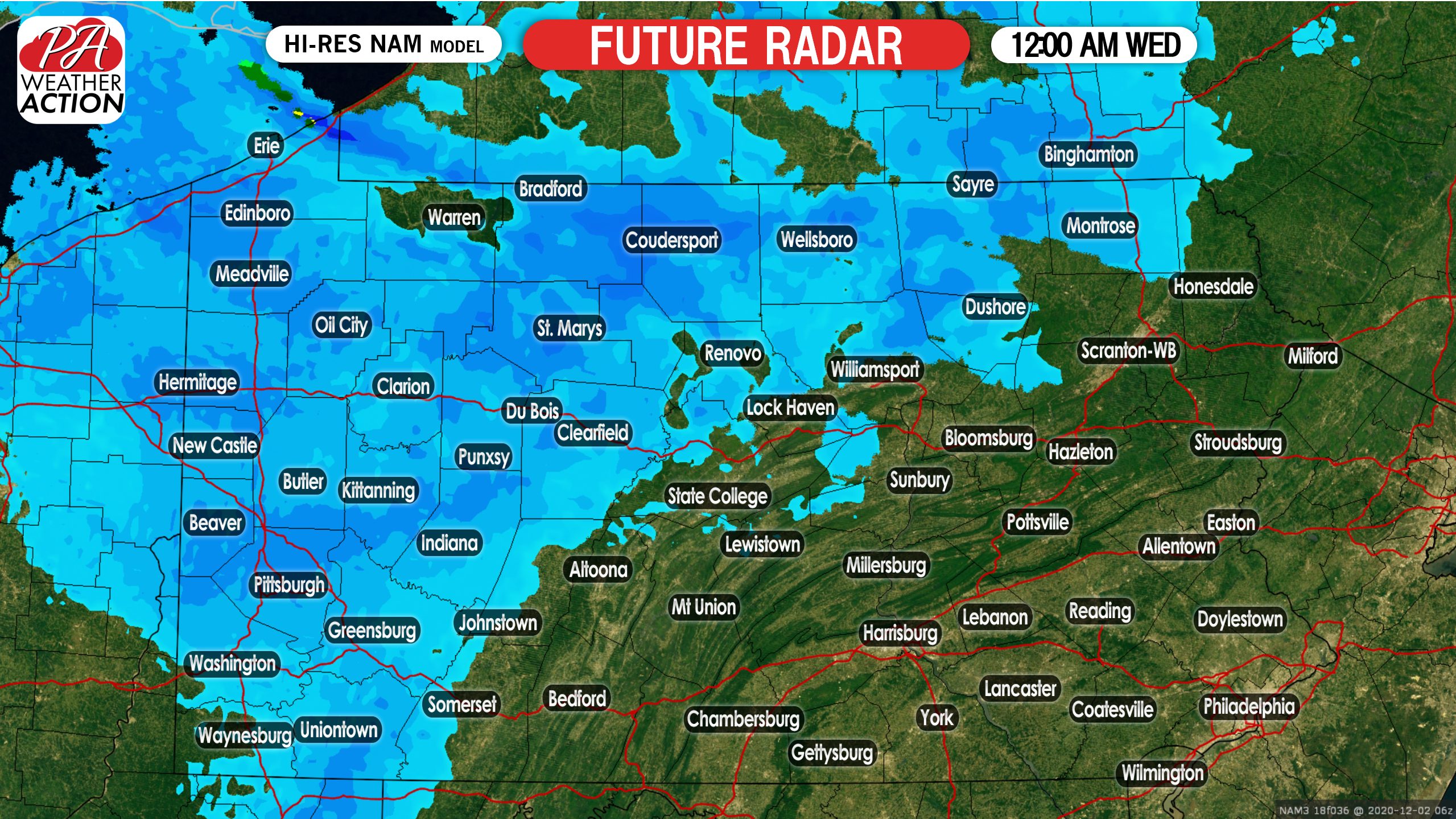
At last, the snow will wind down early Wednesday morning in western PA. A few lake-effect bands may continue, but for most the snow should lighten and then end. Below is future radar for 12:00 Wednesday.
FINAL CALL SNOWFALL FORECAST FOR TUESDAY’S SNOWSTORM
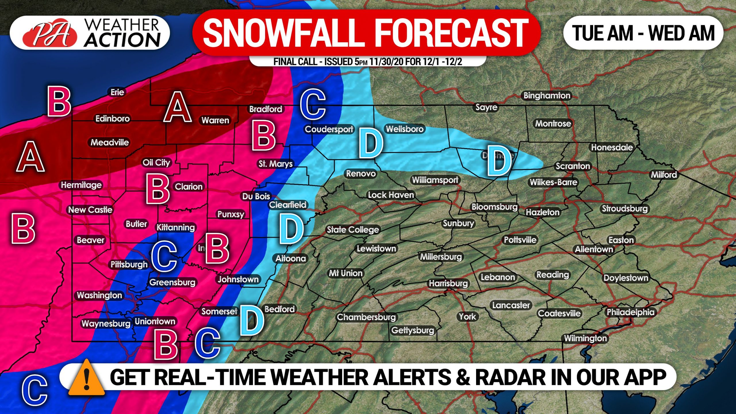
Area A: Light to moderate snow is expected to consistently fall from early Tuesday morning to early Wednesday morning. Intermittent heavy lake-effect snow likely Tuesday afternoon until Wednesday AM. Snowfall accumulation of 7 – 14″ expected, with isolated amounts up to 17″. Delays and closings likely Tuesday due to snow-covered roads.
Area B: Light snow is likely, beginning early Tuesday morning through early Wednesday morning. Occasional moderate snow expected. Snowfall accumulation of 4 – 7″ anticipated. Delays and closings possible Tuesday due to snow-covered roads.
Area C: Light snow is anticipated from early Tuesday morning until early Wednesday morning. Snowfall accumulation of 2 – 4″ expected. Travel may be difficult Tuesday.
Area D: Light snow is likely, starting Tuesday afternoon through early Wednesday morning. Snowfall accumulation of 1 – 2″ expected.
Don’t forget to share this forecast with friends and family who will be impacted using the blue button!
Track the snow on radar and with our hourly forecast with our free iOS & Android app! Get it here >>> Weather Action App

You must be logged in to post a comment.