
As temperatures crash this evening, rain will change to snow from northwest to southeast. In addition, lake effect snow will continue in northwest PA. We’re not talking about anything significant, and once again it will be a mainly grass event outside of the lake effect. Let’s time it out below.
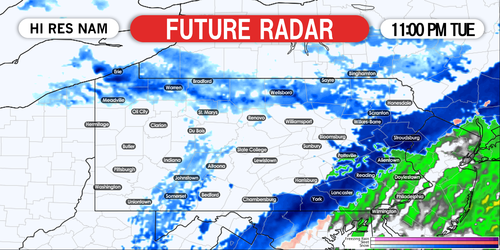
Rain will change to snow late this evening along i81 and i78 in eastern PA. Lake effect snow will also be pushing east into much of the northern tier. Here is future radar for 11:00 PM Tuesday.
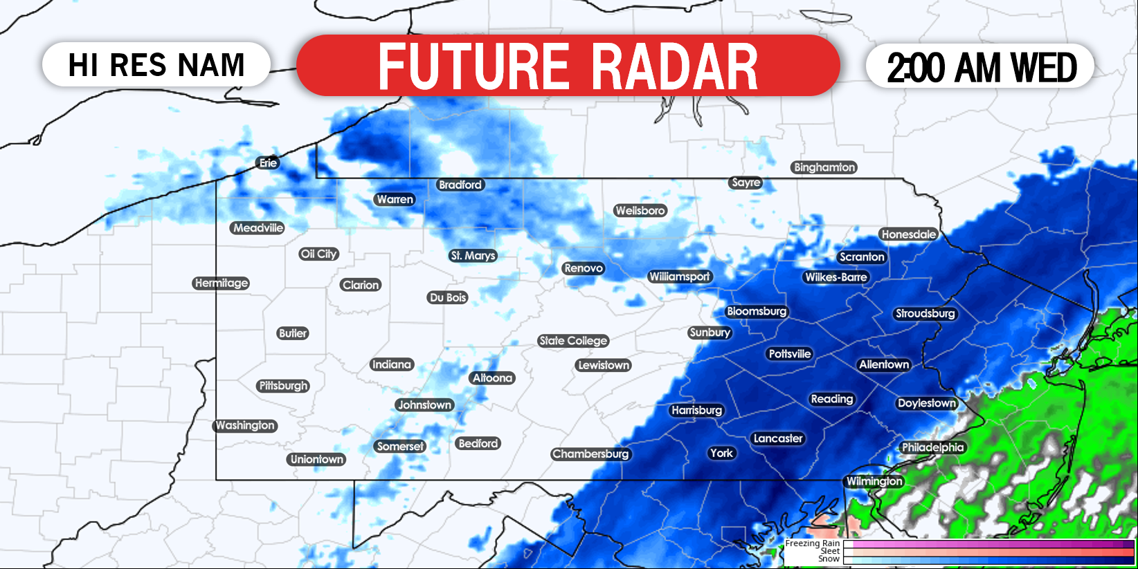
Snow will expand and strengthen in eastern PA as winds become favorable for anafrontal snowfall. By 2:00 AM Wednesday morning, most of eastern PA is expected to be seeing light to moderate snow. Below is future radar for 2:00 AM Wednesday.
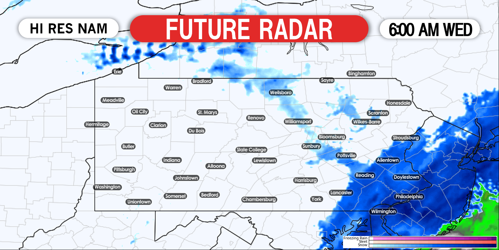
Snow will exit eastern PA from west to east during the Wednesday morning commute. Meanwhile, lake effect snow will lift north into western New York, out of PA. Here is future radar for 6:00 AM Wednesday.
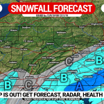
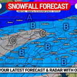
FINAL CALL SNOWFALL FORECAST MAP
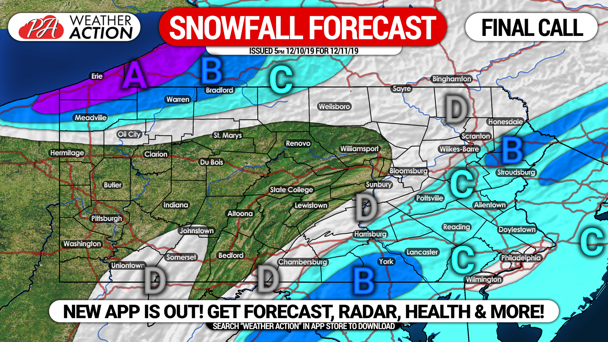
Area A: Snowfall amounts of 3 – 7″+ expected. Expect snow covered roads Wednesday.
Area B: Snowfall accumulations of 2 – 3″ expected. Some slushy roads possible Wednesday morning.
Area C: Snowfall amounts of 1 – 2″ expected, with a coating on the roads above 1000′ elevation.
Area D: Snowfall accumulations of a coating to 1″ expected.
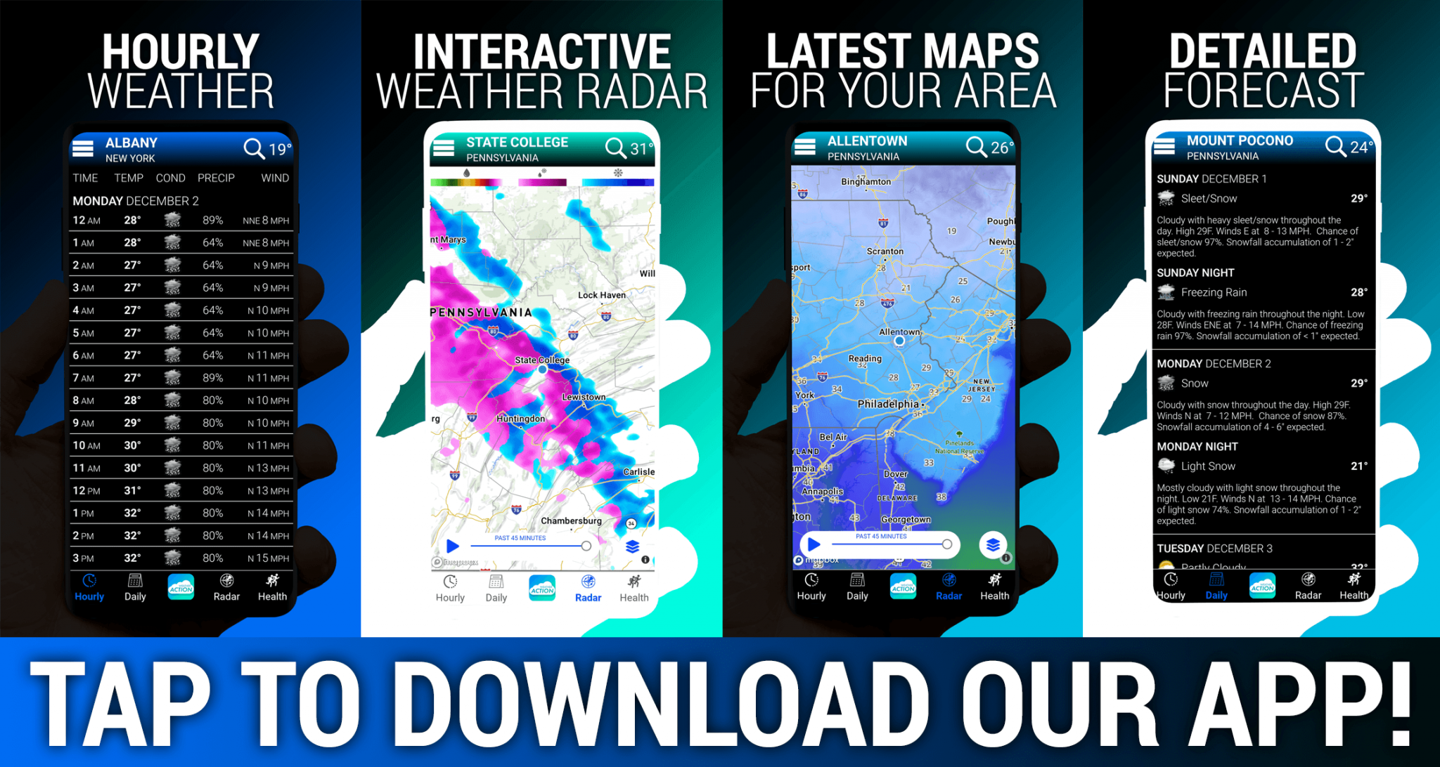
Don’t forget to share this forecast below! To stay ahead of the winter weather in the coming months, download our new and improved app by tapping the banner below!
You must be logged in to post a comment.