
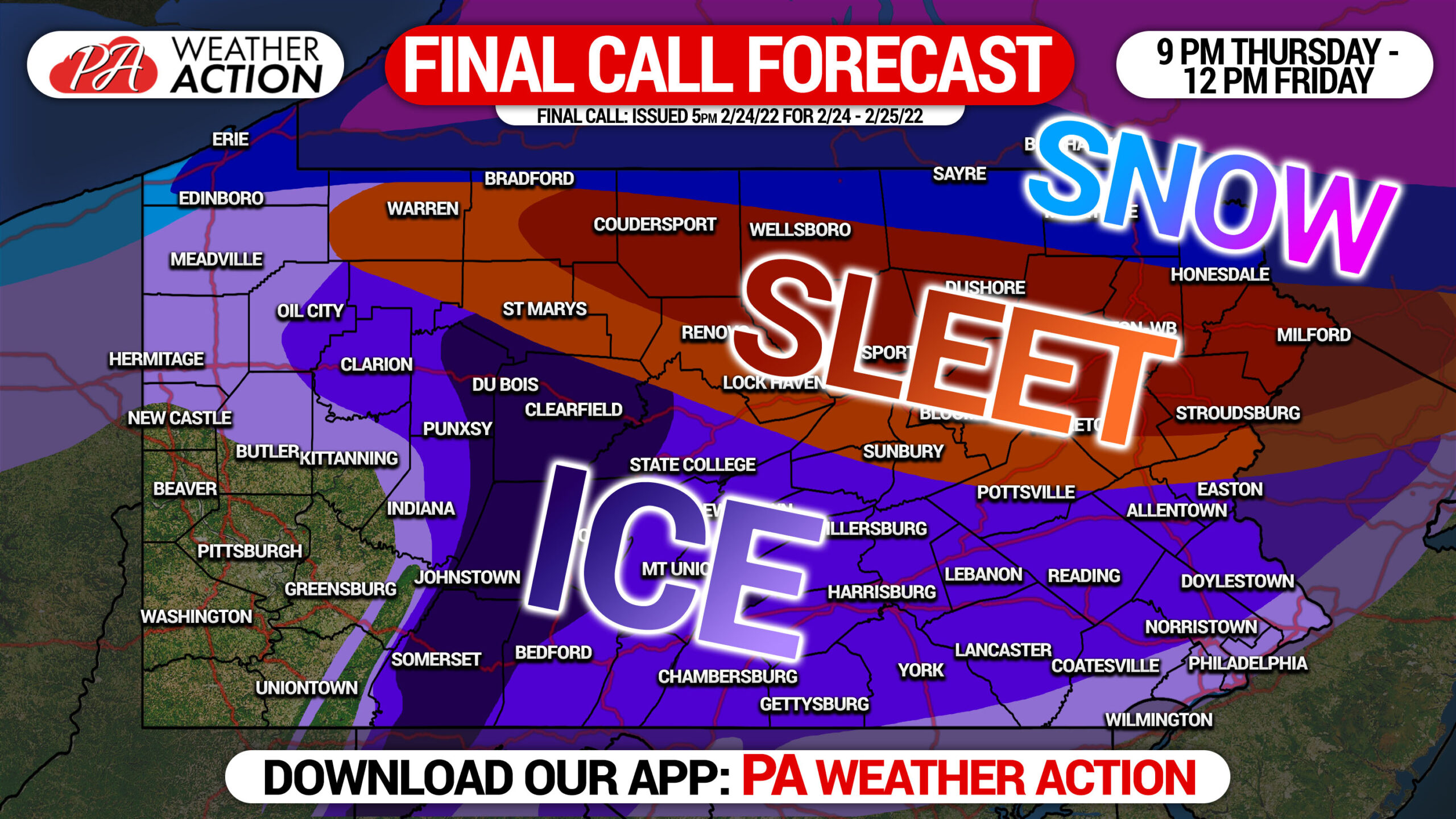
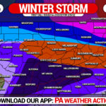
We are now just a few hours from this mess of a storm beginning (as of 5 PM Thurs), and there are some notable shifts to the forecast. We now expect more sleet in Northern PA, which will greatly limit snow totals all the way to the NY border. This will move both the snow component and sleet component of this storm farther north on our maps. The ice threat remains the least unchanged, with an extended period of freezing rain likely in the areas highlighted in our previous forecasts. Is it really a surprise that we will narrowly miss the heavy snowfall once again? It’s just one of those winters, unfortunately for snow-lovers.
This storm will bring greatly differing impacts depending on where in the state you are, but in general worst travel conditions are expected very early Friday morning until late morning. Below is FutureCast radar for the duration of this storm.
The following maps indicate the amount of each frozen precipitation type any given area will experience.
FINAL CALL SNOWFALL FORECAST FOR THURSDAY NIGHT – FRIDAY
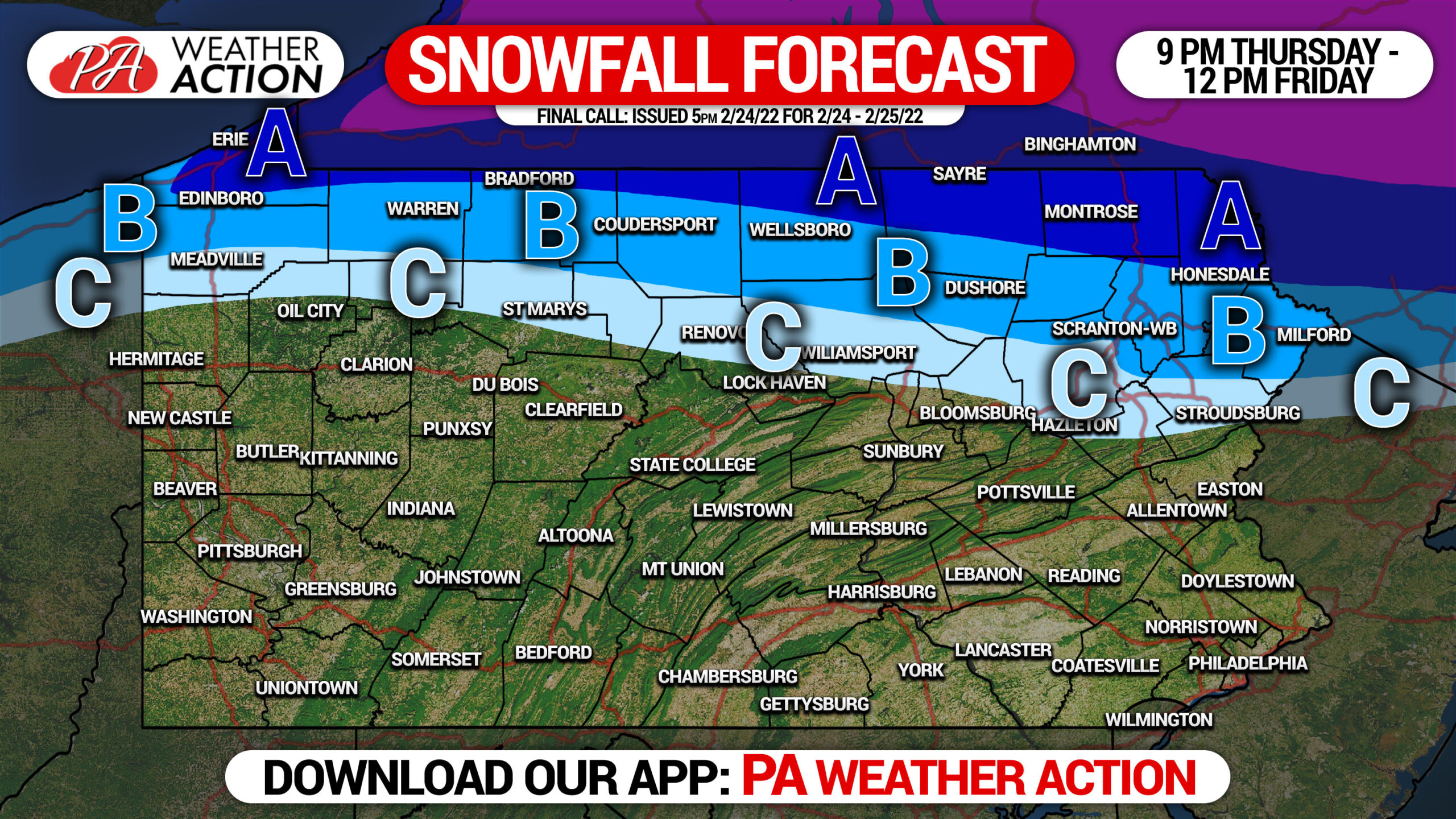
This forecast depicts accumulations on unpaved surfaces. Accumulations will be about 50% of what is shown on paved surfaces, excluding bridges and overpasses.
Area A: Snowfall accumulation of 3 – 5″ expected.
Area B: Snowfall accumulation of 2 – 3″ expected.
Area C: Snowfall accumulation of 1 – 2″ expected.
FINAL CALL SLEET FORECAST FOR THURSDAY NIGHT – FRIDAY
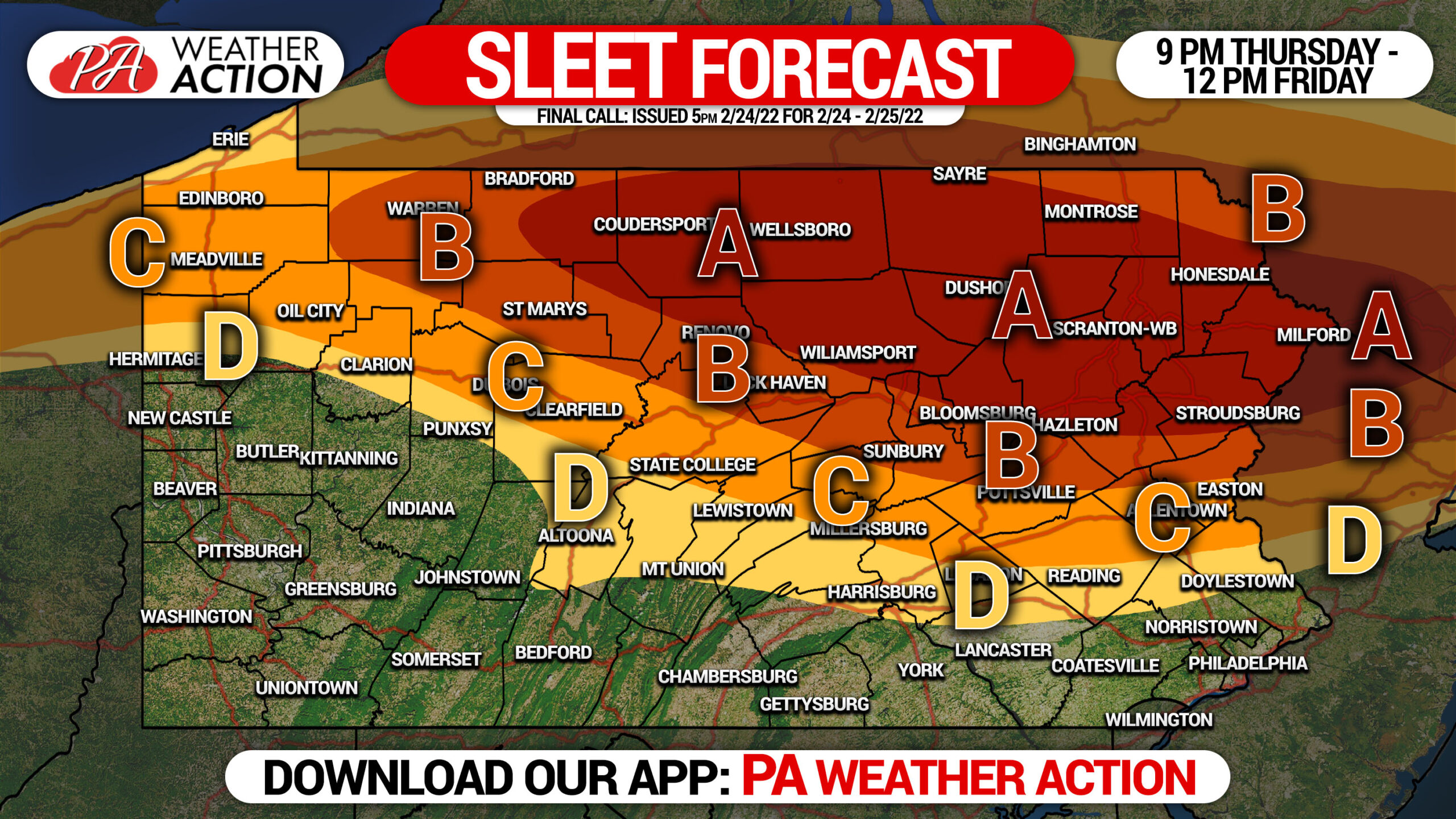
Area A: Sleet accumulation of 1.5 – 2.0″ expected.
Area B: Sleet accumulation of 1.0 – 1.5″ expected.
Area C: Sleet accumulation of 0.5 – 1.0″ expected.
Area D: Sleet accumulation of 0.1 – 0.5″ expected.
FINAL CALL ICE (FREEZING RAIN) FORECAST FOR THURSDAY NIGHT – FRIDAY
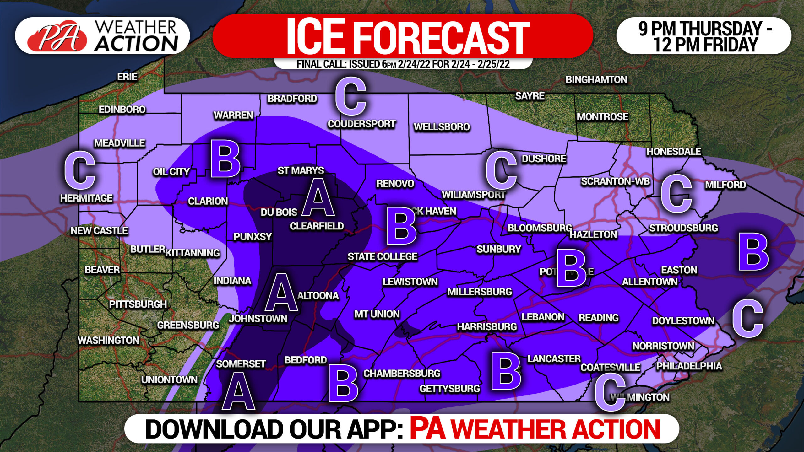
This forecast depicts maximum ice accrual on elevated surfaces. The ground remains warmer than usual, so accumulations especially on paved surfaces will be about 25% of what is shown.
Area A: Ice accumulation of .25 – .50″ expected. Widespread power outages possible.
Area B: Ice accumulation of .10 – .25″ expected. Scattered power outages possible.
Area C: Ice accumulation of .01 – .10″ expected.
Widespread delays and closings are likely Friday, as it really only takes a few hundredths of an inch of ice to produce hazardous conditions for walking and driving.
Don’t forget to pass this forecast along with family and friends. Stay safe!
[social_warfare]
Track the storm with live temperatures, precip-type radar, road conditions and our latest updates. Tap the square below to get our mobile app!
You must be logged in to post a comment.